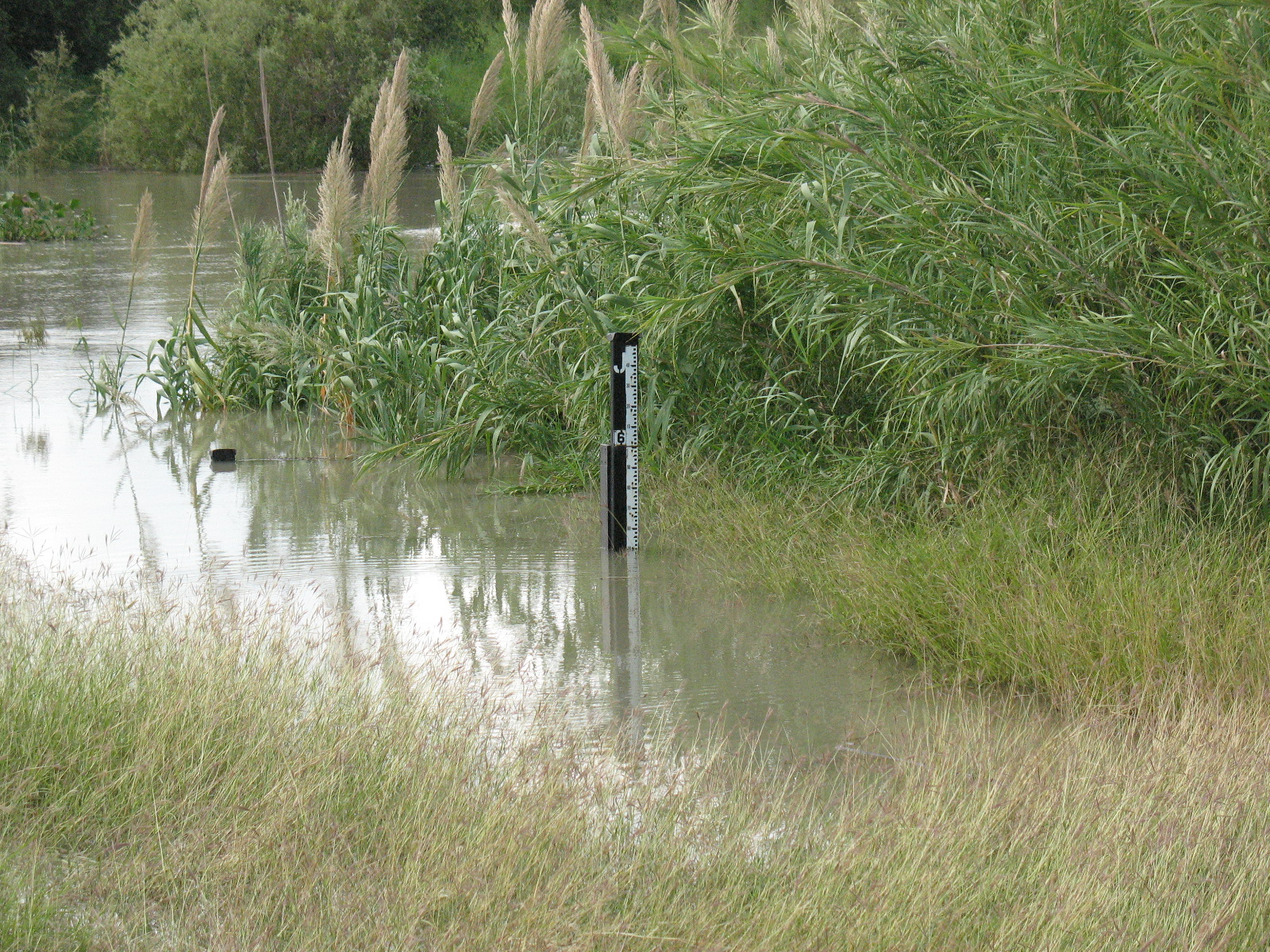
 San Benito/Ramirez (MX) River Gage, taken just after peak level, near 50.84 feet A River Runs Through It Heavy Rains, Upstream Releases Bring High Flows to RGV |
||||||||||||||||
|
The wet late summer of 2008 in the Lower Rio Grande Valley, which turned a nearly dry Lower Rio Grande river bed into a nicely flowing current, would combine with water releases along the middle and upper Rio Grande on the Mexican side of the border in September, to produce a prolonged period of higher than normal water flows at many locations in the Valley, resulting in conditions approaching flood stage at several gaging locations, from the Falcon Reservoir near the Starr/Zapata County line, south to Lower Brownsville. River levels reached "action stage", a condition which requires that residents and local officials keep a close eye on levels, and can also push some water onto secondary roads inside levees, at Falcon Reservoir, San Benito, and Lower Brownsville, at different times from late September through October. As of this writing, the gage at Falcon Reservoir had risen to 299.70 feet, well into action stage. |
") The following crests were observed:
Staff from the NWS office in Brownsville visited sites at Lower Brownsville, San Benito, and Falcon Reservoir, as well as locations along the river in Starr County, during the month of October. A brief photogallery can be found here. |
|||||||||||||||
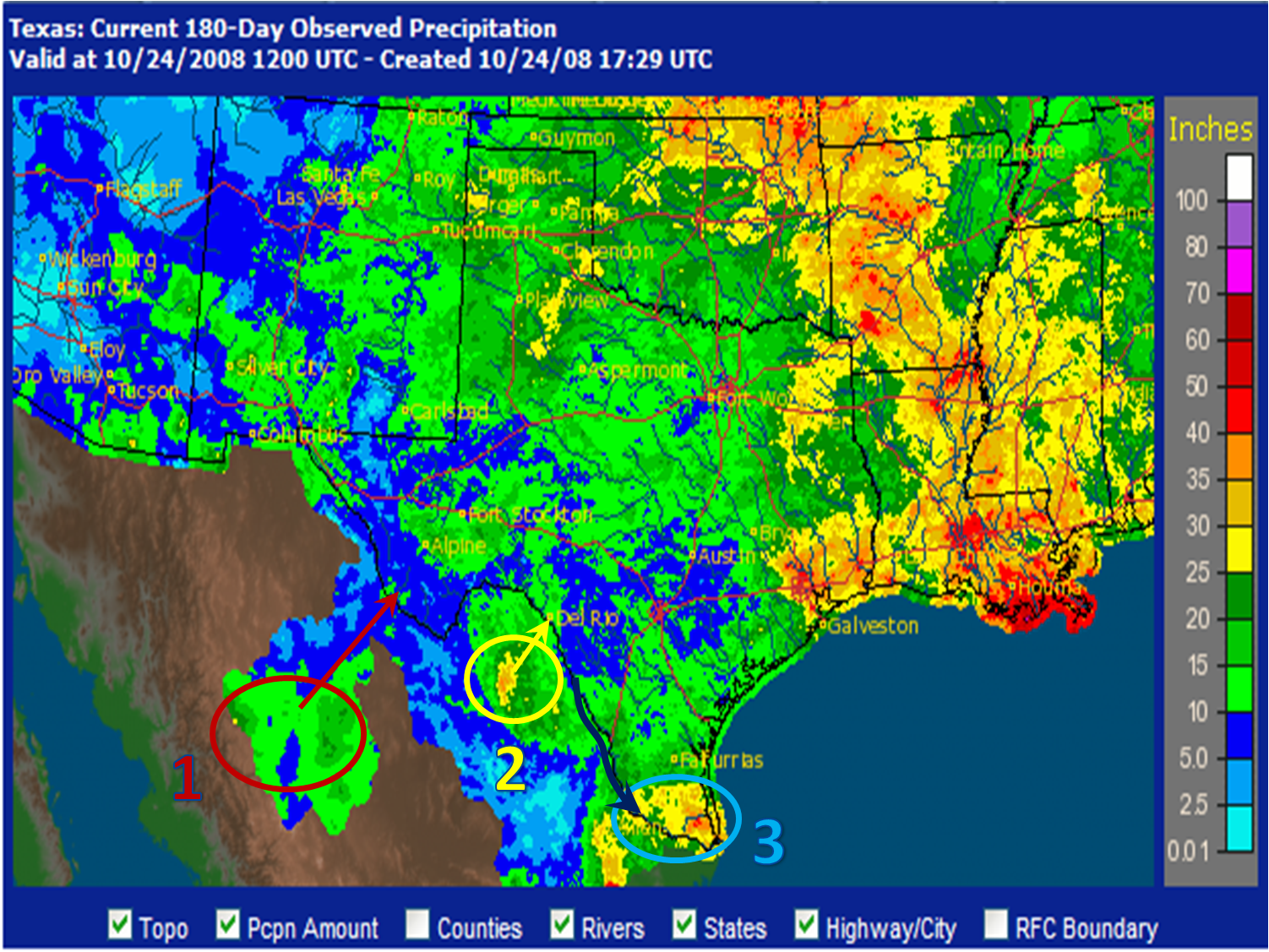
Above: 180 Day rainfall, and critical locations for river rises:
|
||||||||||||||||


 Follow us on YouTube