|
Overview
After more than six weeks of largely rain free weather across Deep South Texas and the Lower Rio Grande Valley, which once again brought severe to extreme drought across much of the area toward the end of June, the skies literally opened up for the first full calendar week in July 2008. The persistent mainly daytime rains, combined with abundant cloud cover, turned brown fields green, produced some minor flooding on July 7th, and provided much welcome drought relief. By July 8th, drought conditions had improved to abnormally dry to moderate across most of the Lower Rio Grande Valley. The lack of sunshine, on July 2nd and again between July 4th and 8th, held daily maximum temperatures on those days between 8 and 15 degrees below average.
The Dynamics of Rain
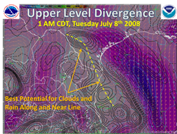
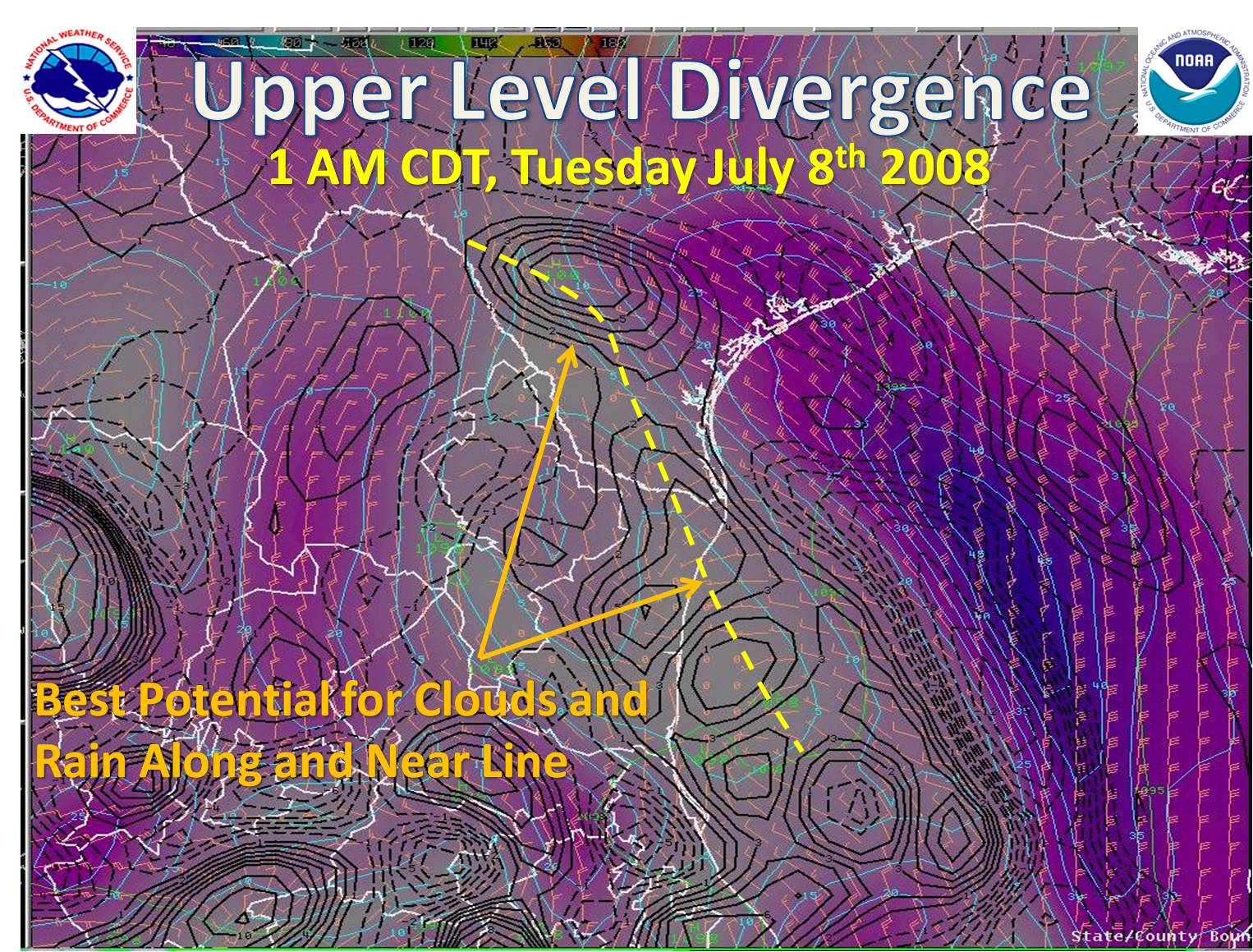
The seed for the early July rains actually arrived during the final weekend of June, when a weakening upper level disturbance eased into northeastern Mexico and the Lower Rio Grande Valley from the south central Gulf of Mexico. While this disturbance only provided meager showers, it helped fill the entire atmosphere above Deep South Texas, the Lower Rio Grande Valley, and much of northeast Mexico with tropical moisture. By the last day of June, a mid latitude disturbance moving east into the southeastern U.S. helped draw drier air into the southern Great Plains and western Mississippi Valley. At the same time, other weak disturbances were moving west to northwest generally along and just north of the Tropic of Cancer, helping to further increase and "pool" moisture across Deep South Texas and northeast Mexico.
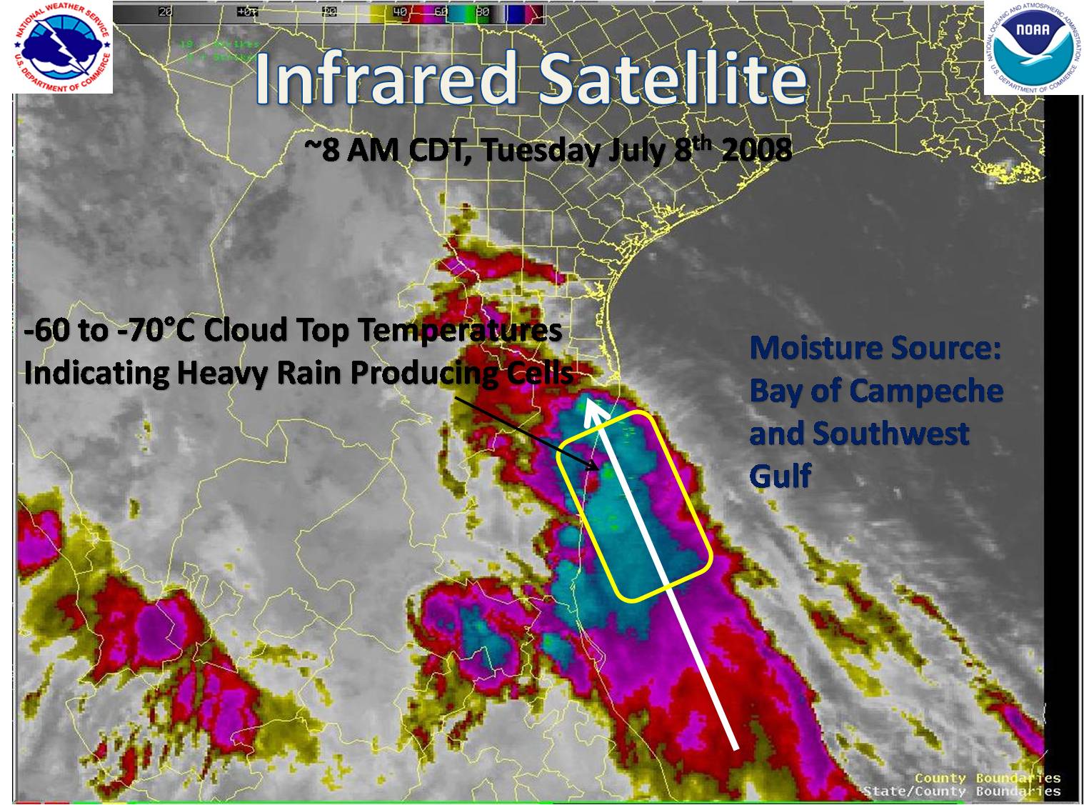
Soon, these disturbances would line up along an axis generally from north to south along and west of the Rio Grande, extending south well down along the coast of northeast Mexico. With no larger scale systems (such as cool season frontal zones) to push this axis of energy out of the way, the stage was set for several days of locally torrential rain bands moving along the mean southeasterly flow pattern below 20,000 feet. The axis of energy, or vorticity, helped aid the spreading out of air at the top of the troposphere (where most weather develops), which results in increased lifting of the deep tropical air into torrential rains (below).
 |
Ark Needed?
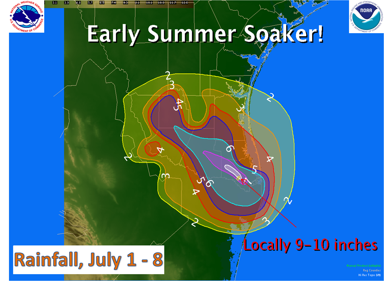
Once all ingredients were in place, the rains began in earnest, starting on July 3rd. And continued, right through July 8th. While amounts varied from day to day and location to location, the typical day began with rain bands around sunrise, then more by mid to late morning, and a final round from early to mid afternoon, with the last activity leaving light drips until late afternoon or early evening each day. While the highest rain totals favored the more populated Lower Rio Grande Valley toward the coast, eventually, some of the heavier rains stretched out to the Rio Grande Plains, where generally 2 to 5 inches fell through the period, particularly in Jim Hogg and Starr Counties.
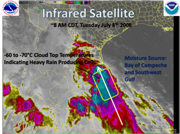
From July 1st through the 8th, a swath of between 5 and 10 inches affected most of Hidalgo, Cameron, and parts of Willacy Counties. On Monday, July 7th, a band of 2 to 4 inches fell during the late morning and early afternoon from Brownsville to Raymondville, with dozens of cases of high standing water and minor flooding of poor drainage areas. A table of rainfall reports follows this article. The satellite image below, early on July 8th, was typical for each morning and early afternoon through the July 4th weekend and beyond.
Record Setters and other Tidbits
The prolonged period of rain and rather cool weather was quite unusual for early July. The following are a few interesting statistics:
Brownsville
*6.17 inches through July 8: 5th wettest July
*Number of July High temperatures below 82°F in 2008: 3
*Number of July High temperatures below 82°F before 2008, since 1878: 15
Harlingen
*6.18 inches through July 8: 6th wettest July
*Daily rainfall records: July 5th, 2.34 inches (8th wettest single day); July 7th, 2.67 inches (5th wettest single day).
*Number of July High temperatures below 82°F in 2008: 3
*Number of July High temperatures below 82°F before 2008, since 1911: 11
McAllen
*4.87 inches through July 8: 6th wettest July
*Daily rainfall records: July 6th, 0.76 inches; July 7th, 1.57 inches (11th wettest single day)
|


 Follow us on YouTube