 Santa Blows in with the Wind in 2009 Gusts early and late cause minor damage in Valley |
||
|
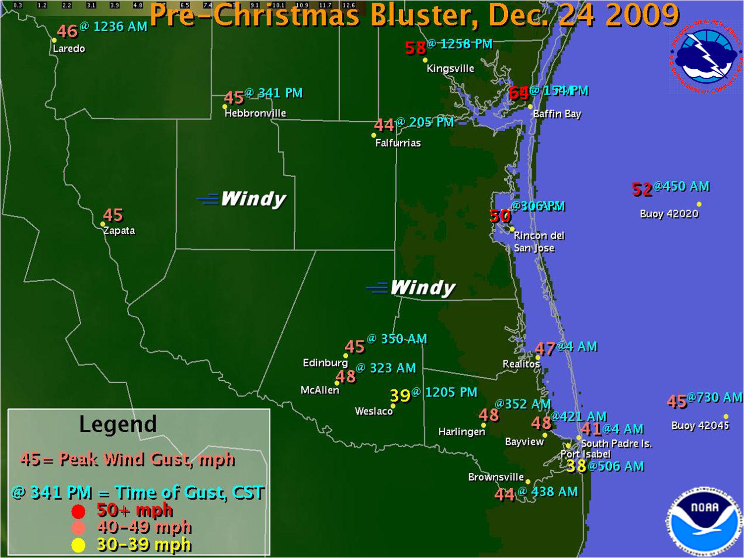
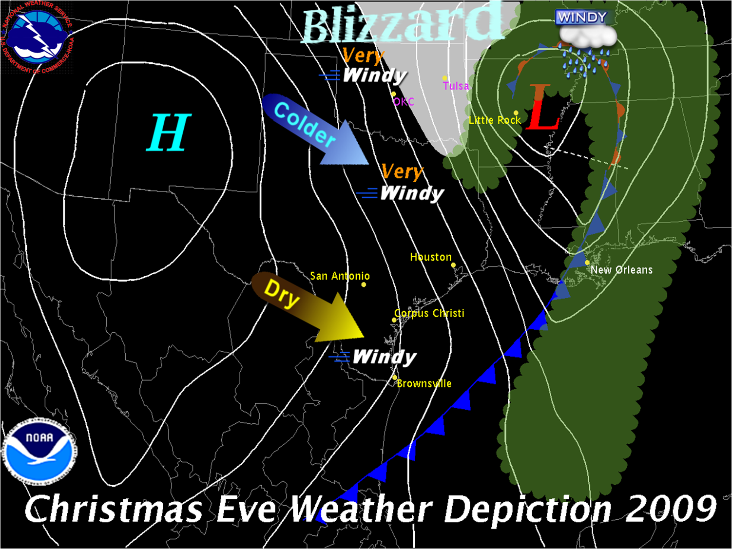
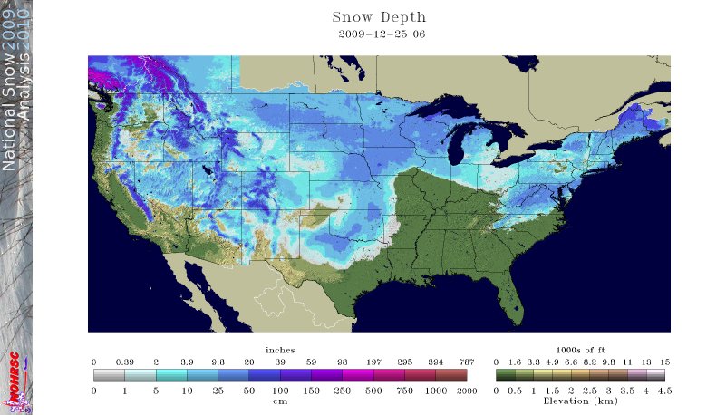
An intensifying cyclone, which moved across North Texas into Arkansas (below) before turning northward and easing up the Mississippi Valley, pushed a vigorous front through Deep South Texas during the pre dawn hours of Christmas Eve. As the storm deepened, a low level northwesterly jet developed on its southern and western flank, with wind speeds ranging from 50 to more than 60 knots (60 to 75 mph) not too far above the earth’s surface from central Oklahoma south to the Rio Grande Valley. These winds would concurrently produce a bona fide blizzard (below, and box at right) in Oklahoma, where more than a foot of snow was blown by sustained winds peaking near 50 mph and gusting over 60 mph at times! Across Deep South Texas, two wind peaks were noted: First, along and just behind the early morning cold front, where northwest winds gusted briefly between 40 and at least 50 mph, causing the bulk of the initial minor damage; later, when low level warming (from compression of the air) mixed down some of the 50 to 60 mph northwesterly winds associated with the developing jet. Afternoon surface gusts mainly between 1 PM and 5 PM ranged from more than 50 mph in Kleberg County, to 35 to 45 mph across nearly all of Deep South Texas. Mariners in the offshore waters beyond 20 nm did not experience the same daybreak lull; Gale or near Gale force sustained winds prevailed from the pre dawn hours until near sunset. The pulsing wind gusts did not leave the Lower RGV unscathed. While there were no reports of significant damage, the estimated 50 mph gusts helped to uproot a 40 foot tall oak tree in Pharr between 330 and 4 AM, blew off shingles from older apartments near the intersection of Price Road and Old Port Isabel Highway in Brownsville at around 430 AM, and blew down a 50 foot section of fence in north Brownsville at around the same time. Dozens of palm fronds and a few mesquite branches were also blown down in Brownsville. The second wave of strong winds blew down a parking lot light pole in McAllen, causing damage to vehicles parked nearby. |
|
|
 |
||


 Follow us on YouTube