 Drought Slightly Dented First Rains in Nearly Two Months for Some |
|
|
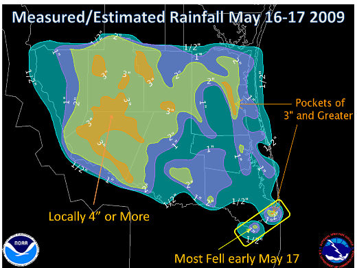
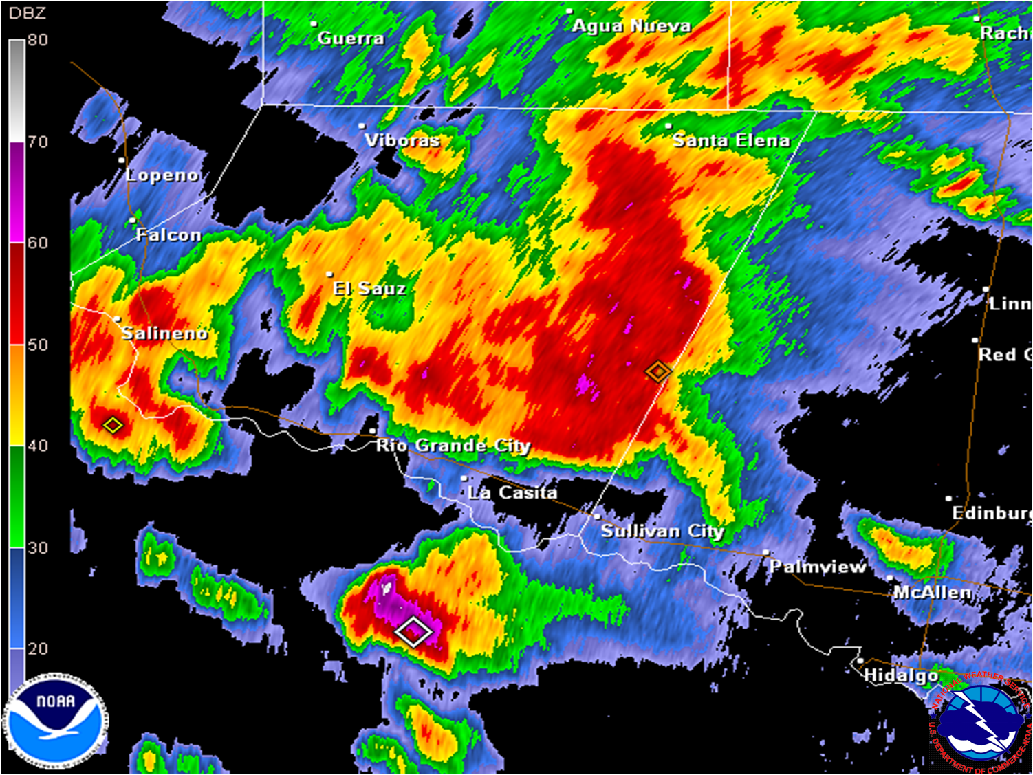
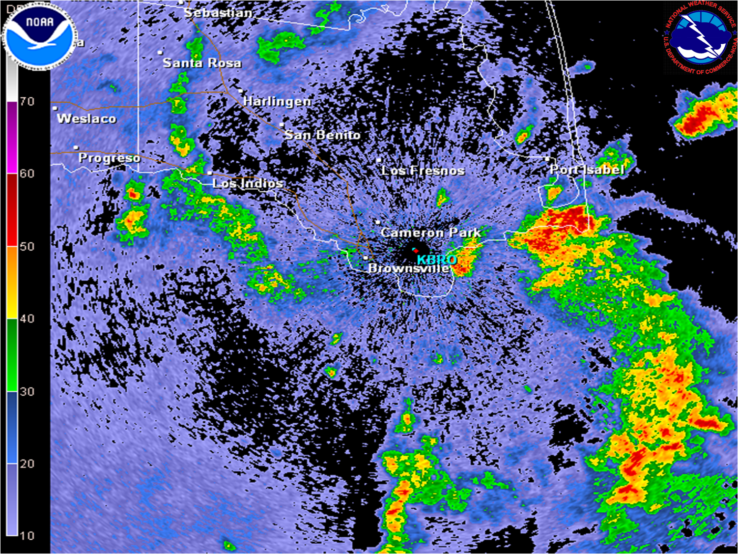
After more than two weeks of searing heat (by spring standards), persistent south to southeast winds, and no rain, the weather pattern finally underwent a change. Increasing north to northwest flow well above the atmosphere helped push a cooling front into Deep South Texas during the weekend of May 16th and 17th. Ahead of the front, on May 16th, outflow boundaries from thunderstorms over the Rio Grande Plains and Highlands generally north of Laredo early in the day pushed southeast by afternoon. These boundaries provided the lifting mechanism necessary to activate the unstable air mass across the middle Rio Grande Valley, and strong thunderstorms containing welcome, though relatively brief, torrential rains developed across Jim Hogg and Zapata County and quickly expanded and intensified into Starr and Hidalgo County by mid afternoon (radar image, lower left). The storms pressed east, gradually weakening as they headed into the Lower RGV. By the end of the day, general rains from 1 to 3 inches had fallen across much of Starr and Jim Hogg County, as well as western Hidalgo County, with areas of estimated totals of 3 to 5 inches. Stronger cells appeared to have produced marginally severe weather across western Hidalgo County, where estimated wind gusts of 50 to near 60 mph were reported near McCook. Radar signatures also indicated possible hail, though no reports had yet been received as of this Rainfall dropped off across Hidalgo and Cameron Counties as the storms weakened toward evening, with only light rains falling from anvil "debris" by the time the weather reached Brownsville. By early morning of the 17th, as the air mass boundary edged across the Rio Grande, a band of locally heavy rains developed from Boca Chica Beach west toward the east side of Brownsville, generally along Texas State Highway 4. These rains dropped an inch and a third of rain at the Brownsville/South Padre Island International Airport, while locations less than 10 miles away saw very little rain (radar image, lower right). Cooler, drier weather followed the rains into the week of May 18th. For a table of measured rainfall, click here. |
|
 |
 |


 Follow us on YouTube