Photo of rapidly spreading wildfire on the King Ranch, 2 PM January 2nd, 2011. At this point, the Incident Command Post was abandoned. Photo credit: Frank Torres, Emergency Management Coordinator, Willacy County. |
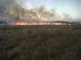
Photo of a back burn – a small wild fire set purposefully to help contain the larger fire on the King Ranch just before sunset, January 2nd, 2011. Photo credit: Frank Torres. |
|
Recap
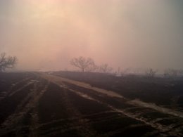
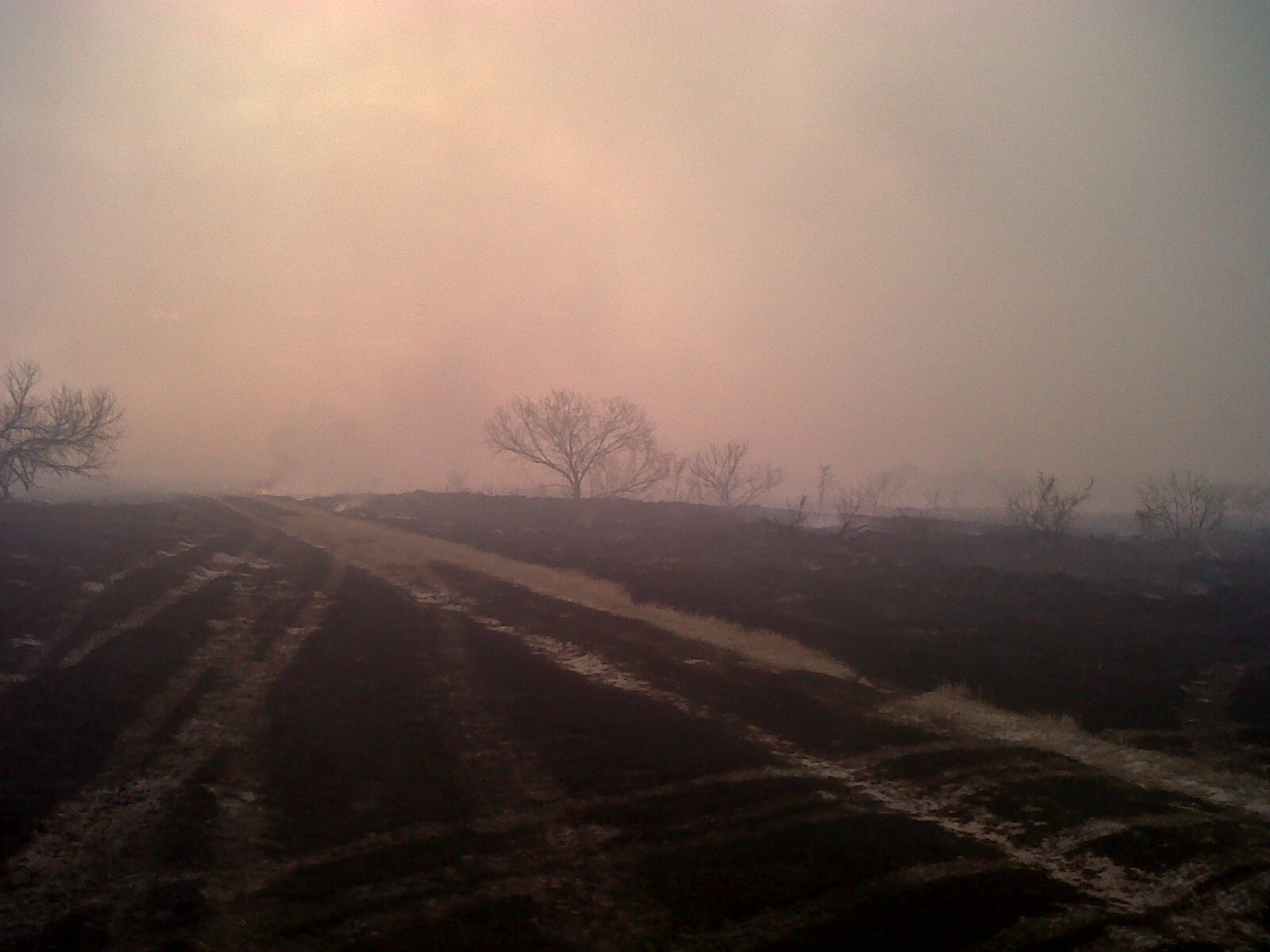
The sum of all wild fire fears was realized during the late morning through late evening of Sunday, January 2nd, on the King Ranch in southwestern Kenedy County, approximately 14 miles north of Raymondville. Preliminary indications suggest sparks from a passing train set off the highly cured, highly "loaded" mix of grasses and brush just west of Federal Highway 77 in the vicinity of Rudolph. At least five separate fires were located by first responders on the scene, after the initial call was received at around 11 AM. Before long, the fires coalesced into a massive blaze which engulfed between seven and eight thousand acres. Fortunately, the fire began on the west side of the highway and was driven farther west by light to moderate easterly winds during the afternoon. As of this writing, the fire was known to have burned only ranchland; no persons, livestock, or structures were harmed.
The conflagration spread so rapidly during the early afternoon that a temporary Incident Command Post had to be moved to safety after the fire crashed through a temporary break. As the day wore on, crews from all fire departments on Willacy County, the County Emergency Management Office, and the U.S. Fish and Wildlife Service arrived and were able to begin to quell the situation through a series of backburns, which helped set up fire breaks and ultimately allowed the responders and firefighters to contain the fire around 10 PM, nearly 12 hours after the blaze started. NWS Brownsville/Rio Grande Valley staff played a significant role in aiding back burning operations through two spot forecasts and telephone coordination through the afternoon and evening. Click for the initial spot forecast.
Other Activity
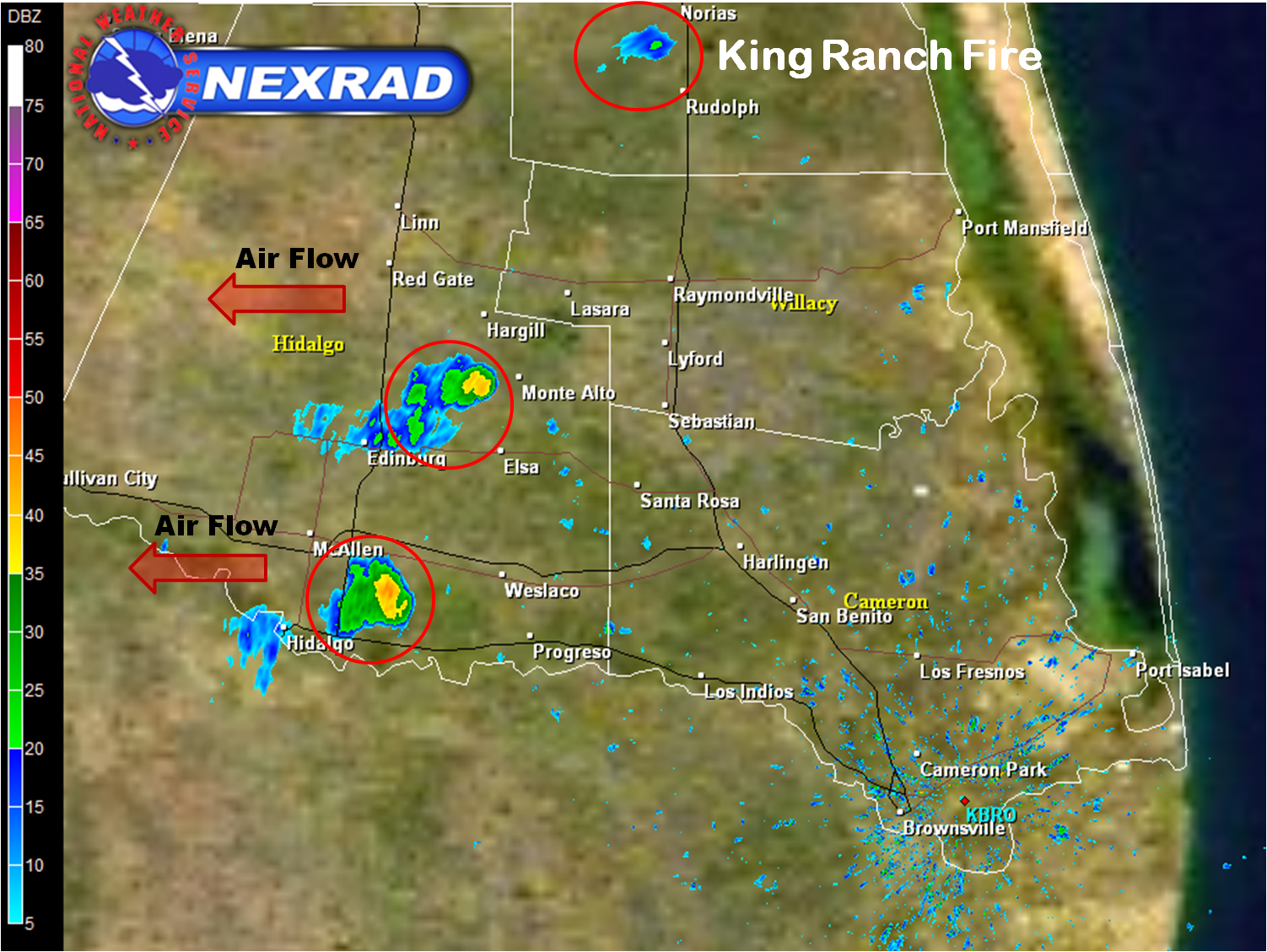
The image below shows more than the King Ranch Fire (near the top). Other fires formed in Hidalgo County, including south of Donna and, by radar inspection, between Monte Alto and Hargill. A trash fire quickly grew out of control on a small farm near Donna, burning two travel trailers but thankfully sparing injury or death to the family or small animals on the farm. Local news reported perhaps six small grass fires occurred in and near Donna during the afternoon of January 2nd.
No Sustained Relief in Sight
Forecast data and continued trends of moderate La Niña and a persistent negative Arctic Oscillation since November argue for little appreciable rain, sandwiched between more dry fronts into the middle of January. Conditions are as dangerous as they can get for January in Deep South Texas:
- October through December rainfall was the lowest on record, dating back more than 100 years on many cases
- At least a dozen days have seen afternoon humidity fall into the teens or lower, particularly from Hidalgo and Brooks County out to the Rio Grande Plains
- Six minor freezes have occurred in the same areas since late November
- All fronts have either been dry, or accompanied by minimal rainfall before sunshine, low humidity, and gusty north winds return
Remember to stay FireWise! And, don’t forget to Get Your Smokey (Bear) On!
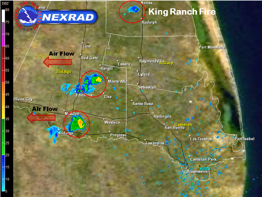
Doppler radar, at 113 PM CST January 2nd, showing three separate smoke plumes: From bottom to top, near Donna, between Monte Alto and Hargill, and on the King Ranch. The King Ranch looks less impressive, but the level of the smoke was 1400 feet higher (4700 vs. 3200 feet), based on the lowest elevation radar scan. |


 Follow us on YouTube