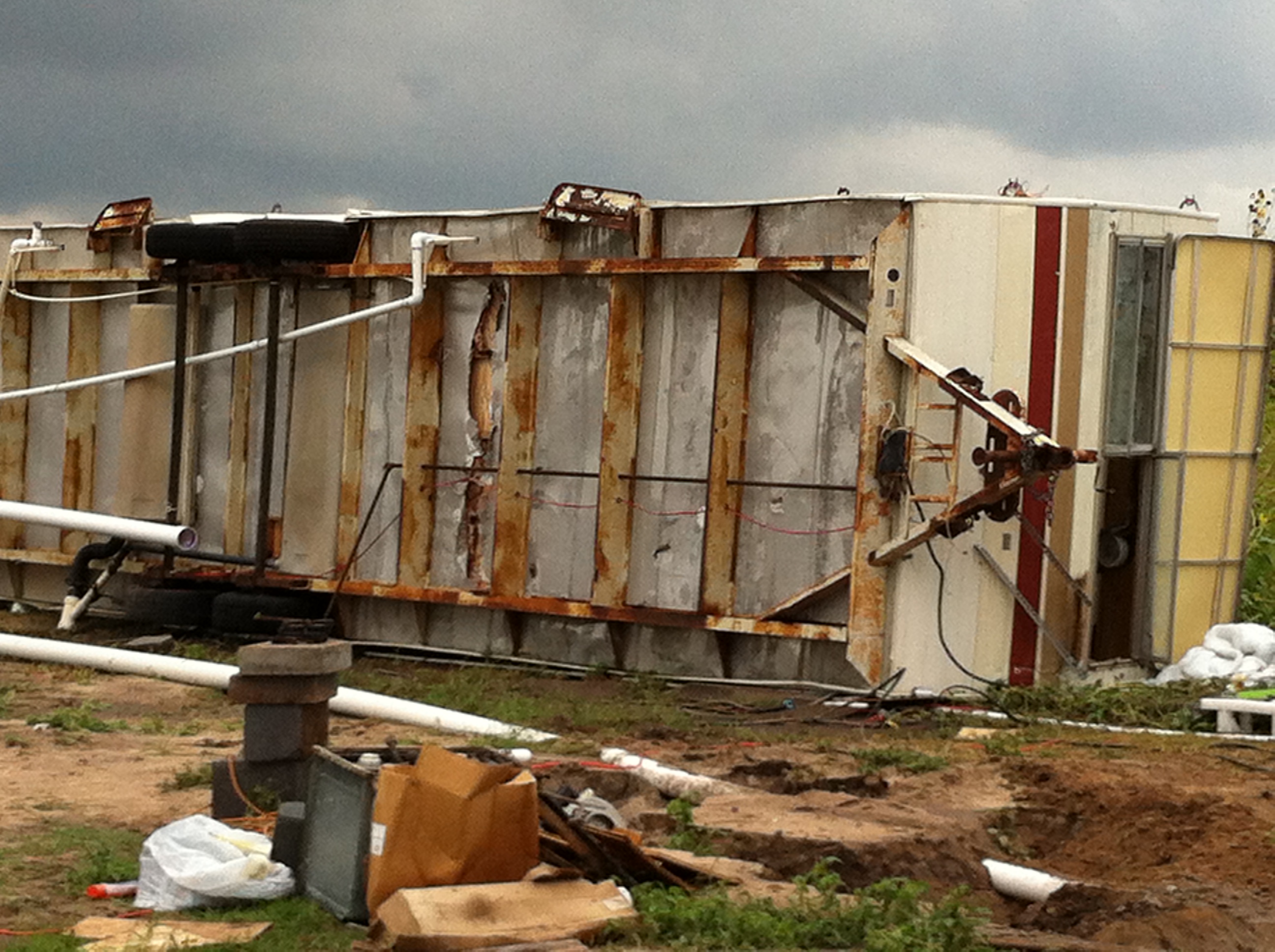
 Photos taken from Doolittle, Texas (6 miles northeast of Edinburg) after microburst containing 60 to 65 mph winds damaged many homes and buildings. For individual pictures, click here. |
|
| Busy Spring Storm Season Continues Mini Supercell Brings Damaging Winds, More Hail on May 9th 2012 |
|
|
Event The storm would continue east through Hidalgo County, just north of State Highway 107, then persist into southern Willacy County, where additional hail fell. Much of the hail was the size of a quarter or less, though some reports indicated a few golfball to baseball size stones mixed in. A second storm moved northeast through the King Ranch at about the same time the rotating storm which produced the Hidalgo County damage slid into Sebastian (Willacy County). The following preliminary storm report provided additional details:
PRELIMINARY LOCAL STORM REPORT...SUMMARY
NATIONAL WEATHER SERVICE BROWNSVILLE TX
1158 PM CDT WED MAY 09 2012

..TIME...   ...EVENT...      ...CITY LOCATION...     ...LAT.LON...
..DATE...   ....MAG....      ..COUNTY LOCATION..ST.. ...SOURCE....
            ..REMARKS..

0940 PM     TSTM WND DMG     4 NE EDINBURG           26.34N  98.12W
05/09/2012                   HIDALGO            TX   EMERGENCY MNGR

            HIIDALGO EM REPORTS TWO MOBILE HOMES DESTROYED AND HOME
            UNDER RENOVATION SEVERELY DAMAGED. OUTBUILDINGS AND
            OTHER STRUCTURES ALSO DAMAGED NEAR DOOLITTLE. NO
            INJURIES.

0946 PM     HAIL             EDCOUCH                 26.29N  97.96W
05/09/2012  E2.75 INCH       HIDALGO            TX   TRAINED SPOTTER

            SPOTTER REPORTED HAIL HAD BUSTED HER WINDOWS IN IN
            EDCOUCH. WAS NOT CONFIDENT OF EXACT HAIL SIZE.

0957 PM     HAIL             10 NE EDINBURG          26.40N  98.05W
05/09/2012  E0.75 INCH       HIDALGO            TX   PUBLIC

            PUBLIC REPORTS PENNY-SIZE HAIL 10 MILES NE OF EDINBURG
            NEAR ELSA AT THE INTERSECTION OF FM 2812 AND VAL VERDE
            ROAD.

1033 PM     HAIL             15 S SARITA             27.00N  97.80W
05/09/2012  E1.00 INCH       KENEDY             TX   OTHER FEDERAL

            BORDER PATROL CHECKPOINT 15 MILES SOUTH OF SARITA
            REPORTS PREDOMINANTLY NICKEL-SIZE HAIL WITH EMBEDDED
            QUARTER-SIZE HAIL.

1035 PM     HAIL             SEBASTIAN               26.34N  97.80W
05/09/2012  E4.50 INCH       WILLACY            TX   EMERGENCY MNGR

            TRAINED SPOTTER REPORTS SOFTBALL SIZED HAIL FALLING IN
            SEBASTIAN FOR LAST FIVE MINUTES. HAPPENING RIGHT
            NOW...FROM WILLACY EM.

1045 PM     HAIL             2 S RAYMONDVILLE        26.45N  97.78W
05/09/2012  E1.75 INCH       WILLACY            TX   EMERGENCY MNGR

            WILLACY COUNTY EMERGENCY MANAGER REPORTS GOLFBALL-SIZE
            HAIL 2 MILES SOUTH OF RAYMONDVILLE.
|
|
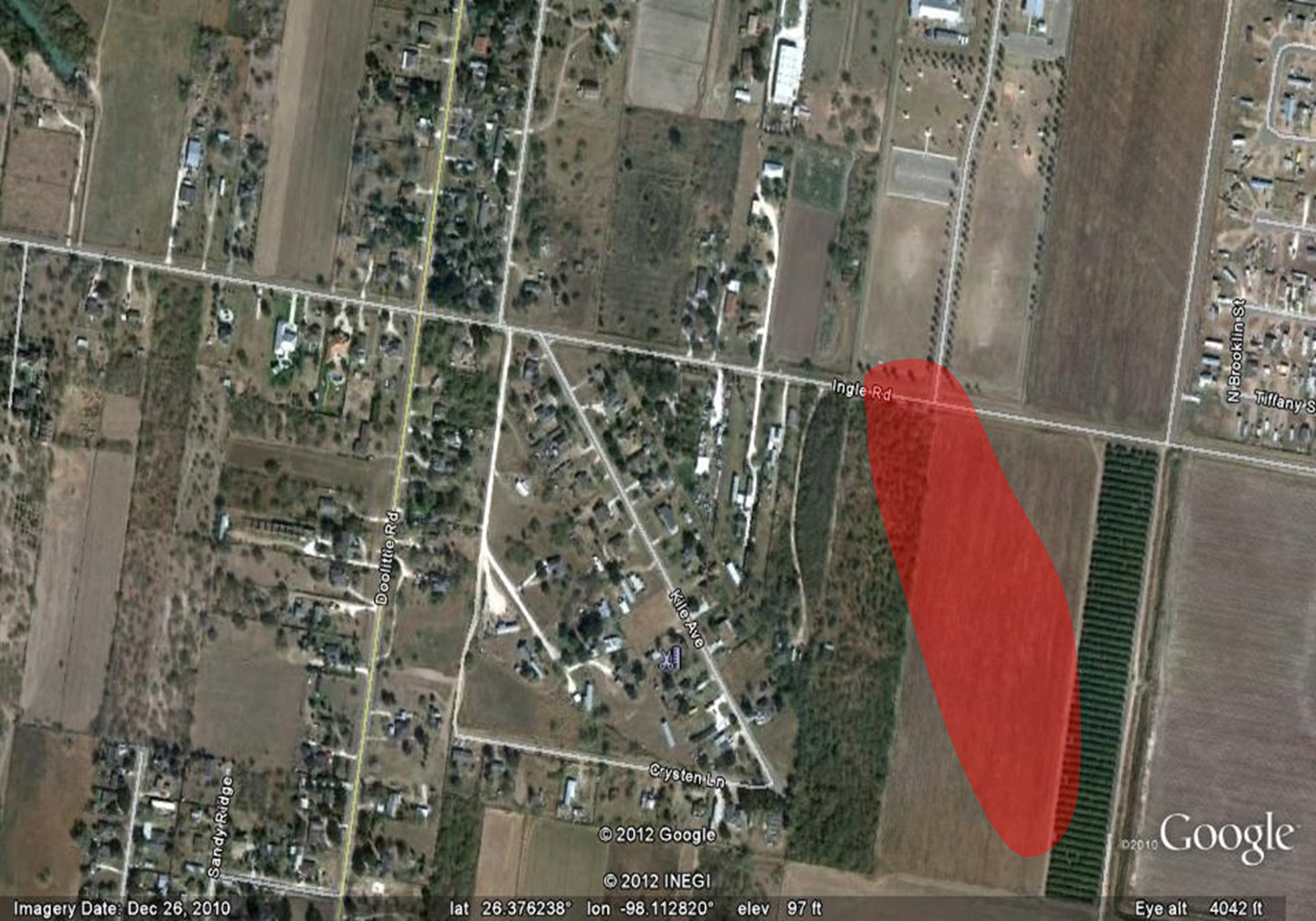 Map of primary damage area, Doolittle, Texas (about 6 miles northeast of Edinburg). Red shaded area was surveyed; colonia did not exist when the map image was created. |
|
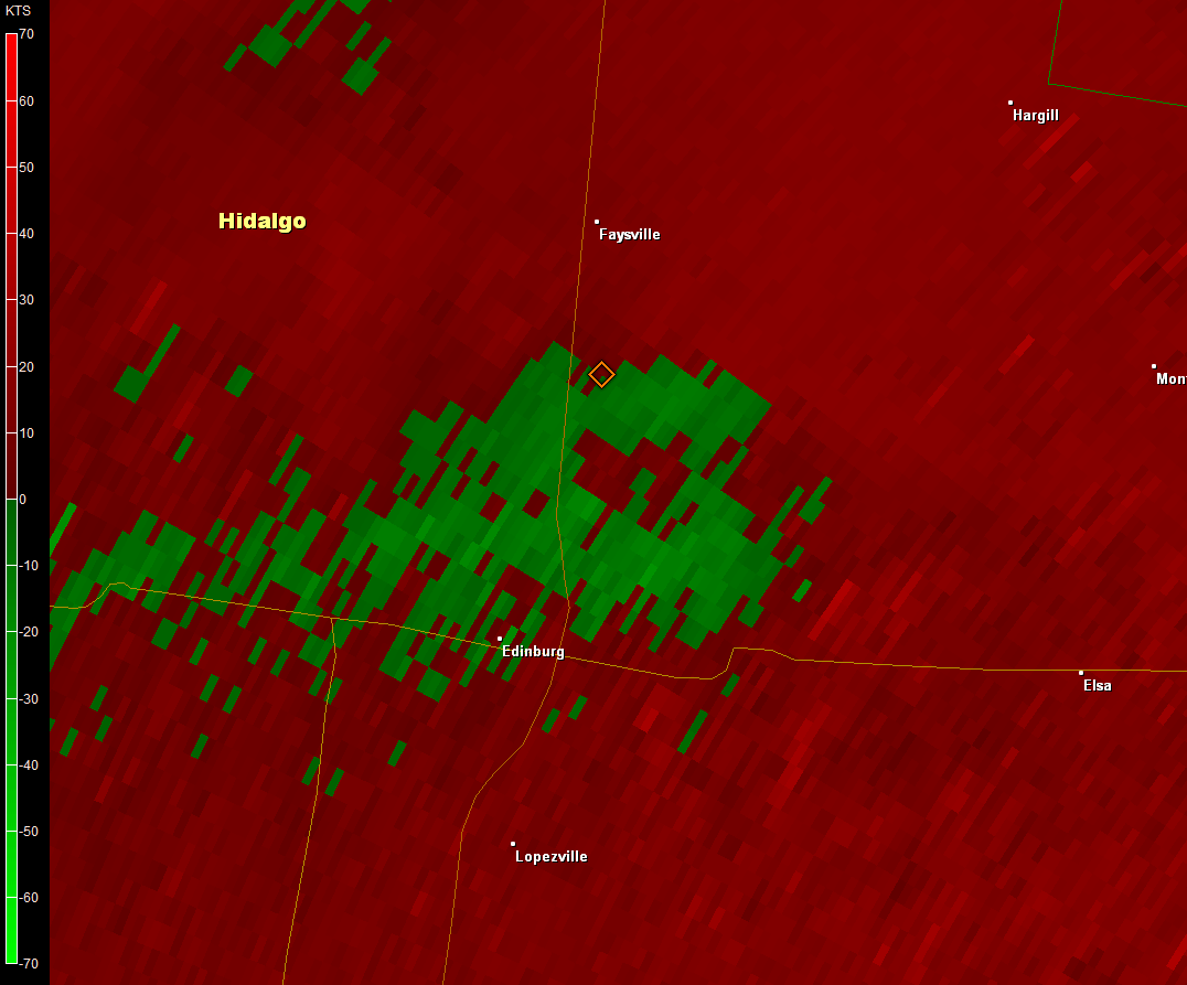 Loop of 0.5° base velocity images between 921 and 945 PM CDT May 8th, across central Hidalgo County along and just east of Highway 281. The third frame (931 PM CDT, time not shown) shows a thin bright green stripe near the damage area, which indicated near 60 mph winds at around 5000 feet above the ground. |
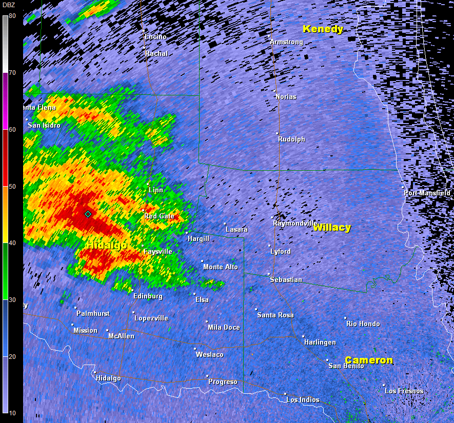 Loop of 0.5° base reflectivity images between 859 and 1056 PM CDT May 9th. The time lapse shows a rotating thunderstorm moving from central Hidalgo County into southern Willacy County. Bright white and gray colors indicate abundant hail of different sizes, along with torrential rains. |


 Follow us on YouTube