|
After thirty–eight of thirty–nine days featured triple–digit heat in McAllen between mid July and late August, the comibination of a slow, east to west moving tropical upper tropospheric trough (or "TUTT") that stalled over south Texas and northeast Mexico with a stronger, mid latitude system that dropped a legitimate but unusual early season cold front through parts of Texas brought multiple rounds of hazardous summer weather, culminating with torrential flooding rains, fierce lightning, and even some rare large August hail on the 20th. The combination of events produced hundreds of thousands of dollars in property damage, including at least five homes struck by lightning in the McAllen/Weslaco metro area. The streak of triple digit heat was slammed shut by the thunderstorm complex on the 20th; afternoon temperatures failed to get out of the eighties that afternoon.
August 17: Small Storm Carries a Big Punch for West Harlingen
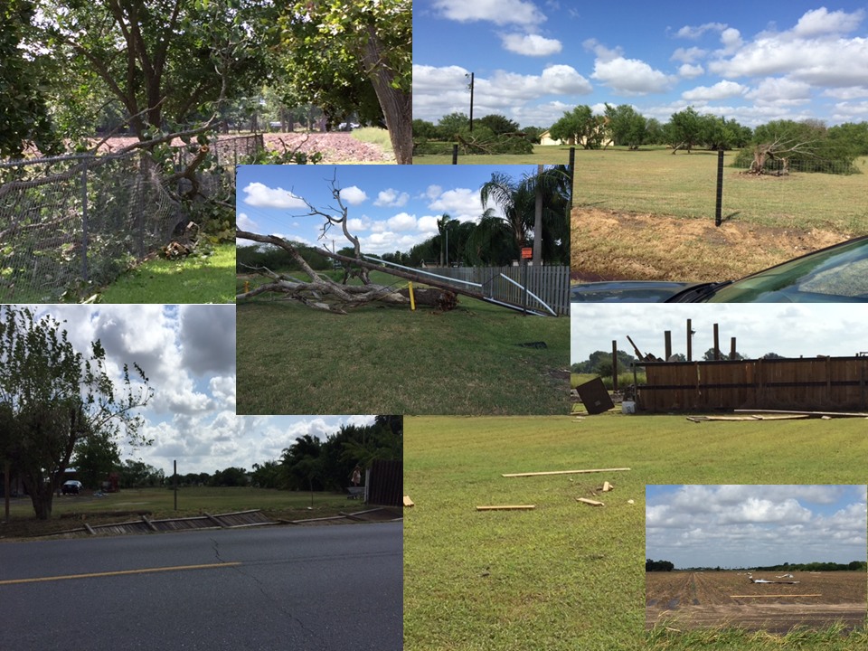
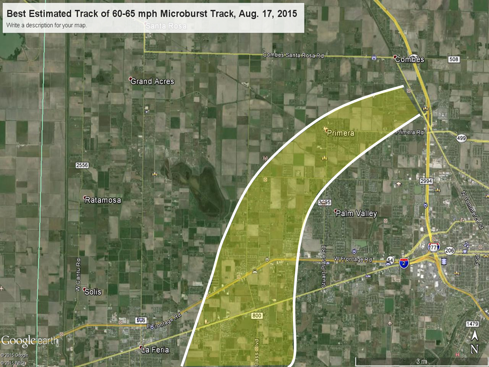
As the TUTT low centered itself across the Rio Grande Valley, unusually cold air well above the surface (for August) combined with low relative humidity above the cloud base, around 4500 feet, combined with the afternoon sea breeze to trigger clusters of thunderstorms from eastern Willacy County through the King Ranch (Kenedy County). Those storms produced their share of lightning and rain, but added more boundaries to the atmosphere. One of these boundaries slid south into northern Cameron County soon after 5 PM, and helped launch an isolated storm that would ultimately cause tens of thousands in property damage. The storm (below) oozed west, then south, affecting Primera, Palm Valley, and west Harlingen including Interstate Highway 2.

Best estimate of August 17th microburst track from Primera to the southwest side of Harlingen
The storm, which pulsed a microburst several times along a slow path, produced the following impacts roughly from 605 to 630 PM:
- 60 to 65 mph wind gusts
- A flipped unanchored Gulfstream trailer
- Several partial roof removals including one at an auto dealership (Altas Palmas Road), a new tin roof, and an old lean–to roof in Primera
- Hundreds of large cottonwood, sycamore, and mesquite tree limbs broeken, including multiple older, tall sycamore and poplar branches, two which fell onto a residence
- Several uprooted mesquite trees
- Blinding rain caused an eleven vehicle pileup on Interstate 2, with minor injuries
Base reflectivity loop (1.5°) of west Harlingen microburst, August 17, 2015 |
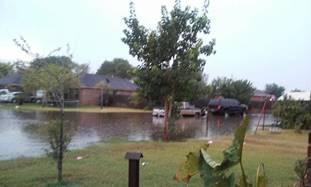
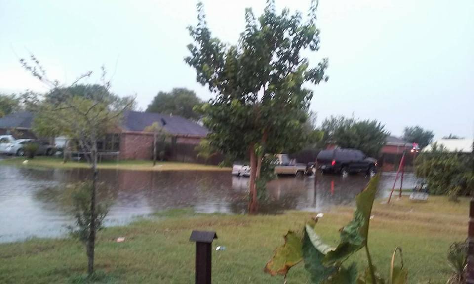
Minor flooding near Weslaco, August 20, 2015. Photo courtesy of Leslie Salazar, NWS Brownsville/Rio Grande Valley volunteer.
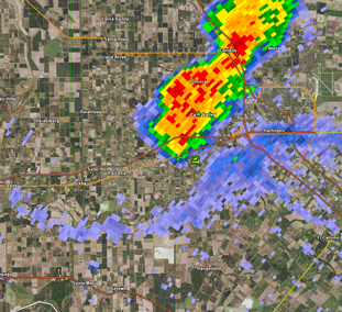
August 19/20: Light Show, Flood Show: Surprise All–Nighter Lightning Storms Ravage McAllen/Mission, Weslaco
Well, that was a surprise!
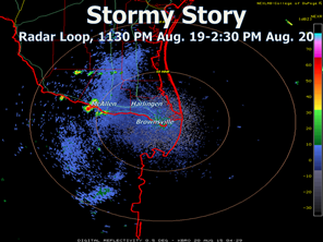
Rarely does the atmosphere pull a fast one with little notice, but that’s exactly what happened just before midnight on August 20th. Extremely unstable air across the mid Valley – Apparant temperatures at McAllen were above 100°F at 11 PM(!) with the actual temperature just under 90°F, and for a reason to be researched (likely a boundary or multiple boundaries), explosive thunderstorm development began soon after. After the initial craziness (which produced wind, hail, lightning, and flooding) subsided around 2 AM, the action resumed after 4 AM and continued through 630 AM, mainly with more heavy rain and frequent to excessive lightning. It was this event that pushed water depths up to three feet in some areas. Forecast models had suggested such an event – some six to eight hours later (beginning roughly at 8 AM or so), but the atmosphere had other ideas. When all was said and done some eight hours later, the combination of excessive lightning, flooding rain, and even wind and hail left the following in its wake:
- At least five homes were struck by lightning and burned in spots in the McAllen Metro and Weslaco areas, with considerable damage
- Four to seven inches of rainfall in Weslaco, in some spots triple the August average in a little more than six hours (average is 1.95 inches). Four to six inches in McAllen/Mission/Alton.
- Widespread minor flooding and pockets of life threatening flooding (up to three feet of water depth), with pumping operations required to open roads and parking areas in McAllen/Mission/Alton and Weslaco
- Trees down and some roof/antenna damage between Pharr and Weslaco
- Quarter to Golfball size hail with the initial storm (midnight to 1 AM) in Mission and Palmview
- More than 30,000 AEP Texas residents without power during the peak of the storms, during the pre dawn hours of the 20th.
- The downpours may have wiped out a number of cotton fields in full boll; such rain can strip the cotton or soak it beyond usability. Damage/production loss was unknown as of this writing
Other areas not in the four to seven inch core received a good soaking (one to three inches), placing nearly all of the populated Rio Grande Valley above monthly averages in one fell swoop [Monthly averages generally range from 2 to 2.5 inches]. A preliminary map of measured and bias–corrected rainfall estimates is shown below.
|


 Follow us on YouTube