

Early On
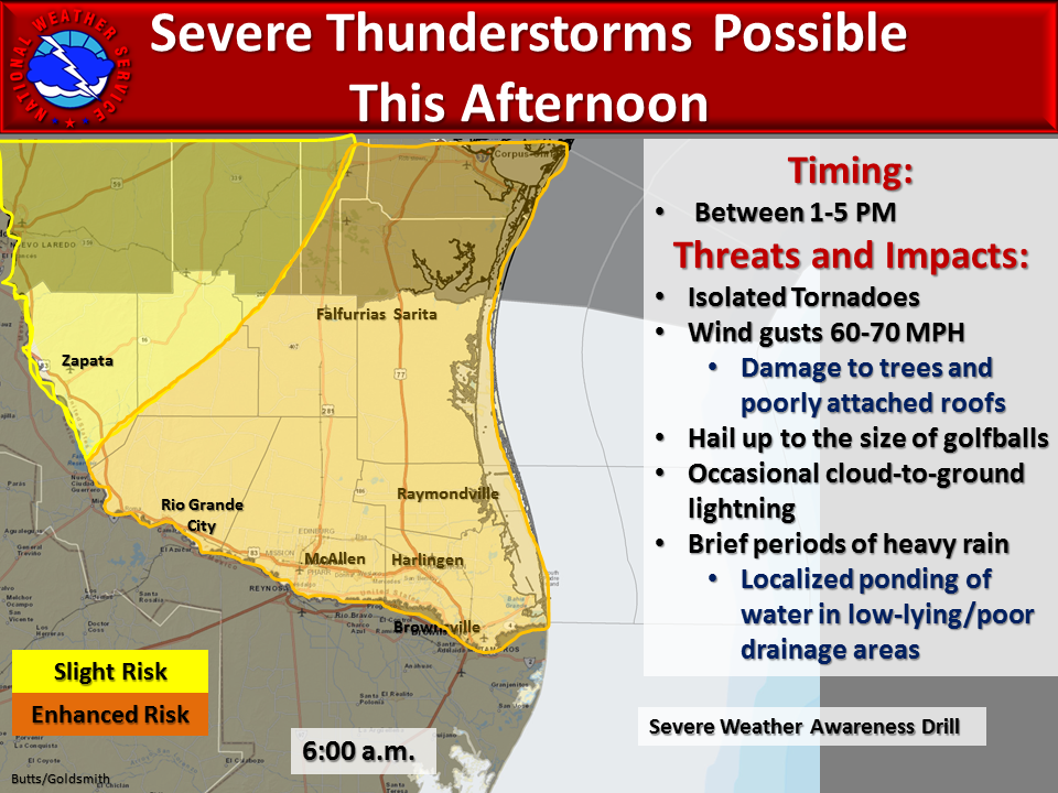
6:00 a.m.
It's first thing in the morning on a warm, slightly muggy day. You notice the morning weathercast is talking about rain and thunderstorms today and you see this graphic from our office.
What's Important?
The risk covers a large area, all of the Rio Grande Valley and Deep South Texas. It is very difficult to pinpoint small areas that are most at risk several hours before thunderstorms develop. What this graphic says is, everyone in the orange and yellow areas are at some risk.
The severe weather risk is for isolated tornadoes, damaging winds and large hail. Any storms that develop will also produce lightning and brief heavy rain.
You then go to our website and see the forecast:
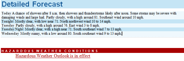
You then click to check the Hazardous Weather Outlook
What do you do now?
Be aware. Think about where you will be through the day.
Can you monitor the weather through the day?
Will you be outdoors?
Will you be in a building that isn't able to protect you from the wind?
Will you be traveling?
If these storms happen will you need to do anything extra to stay safe?
Do you have a NOAA Weather Radio that can actively alert you?
Am I responsible for the safety of any people this may impact?
Which county do I live in? What towns are close-by?
Simply knowing the risk, completing a mental checklist and staying aware through the day is the first step to safety.
 Follow us on YouTube