HOME
FORECAST
Local
Graphical
Aviation
Marine
Rivers and Lakes
Hurricanes
Severe Weather
Fire Weather
Sun/Moon
Long Range Forecasts
Climate Prediction
Space Weather
PAST WEATHER
Past Weather
Heating/Cooling Days
Monthly Temperatures
Records
Astronomical Data
SAFETY
Floods
Tsunamis
Beach Hazards
Wildfire
Cold
Tornadoes
Air Quality
Fog
Heat
Hurricanes
Lightning
Safe Boating
Rip Currents
Thunderstorms
Space Weather
Sun (Ultraviolet Radiation)
Safety Campaigns
Wind
Drought
Winter Weather
INFORMATION
Wireless Emergency Alerts
Brochures
Weather-Ready Nation
Cooperative Observers
Daily Briefing
Damage/Fatality/Injury Statistics
Forecast Models
GIS Data Portal
NOAA Weather Radio
Publications
SKYWARN Storm Spotters
StormReady
TsunamiReady
Service Change Notices
EDUCATION
Be A Force of Nature
NWS Education Home
NEWS
NWS News
Events
Pubs/Brochures/Booklets
NWS Media Contacts
SEARCH
Search For
NWS
All NOAA
ABOUT
About NWS
Organization
Strategic Plan
Commitment to Diversity
For NWS Employees
International
National Centers
Careers
Contact Us
Glossary
Social Media
Local forecast by
"City, St" or ZIP code
Sorry, the location you searched for was not found. Please try another search.
Multiple locations were found. Please select one of the following:
Location Help
News Headlines
March 23 2024 Late Season Heavy Snow
Meteorological Conditions across Vermont and northern New York During the Total Solar Eclipse of 8 April 2024
Check out when the next Skywarn Class will be and where!
Click here for the latest NWS Burlington Spring Flood Outlook
NWS launches new website to house the next generation of water forecast services! Check it out here!
Additional Headlines
Customize Your
Weather.gov
Enter Your City, ST or ZIP Code
Remember Me
LOADING...
Burlington, VT
Weather Forecast Office
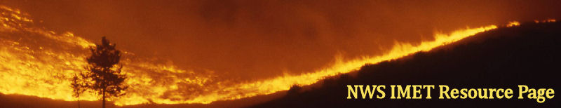
NWS IMET Resource Page
Weather.gov
>
Burlington, VT
> NWS IMET Resource Page
Current Hazards
River Flooding
Briefing Page
Winter
Space
Local Outlook
Drought
Thunderstorms
Hurricanes
Graphical Hazards Outlook
Current Conditions
Observations (List)
Rainfall
Air Quality
Satellite
Observations (Map)
Mesoscale Analysis
Spotter Reports
Local Storm Reports
Webcams
Road Conditions
Radar
Local KCXX Standard Radar (low bandwidth)
Local KCXX Enhanced Radar
Regional Standard Radar (low bandwidth)
National Standard Radar (low bandwidth)
Local KTYX Standard Radar (low bandwidth)
Local KTYX Enhanced Radar
Forecasts
Forecasters' Discussion
Hourly View
Map View
Aviation
Tropical
Activity Planner
Recreational
Fire Weather
Request Spot Forecast
Avalanche Weather Information
Air Quality
Rivers and Lakes
River Observations (Map)
River Forecasts (Map)
Current & Past Streamflow
Ensemble River Guidance
River Forecast Centers
Spring Flood Outlook
Climate and Past Weather
Past Observed Weather
24 Hour Summary
CoCoRaHS
Past Rainfall
Snowfall Records
Drought Outlook
Historical Records
Climate Prediction
Local Climate Data/Records/Maps
Past Weather Event Summaries
Daily Climate Maps
Local Snowfall Analysis Archive
Local Programs
COOP Program
Office Staff
Local Recorded Web Seminars
SKYWARN
Seasonal Newsletters
Host a NWS Talk
EM Wx Request
Local Research
Local CoCoRaHS Program
Hazard Awareness
Contact Us
Warning Criteria
Ntl. Fire Page
Sit. Report
Wildfire NICC
Inciweb
Wildfire Map
ROMAN
Overview
Conv. Outlooks
Watches
MDs
Reports
Mesoanalysis
Fire
Hazards
National Hazard Map
WRH Hazard Map
SRH Hazard Map
ERH Hazard Map
ARH Hazard Map
U.S. Threats
FWF
RFW
FWS
FWM
RFD
FDI
PFW
SPC Fire
Predictive Services
SPC Severe
NHC
HPC
AWC Products
NDFD Graphics
Products From SRH
Outlooks To 3 Months
Year Long Outlooks
Predictive Services
Radar
NWS Radar
Ridge Radar
Ridge2 Radar
AWC Radar
RAP/UCAR Radar
College Of Dupage
Satellite
Aviation Wx Center
Western Region
GOES Full Suite
GOES E/W Sectors
GOES E WFOs
GOES W WFOs
NOAA SSD
College Of Dupage
NESDIS
SSEC
MODIS
OSEI
Surface
ROMAN
Mesowest
Aviation Wx Center
HPC
Latest Sfc Map
UCAR
FSL
UIUC
Air Sports Net
Missoula Site
College Of Dupage
NowCOAST
Upper Air
SPC Soundings
UCAR Soundings
U. of Wyo Soundings
SPC Upper Plots
UCAR Upper Plots
U. of Wyo Plots
Model Data
NCEP
NCEP Convective
MOS
Ensembles
PSU Ensembles
E-Wall From PSU
WRF
NWS WRFs
SPC Meso
HRRR
FWIS CONUS 00/12
FWIS CONUS 06/18
FWIS Alaska 00/12
FWIS Alaska 06/18
FWIS Near Surface
FCAMMS
Tropical
SPC SREF
NCEP Loops
EMC
Canadian
Smoke Management
NIFC Smoke Mgmt
FCAMMS
Airfire
Bufkit
National Data
NWS Buffalo Page
IMET Bufkit Paper
WIMS
Observations
Forecasts
WIMS Home
WFAS
Quick Links
Main Page
WFAS Google Earth
Drought/PCPN
Drought Outlook
Drought Discussion
Drought Assessment
Keetch-Byrum
Palmer Drought
US Climate Monitor
AHPS PCPN
24hr QPF
CPC Pcpn
PCPN Time Series
Reg. Climate Maps
WRCC
Hazmat
Response/Restore
NOAA ARL Site
Worldwide Hazards
NIFC
NICC
Predictive Services
NWCG
Forest Service
BLM
Fish & Wildlife
NPS
Fire Sciences Lab
Quick Reference
Weather.gov
IMET SharePoint Site
Work E-mail
WRH Fire Page
SLC IMET Page
NIFC
SPC
BLM Lightning
WRH Satellite Page
AWC Satellite
Ridge2 Radar
AHPS
MyFireCommunity
NWS Fire Directives
GSA Per Diem Rates
IMET Travel Map
Wildfire Training
IMET TEXAS SUPPORT
Page Updated 3-18-11
Radar
Current Weather
Rivers & Lakes
Satellite
Forecast Maps
Hour by Hour Forecast
Winter Weather
Graphical Hazards
Recreational Forecast
Forecaster's Discussion
Text Bulletins
Submit Storm Report
Aviation
Fire Weather/Spot
Weather Hazard Briefing
Climate Plots
Skywarn
Follow us on Twitter
Follow us on Facebook
Follow us on YouTube
BTV RSS Feed


 Follow us on YouTube