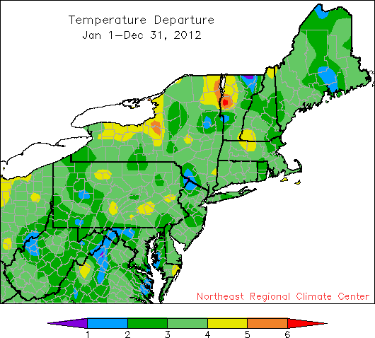
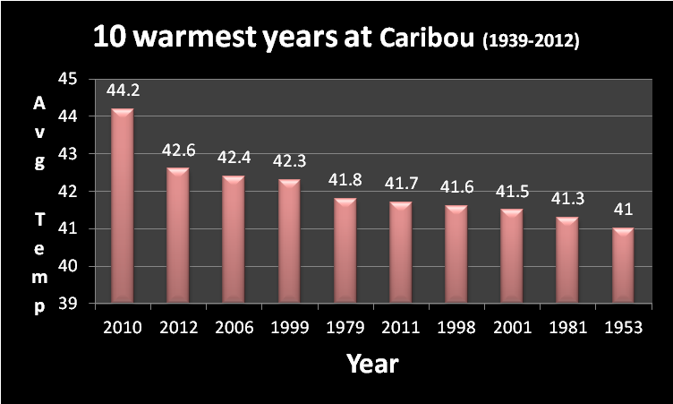
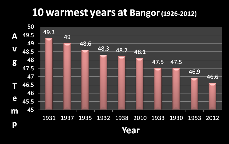
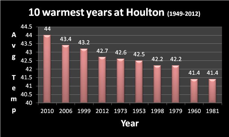
2012 ended up as the 2nd warmest year on record at Caribou. This is somewhat deceptive as weather records began in 1939 and therefore did not include the entire warm decade of the 1930s. If one is to look at Bangor where weather records include the entire decade of the 1930s (weather record began in 1926), this past year ranked as only the 10th warmest on record. Seven of the top 10 warmest years on record at Bangor were in the 1930s. If we had a longer period of record at Caribou it is quite possible that 2012 would have ranked much further down on the list. At Houlton, 2012 ranked as the 4th warmest on record. Weather records at Houlton began in 1949, so once again they did not include the warm decade of the 1930s.
2012 was the warmest year on record for twenty-three of the thirty-five major climate sites in the Northeast. Burlington, VT, had the greatest departure above their old record. The city reported an annual temperature of 50.0°, beating their old record, set in 1998, by 1.6°. Of the sites that broke the record, Scranton, PA, and Williamsport, PA, had the longest-standing record. Scranton was 0.7° warmer in 2012 and Williamsport was 0.1° warmer in 2012 than the previous warmest year, 1921. Syracuse, NY, broke an old record by a fair amount with 2012 coming in 1.1° warmer than the previous warmest year, 1931.
Preliminary figures indicate that eight out of ten states the Northeast broke their record for the warmest year. 2012 is also the warmest on record for the Northeast as a whole.
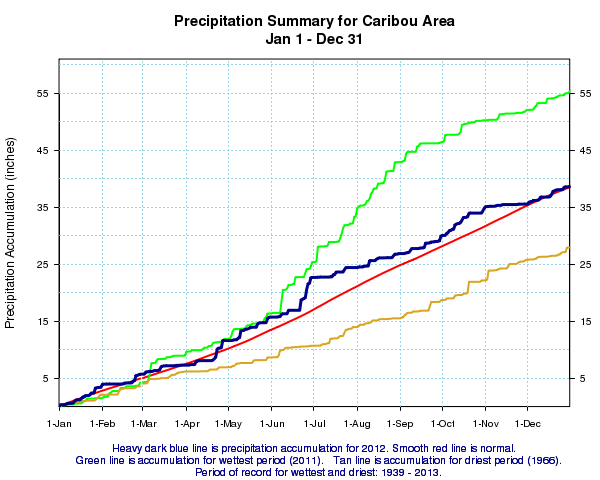
As far as precipitation goes, Caribou ended up 2012 with a total of 38.61 inches of rain (and melted snow), which was only 12 hundredths of an inch above the 1981-2010 normal. It was the driest year since 2004, which in part was due to November being the driest on record since 1939. Total snowfall for the 2011-2012 season of 103.7 inches was just 5.3 inches below normal.
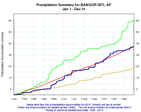
At Bangor, a total of 42.25 inches of rain (and melted snow) was observed this past year, which also made it the driest year at Bangor since 2004. The total precipitation for the year was 32 hundredths of an inch above the 1981-2010 normal, and this was despite July being the driest on record since 1952, and November being the driest since 1978. Total snowfall for the 2011-2012 season of 49.1 inches was the lowest seasonal snowfall total since 2005-2006, and was well below the 1981-2010 normal of 66.1 inches.
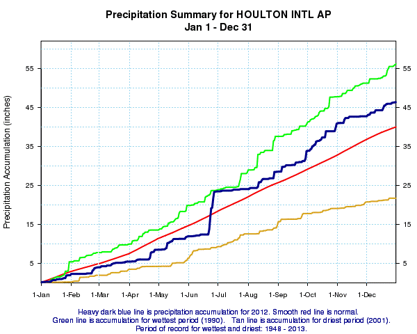
Houlton on the other hand had the wettest year on record since 2005, with a yearly total of 46.33 inches. A large part of this was due to June which was the wettest on record at Houlton with a total of 11.51 inches. Precipitation (rain and melted snow) was 6.35 inches above the 1981-2010 normal of 33.98 inches. Snowfall data is no longer available for this location.


 Coastal Flood
 Follow us on YouTube