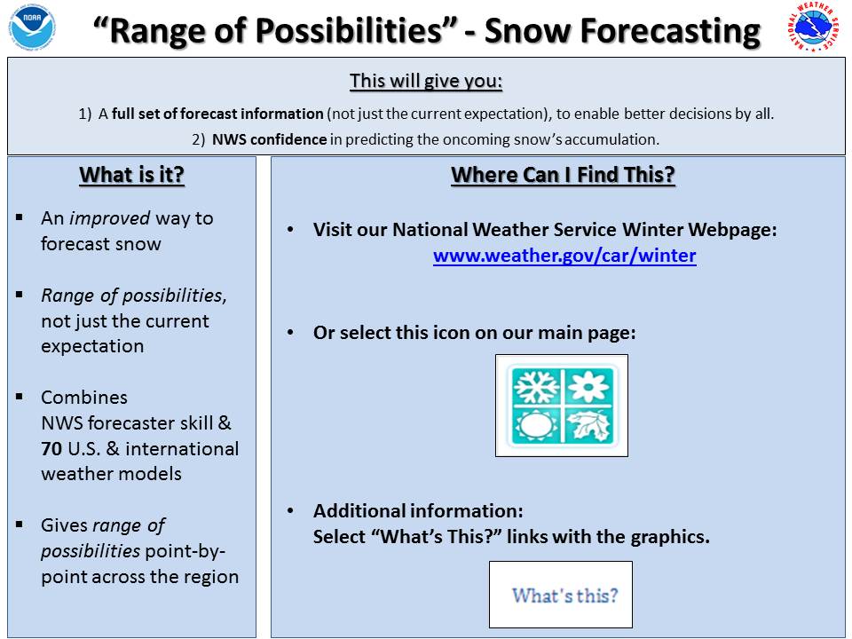
Snowfall Forecasting - “What are the Range of Possibilities?”
- Snowfall amounts can vary a lot during storms and can be difficult to forecast, especially 2 - 3 days before the storm.
- Until now, we have only shown what we believe to be the “most likely” snowfall.
- Unfortunately, this doesn’t provide you with everything we know, or reflect the uncertainty inherent in snowfall forecasts.
- We will now provide you with the full range of possibilities for a storm, so you can make the best decisions possible.
- Our Winter Weather page has undergone many changes, some of which are detailed below.
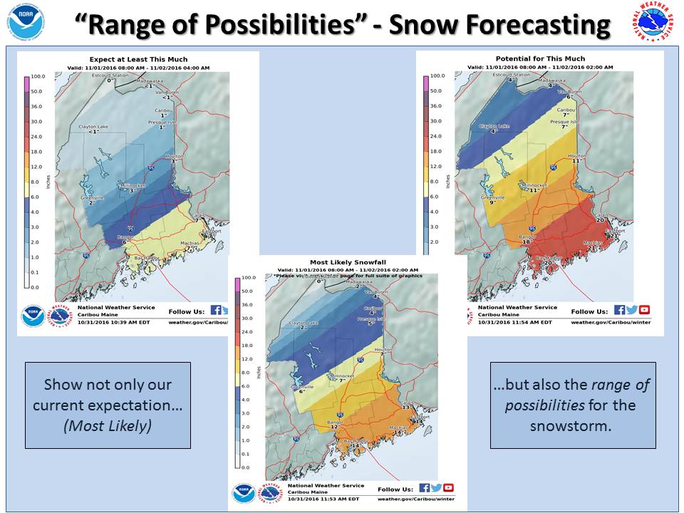
- The below image shows how we will now provide not only the “most likely” accumulation, but also we can “expect at least this much” & we have the “potential for this much” from an oncoming snow storm.
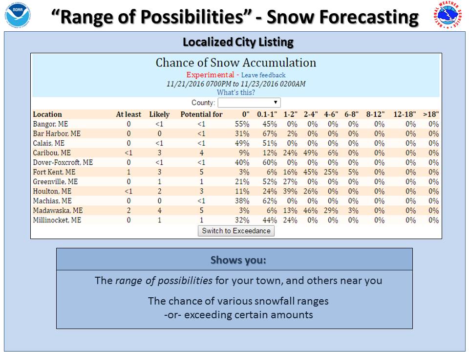
- We'll also provide a "Localized City Listing" that quickly shows information for many towns and cities in the area.
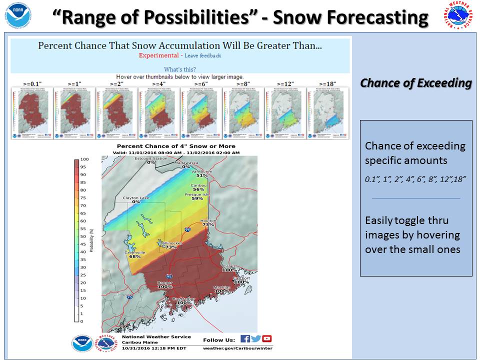
- We also will post maps that show you the Chance of Exceeding certain amounts. Just move your mouse over the smaller images to show the percent chance that snow will be at least a certain amount.
- We hope that you find this additional information useful, especially compared to just getting a single value snowfall forecast. This 'range of possibilities' snowfall forecasting is still considered experimental, so if you notice any errors or have any other feedback or questions, please do not hesitate to contact us using the link at the bottom of the page.


 Coastal Flood
 Follow us on YouTube