|
|
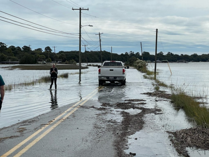
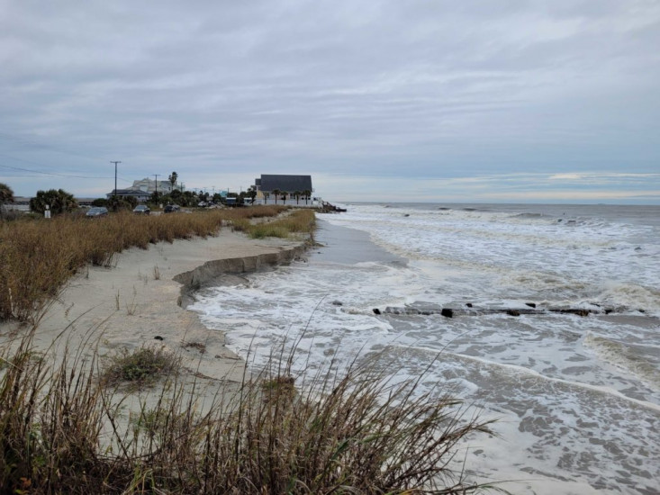
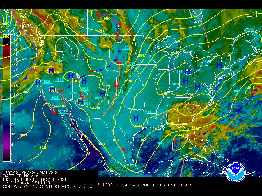
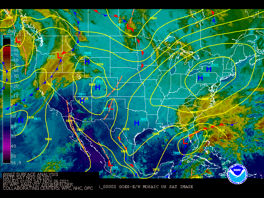
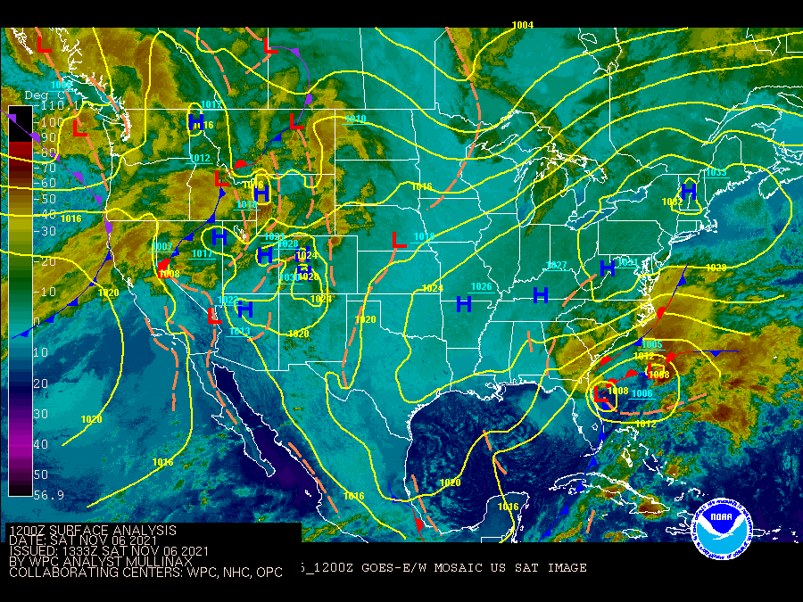
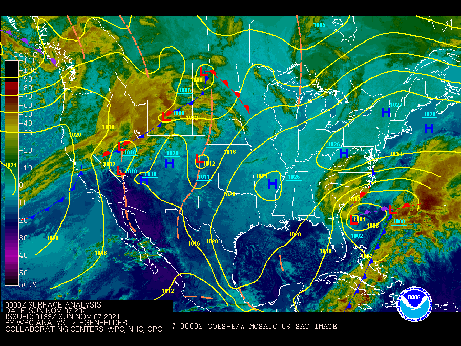
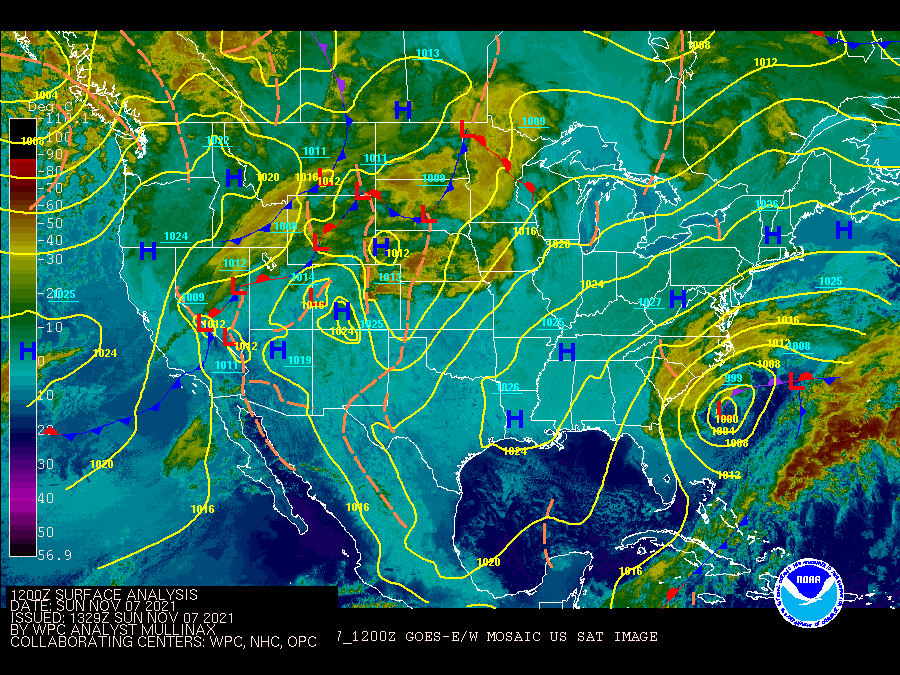
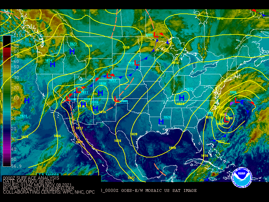
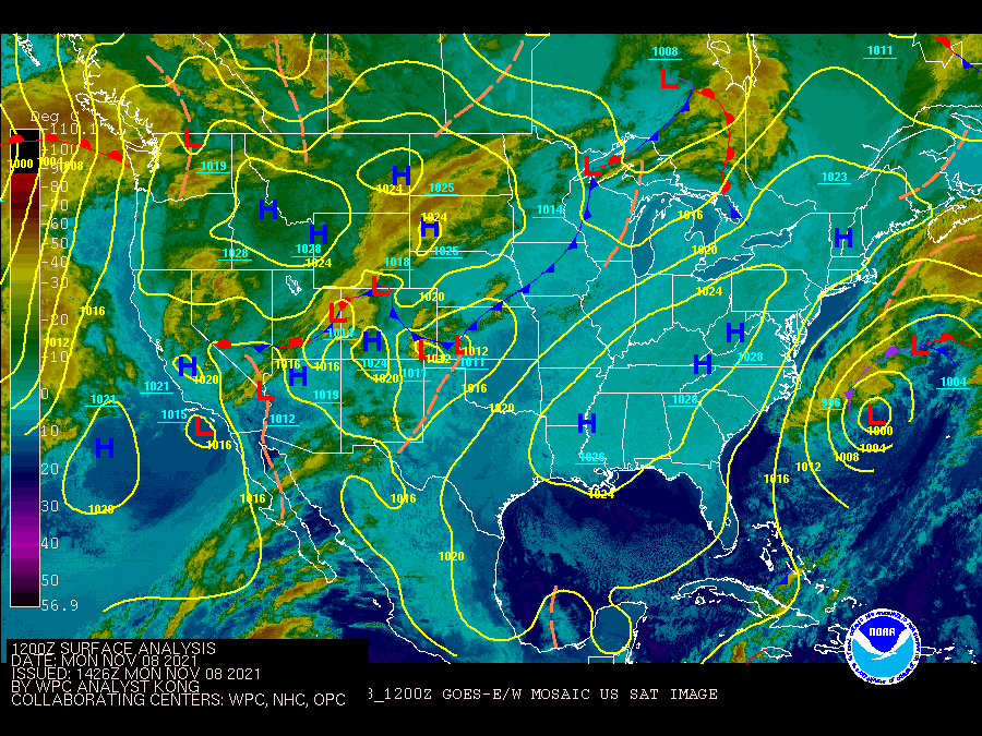
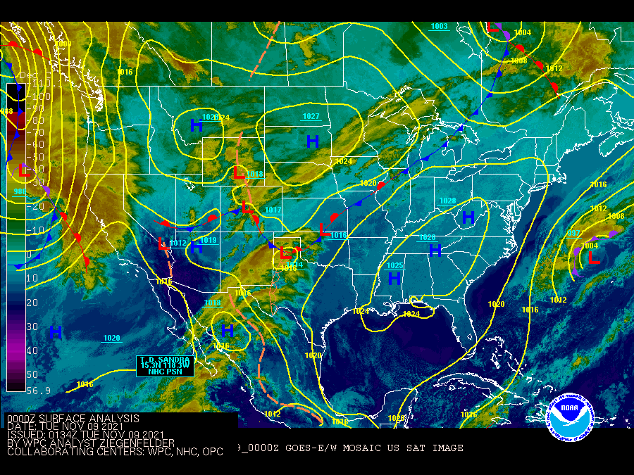
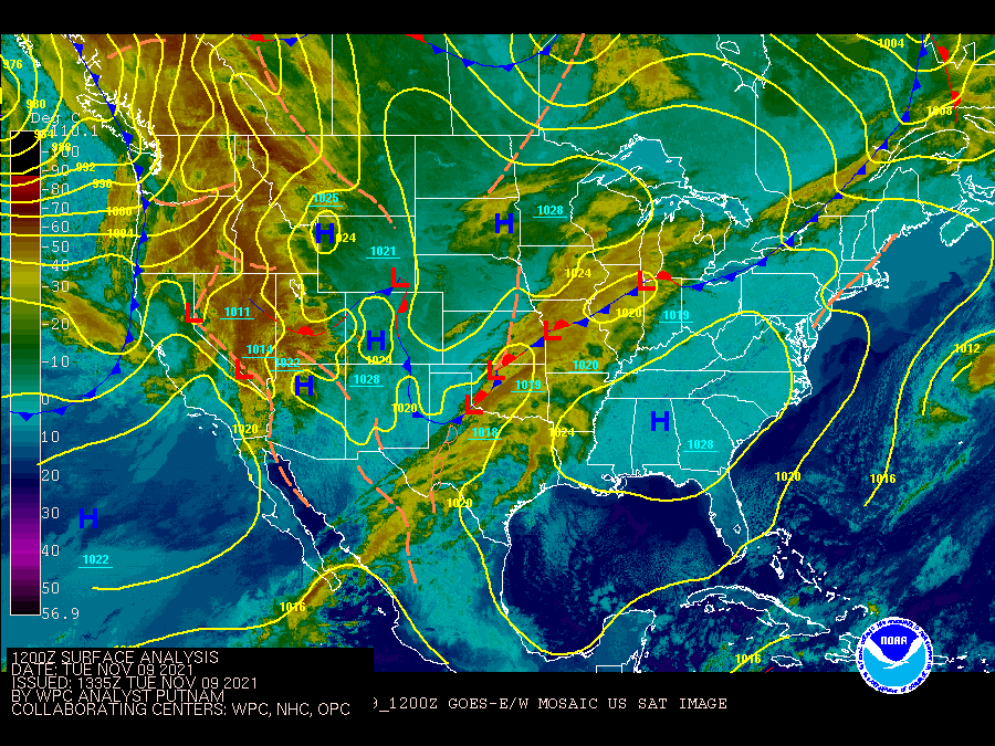
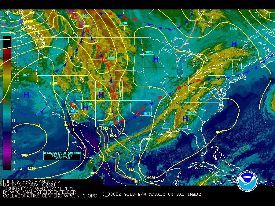
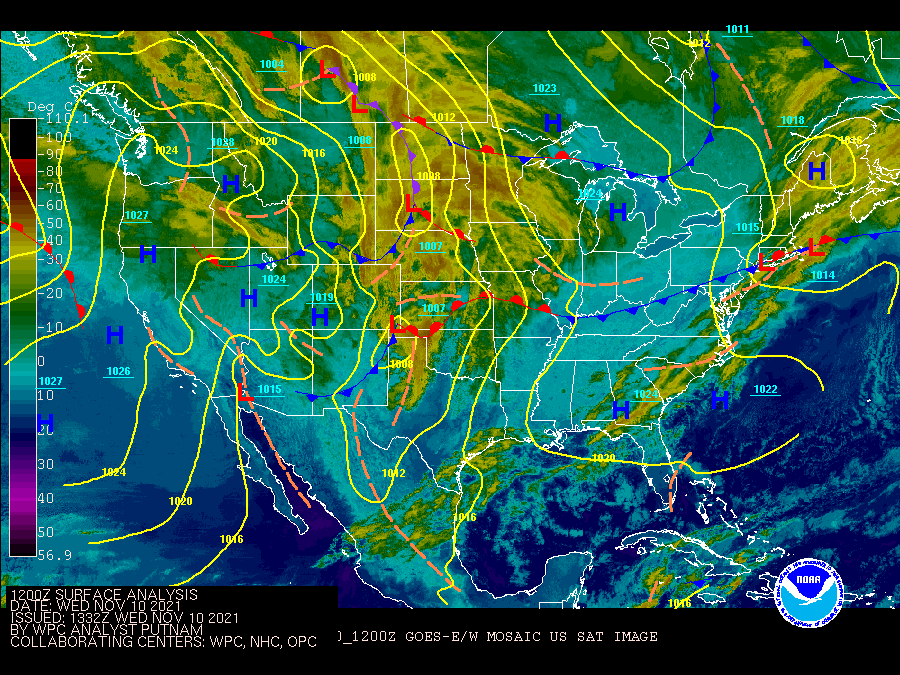
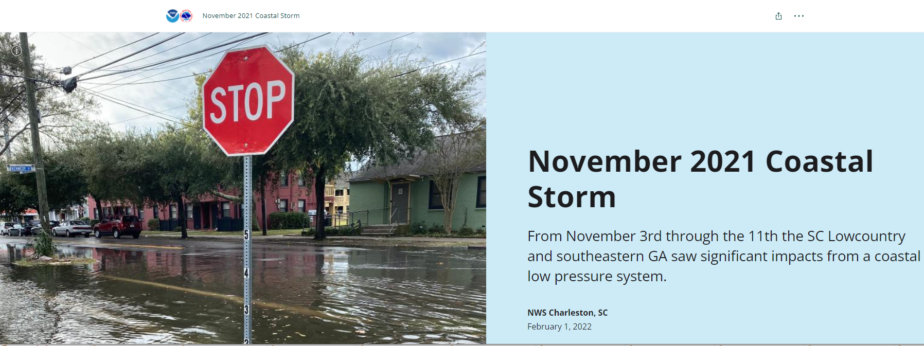
A strong coastal storm impacted the SC Lowcountry and GA Coastal Empire for several days during early November 2021 producing significant coastal flooding, strong winds, and heavy rainfall. Substantial beach erosion also occurred in some spots.
An extended period of high tides occurred due to a combination of astronomical, meteorological and oceanographic factors. Tides were already running high due to the lunar perigee and new moon and the strong onshore winds caused more water to push ashore and increase the wave runup/setup. Other factors could have played a role, including the slowing of the Gulf Stream current. All in all, this was definitely one of our more challenging tide forecasts given the unusually long period of high tides. |
||||
 |
 |
||||
| Charleston, SC - November 7, 2021 (courtesy of Steve Taylor) | Folly Beach, SC - November 7, 2021 (courtesy of Eric Lutz) | ||||
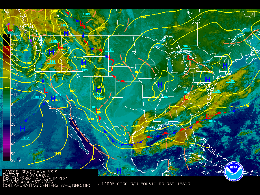
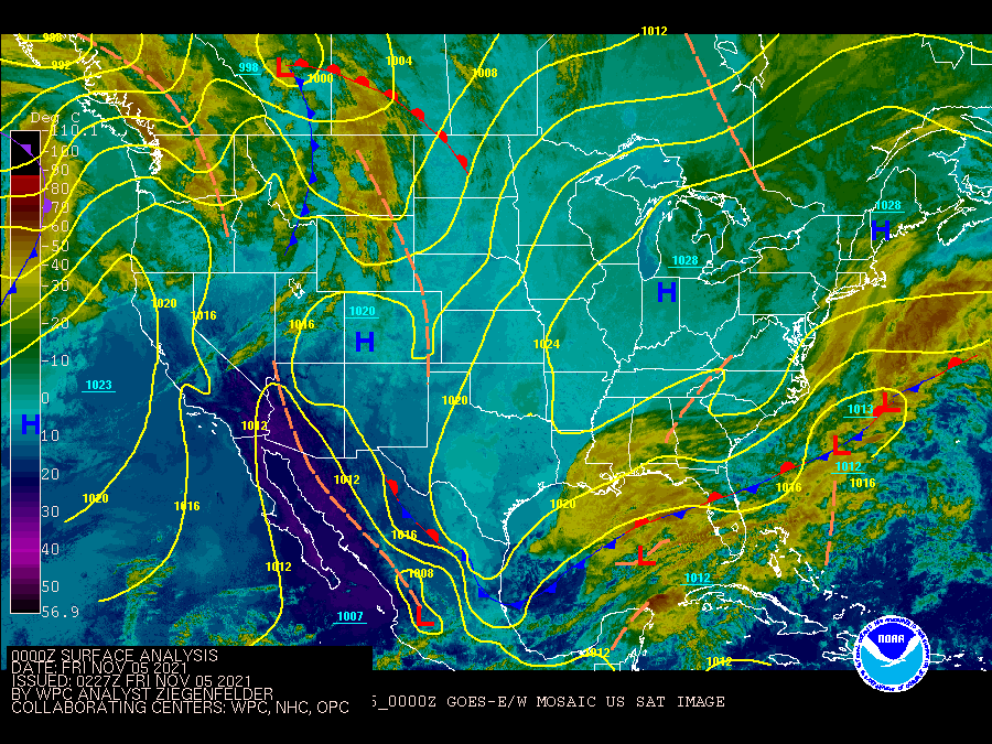
| The weather pattern during this period featured high pressure to the north and west as well as a few areas of low pressure off the Southeast U.S. coast. This led to enhanced onshore winds across much of the region which built rather high water levels for an unusually long period. Also, since the main stronger low pressure system during November 7-9 tracked more easterly away from the area instead of more north/northeast and thus likely directed more wave energy than normal back toward the coast. | |||||
|
|||||
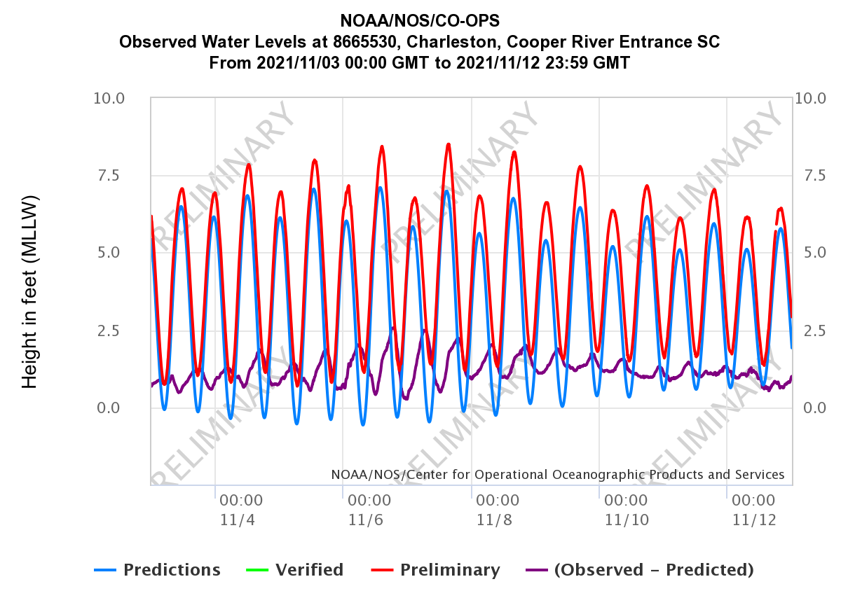 |
| The tide level at the NOS gage in Charleston Harbor, SC reached at least 7.0 feet MLLW (minor flood stage) for 9 consecutive days (Nov 3-11), including 4 tides at least 8.0 feet MLLW (major flood stage). The highest tide occurred on 11/7/21 (8.51 feet MLLW), which preliminarily ranks as the 10th highest level on record. The peak storm surge (observed tide - astronomical tide; purple line in chart above) was ~2.6 feet. Note how many of the peak (and low) water levels occurred after the time of the peak (and low) astronomical tides as well as how many consecutive high tides reached at least minor coastal flooding thresholds. |
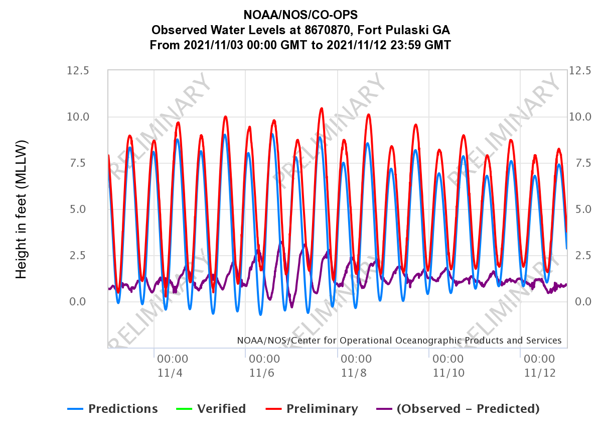 |
| The tide level at the NOS gage at Fort Pulaski, GA reached minor to moderate flood stage (9.5 ft MLLW to less than 10.5 ft MLLW) for 6 consecutive days (Nov 4-9). The highest tide occurred on 11/7/21 (10.45 feet MLLW), which was very close to major flood stage (10.5 ft MLLW) and preliminarily ranks as the 4th highest level on record. The peak storm surge (observed tide - astronomical tide; purple line in chart above) was ~3.2 feet. Note that some of the peak (and low) water levels occurred after the time of the peak (and low) astronomical tides. |
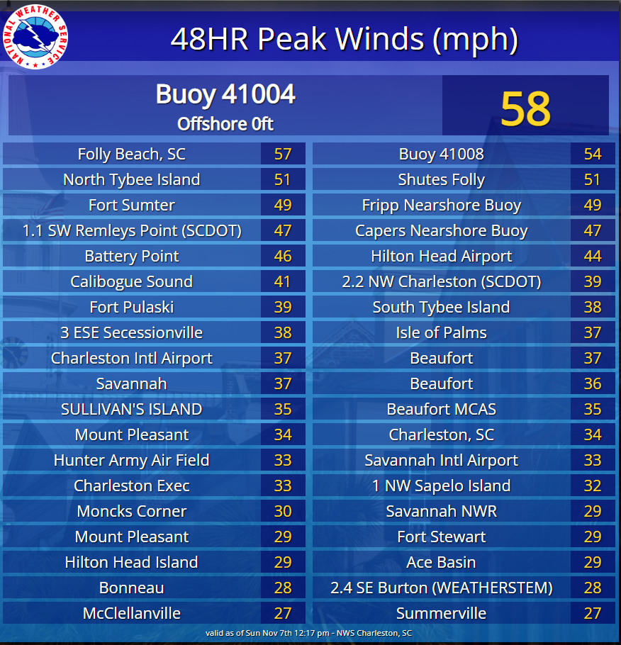
| These are 48 hour peak wind gusts ending around 12 pm on November 7, 2021. |
 |
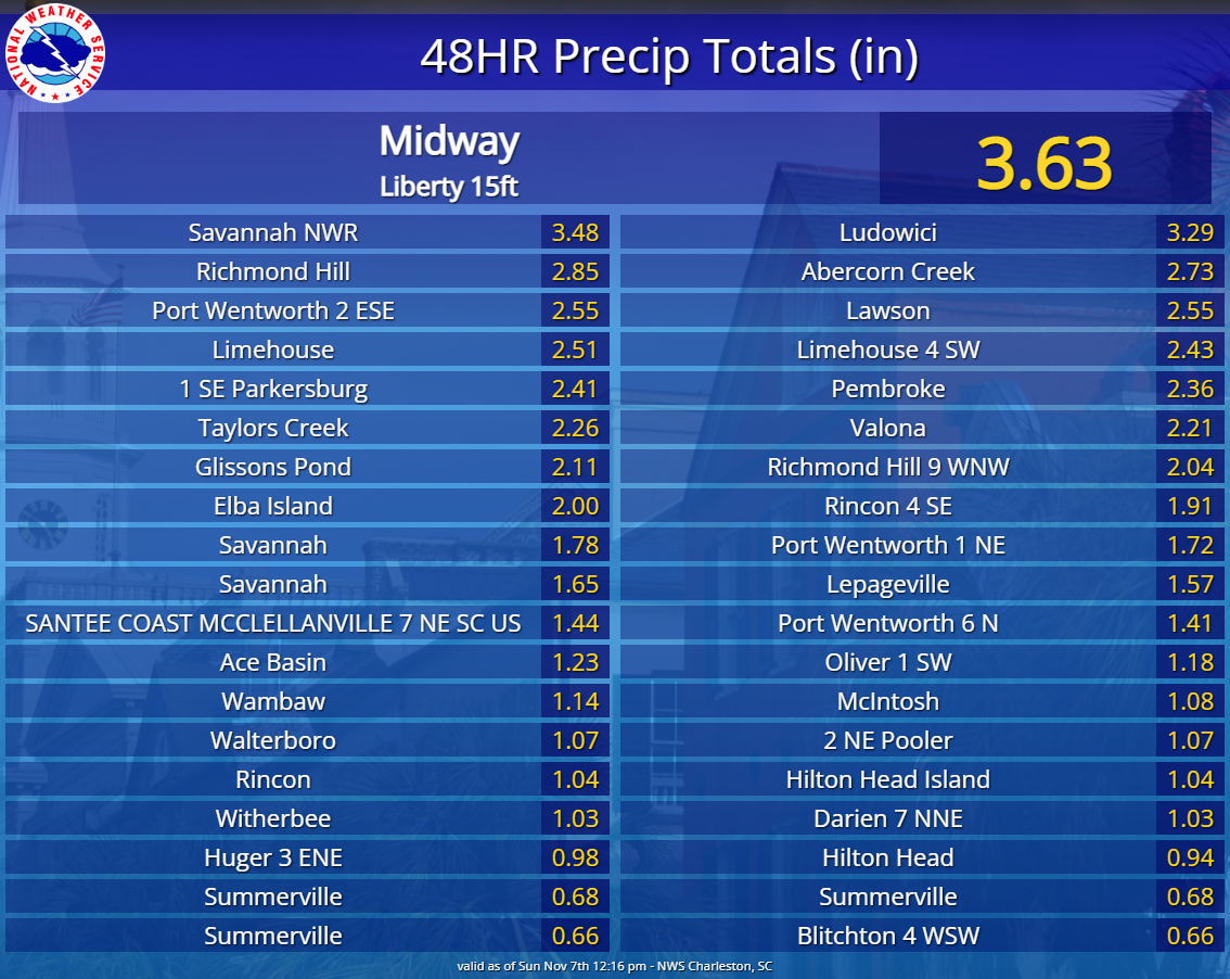
| These are 48 hour rainfall amounts ending around 12 pm on November 7, 2021. |
 |


 Coastal Flood
 Follow us on YouTube
Major Coastal Flooding - November 5-8, 2021