Click any image for a larger version.
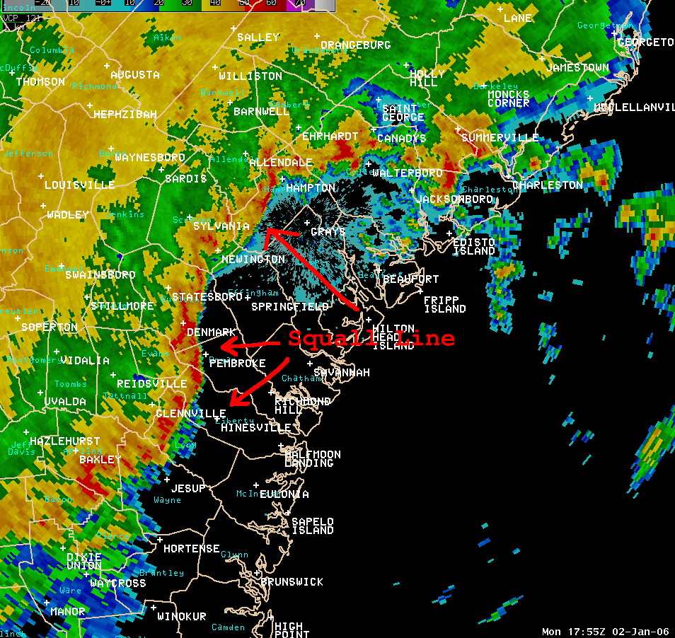
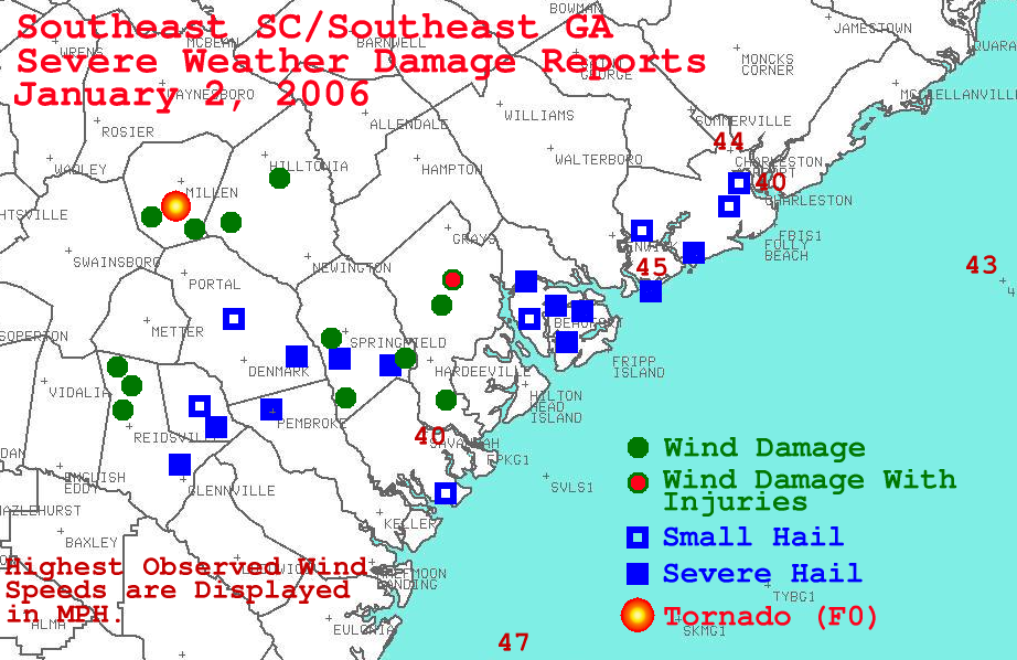
A large outbreak of severe thunderstorms impacted much of southeast South Carolina, southeast Georgia and the adjacent Atlantic coastal waters on Monday, January 2, 2006 as a powerful storm system moved across the Ohio Valley and the Mid-Atlantic states. The combination of unusually warm, unstable air at the surface with very cold air aloft resulted in the development of widespread showers and thunderstorms across the region. Numerous instances of high winds, wind damage and large hail were reported to forecasters at the National Weather Service Forecast Office in Charleston, SC for a 10 hour period, between 12 pm and 10 pm.
The outbreak occurred in three distinct waves. The first wave of severe weather developed across interior portions of southeast Georgia where thunderstorms quickly evolved into a squall line between 11 am and 1 pm. The squall line moved rapidly east northeast (on the order of 50-60 mph) across a good portion of southeast Georgia and south coastal South Carolina and produced many instances of large hail and damaging wind between Reidsville, GA to just north of Savannah, GA to as far northeast as Charleston, SC. Hail to the size of quarters were reported with damaging winds in excess of 60 mph. The squall line cleared the
Charleston County coast by mid afternoon, but continued to produce high winds across the adjacent Atlantic waters for several more hours. Winds in excess of 40 knots were reported at buoys 41008 and 41004 as this line of severe thunderstorms moved through.
 KCLX Reflectivity at 1712 Z (1212 PM EST) |
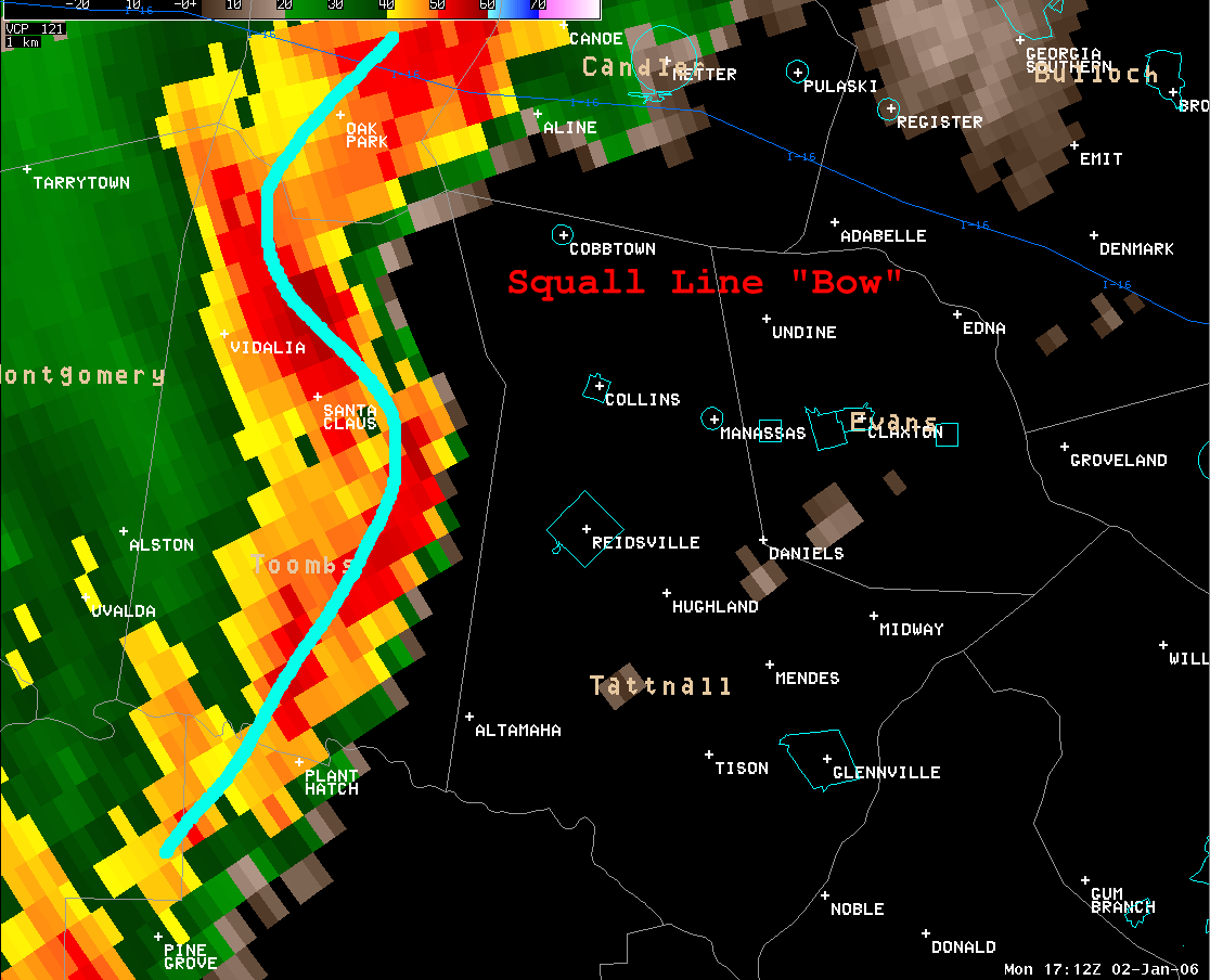
 KCLX Storm-relative Velocity at 1712 Z (1212 PM EST) |
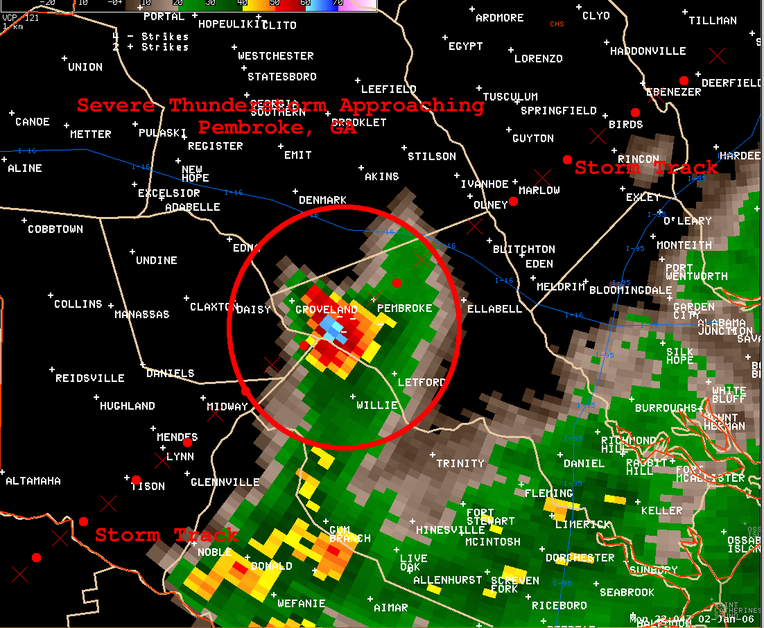 KCLX Reflectivity at 2204 Z (504 PM EST) |
 KCLX Velocity at 0211 Z (904 PM EST). |
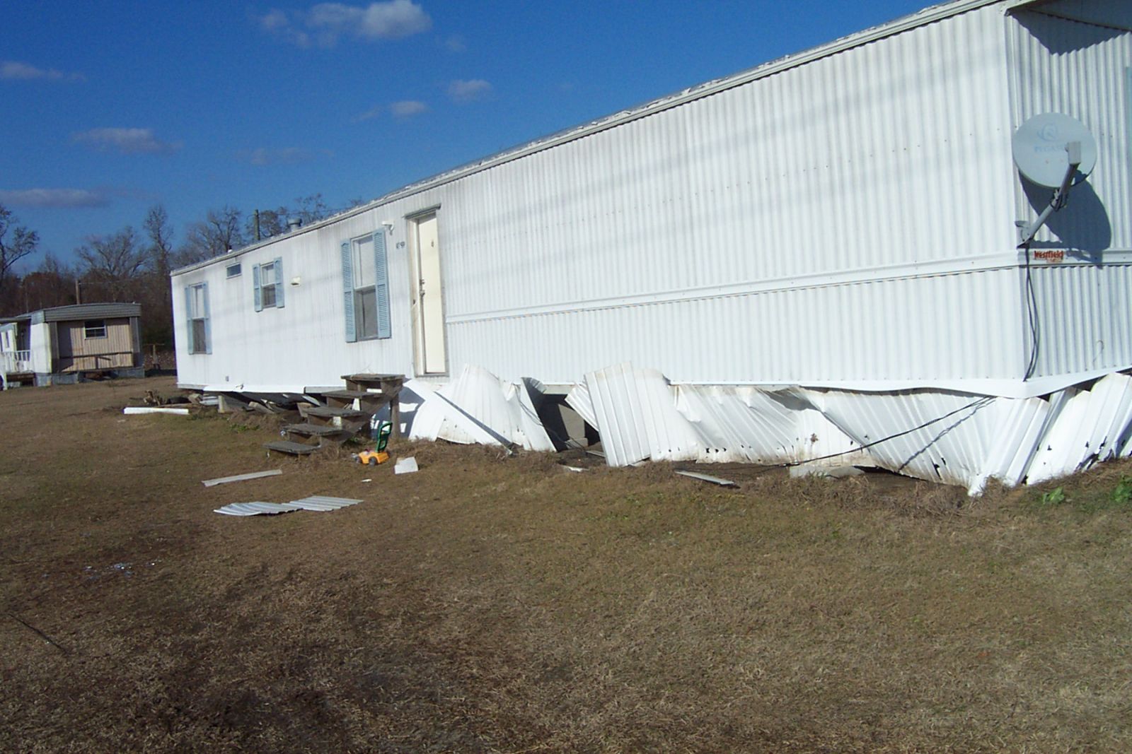
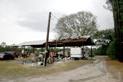
First row: Jenkins County, Georgia
Second row: Tattnall County, Georgia
 |
 |
 |
 |
 |
 |
 |


 Coastal Flood
 Follow us on YouTube