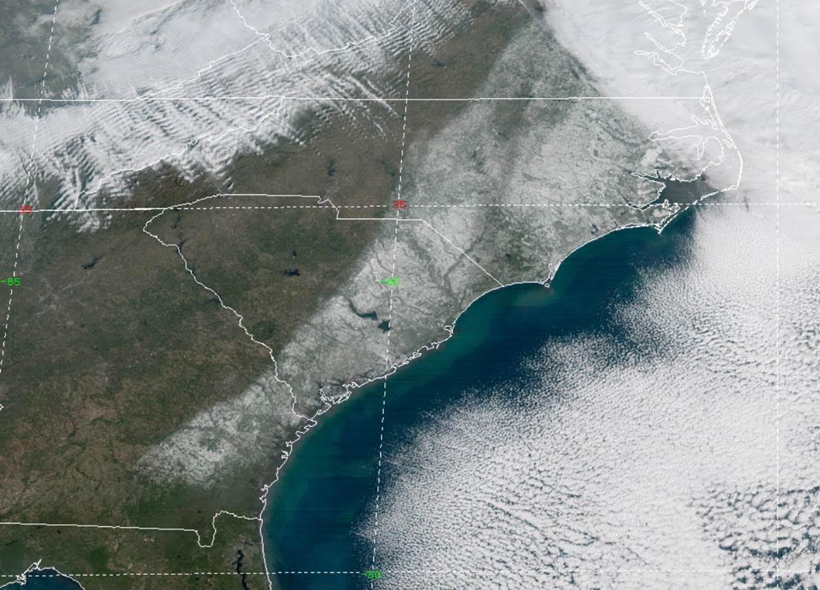
GOES satellite imagery of the strengthening winter storm off the NC coast moving north after affecting
southeast SC/GA on January 3, 2018.
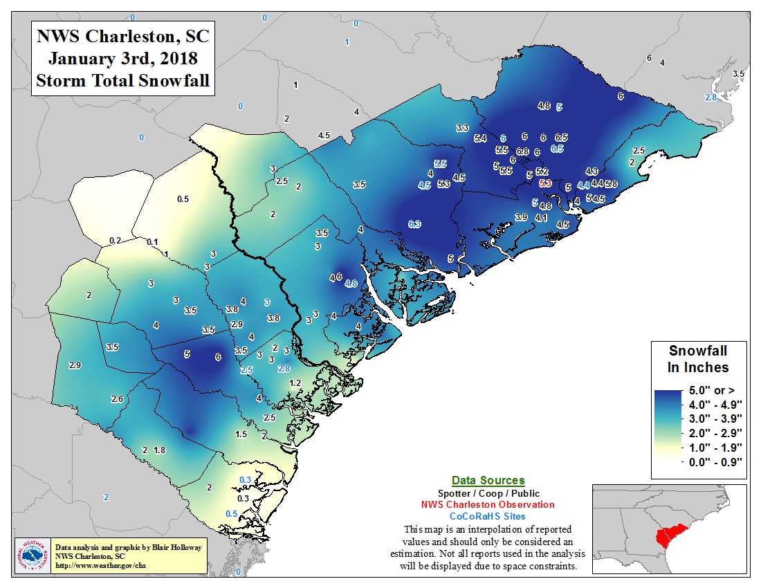
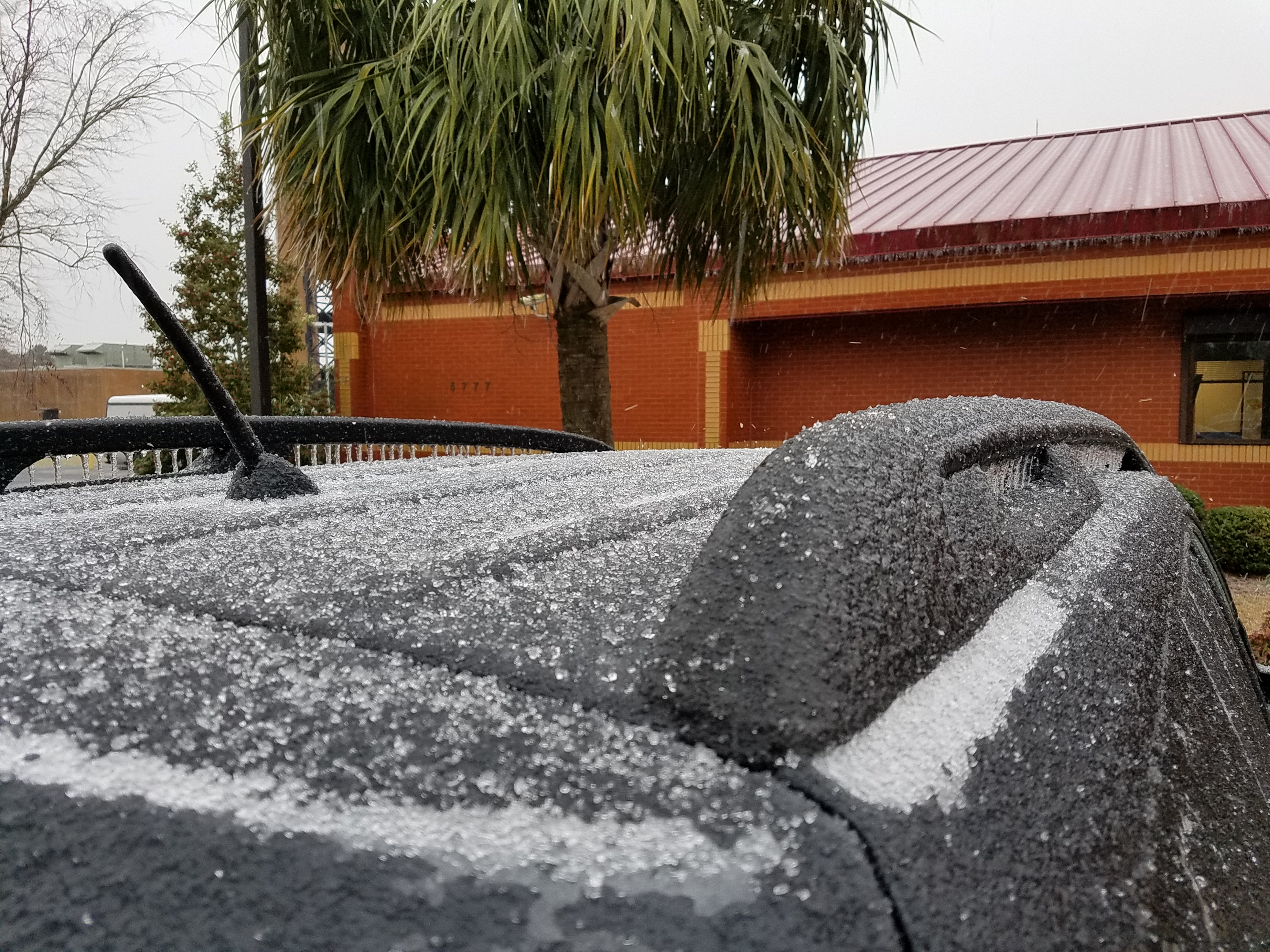
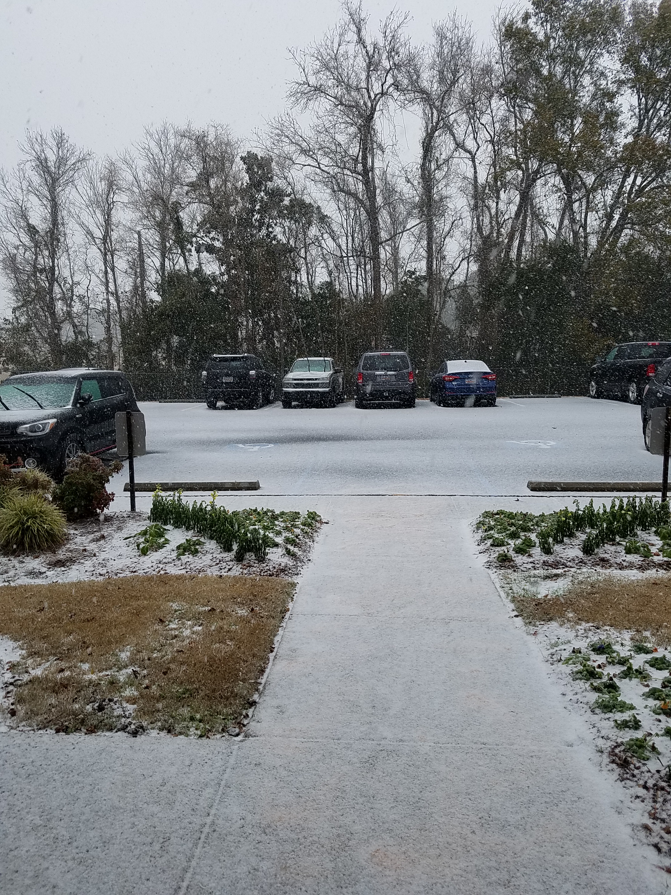
A rare winter storm affected southeast South Carolina and southeast Georgia on January 3, 2018. The storm produced a variety of wintry precipitation, including snow, sleet and freezing rain. Charleston Airport (KCHS) measured 5.3 inches of snow, the 3rd greatest daily snowfall on record, just 0.1 inches shy of the 5.4 inches that fell during the 1973 storm. This made it the snowiest January on record at Charleston Airport and 2nd snowiest at Savannah Airport (KSAV). Due to the continued cold air in place even after the storm, the snow/ice remained on the ground in spots for many days causing significant disruptions to travel and commerce. Charleston Airport recorded snow on the ground for 5 consecutive days which is the most on record. Check out a visible satellite image on January 4 showing the snow left behind from the storm.
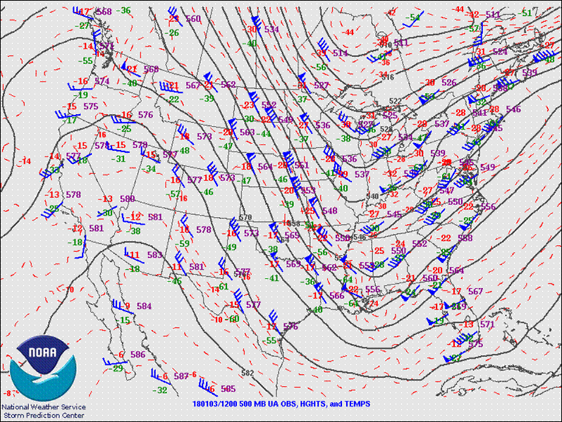
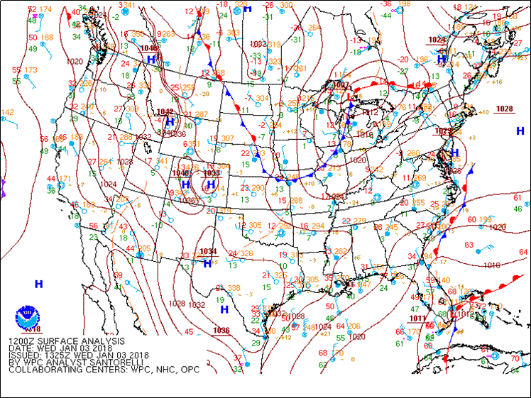
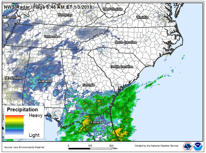
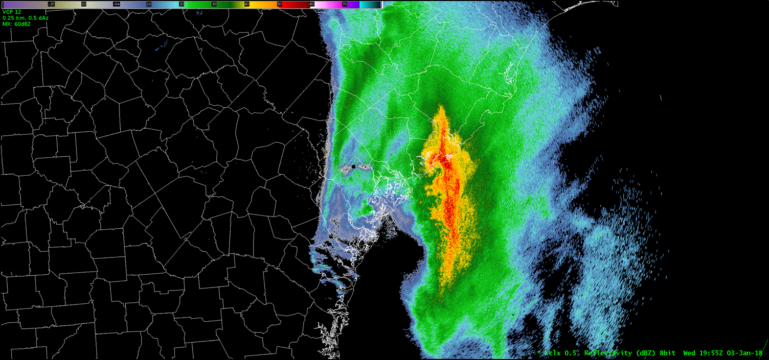
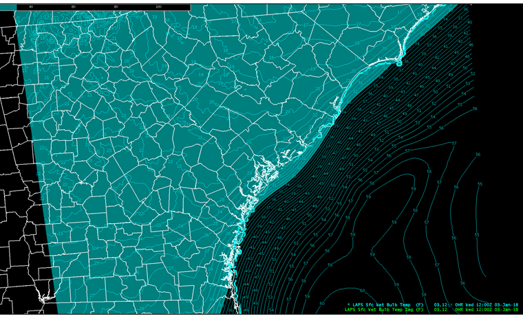
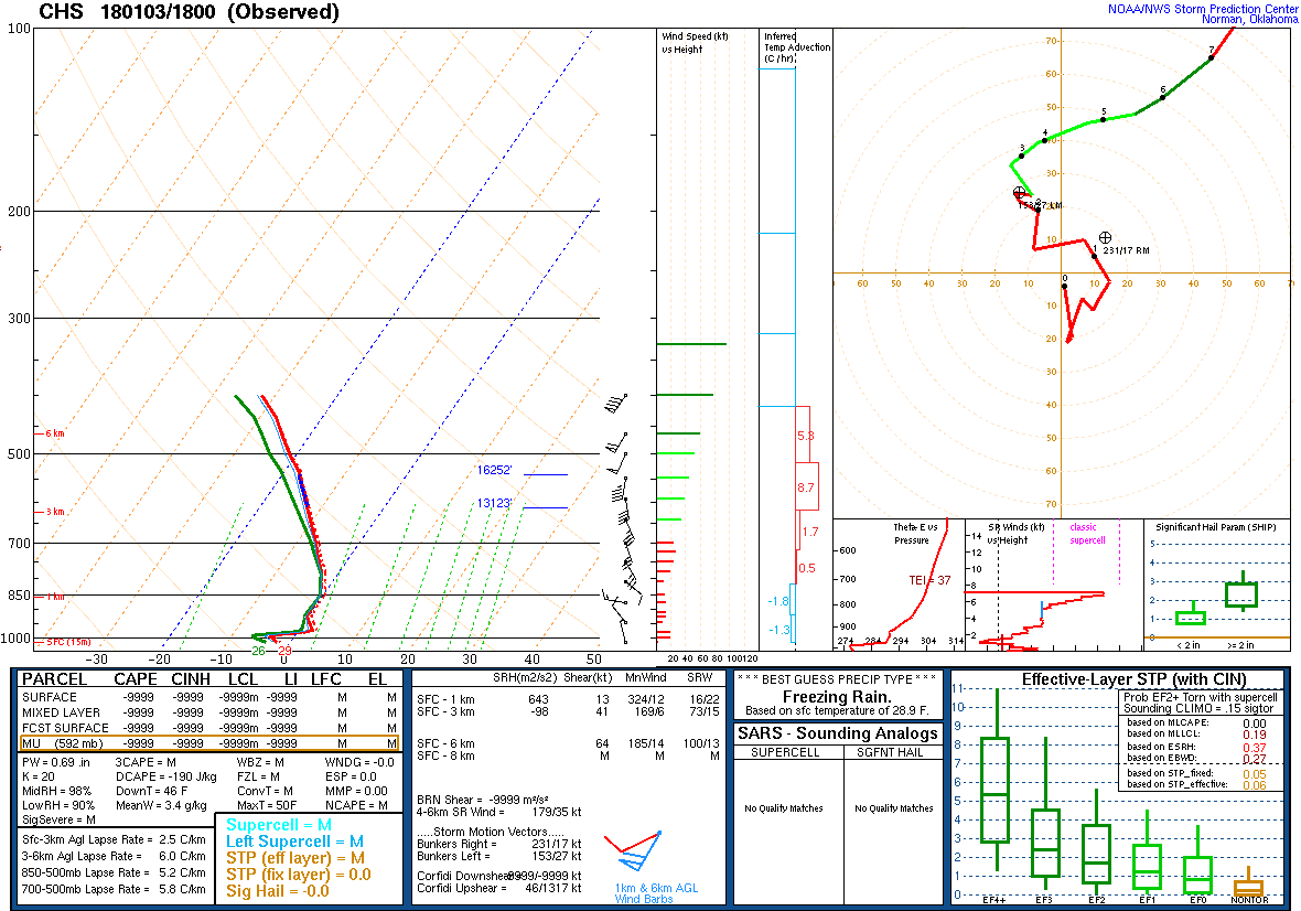
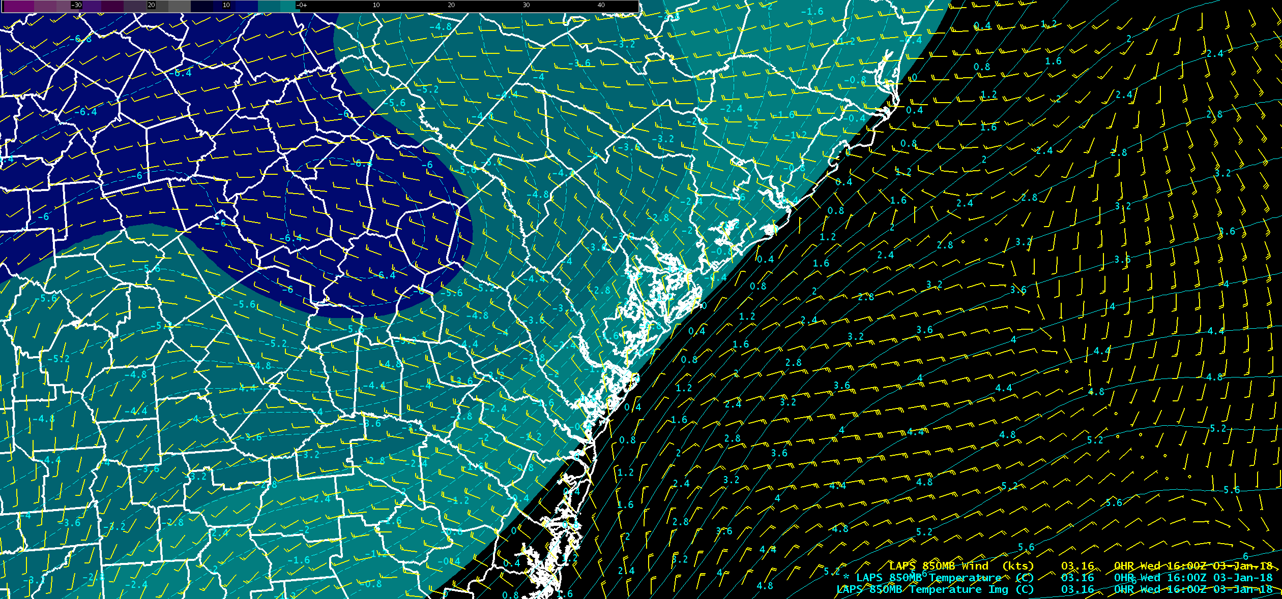
Arctic high pressure was in place at the surface ahead of an upper-level disturbance moving east across the Southeast U.S.. This caused surface low pressure to develop near the Bahamas, then move northward near the Gulf Stream and spread moisture across southeast Georgia and southeast South Carolina. Precipitation began in the predawn hours along the Georgia coast, then spread north and west during the day before tapering off across Georgia in the afternoon and in the evening across South Carolina. Surface wet-bulb temperatures were at or below freezing at the onset. However, due to a shallow, above-freezing layer just above the surface, as noted on the 18 UTC (1 PM EST) upper-air sounding at Charleston, precipitation began as primarily freezing rain with some sleet mixed in. Then, colder air moved into the area from the northwest during the afternoon as the surface low pressure system moved by offshore causing the precipitation to transition to snow. Aside from a brief burst of sleet that spread up the coast during the afternoon, snow was the predominant precipitation type until the end of the event. As is often the case during winter storms determining when this changeover would occur was one of the forecast challenges we faced.
Another challenging aspect to the forecast was determining the snow-to-liquid ratios (SLR) during the event, which typically are ~7:1 on average in this area, meaning that for every inch of liquid precipitation that falls there will be ~7 inches of snow. Of course, in reality this usually changes during an event as the amount of moisture and the vertical temperature profile of the atmosphere change.
For more information on the technical terms discussed, check out the NWS JetStream glossary.
Public Information Statement
Spotter Reports
National Weather Service Charleston SC
219 PM EST Fri Jan 05 2018

The following are unofficial observations taken by various quality
controlled observations systems from across Southeast South Carolina
and Southeast Georgia.

********************STORM TOTAL SNOWFALL********************

LOCATION          STORM TOTAL     TIME/DATE   COMMENTS
                     SNOWFALL           OF
                     /INCHES/   MEASUREMENT

GEORGIA

...Bryan County...
   Ellabell               6.0   500 PM  1/03  Social Media
   Pembroke               5.0   500 PM  1/03  Social Media
   Richmond Hill          4.0   400 PM  1/03  Social Media
   1 N Keller             2.5   400 PM  1/03  Other Federal
   Lanier                 1.5  1224 PM  1/03  Amateur Radio

...Bulloch County...
   Nevils                 4.0   500 PM  1/03  Social Media
   Brooklet               3.5   500 PM  1/03  Social Media
   5 SE Brooklet          3.5   500 PM  1/03  Social Media
   6 SSE Stilson          3.5   311 PM  1/03  Social Media
   Statesboro             3.0   500 PM  1/03  Social Media

...Candler County...
   Metter                 2.0   100 PM  1/03  911 Call Center

...Chatham County...
   Garden City            4.0   500 PM  1/03  Social Media
   Bloomingdale           3.0   500 PM  1/03  Social Media
   Pooler                 3.0   145 PM  1/03  Broadcast Media
   Port Wentworth         3.0   500 PM  1/03  Social Media
   2 SW Windsor Forest    2.5   500 PM  1/03  Trained Spotter
   2 ENE Skidaway Islan   2.0   210 PM  1/03  CoCoRaHS
   2 SW Meinhard          2.0  1226 PM  1/03  Broadcast Media
   1 WSW White Bluff      1.2   140 PM  1/03  Trained Spotter

...Effingham County...
   Springfield            4.0   500 PM  1/03  Social Media
   4 NE Eden              4.0   400 PM  1/03  Trained Spotter
   Guyton                 3.8   500 PM  1/03  Social Media
   Rincon                 3.8   300 PM  1/03  Social Media
   Meldrim                3.5   352 PM  1/03  Social Media
   Marlow                 2.9   500 PM  1/03  CoCoRaHS

...Evans County...
   1 WNW Hagan            3.5   300 PM  1/03  Emergency Manager

...Jenkins County...
   6 SW Scarboro          0.2   300 PM  1/03  Emergency Manager

...Liberty County...
   Allenhurst             5.1   500 PM  1/03  Social Media
   Sunbury                2.0   158 PM  1/03  Social Media
   4 ESE Midway           1.5   325 PM  1/03  Public
   Hinesville             0.9   230 PM  1/03  Public
   2 ENE Retreat            T   455 AM  1/03  Law Enforcement

...Long County...
   Ludowici               3.0   500 PM  1/03  Social Media
   4 W Ludowici           2.0   400 PM  1/03  Social Media

...McIntosh County...
   Townsend               2.0   130 PM  1/03  Social Media
   Darien                 1.0   115 PM  1/03  Snow total.
   Crescent               0.3   300 PM  1/03  Social Media

...Screven County...
   Oliver                 3.0   230 PM  1/03  Social Media
   1 SSW Newington        3.0   230 PM  1/03  Social Media
   Dover                  1.0   200 PM  1/03  Social Media
   5 N Sylvania           0.5   230 PM  1/03  Social Media

...Tattnall County...
   Reidsville             2.9   400 PM  1/03  Social Media
   Glennville             2.6   400 PM  1/03  Social Media

SOUTH CAROLINA

...Allendale County...
   Fairfax                2.0   330 PM  1/03  Utility Company

...Beaufort County...
   Hilton Head Island     4.5   400 PM  1/03  Amateur Radio
   Bluffton               4.0   230 PM  1/03  Amateur Radio
   4 NE Beaufort          3.5   525 PM  1/03  Emergency Manager
   5 NE Beaufort          3.5   530 PM  1/03  Emergency Manager
   3 NNE Beaufort         2.2   530 PM  1/03  Social Media
   3 NNE Hilton Head Is   1.0   135 PM  1/03  Public
   6 NNW Tybee Island     1.0   705 AM  1/03  CoCoRaHS

...Berkeley County...
   1 NE College Park      6.8   600 PM  1/03  Public
   1 W Sangaree           6.8   630 PM  1/03  Trained Spotter
   7 SSE Moncks Corner    6.5   432 PM  1/03  Social Media
   5 NE College Park      6.3   630 PM  1/03  Social Media
   7 NNE College Park     6.0   722 PM  1/03  Public
   2 ENE College Park     6.0   523 PM  1/03  Social Media
   5 N Sangaree           6.0   650 PM  1/03  Broadcast Media
   1 SSW Crowfield Plan   5.5   600 PM  1/03  NWS Employee
   2 W Daniel Island      5.0   630 PM  1/03  NWS Employee
   1 SW Sangaree          5.0   427 PM  1/03  Social Media
   1 NW College Park      5.0   400 PM  1/03  NWS Employee
   6 NNE Sangaree         5.0   630 AM  1/03  Trained Spotter
   1 NNE Pinopolis        4.8   436 PM  1/03  Social Media
   2 ENE Old Santee Can   4.5   600 PM  1/03  CoCoRaHS
   1 E Wando              4.3   540 PM  1/03  Broadcast Media
   2 N Summerville        4.0   338 PM  1/03  Social Media
   2 NW Sangaree          4.0   317 PM  1/03  Social Media
   1 W College Park       3.9   315 PM  1/03  Social Media
   Jamestown              3.0   300 PM  1/03  Amateur Radio

...Charleston County...
   1 SSE Ladson           6.5   600 PM  1/03  Emergency Manager
   5 ESE Cainhoy          5.8   600 PM  1/03  CAROLINA PARK
   1 SW Goose Creek       5.3   444 PM  1/03  Social Media
   1 ESE Charleston Air   5.3   745 PM  1/03  NWS Office
   1 WNW Hanahan          5.2   600 PM  1/03  Trained Spotter
   2 W North Charleston   5.0   430 PM  1/03  Amateur Radio
   3 NE Mount Pleasant    5.0   700 PM  1/03  Trained Spotter
   1 WSW Ladson           5.0   815 AM  1/05  Broadcast Media
   Ladson                 4.8   412 PM  1/03  Social Media
   2 NNW Mount Pleasant   4.8   600 PM  1/03  CoCoRaHS
   1 SW West Ashley       4.8   545 PM  1/03  NWS Employee
   4 ENE Mount Pleasant   4.5   530 PM  1/03  Public
   2 SSW James Island     4.5   437 PM  1/03  Social Media
   3 WNW Charleston Air   4.5   404 PM  1/03  Social Media
   3 NNE Boone Hall Pla   4.4   630 PM  1/03  NWS Employee
   1 E Mount Pleasant     4.3  1130 PM  1/03  Public
   1 SW Shadowmoss        4.1   630 PM  1/03  NWS Employee
   2 ENE Johns Island     4.1   600 PM  1/03  NWS Employee
   1 WSW Charleston       4.0   630 PM  1/03  Emergency Manager
   2 WNW Mount Pleasant   4.0   650 PM  1/03  Emergency Manager
   2 WNW West Ashley      4.0   540 PM  1/03  Broadcast Media
   4 WNW Johns Island     3.9   610 PM  1/03  Social Media
   2 S Cainhoy            3.5   348 PM  1/03  Social Media
   2 SSW Shadowmoss       3.0   310 PM  1/03  Social Media
   Ravenel                3.0   155 PM  1/03  Public
   5 WSW Shadowmoss       3.0   238 PM  1/03  Social Media
   1 WSW James Island     3.0   430 PM  1/03  Amateur Radio
   2 SSW Goose Creek      3.0   308 PM  1/03  Public
   2 NNW North Charlest   3.0   415 PM  1/03  Amateur Radio
   3 WSW James Island     2.6   250 PM  1/03  Social Media
   Awendaw                2.5   330 PM  1/03  Amateur Radio
   5 NNW Johns Island     2.5   234 PM  1/03  Amateur Radio
   3 S Goose Creek        2.5   232 PM  1/03  Amateur Radio
   3 SSE Shadowmoss       2.3   255 PM  1/03  NWS Employee
   4 SSW Awendaw          2.0   200 PM  1/03  Fire Dept/Rescue
   2 NNW West Ashley      2.0   320 PM  1/03  Amateur Radio
   4 SW Johns Island      2.0   300 PM  1/03  Amateur Radio

...Colleton County...
   3 S Cottageville       5.3   630 PM  1/03  NWS Employee
   Bennetts Point         5.0   500 PM  1/03  Trained Spotter
   4 ESE Cottageville     4.5   500 PM  1/03  Trained Spotter
   Round O                4.0   400 PM  1/03  Amateur Radio
   5 ESE Islandton        3.5   315 PM  1/03  Amateur Radio
   1 E Lodge              2.0   313 PM  1/03  Amateur Radio
   Canadys                1.8   430 PM  1/03  Amateur Radio

...Dorchester County...
   3 SW Summerville       7.3   556 PM  1/03  Broadcast Media
   1 S Summerville        6.8   415 PM  1/03  NWS Employee
   2 ESE Jedburg          5.5   620 PM  1/03  County Official
   5 SSE Knightsville     5.5   343 PM  1/03  Social Media
   3 S Summerville        5.5   635 PM  1/03  Trained Spotter
   Ridgeville             5.4   540 PM  1/03  Emergency Manager
   2 SSE Summerville      5.2   519 PM  1/03  Social Media
   2 S Ladson             5.0   600 PM  1/03  NWS Employee
   3 S Knightsville       5.0   403 PM  1/03  Social Media
   4 S Ladson             5.0   442 PM  1/03  Social Media
   1 NNW Knightsville     4.0   224 PM  1/03  Social Media
   Dorchester             3.3   430 PM  1/03  Amateur Radio
   3 WSW Ladson           3.1   350 PM  1/03  Public
   3 N Givhans            2.8   237 PM  1/03  Social Media
   3 SSW Ladson           2.3   235 PM  1/03  Social Media
   3 W Charleston Airpo   2.2   300 PM  1/03  Amateur Radio
   2 ESE Knightsville     1.8   200 PM  1/03  Public

...Hampton County...
   Yemassee               4.0   500 PM  1/03  Social Media
   Estill                 2.0   300 PM  1/03  Snow total.
   Hampton                2.0   335 PM  1/03  Snow total amount.

...Jasper County...
   2 E Ridgeland          6.0   500 PM  1/03  Social Media
   Ridgeland              4.0   342 PM  1/03  Public
   3 SSW Jasper           4.0   500 PM  1/03  Emergency Manager
   Grays                  3.5   350 PM  1/03  Emergency Manager
   1 NNW Ridgeland        3.5   430 PM  1/03  Emergency Manager
   2 NE Hardeeville       3.0   405 PM  1/03  Emergency Manager
   Hardeeville            3.0   222 PM  1/03  Amateur Radio
   2 W Gillisonville      3.0   345 PM  1/03  Emergency Manager
   Robertville            2.0   330 PM  1/03  Emergency Manager


***********************STORM TOTAL ICE***********************

LOCATION          STORM TOTAL     TIME/DATE   COMMENTS
                          ICE           OF
                     /INCHES/   MEASUREMENT

GEORGIA

...Chatham County...
   2 SW Windsor Forest   0.10  1100 AM  1/03  Trained Spotter
   Isle Of Hope          0.08  1058 AM  1/03  Social Media
   Tybee Island             T   830 AM  1/03  Emergency Manager
   Thunderbolt              T   745 AM  1/03  Emergency Manager

...Liberty County...
   4 ESE Midway          0.25   325 PM  1/03  Public

...McIntosh County...
   Crescent              0.25  1200 PM  1/03  Social Media
   3 W Carnigan             T   430 AM  1/03  Law Enforcement

SOUTH CAROLINA

...Beaufort County...
   2 WSW Beaufort           T   813 AM  1/03  Social Media

...Berkeley County...
   2 ENE College Park    0.13  1030 AM  1/03  Trained Spotter

...Charleston County...
   2 NNW Charleston      0.20  1101 AM  1/03  Social Media
   1 SW James Island     0.20  1151 AM  1/03  Social Media
   4 ENE Mount Pleasant  0.19   132 PM  1/03  Public
   1 E Mount Pleasant    0.18   631 PM  1/03  Trained Spotter
   1 ESE Charleston Air  0.13  1155 AM  1/03  NWS Office
   2 W Charleston        0.01   935 AM  1/03  Law Enforcement
   1 NNE Mount Pleasant  0.01   918 AM  1/03  Law Enforcement
   2 NNE Mount Pleasant  0.01   855 AM  1/03  Law Enforcement
   3 S West Ashley       0.01   944 AM  1/03  Law Enforcement
   1 WSW West Ashley     0.01   840 AM  1/03  NWS Employee
   3 NE Seabrook Island     T  1058 AM  1/03  Law Enforcement
   Seabrook Island          T   757 AM  1/03  Social Media
   4 SSE Cainhoy            T   836 AM  1/03  Social Media
   1 SSE Daniel Island      T   850 AM  1/03  Broadcast Media
   1 ENE James Island       T   740 AM  1/03  Broadcast Media
   3 NNW West Ashley        T  1033 AM  1/03  Law Enforcement
   9 NE Sullivans Islan     T   850 AM  1/03  Social Media
   2 SE Charleston Airp     T  1015 AM  1/03  Local Official

...Dorchester County...
   3 SSW Summerville        T  1045 AM  1/03  Law Enforcement

&&
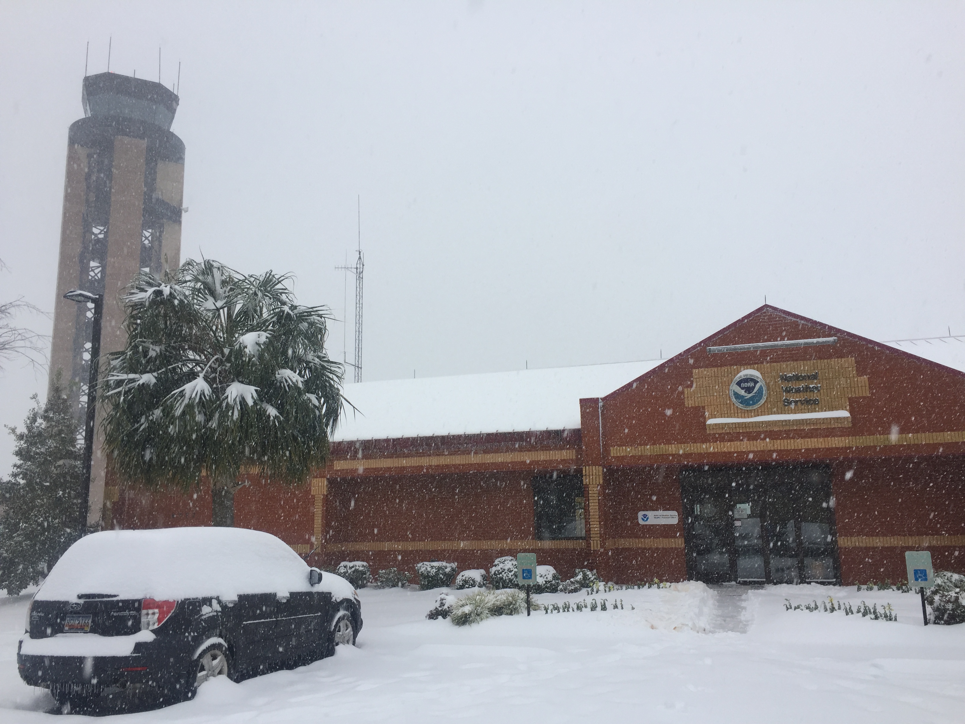
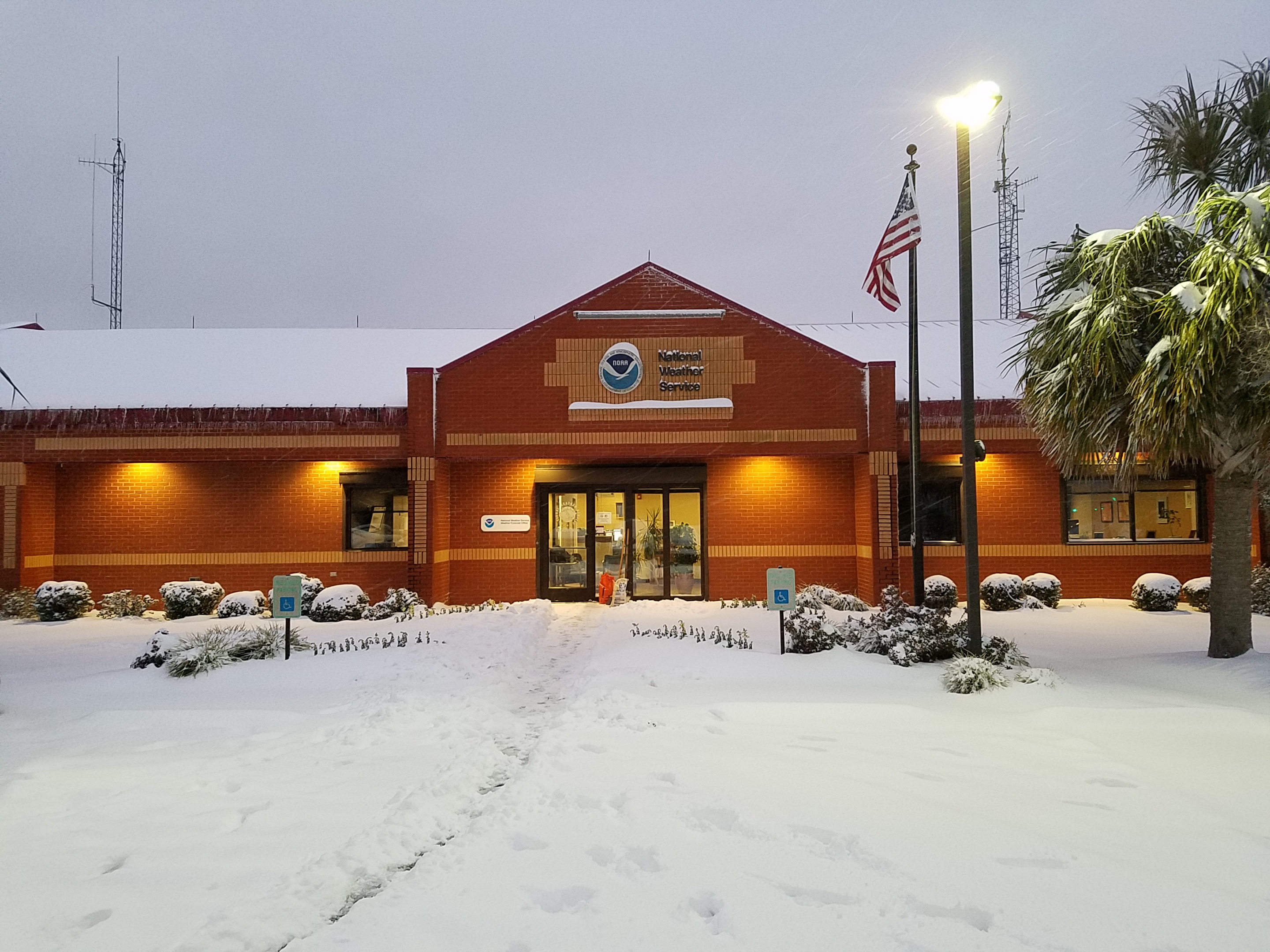
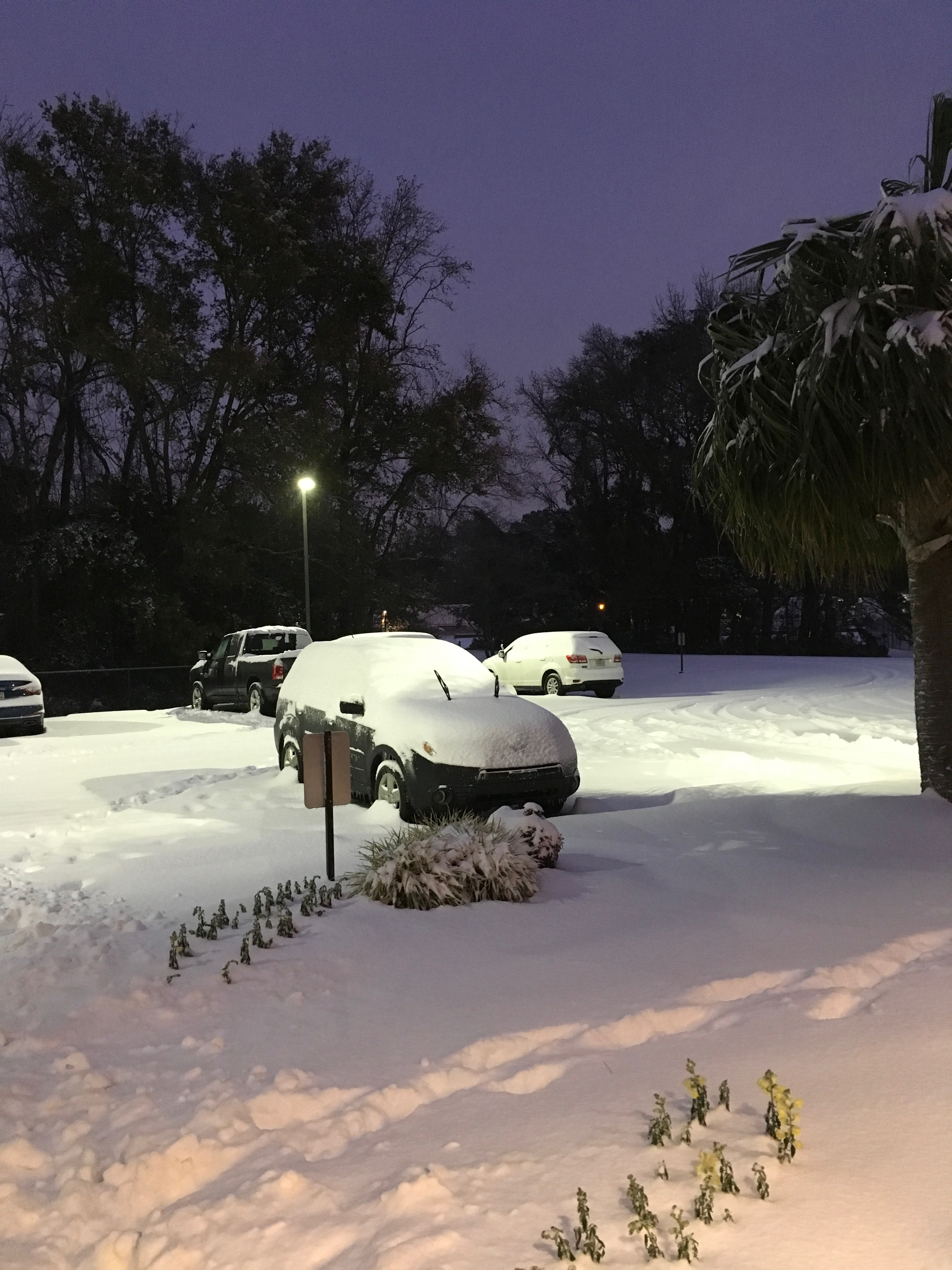
Courtesy of NWS Charleston, SC; click on images to enlarge
| National Weather Service - North Charleston, SC | |||
 |
 |
 |
 |
 |
 |
||
Winter Storm - January 3rd, 2018


 Coastal Flood
 Follow us on YouTube