Labor Day 2017 EF2 Tornado
Crawford and Richland Counties
Public Information Statement
National Weather Service Cleveland OH
834 PM EDT Tue Sep 5 2017
...EF-2 TORNADO CONFIRMED IN CRAWFORD AND RICHLAND COUNTIES
IN OHIO...
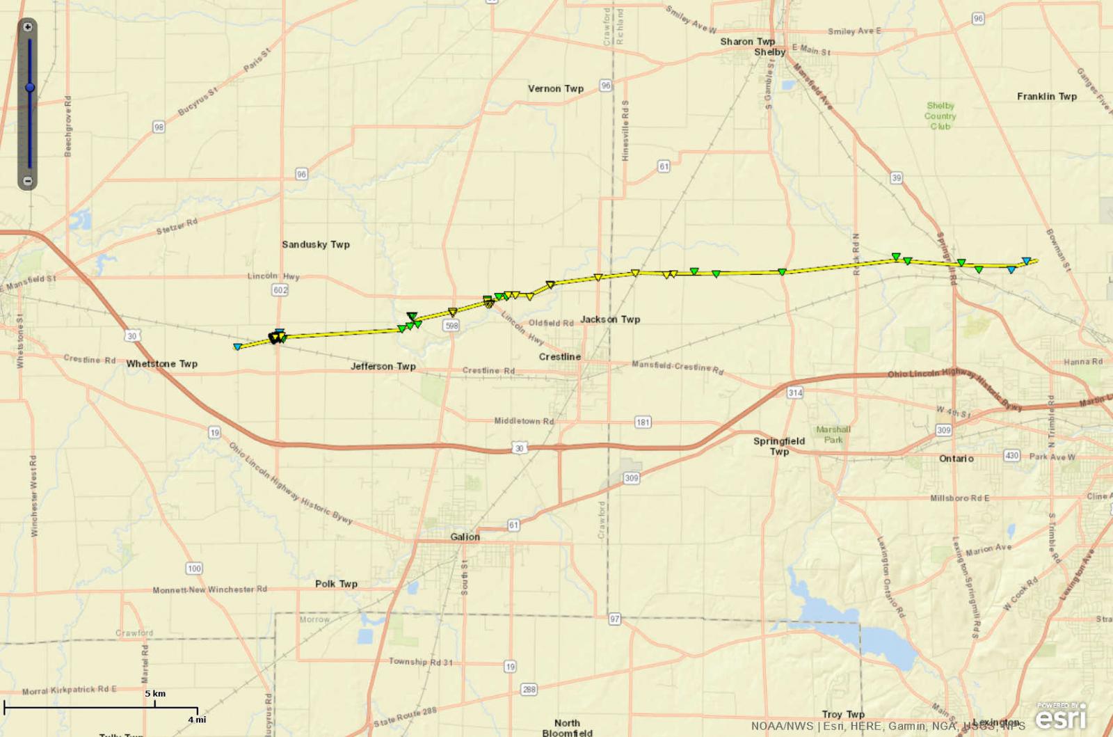
Location...West of North Robinson in Crawford County Ohio to
north of Mansfield in Richland County Ohio
Date...September 4, 2017
Estimated Time...1042 PM EDT to 1102 PM EDT
Maximum EF-Scale Rating...EF-2
Estimated Maximum Wind Speed...130 MPH
Maximum Path Width...Est. 400 yards
Path Length...Around 16.9 miles
Fatalities...0
Injuries...2
* The information in this statement is preliminary and subject to
change pending final review of the event(s) and publication in
NWS Storm Data.
...Summary...
The National Weather Service in Cleveland OH has confirmed a
tornado that touched down near North Robinson in Crawford County
Ohio on September 4, 2017.
Evidence of the tornado touchdown was found just west of Olentangy
Road in a corn field, roughly 0.75 miles west of North Robinson.
The tornado tracked eastward and hit the northern part of North
Robinson, where extensive tree and structural damage was found.
Several garages were completely destroyed, with significant damage
to several residences.
The tornado continued to track eastward through fields, before
striking a property south of Lower Leesville Road just west of
Leesville Road, where dozens of healthy trees were snapped in a
swath roughly 250 yards wide. The tornado widened a bit and turned
more northeastward, tracking just north of Leesville and striking
several properties near the intersection of Krichbaum Road and
Old Lincoln Highway. Extensive tree and structural damage was
found, including two outbuildings completely destroyed and a large
wooden barn severely damaged.
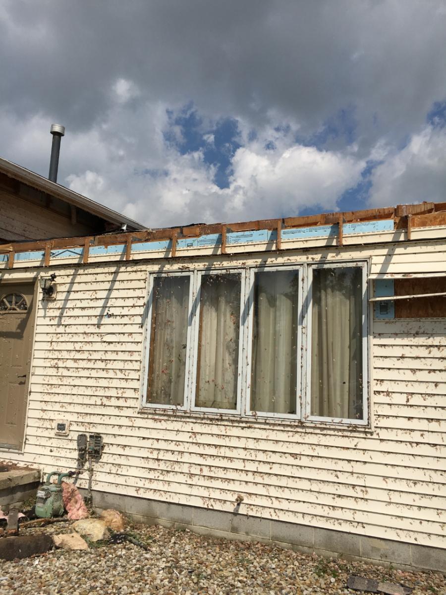
The tornado continued to track eastward along Krichbaum Road just
north of Crestline, causing sporadic tree and property damage,
including a brick garage collapsed, a roof partially blown off a
home, and an outbuilding completely destroyed. The tornado then
tracked east through fields and groves of trees, snapping and
twisting the tops off dozens of trees, before crossing State Route
61 just south of Hook Road, moving quickly into Richland County.
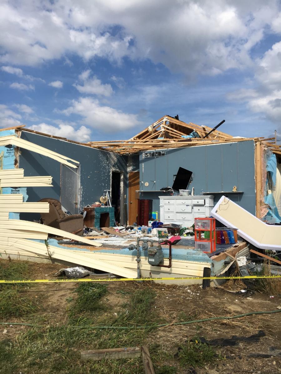
Extensive damage to a residence was found on Hook Road just west
of Thrush Road, where a first story bedroom on the southwest
corner of the house was destroyed. Half of the roof was ripped off
the home, and the attached garage on the northeast side of the
house was mostly destroyed. An adjacent detached garage was
completely destroyed, with the debris carried nearly 100 yards to
the east, including a riding lawnmower. Two minor injuries were
reported at this residence after they were thrown from the
destroyed bedroom south into the yard. Maximum estimated winds at
this location were 130 mph.
The tornado continued eastward for several miles along Hook Road,
causing tree and structural damage. After crossing State Route
314, the tornado continued eastward through fields, crossing Rock
Road. Shortly after, the tornado caused damage to trees and
structures along Stiving Road roughly halfway between Rock Road
and State Route 39. The tornado began to weaken, with damage
becoming more limited to isolated tree damage near State Route 39.
The tornado crossed State Route 39 just south of a recycling
plant, tracking eastward just north of Cairns Road, causing minor
tree damage. The weakening tornado continued eastward and crossed
Kline Road, where it lifted roughly a quarter mile eastward.
This information can also be found on our website at
weather.gov/cle.
For reference: the Enhanced Fujita Scale classifies tornadoes
into the following categories:
EF0...Wind speeds 65 to 85 mph
EF1...Wind speeds 86 to 110 mph
EF2...Wind speeds 111 to 135 mph
EF3...Wind speeds 136 to 165 mph
EF4...Wind speeds 166 to 200 mph
EF5...Wind speeds greater than 200 mph


 Follow us on YouTube