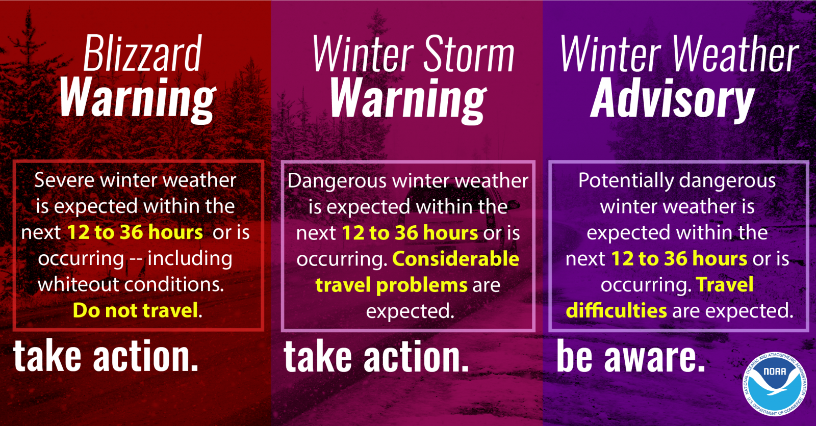
What is standard across statements issued by the National Weather Service is the awareness and action to take for watches, warnings, and advisories. Watches are your 'heads up' information that a hazardous weather may materialize. In winter, this signals that potentially dangerous winter weather conditions may occur within the next 1 to 2 days.
Warnings are your alert to take action.
For warnings, hazardous weather has a high likelihood of occurring, is imminent, or already occurring. For winter weather a Winter Storm Warning or Blizzard Warning are issued when the dangerous or severe winter weather is expected within the next day and a half. Each come with locally defined criteria (a little bit of snow in Atlanta is a big problem, but is just another day in the snow-belt of Ohio and Pennsylvania!).
| SNOW | NWS Watch, Warning or Advisory | Impact Expected |
|---|---|---|
| 4" to less than 6" of snow | Winter Weather Advisory | Travel difficulties are expected |
| 6" or more of snow in 12 hours | Winter Storm Watch or Winter Storm Warning | Considerable travel problems are expected |
| 8" or more of snow in 24 hours | Winter Storm Watch or Winter Storm Warning | Considerable travel problems are expected |
A Blizzard Warning is in a category by itself! Note that snow does not need to be falling to have a blizzard and that conditions will persist for 3 or more hours. This is significantly different from temporary whiteout conditions.
| Blizzard Warning | Impact Expected |
|---|---|
|
Sustained wind or frequent gusts 35+ mph accompanied by falling and/or blowing snow, frequently reducing visibility to 1/4 mile or less for 3 or more hours. |
Do not travel |
Hazard Simplification
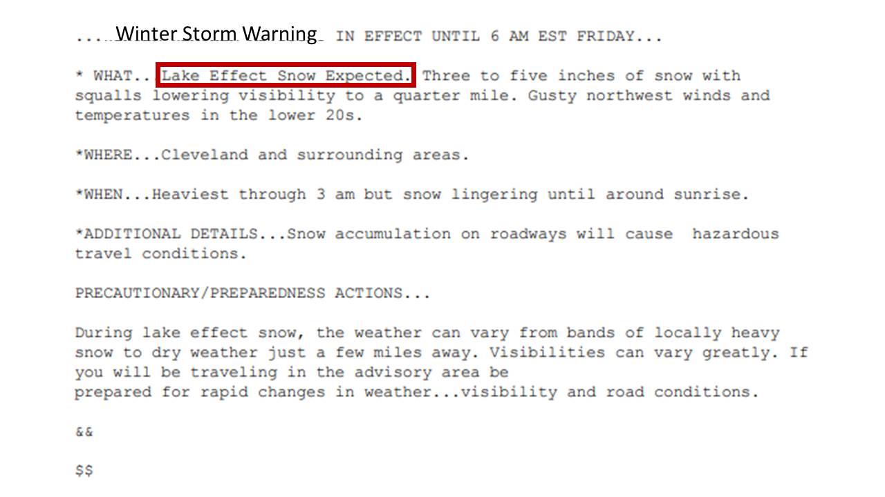
As part of a nationwide effort to re-format and consolidate the number of statements issued by the National Weather Service, the individual Lake Effect Snow Warning and Lake Effect Snow Advisory will be wrapped into the Winter Storm Warning or Winter Weather Advisory.
Any lake effect snow event of significance will now be issued under a winter weather advisory or a winter storm warning. The most important thing to note, is if NWS Cleveland issues a winter weather advisory or a winter storm warning, look at the “what” section of the advisory/warning to see what it has been issued for.
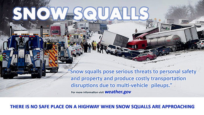
Snow Squall Warnings
Every so often northern Ohio and northwest PA experience a (non-lake effect) snow squall which arrives in association with a cold front that produces a short-lived burst of heavy snow accompanied by gusty winds and a drop in temperature. They do not produce enough snow to warrant a Winter Storm Warning, but a medium is needed to communicate the threat. We can now issue a Snow Squall Warning (CLESQWCLE) to alert of the dangerous conditions. (You will not see a Snow Squall Warning if there already is a Winter Storm Warning or Blizzard Warning in effect or for any lake effect snow of significance.)
These warnings will be short in duration, typically around an hour, similar to a severe thunderstorm warning. Snow squalls are relatively rare events in the NWS Cleveland area, so you will likely not see many of these warnings issued.
Snow squall warnings are short-fused and focused on distinct areas (like tornado and severe thunderstorm warnings). These warnings provide critical, highly localized life-saving information. If a snow squall warning is issued for your area, avoid or delay motor travel until the squall passes through your location. Warnings will be out for 30 to 60 minutes.
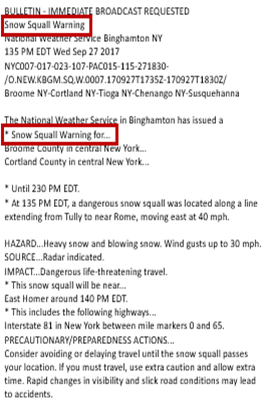
A Snow Squall Warning will be issued for:
•Intense short-lived bursts of heavy snow
•Strong, gusty winds
•Rapid drop in temperatures behind the squall
•Leads to white out or near white out conditions (reducing visibility to 1/4 mile or less)
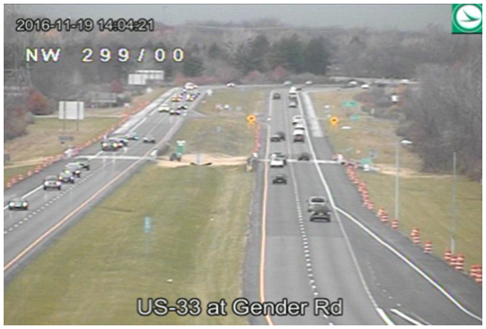
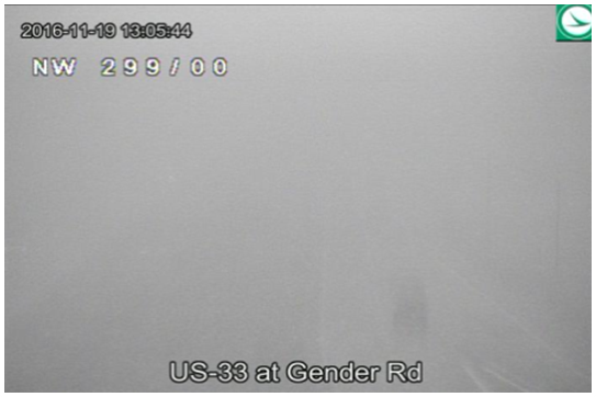
Images courtesy of ODOT.
This will be the third winter in a row now that your NWS Cleveland has specifically worked with the Ohio Department of Transportation (ODOT) in jointly conveying weather and safety messages to the driving public. The ODOT Traffic Management Center in Columbus now relays our Advisory, Watch, and Warning information in a condensed manner on their digital message signs. We are also jointly promoting weather safety actions when inclement weather visits northern Ohio with both of our social media accounts. We have also been coordinating with PennDOT on similar messaging actions.
During the winter of 2015-2016 we put a renewed focus on highlighting particularly intense bands of snow (usually within lake effect) that would affect the traveling public. We focused on the scenarios where a driver may abruptly go from a nearly unlimited visibility situation to less than a quarter of a mile across a short distance (sound familiar snow belt residents!). So even if there is a Winter Storm Warning in effect, we may still utilize a Special Weather Statement to highlight this particular imminent danger. Special Weather Statements are a multi-use statement that is typically issued for a not-quite severe situation (thunderstorms with gusts up to 50 MPH, for example).
NWS Cleveland Winter Page
Winter Weather Warnings / Watches / Advisories
Public Information Statement (has snow totals when available)
Local Storm Reports (has snow reports of 2"+ when available)


 Follow us on YouTube