Christmas 1983 Blizzard and Cold
30 Year Anniversary
Christmas of 1983 was the coldest Christmas ever with blizzard conditions across northeast Ohio and northwest Pennsylvania. The combination of the arctic cold temperatures and the wide open Great Lakes set the stage for the development of a Lake Effect blizzard. Snow fell across northern Ohio and northwest Pennsylvania on December 24th and 25th. Winds of 40 to 50 mph whipped between 6 and 20 inches of new snow into 10 to 15 foot drifts. WJET-TV 24 Meteorologist remembered the high winds and incredible snow drifts that developed from the fine snow because the air was so cold making the snow lighter. Visibilities were zero for several hours and virtually all roads were closed from just east of Cleveland, Ohio to Buffalo, New York. Utilities were out for several hours and hundreds of residents and travelers had to go to shelter areas. The City of Ashtabula was declared a disaster area and the National Guard was activated. Several people suffered frostbite as air temperatures fell below zero.
Former WJW-TV 8 and WFMJ-TV 21 Meteorologist Mark Koontz reflected on this event and stated that the shoreway in Cleveland was "quite surreal". There was no activity on the shoreway during the blizzard. Mark stated the high winds and wind chill values were unreal and the city of Cleveland virtually did not exist and was shut down and became a ghost town. The Lakeside Yacht Club near Burke Lakefront Airport sustained significant damage with docks ripped up by at least 12 foot waves. The shoreway was shutdown due to visibilities being reduced to a 100 feet or less and drifting snow. Spray from the large waves hitting the bank along the shoreway was deposited on the shoreway making it extremely slippery. Spray even blew over 100 yards to the North side of the WJW TV station and accumulated ice. Cleveland Hopkins International Airport was also shut down for the duration of the storm. Stranded passengers had to live in the airport until flights were resumed.
Kirk Lombardy, Meteorologist at the National Weather Service in Cleveland, Ohio recalled watching Mark Koontz on the air at WJW-TV 8 talking about the great Christmas blizzard. Kirk said Mark displayed the old WSR-74C radar imagery while on the air and the entire scope was filled with green indicating a lot of snow. Kirk even remembered that every Christmas Eve service was cancelled that evening because of the extreme weather.
The entire region suffered from December 22nd through the 26th as record cold temperatures persisted for several days. Many areas experienced the coldest Christmas ever. Temperatures remained below 0 for 60 hours in some areas.
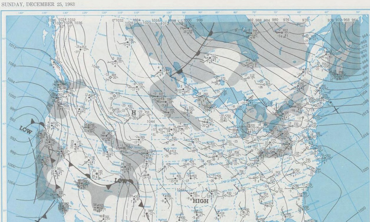
The coldest Christmas on record came one year after the warmest Christmas in 1982. This record cold wave affected all of the continental United States except in the southwestern deserts. Some meteorologists called this the "Great Freeze of '83" and the worst cold weather event of the century in the United States (Mogil, Stern, and Hagan 1984).
The arctic blast developed over Alaska on December 15th and moved southeast over western Canada and the northern Plains. The arctic air mass remained in place for several days over the snow-covered arctic darkness of Alaska before moving southeast toward the Great Lakes region.
The arctic high pressure intensified rapidly and spead into the central United States on December 22nd and 23rd. Snow covered 74 percent of North America in December resulting in the Great Freeze of '83. All time December cold records were set in cities across 29 states from Washington to North Dakota and Florida.
Subzero weather moved into Ohio and western Pennsylvania on Thursday evening, December 22nd in advance of the massive southward movement of arctic air. Temperatures dipped to -52 degrees in Butte, Montana, and a new contiguous United States record high barometric pressure of 31.42 inches was set at Miles City, Montana. This was an indication of how cold the air was that was headed southeast.
Temperatures on Christmas morning were -10 to -15 degrees in southern Ohio and near Lake Erie. Elsewhere across the area temperatures fell to -15 to -20 degrees. This record cold exceeded the Christmas temperatures of 1924.
The bitter cold temperatures combined with the strong winds caused wind chills of -50 degrees. Die hard shoppers still filled the suburban shopping malls on Christmas Eve.


A special thank you to former WJW-TV 8 and WFMJ-TV 21 Meteorologist Mark Koontz and WJET-TV 24 MeteorologistTom Atkins for their contributions to this article on the lake effect blizzard and extreme cold on Christmas, 1983. Exerpts for this article were taken from Thunder in the Heartland, authored by Dr. Thomas Schmidlin and Jeanne Schmidlin by permission. (Note: Before 1985, WJW-TV 8 was formerly WJKW-TV 8.)

