Although fifty years have passed, no other hurricane has made landfall in Texas with the intensity of Hurricane Carla since. Carla was the most intense hurricane to make landfall on the Texas coast in the 20th century and second in recorded history only to the Indianola hurricane of 1886. Carla was the last of 6 hurricanes to make landfall on the Texas coast as a Category 4 hurricane on the Saffir-Simpson scale, with sustained winds stronger than 130 mph, in the 20th century. Carla ranks as the 9th most intense hurricane to affect the United States since 1851.
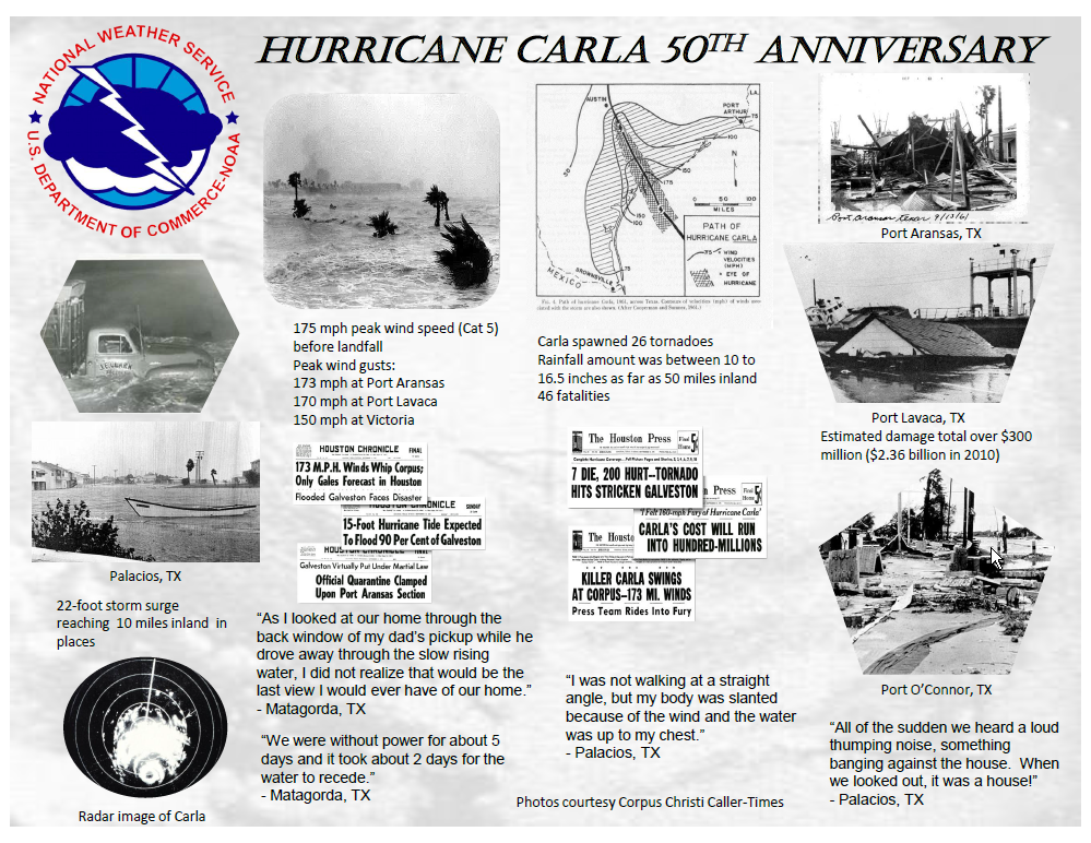
Carla began as a tropical depression in the southwest Caribbean Sea on September 3rd, 1961. It became a tropical storm off the coast of Honduras on the 5th and quickly gained hurricane strength as it moved north to east of the Yucatan peninsula on the 6th. After skimming the Yucatan peninsula, Carla moved northwest and strengthened to a large major hurricane over the Gulf of Mexico on the evening of the 7th. The winds increased to around 175 mph early on the morning of the 11th making Carla a Category 5 hurricane. Carla weakened slightly as it made a loop off the coast from Port O'Connor. Carla made landfall on the afternoon of the 11th on the northeast part of Matagorda Island as a strong Category 4 hurricane with a minimum central pressure of 931 millibars, or 27.49 inches of mercury, and sustained winds of 145 mph. The eye of Carla moved across Port O'Connor and Port Lavaca and then inland just east of Victoria. Carla weakened to a tropical storm on the morning of the 12th just east of Austin.

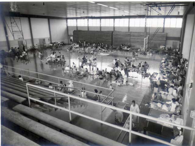
Hurricane watches were issued for the entire Texas coast on the 8th of September and warnings were issued on the 9th all along the Texas coast. The warnings prompted a large scale evacuation of the islands and low lying coastal areas of Texas into southwest Louisiana, which had been devastated by Hurricane Audrey in June of 1957. The evacuation of a half of a million people was determined to be the largest evacuation in United States history up to that time. Most assuredly, this impacted the number of fatalities associated with this dangerous hurricane with 46 people killed and 465 injured. In comparison, the storm surge from Hurricane Audrey led to 416 fatalities in Louisiana and extreme southeast Texas.
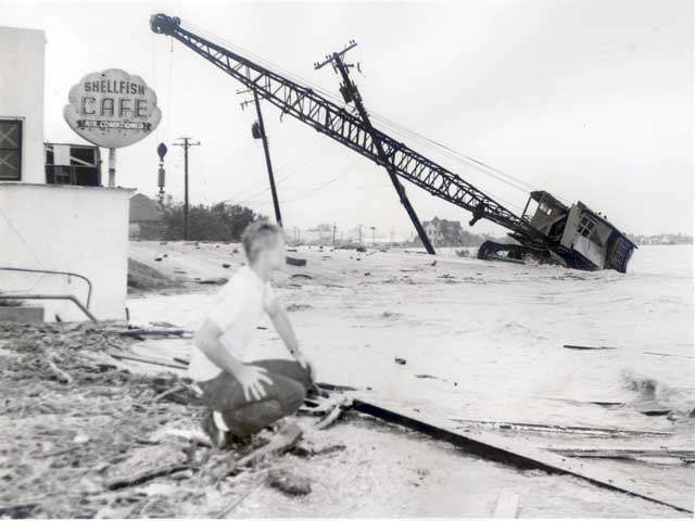
Carla was an extremely large hurricane with devastating effects from the winds and storm surge for the Middle and Upper Texas coast. Hurricane force gusts were recorded along the Texas coast from Port Mansfield to Galveston. The highest sustained wind speeds reported were 115 mph at Matagorda, 110 mph at Victoria, and 88 mph at Galveston. Extreme peak wind gusts were estimated to be near 170 mph at Port Lavaca as the wind equipment blew away after reading 153 mph. Wind gusts were estimated to be around 150 mph at Victoria, Port Aransas, and Edna. Wind gusts of 80 to 90 mph were reported from Rockport to Corpus Christi.
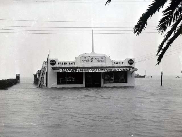
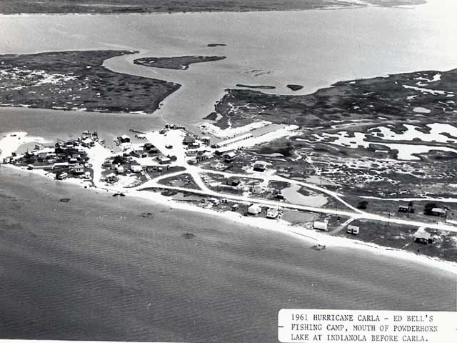
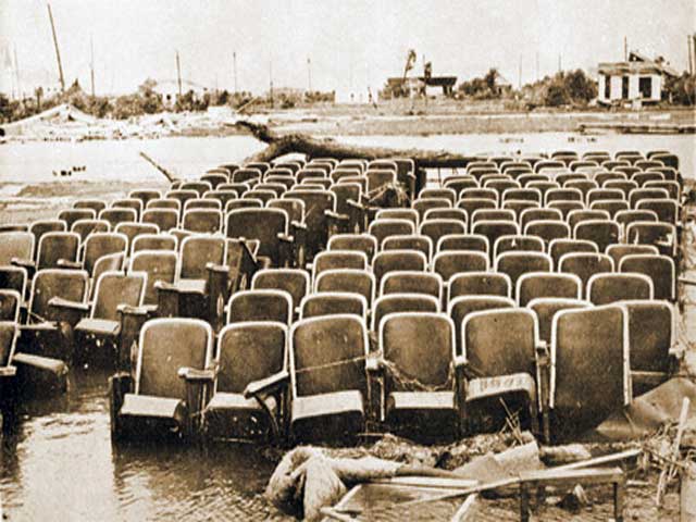
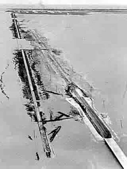
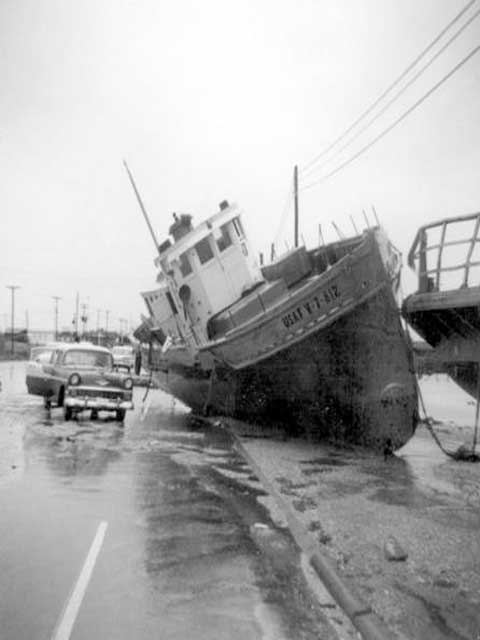
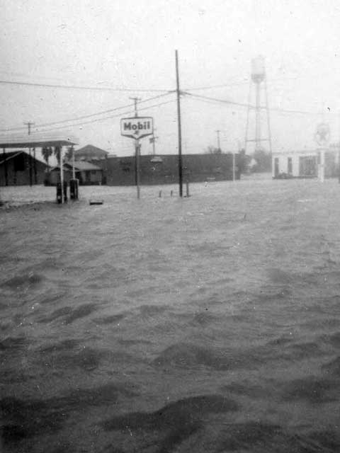
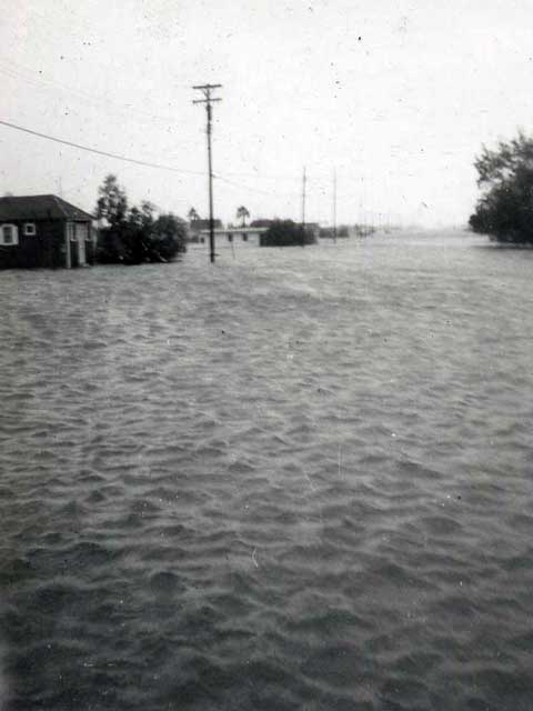
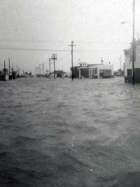
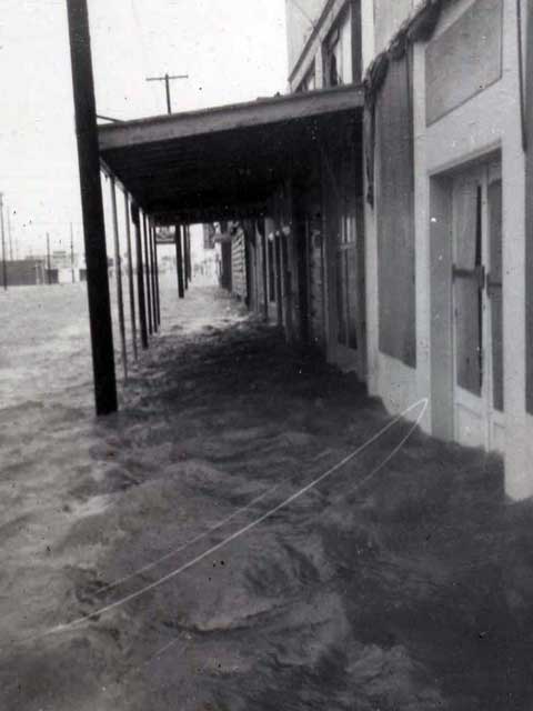
Carla's storm surge devastated the Texas coast, rising to 10 feet above normal along a 300 mile swath from Port Aransas to Sabine Pass. The higher tides reached the Upper Texas coast by the 8th as the large hurricane approached with storm surge eventually reaching 10 to 15 feet around Galveston Bay. Tides of 15 to 17 feet above mean sea level inundated Port O'Connor, Indianola, Palacios and Matagorda. The extreme tides inundated downtown Port Lavaca with 2 feet of flood water and displaced fishing boats and tug boats on Highway 35. With the slow movement of Carla, the hurricane pushed a storm surge of 22 feet above mean seal level at the head of Lavaca Bay in Port Lavaca. This is the highest storm surge in Texas hurricane history. Total inundation of the Texas coastline was around 1.7 million acres with the storm surge reaching 10 miles inland in places.
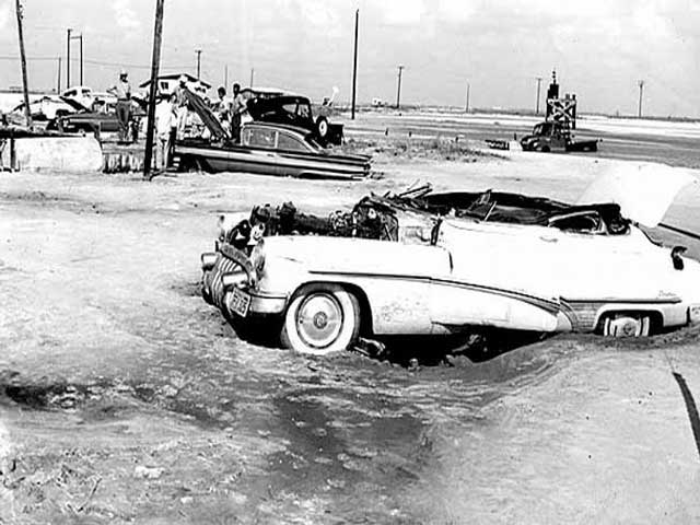
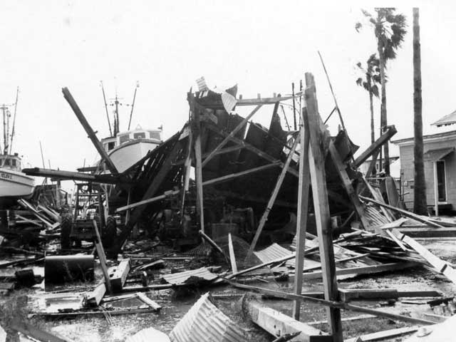
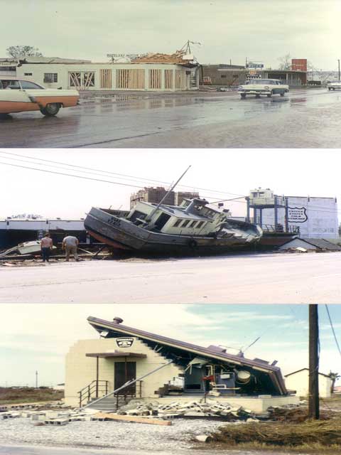
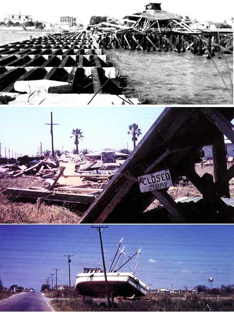
Total damage in Texas was two-thirds from property losses and one-third from crop losses. Most of the crop losses were due to unharvested rice and to a lesser degree for cotton. Estimated total damage exceeded $2.36 billion dollars in reference to 2010 dollar value. Property damage for the coastal communities of the Middle and Upper Texas was catastrophic. Port O'Connor, Palacios, and Indianola were leveled by the storm surge along with the devastating winds. Matagorda Island Air Force Base was almost completely destroyed. In Texas, 1,915 homes and 983 businesses, farm buildings, and other buildings were completely destroyed. Major damage occurred to 7,398 homes and 2,601 businesses, farm buildings, and other buildings. Minor damage was reported to 43,325 homes and 13,506 businesses, farm buildings and other buildings.
Carla spawned 18 tornadoes with 10 in Louisiana and 8 in Texas. There were 2 tornadoes in Galveston with one a devastating F4 tornado killing 8 people. Other cities in Texas affected by tornadoes were Bay City, Channelview, Hardin, Jacksonville, and two other small communities in East Texas.

Rainfall amounts were heaviest from Port Lavaca to Galveston and then up to 50 miles inland. Maximum rainfall amount recorded was 17.48 inches at Bay City. The Galveston Airport received 16.49 inches of rain over a four day period. Other cities that recorded rainfall amounts above 10 inches were Wharton (13.05"), Liberty (12.55"), Dickinson (12.47"), and Flatonia (11.8 "). The immediate coastal regions in the Coastal Bend received 4 to 5 inches of rain with Corpus Christi receiving 4.73" while Victoria recorded 6.25 inches of rain. As Carla weakened further as it moved toward the Upper Midwest, it produced rain amounts of 4 to 8 inches of rain from Oklahoma to Kansas and Missouri into northern Illinois. This produced flash flooding that caused 5 deaths in Kansas and 1 in Missouri. The remnants of Carla produced heavy rainfall as far north as Michigan.


 Follow us on YouTube