|
The outflow winds from these thunderstorms pushed to the southwest into the northern Rio Grande Plains during the early evening hours. The seabreeze boundary had moved into the eastern Rio Grande Plains by 8 pm. Strong low level convergence was located over the Rio Grande Plains by this time. Temperatures were still in the upper 90s at Cotulla and Laredo with dewpoints around 70. The airmass over the region was moderately unstable. The southern portion of the upper level disturbance was moving into the area at this time. Scattered strong thunderstorms developed over Dimmit, La Salle, and Northern Webb counties at 8 pm. The southern storm became predominant and intensified. A Severe Thunderstorm Warning was issued at 824 pm for Northwestern Webb County until 930 pm. A co-op observer relayed reports from a relative which was working on an oil rig 15 miles west of Encinal. A report of quarter sized hail and winds around 50 mph was received from them at 843 pm.
KGNS-TV reported winds gusts estimated at 70 mph at 932 pm. The public reported golf ball sized hail 2 miles east of downtown Laredo in the Heights area at 938 pm. The Corpus Christi Doppler Radar indicated the possibility of a tornado developing over the eastern portions of the city...near the International Airport. At 944 pm...a Tornado Warning was issued for Webb County until 1015 pm. The severe thunderstorm produced considerable damage to mobile homes on the southeast side of Laredo around 955 pm. Widespread wind damage occurred over the northern, eastern and southeastern sections of the city of Laredo. Numerous windows were broken, widespread power outages occurred due to power lines being blown down, and debris littered the roadways. No reports of injuries have been received at the time of this writing.
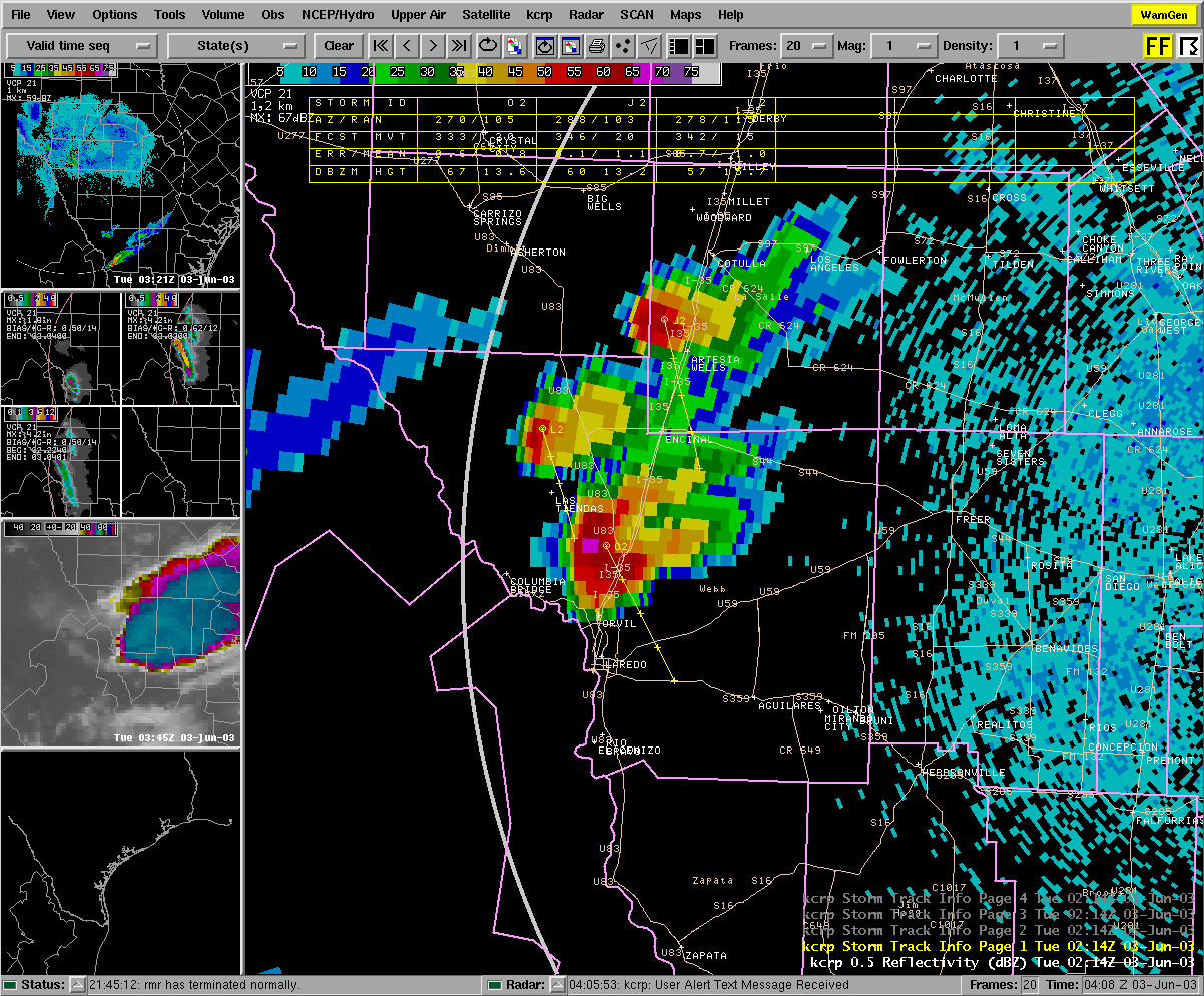
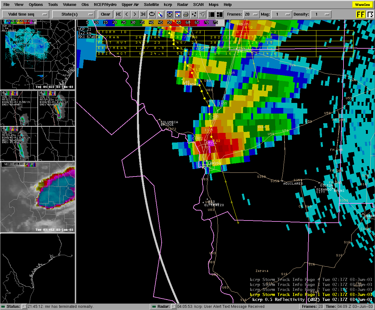
Below are some images of the storm captured on the WSR-88D Doppler Radar located at the Corpus Christi airport.
|


 Follow us on YouTube