Overview
|
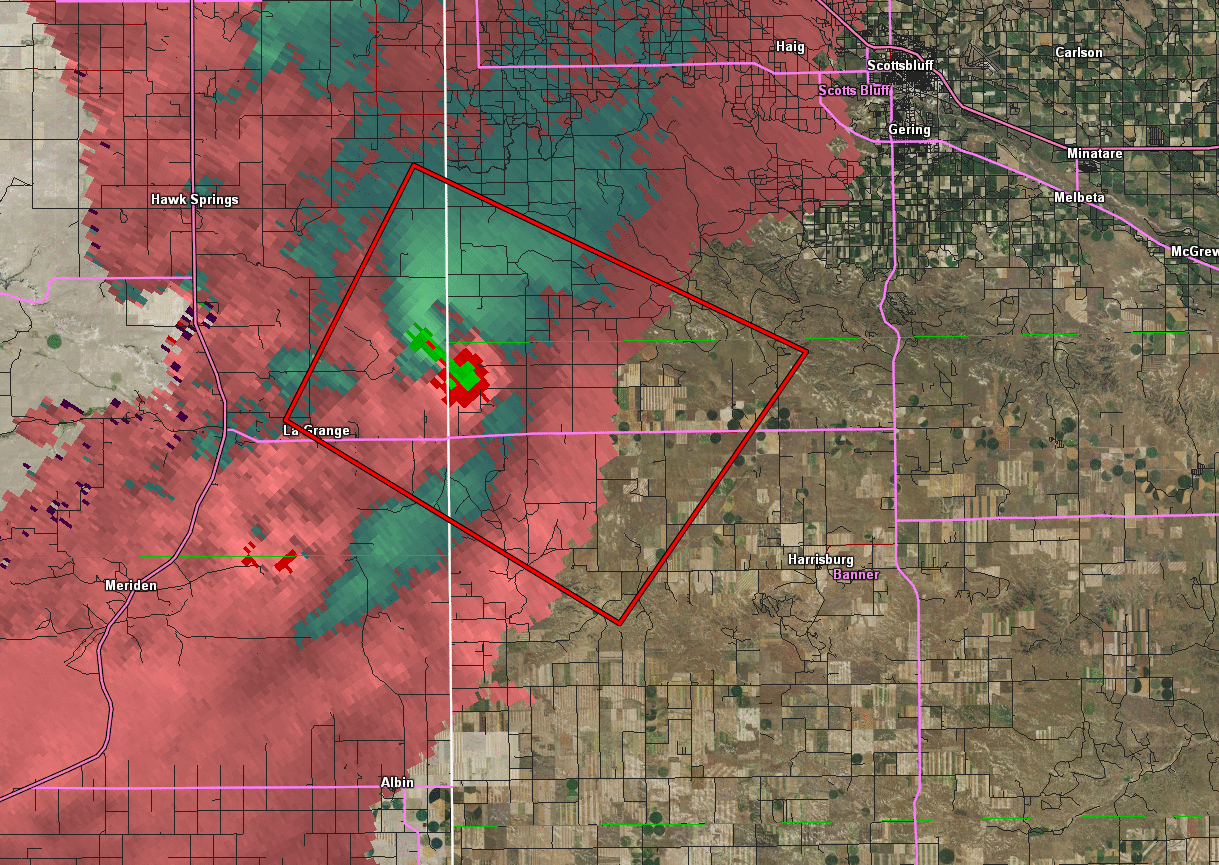
The day of June 22, 2013 the Storm Prediction Center identified most of southeast Wyoming and Western Nebraska as a "slight" risk for severe storms. Storms began to develop into the mid afternoon and producing a tornado an EF 1 tornado at 3:54 PM. The tornado touched down west of La Grange, WY and moved southeast over the Nebraska border. The tornado dissipated north of Harrisburg, NE. Two other weaker tornadoes developed during the afternoon southwest of Wheatland, WY and Kimball, NE. |
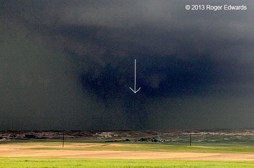
On Highway 151, west of La Grange. Looking NNW at the tornado Roger Edwards SPC |
 |
 |
 |
|
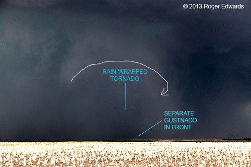
Arrow Showing rotation area around the tornado. Roger Edwards SPC |
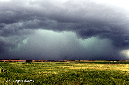
Dark area in lower middle corresponded to tight zone of rapid rotation relative to remainder of precip drum. Roger Edwards SPC |
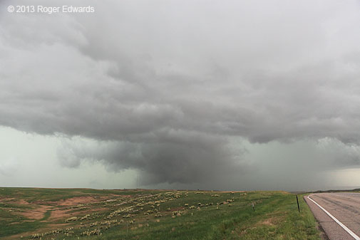
Faint, fuzzy condensation vortices were seen moving around on both sides of stubby funnel right before this photo Roger Edwards SPC |
Tornadoes:
|
Tornado - Harrisburg, NE
Track Map
 |
The Enhanced Fujita (EF) Scale classifies tornadoes into the following categories:
| EF0 Weak 65-85 mph |
EF1 Moderate 86-110 mph |
EF2 Significant 111-135 mph |
EF3 Severe 136-165 mph |
EF4 Extreme 166-200 mph |
EF5 Catastrophic 200+ mph |
 |
|||||
Photos & Video:
Banner County Storm Damage
 |
 |
 |
|
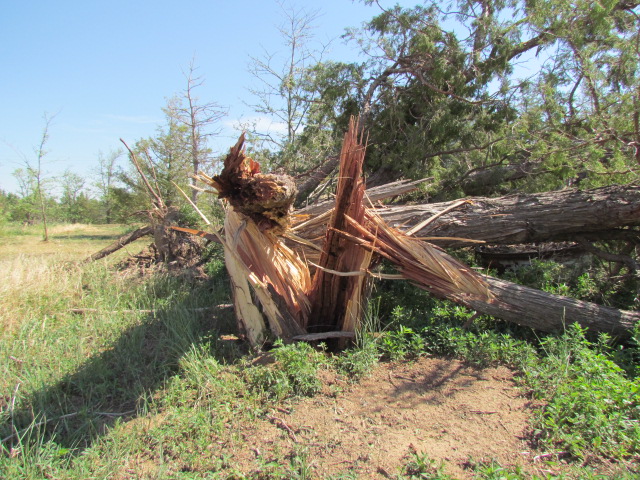
Tree Damage in Banner County NWS Cheyenne |
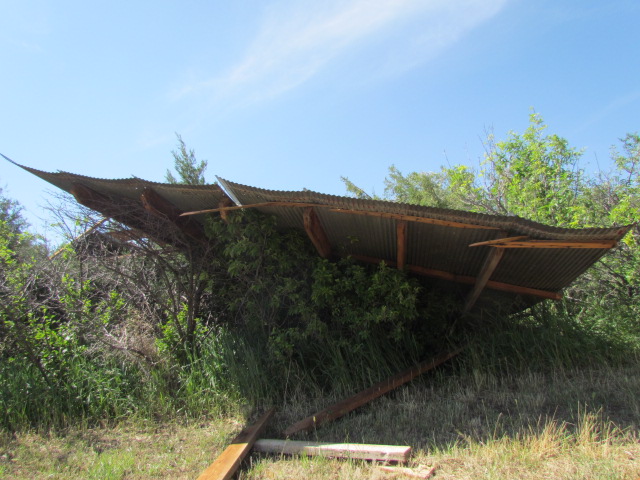
Roof Blown off a nearby Barn NWS Cheyenne |
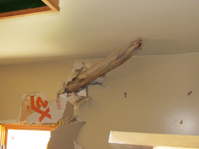
Tree Lodged in the Side of a Home NWS Cheyenne |
Radar:
Header
 |
 |
|
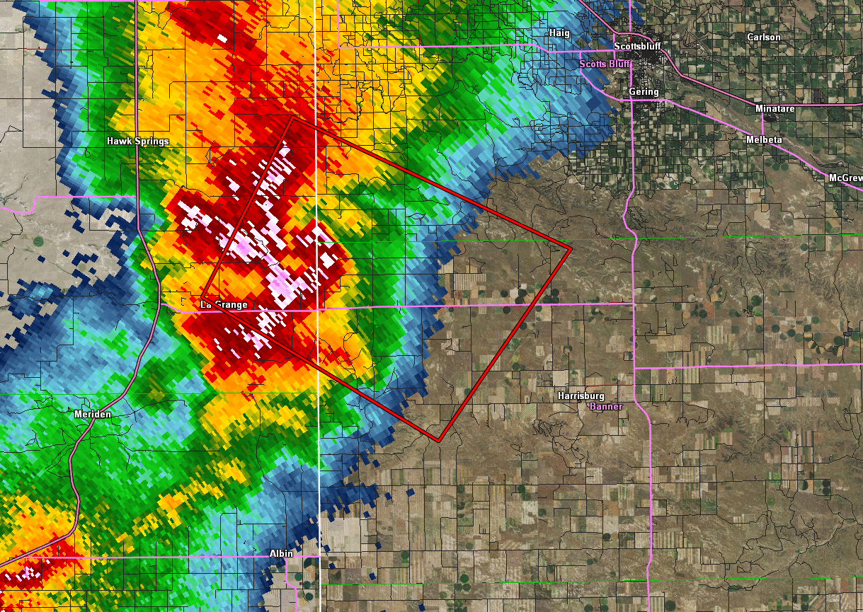
Reflectivity loop from 446 PM to 528 PM as the supercell thunderstorm and associated tornado moved to the southeast. |
Storm relative velocity loop from 446 PM to 528 PM. The green-red couplet shows the strong rotation of the supercell thunderstorm and tornado. |
Storm Reports
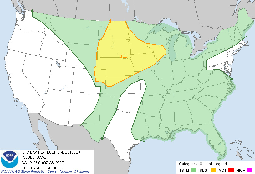
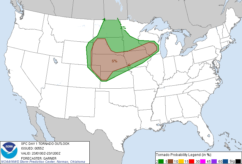
Storm Prediction Center Outlooks
 |
 |
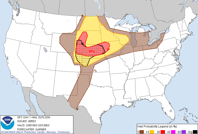 |
| SPC Day 1 Categorical Outlook | SPC Day 1 Tornado Outlook | SPC Day 1 Hail Outlook |
Storm Reports
 |
|
||||||||||||
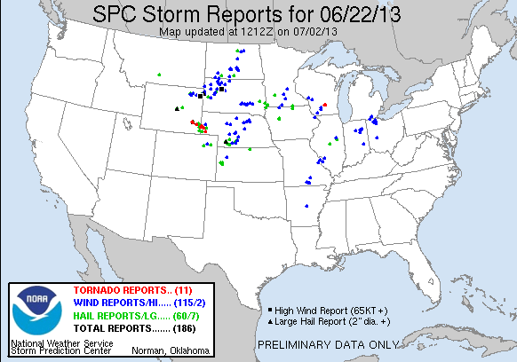
| June 22, 2013 Storm Reports |
 |
Media use of NWS Web News Stories is encouraged! Please acknowledge the NWS as the source of any news information accessed from this site. |
|


 Weather Story
 Weather Map
 Local Radar
 Follow us on YouTube