|
Snow Showers Southeast. Mainly Dry North/Central.
Weekend Highlights
SKYWARN Spotter Training Schedule 2024
19/325AM: The Friday forecast for southeast Wyoming and Nebraska Panhandle calls for light snow showers on and off through the day across southeast portions of the forecast area. Dry weather for our northern and central areas today. Highs today range from 38 at Lusk to 56 in Baggs. Better chances for snow showers tonight across the southeast. Locations along Interstate 80 from Sidney to the I-80 Summit west of Cheyenne could see accumulations of 2-3 inches overnight. Lows range from 20 at Harrison, to 30 at Baggs.
5 PM April 18th - Cooler, wet weather continues late this week with chances for precipitation, mainly light snowfall, across southeast Wyoming and portions of the Nebraska panhandle Friday into early Saturday. Headed later into the weekend into next week, we are expecting a warm up with temperatures climbing into the 60s once again. Be sure to check weather.gov/cys for the latest local forecast.
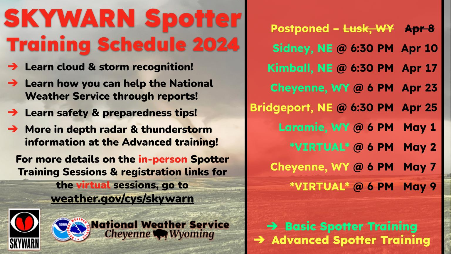
🚫SkyWarn Spotter Training UPDATE: The Lusk, WY Advanced Spotter Training Session has been postponed due to hazardous weather. Refer to future Spotter Training Session locations across southeast Wyoming and western Nebraska or sign up to attend our virtual Spotter Training Sessions!
---
🌪️The 2024 SKYWARN Spotter Training Schedule for Southeast Wyoming and Western Nebraska is out! Check to see if we're coming to a city near you or sign up to attend the virtual spotter training sessions!
🌪️For more information, go to weather.gov/cys/skywarn
|
 |
Storm Prediction Center Main Page |
 Current Mesoscale Discussions |
 Current Convective Watches |
 Yesterday's Storm Reports |
 Today's Storm Reports |


 Weather Story
 Weather Map
 Local Radar
 Follow us on YouTube