Overview
A line of fast-moving thunderstorms initially developing along the CO...KS state line Tuesday evening, shifted eastward through western and central KS during the evening to overnight hour. Several small tornadoes developed along the leading edge of this line with the initial tornado starting near Sublette. The final tornado occurred near Trousdale shortly after midnight. Survey results indicated EF1 strength circulations existed with most tornadic damage.
Tornadoes:
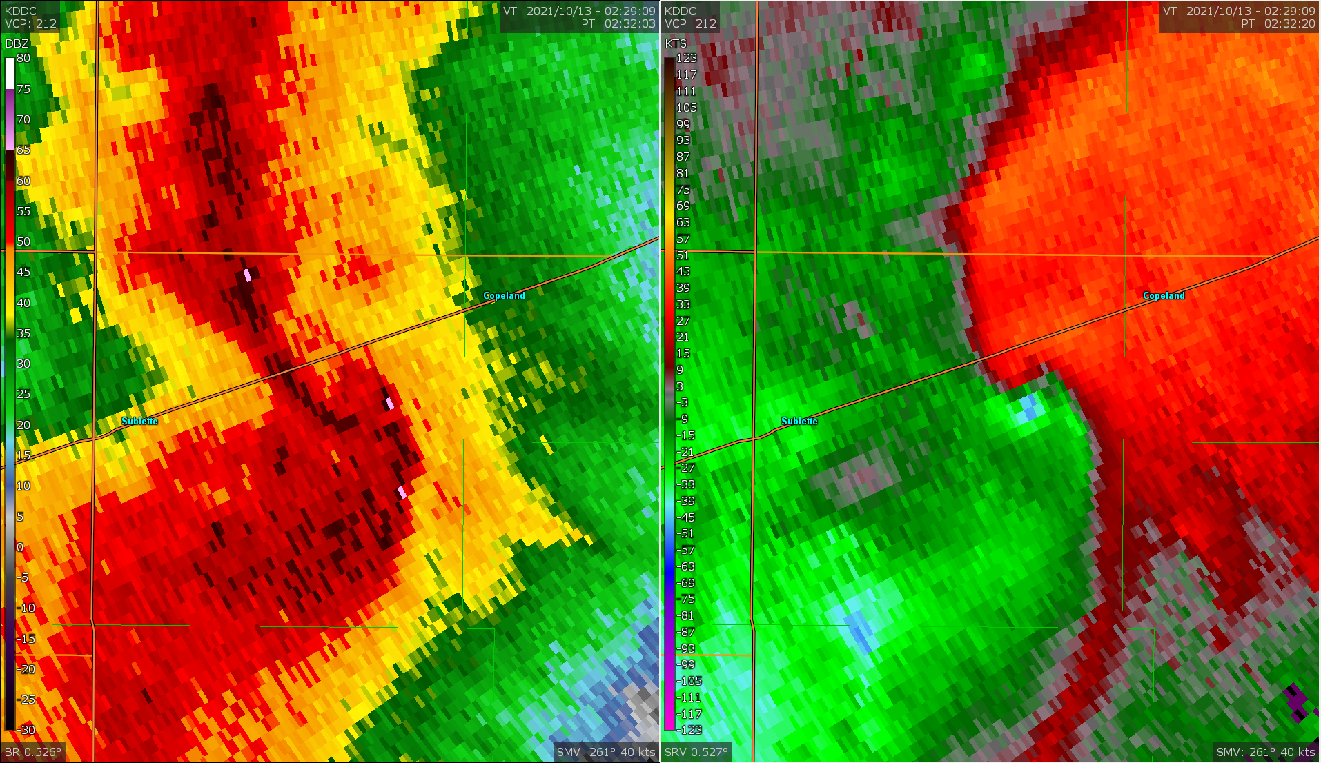
Tornado #1 - Sublette to Copeland, KS
Haskell-Gray Counties
| Date |
10/12/2021 |
| Time (Local) |
09:23 PM CDT |
| EF Rating |
EF1 |
| Est. Peak Winds |
110 mph |
| Path Length |
13.5 miles |
| Max Width |
150 yards |
| Injuries/Deaths |
0 / 0 |
|
Summary:
Damage with this fast-moving vortex was
confined to mostly rural locations in
Haskell and far southwest Gray Counties.
Several pivot irrigation systems were
flipped along with some farm outbuildings
damaged.
|
|
Tornado #2 - Cimarron, KS
Gray County
| Date |
10/12/2021 |
| Time (Local) |
10:02 PM CDT |
| EF Rating |
EF1 |
| Est. Peak Winds |
90 mph |
| Path Length |
2 miles |
| Max Width |
75 yards |
| Injuries/Deaths |
0 / 0 |
|
Summary:
Short-lived tornado starting south
of Cimarron.
|
|
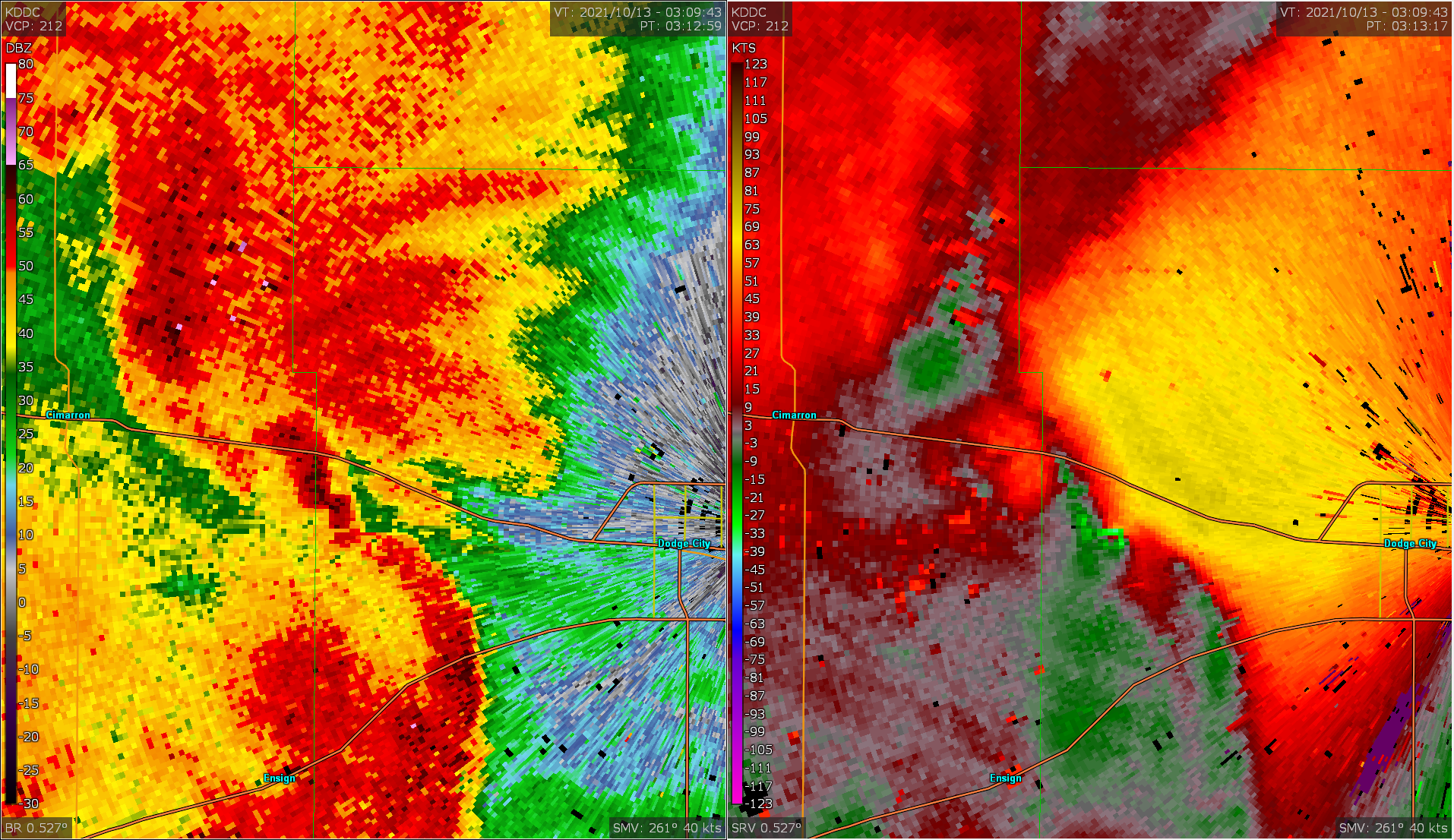
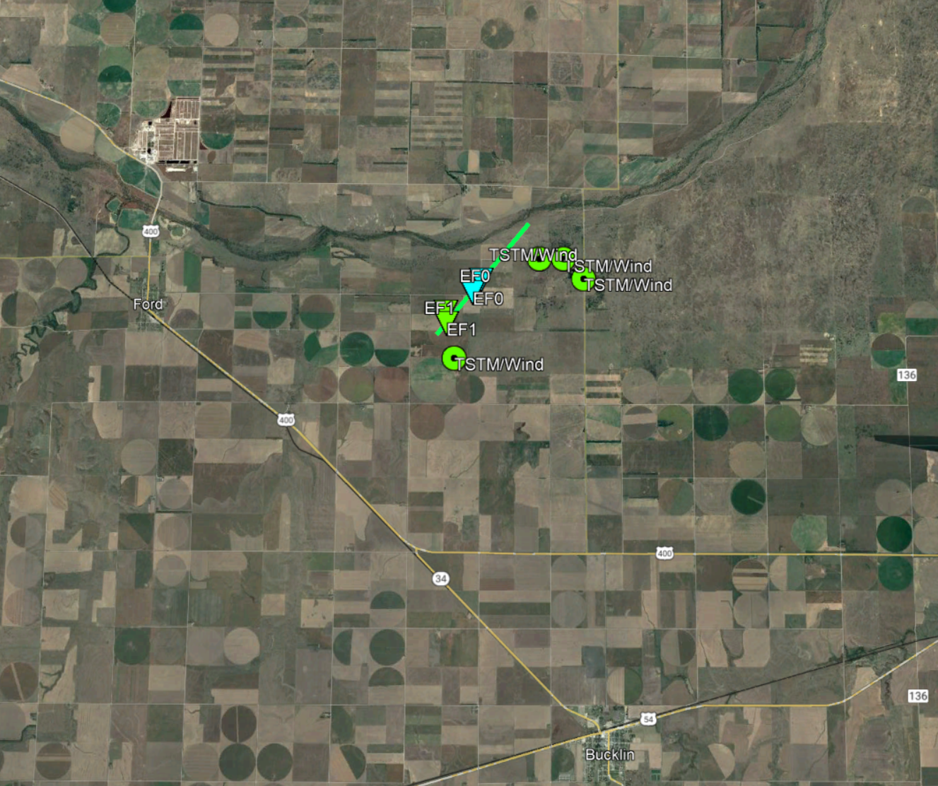
Tornado #3 - Howell, KS
Ford County
| Date |
10/12/2021 |
| Time (Local) |
10:12 PM CDT |
| EF Rating |
EF1 |
| Est. Peak Winds |
100 mph |
| Path Length |
7 miles |
| Max Width |
75 yards |
| Injuries/Deaths |
0 / 0 |
|
Summary:
Short-lived tornado starting south of
Howell that mostly impacted open fields
with only minor damage to a farm
outbuilding and pivot irrigation system.
|
|
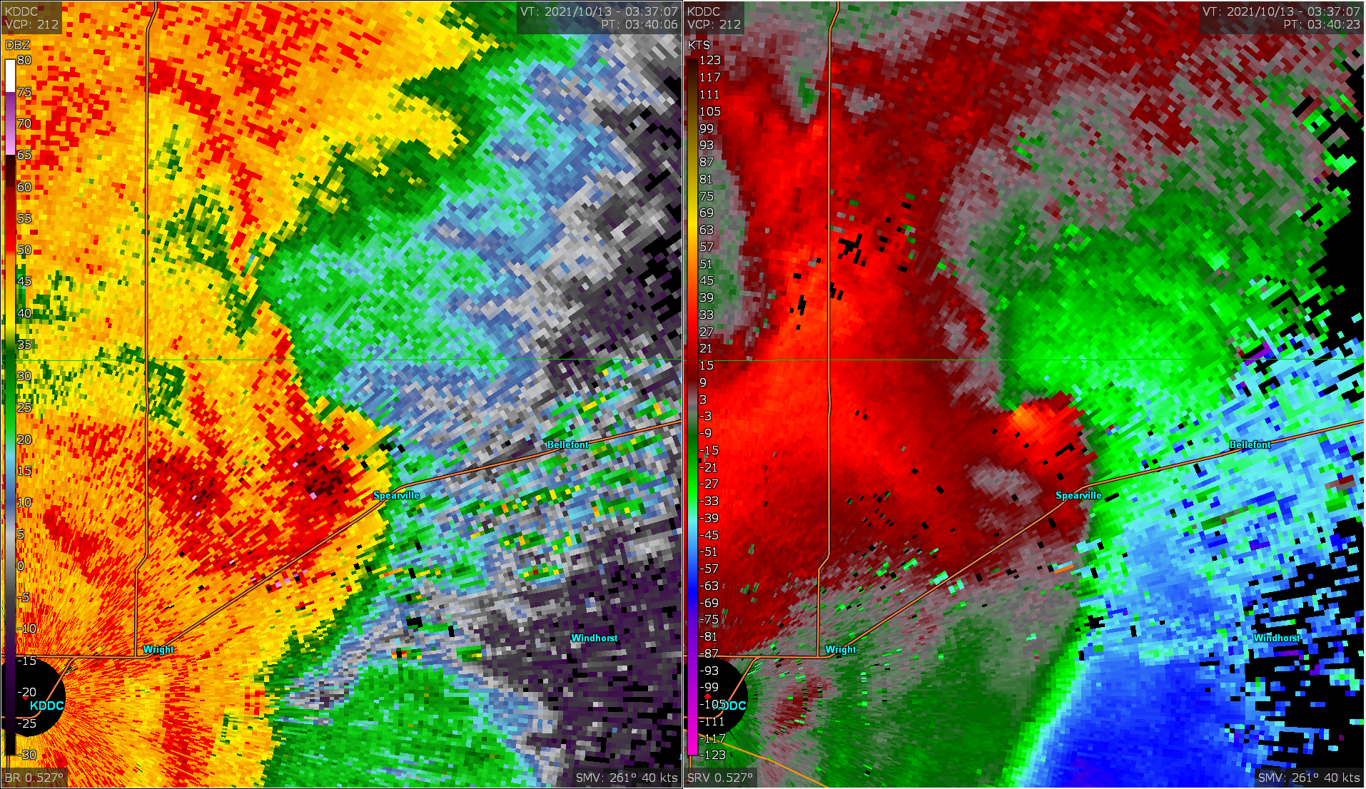
Tornado #4 - Spearville to Hanston, KS
Ford-Hodgeman Counties
| Date |
10/12/2021 |
| Time (Local) |
10:39 PM CDT |
| EF Rating |
EF1 |
| Est. Peak Winds |
110 mph |
| Path Length |
10.7 miles |
| Max Width |
75 yards |
| Injuries/Deaths |
0 / 0 |
|
Summary:
Damage with this fast-moving vortex was
confined to mostly rural locations in
northeast Ford and southeast Hodgeman
Counties. Several pivot irrigation
systems were flipped along with some farm
outbuildings damaged. Also of note,
strong straight-line winds up to 100 mph
occurred immediately to the southeast of
the vortex with multiple round bales
rolled over one quarter mile.
|
|
Tornado #5 - Ford, KS
Ford County
| Date |
10/12/2021 |
| Time (Local) |
11:22 PM CDT |
| EF Rating |
EF1 |
| Est. Peak Winds |
110 mph |
| Path Length |
2 miles |
| Max Width |
75 yards |
| Injuries/Deaths |
0 / 0 |
|
Summary:
Short-lived tornado east of Ford with
damage mostly confined to pivot
irrigation systems and electrical
transmission poles.
|
|
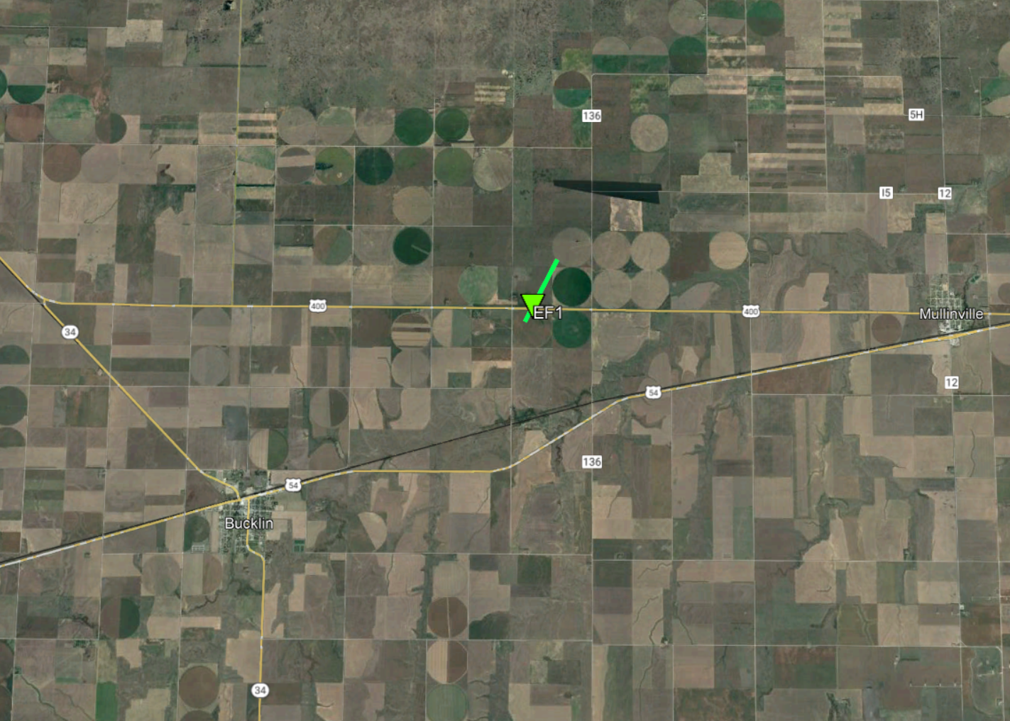
Tornado #6 - Bucklin, KS
Ford County
| Date |
10/12/2021 |
| Time (Local) |
11:38 PM CDT |
| EF Rating |
EF1 |
| Est. Peak Winds |
90 mph |
| Path Length |
1 mile |
| Max Width |
50 yards |
| Injuries/Deaths |
0 / 0 |
|
Summary:
Short-lived tornado northeast of Bucklin
associated with tree damage along a
shelter belt along U.S. Highway 400.
|
|
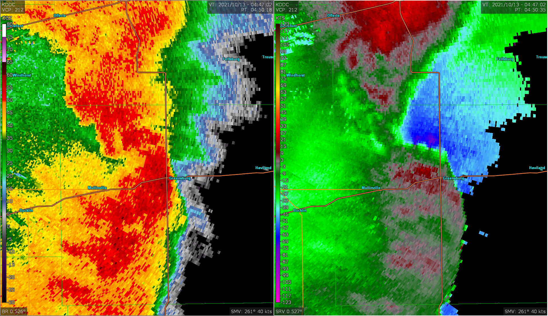
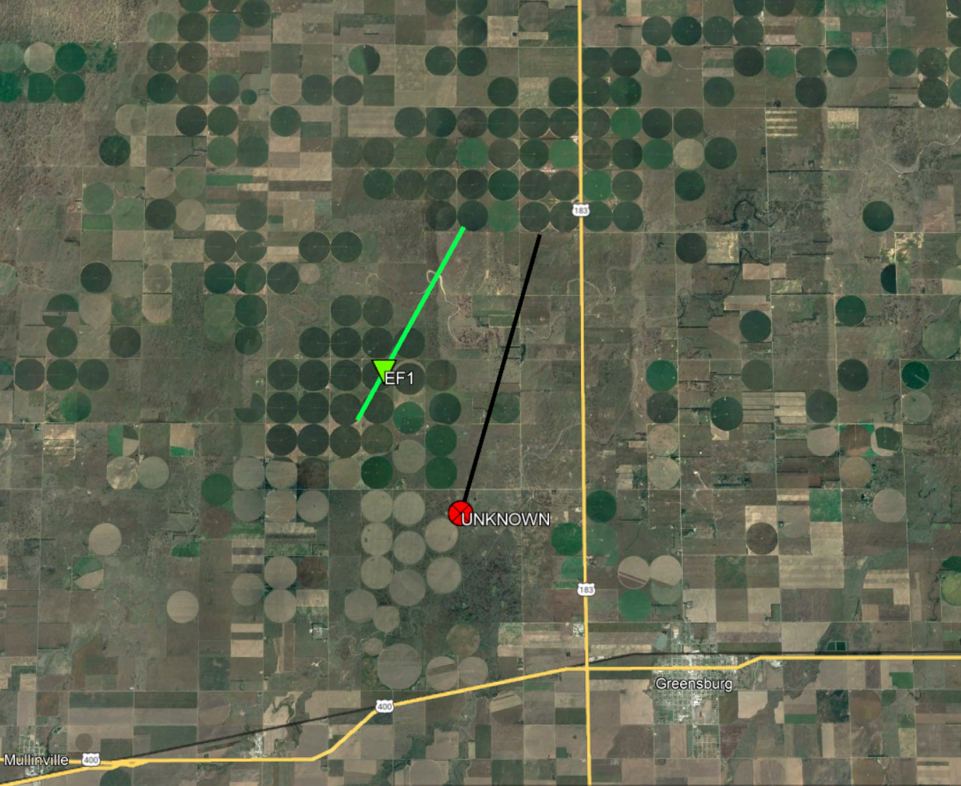
Tornado #7 - Greensburg, KS #1
Kiowa County
| Date |
10/12/2021 |
| Time (Local) |
11:48 PM CDT |
| EF Rating |
EFU (Unknown) |
| Est. Peak Winds |
N/A |
| Path Length |
4.6 miles |
| Max Width |
N/A |
| Injuries/Deaths |
0 / 0 |
|
Summary:
Short-lived tornado that was part
of a pair of concurrent tornadoes
northwest of Greensburg. This
first tornado tracked over open
fields with no documented damage.
|
|
Tornado #8 - Greensburg, KS #2
Kiowa County
| Date |
10/12/2021 |
| Time (Local) |
11:49 PM CDT |
| EF Rating |
EF1 |
| Est. Peak Winds |
86 mph |
| Path Length |
3.5 miles |
| Max Width |
75 yards |
| Injuries/Deaths |
0 / 0 |
|
Summary:
Short-lived tornado that was part
 of a pair of concurrent tornadoes
northwest of Greensburg. This
second tornado flipped a pivot
irrigation system but otherwise
tracked over open fields.
|
|
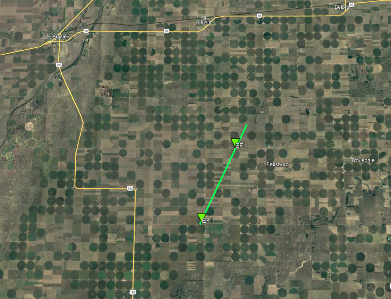
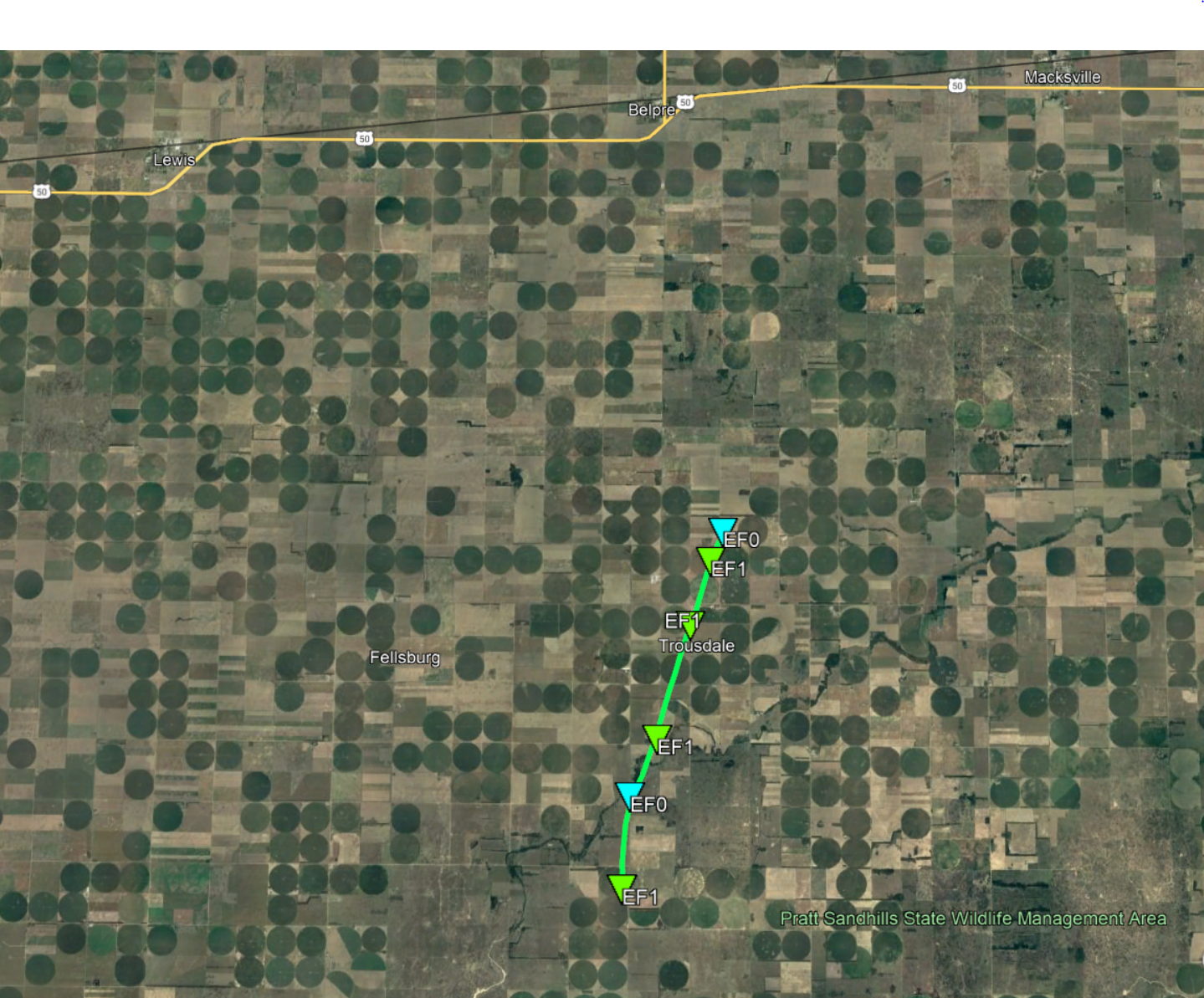
Tornado #9 - Fellsburg, KS
Edwards County
| Date |
10/12/2021 |
| Time (Local) |
11:59 PM CDT |
| EF Rating |
EF1 |
| Est. Peak Winds |
90 mph |
| Path Length |
6.3 miles |
| Max Width |
100 yards |
| Injuries/Deaths |
0 / 0 |
|
Summary:
Part of a pair of concurrent
tornadoes near Fellsburg and
Trousdale. This first tornado
closer to Fellsburg damaged
several pivot irrigation systems
along the 6 mile path but
with minimal damage reported
otherwise.
|
|
Tornado #10 - Trousdale, KS
Edwards County
| Date |
10/13/2021 |
| Time (Local) |
12:05 AM CDT |
| EF Rating |
EF1 |
| Est. Peak Winds |
90 mph |
| Path Length |
6.5 miles |
| Max Width |
100 yards |
| Injuries/Deaths |
0 / 0 |
|
Summary:
Part of a pair of concurrent
tornadoes near Fellsburg and
Trousdale. This second tornado
closer to Trousdale initially
damaged a small portion of a
pivot irrigation system with
mostly tree damage occurring
as the tornado progressed to
the northeast. The most widespread
damage existed at a farm
north-northeast of Trousdale
with a greenhouse destroyed
along with multiple trees downed.
|
|
The Enhanced Fujita (EF) Scale classifies tornadoes into the following categories:
EF0
Weak
65-85 mph |
EF1
Moderate
86-110 mph |
EF2
Significant
111-135 mph |
EF3
Severe
136-165 mph |
EF4
Extreme
166-200 mph |
EF5
Catastrophic
200+ mph |
 |
Radar
Radar Images of Tornadoes
 |
 |
 |
 |
| Copeland Tornado |
Howell Tornado |
Spearville Tornado |
Greensburg Tornadoes |
 |
|
|
| Fellsburg and Trousdale Tornadoes |
|
|
|


.PNG)
 Follow us on YouTube