Gusty winds are expected from portions of the Mid-Atlantic into the Northeast through the night following the system that brought rain to the area. An atmospheric river will move into the Northwest late today into Saturday bringing moderate to heavy rainfall, mountain snow, windy conditions, and high surf to the area over the weekend. Read More >
Historic Tornado Outbreak of November 16, 2015
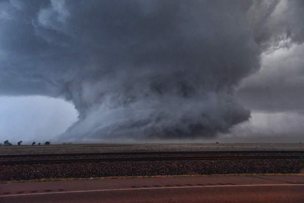
An outbreak of tornadoes occurred in southwest Kansas on November 16th as a deep upper level cyclone propagated toward the Central Plains. An event of this magnitude in late Fall is unprecedented in recorded history for southwest Kansas. In all, there were 9 confirmed tornadoes during the late afternoon and evening hours, including several large, long-lived and long-tracked tornadoes.

Details and images of the most significant tornadoes (and damage) follow...
Kismet to Ensign Tornado (Rating EF-3)
Estimated Peak Wind: 155 mph
Path Length: 51 miles
Maximum Width: 2000 Yards (1.1 miles)
Fatailities/Injuries: 0/0
Start: 5:38pm, 4 miles northeast of Liberal
End: 6:56pm, 7.5 miles northeast of Montezuma
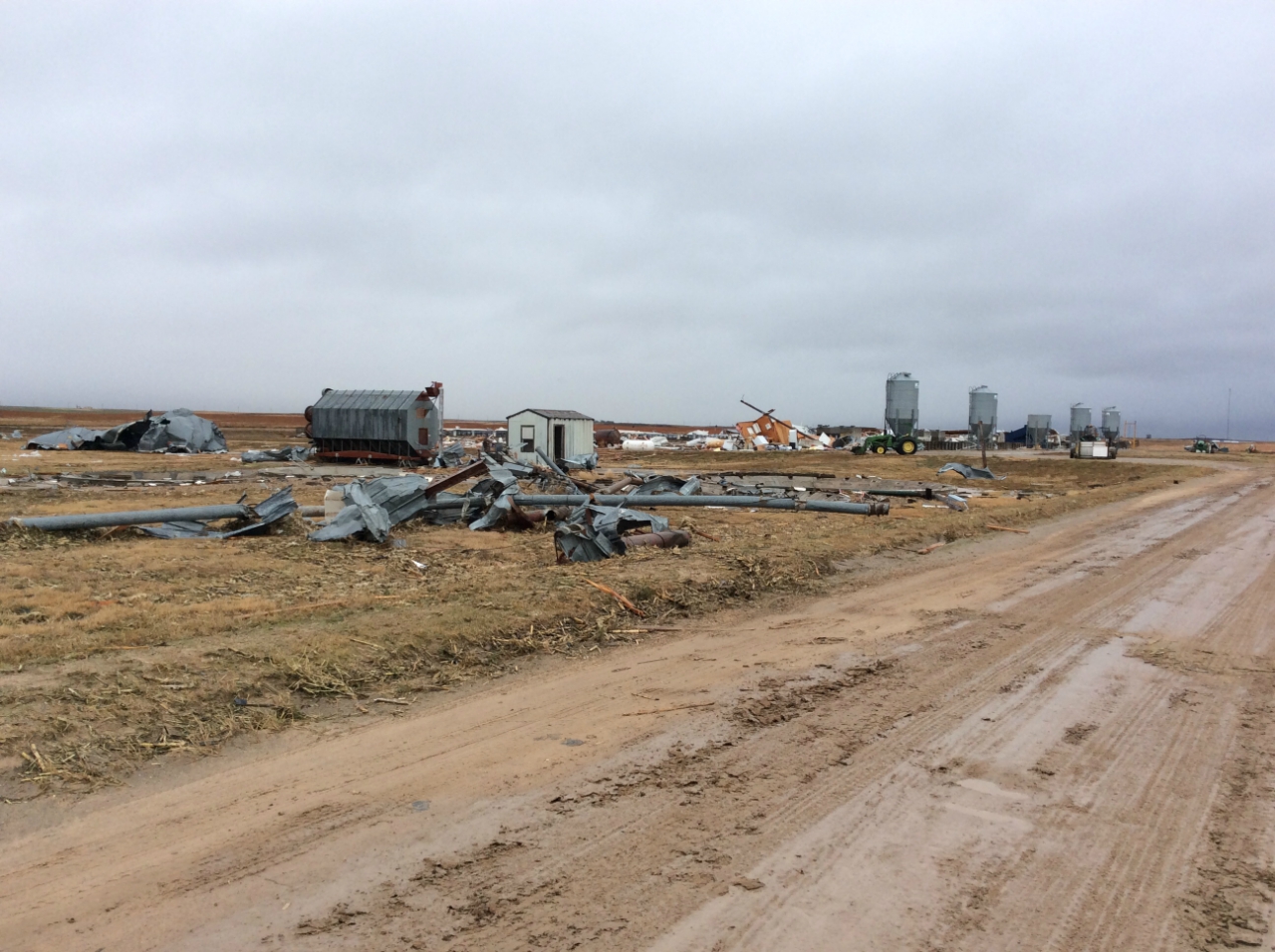
The most significant damage was done to a farm that is located west of Kismet in Seward County. There were numerous pivot irrigation sprinklers damaged or destroyed, along with many out buildings, power poles, and trees.
|
|
|
|
Photographs of the tornado by storm chasers...
|
|
|
|
|
|
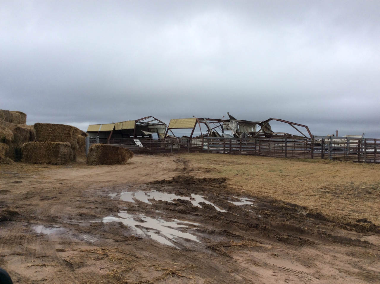
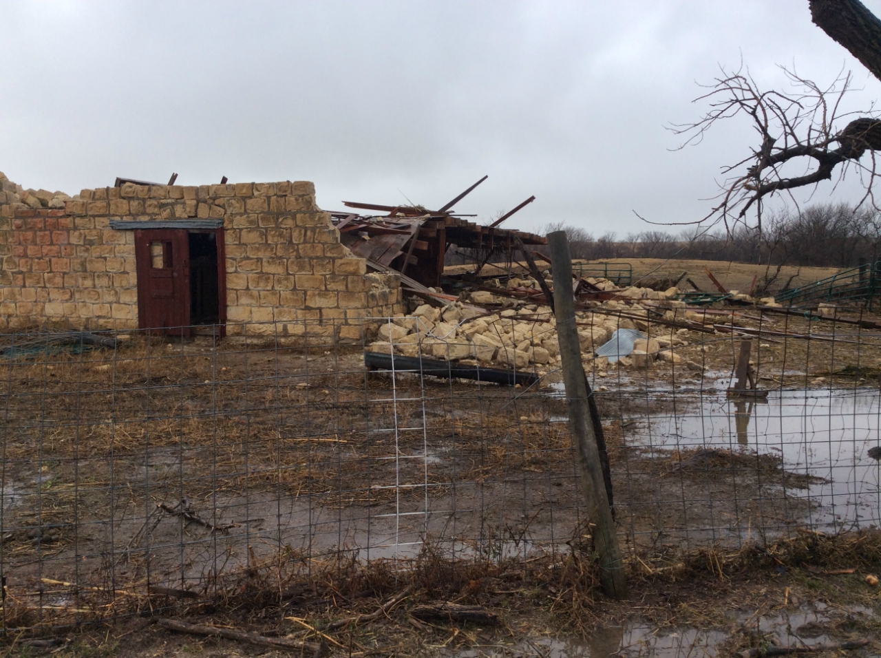
Photographs from NWS damage survey team (click the image for a larger version)...
|
|
 Residence hit with house heavily damaged along with numerous outbuildings destroyed. |
 Outbuilding destroyed. |
Ensign to Howell Tornado (Rating EF-2)
Estimated Peak Wind: 115 mph
Path Length: 13.9 miles
Maximum Width: 500 Yards (~ 1/4 mile)
Fatailities/Injuries: 0/0
Start: 6:55pm, 1.5 miles south of Ensign
End: 7:18pm, 3 miles north of Howell
After the long track tornado dissipated northeast of Montezuma, this tornado developed to its southeast and caused structural damage near Howell and points south.

Track of this tornado based on damage survey and radar data. This tornado
narrowly missed Ensign to the east and Howell to the west. The tornado crossed US
Highway 50 just inside the Ford County line before it dissipated.
|
|
|
Southeast Comanche County Tornado (Rating EF-1)
Estimated Peak Wind: 110 mph
Path Length: 16.1 miles
Maximum Width: 810 Yards (~ 1/2 mile)
Fatailities/Injuries: 0/0
Start: 10:13pm, 18.4 miles south of Coldwater
End: 10:38pm, 12.6 miles east southeast of Coldwater
This tornado moved out of Woods County, Oklahoma and caused some structural damage southeast of Coldwater.
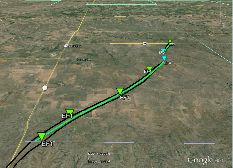
Track of this tornado based on damage survey and radar data. This tornado remained
well southeast of Coldwater across rural southeastern Comanche County during the
late night hours.
Northern Ness County Tornado (Rating EF-1)
Estimated Peak Wind: 101 mph
Path Length: 8 miles
Maximum Width: 200 Yards
Fatailities/Injuries: 0/0
Start: 6:27pm, 7 miles northwest of Ness City
End: 6:39pm, 10 miles north northwest of Ness City
Damage was done to trees, vehicles, power lines, and buildings. A historic 115 year old stone and frame barn was destroyed.
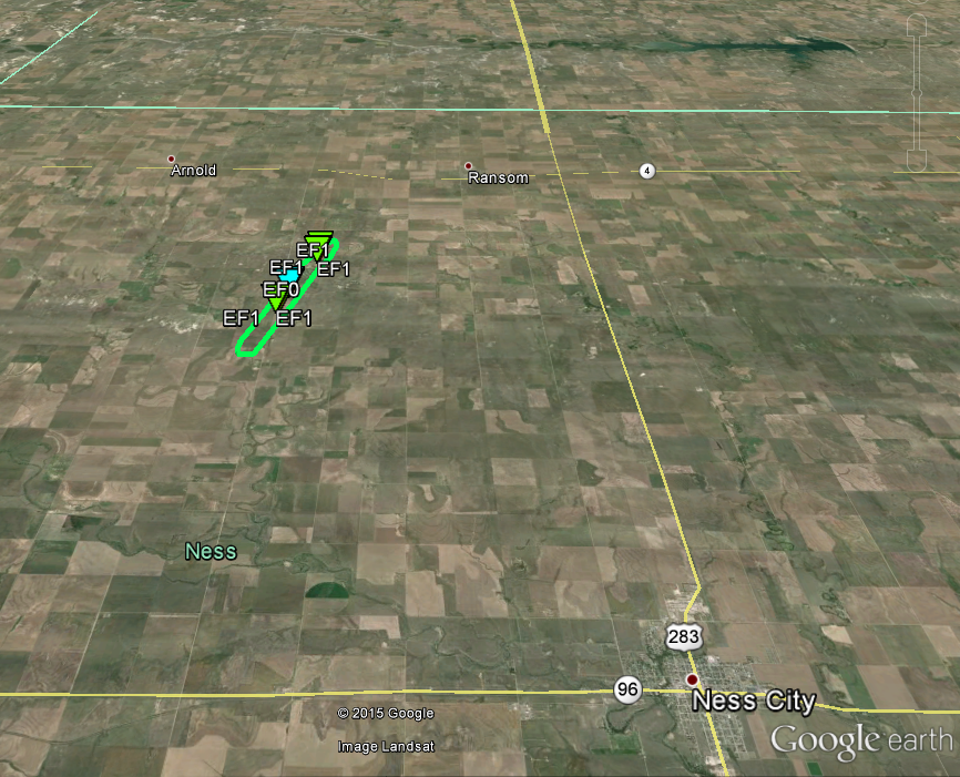
Track of this tornado based on damage survey and radar data.
|
|
|
Download the Google Earth KMZ file of all the damage survey points for all the tornadoes surveyed:
https://www.weather.gov/source/ddc/hysplit/storm_survey.kmz