
Severe thunderstorms, excessive rainfall, critical fire weather are all in the outlook today and into this last weekend of April. Very large hail, severe wind gusts, and a couple strong tornadoes will all be possible across the central and southern Plains today. Flash flooding also possible for portions of the Plains and Mississippi Valley. Critical fire weather conditions for Southern High Plains Read More >
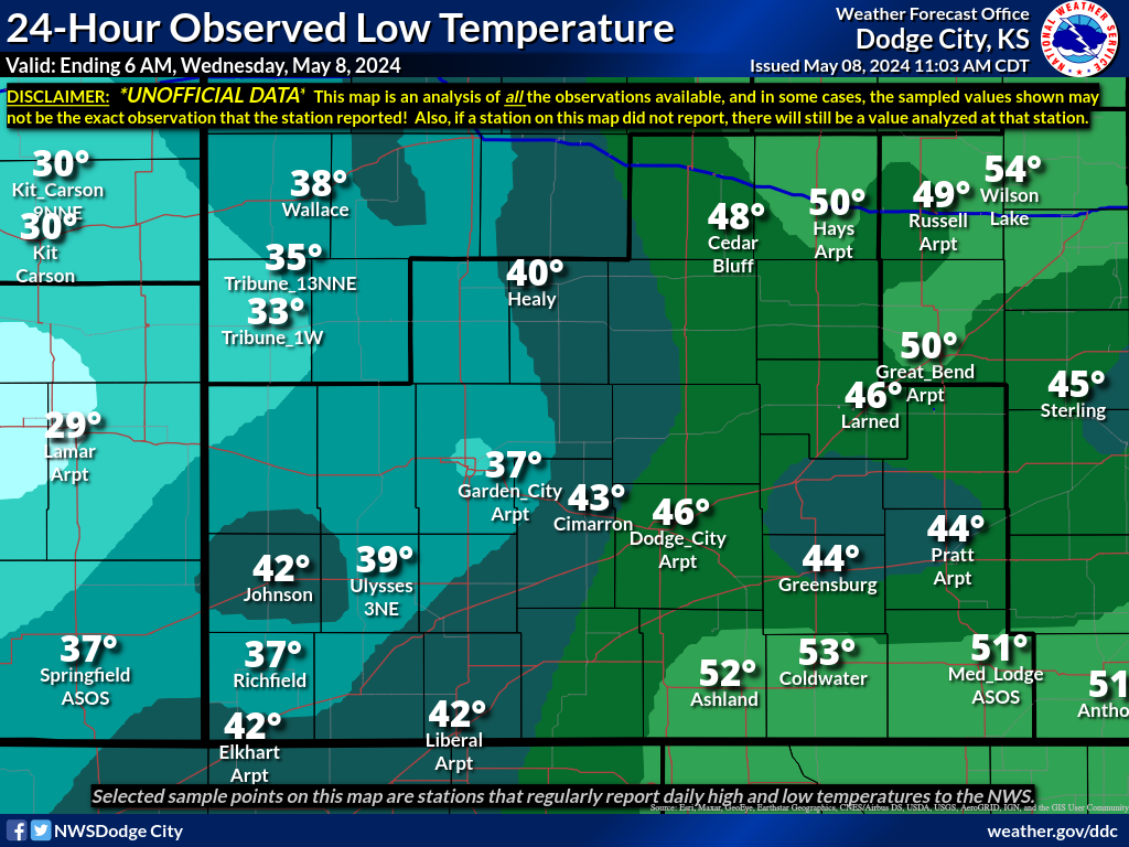
The map below represents the observed minimum temperatures during the past 24 hours across southwest Kansas. Please note that this data is not official. The data is compiled using reports from ASOS sites, volunteer spotters, and cooperative observers.
A text version of the latest data is available on the Regional Temperature and Precipitation Summary.
You can view ALL the data that was used to create this image HERE.
Also Available: High Temperatures | Precip | Snowfall | Snow Depth | Maps Home


 Follow us on YouTube