Overview
|
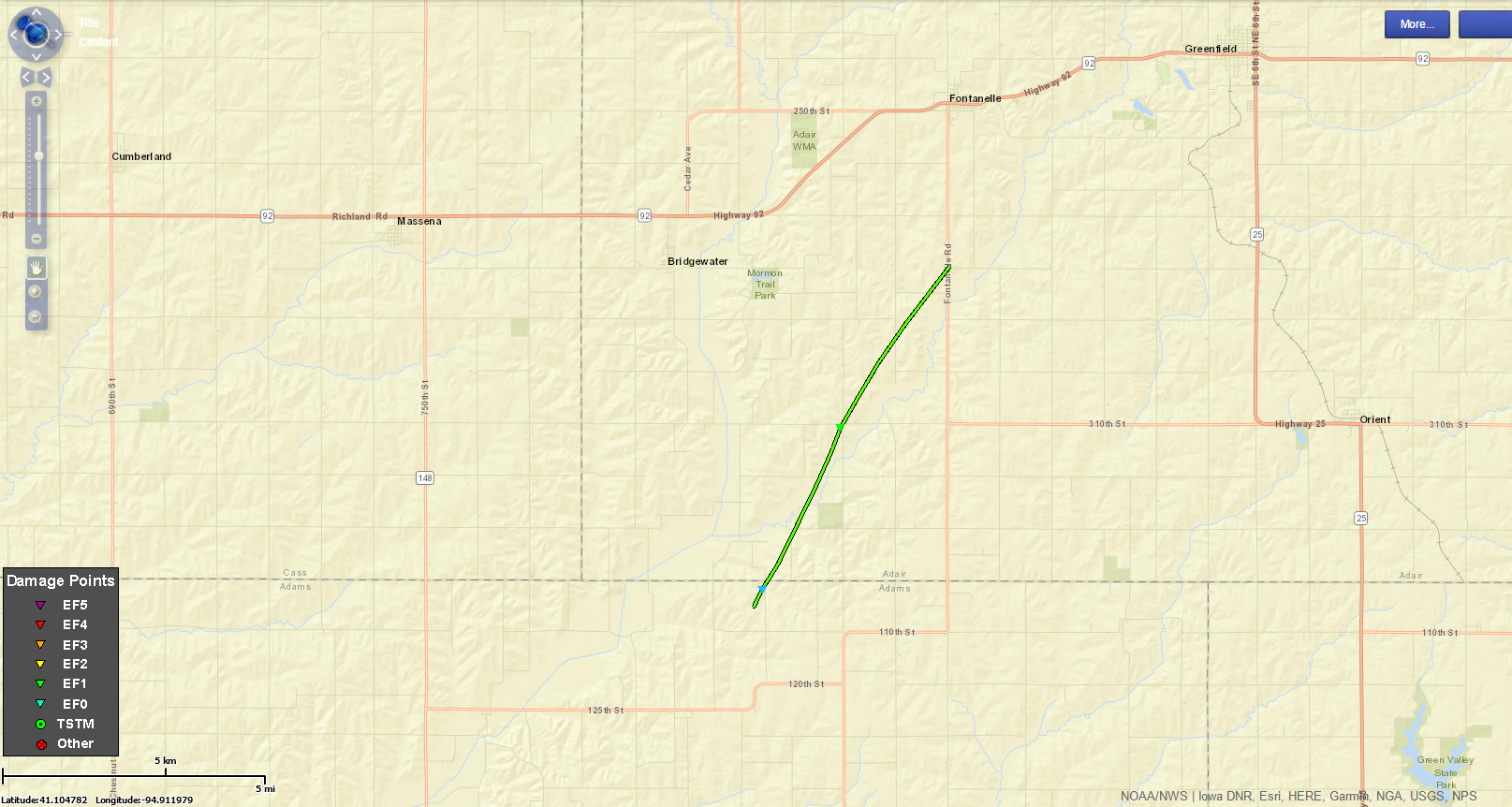
A strong spring storm system moved through portions of the Midwest on Saturday, March 28th, 2020. Thunderstorms developed over portions of southwest Iowa during the early afternoon hours along a northward advancing warm front. Scattered storms then raced quickly to the northeast across central and northeastern Iowa. One EF1 tornado occurred near the Adair and Adams County line with several other brief and weak tornadoes occurring over Marshall and Black Hawk Counties. Hail reports of pea to half dollar sized hail were also received over portions of central and northern Iowa on the cooler side of the boundary. Minor to moderate property damage was reported with the tornadoes but thankfully no injuries. In addition to the 4 tornadoes in the WFO DMX area, 2 additional tornadoes formed in NWS ARX, including an EF-1 that hit the west side of Oelwein, Iowa. Here, you can find a write-up for northeast Iowa. These were the first tornadoes of 2020 for Iowa. |
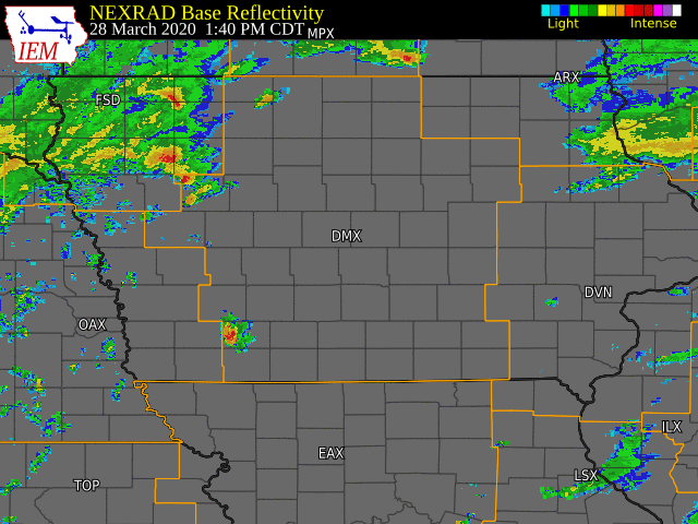 Radar loop of the entire of event with warnings overlaid. |
 |
 |
.jpg) |
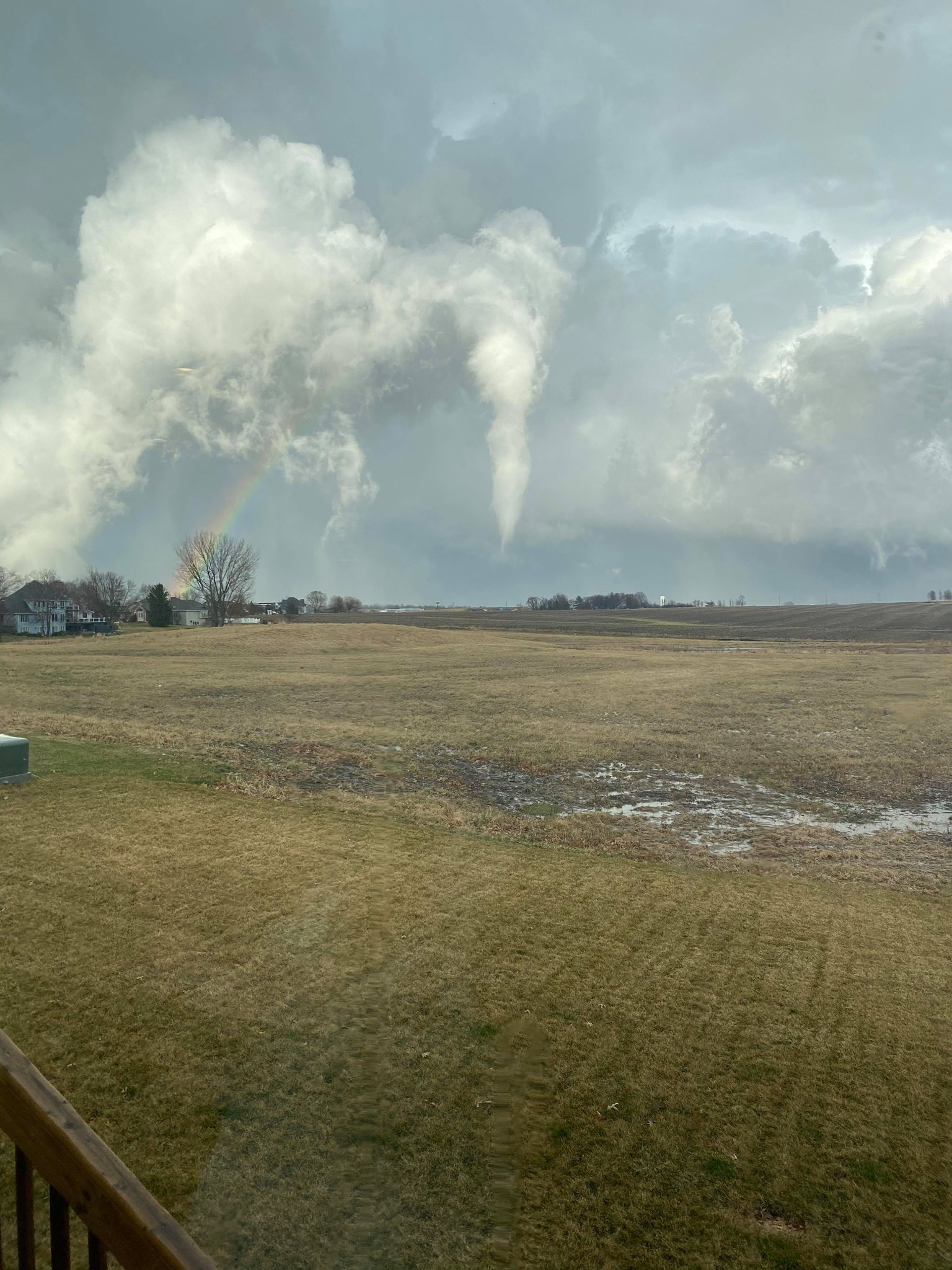
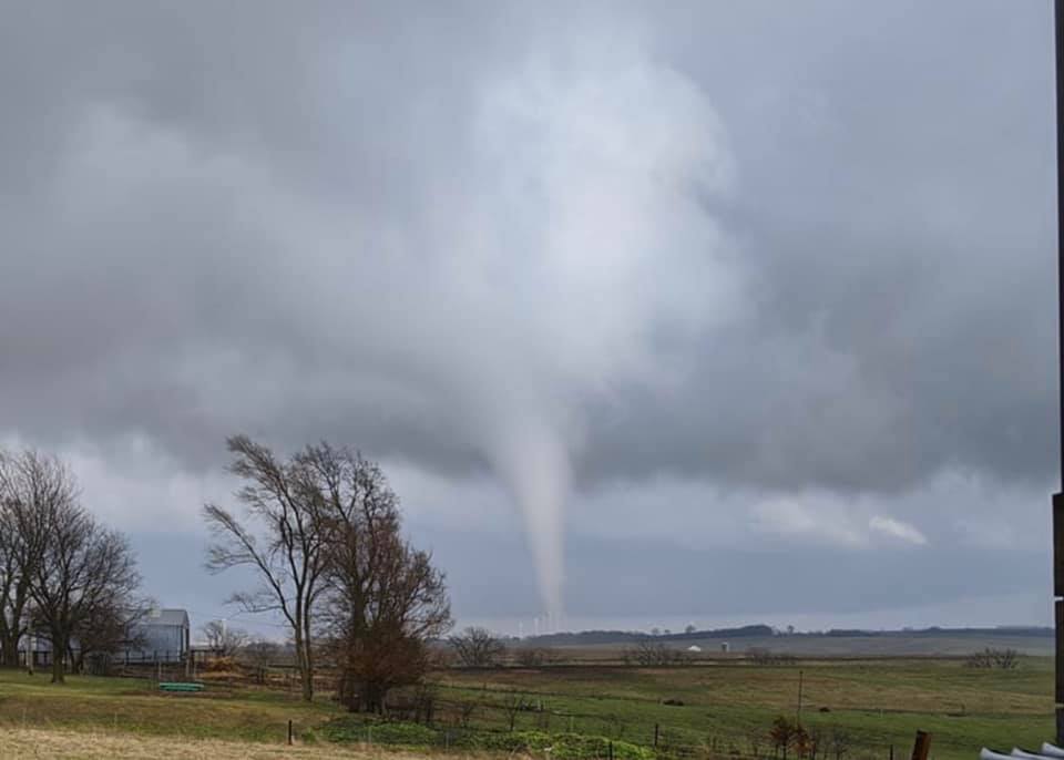
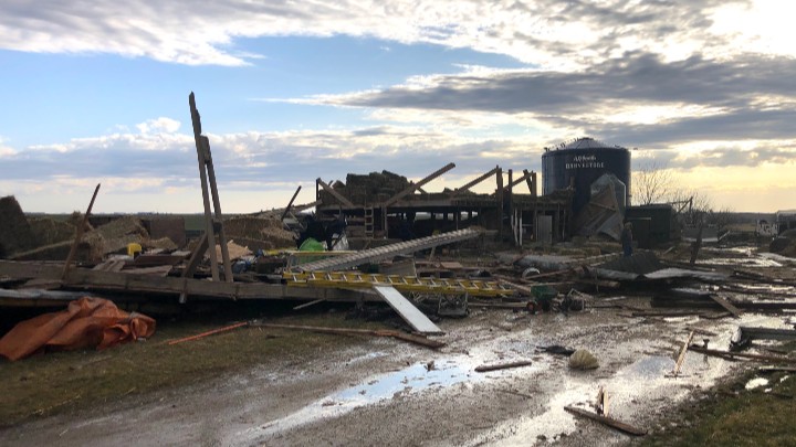
| Tornado and rainbow south of Waterloo, Iowa. Photo courtesy of Mark Schnackenburg | Near Stuart, Iowa. Photo courtesy of Gregory Clark. | Damage to two machine sheds south of Bridgewater, Iowa in Adair County. Photo Courtesy of Emergency Manage Bob Kempf. |
Tornadoes
|
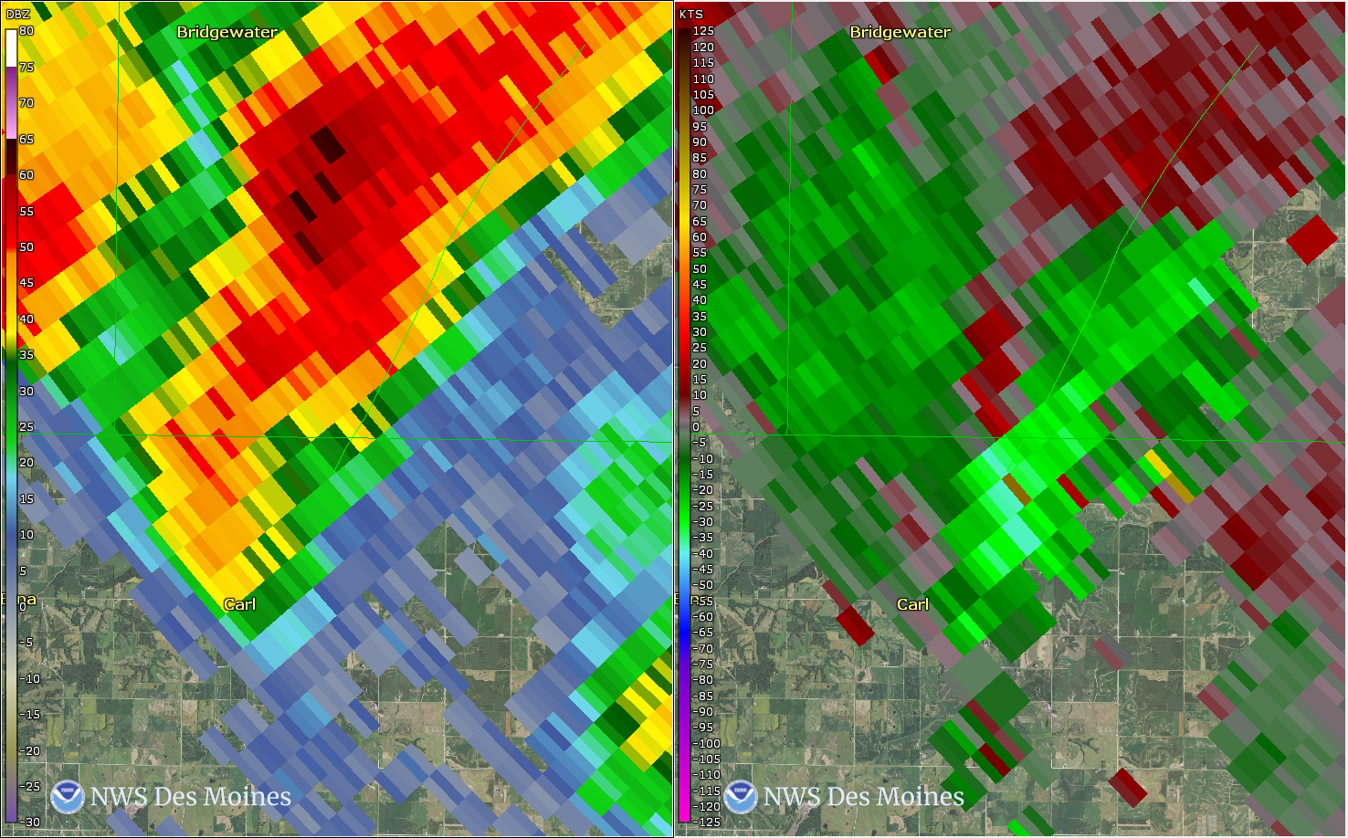
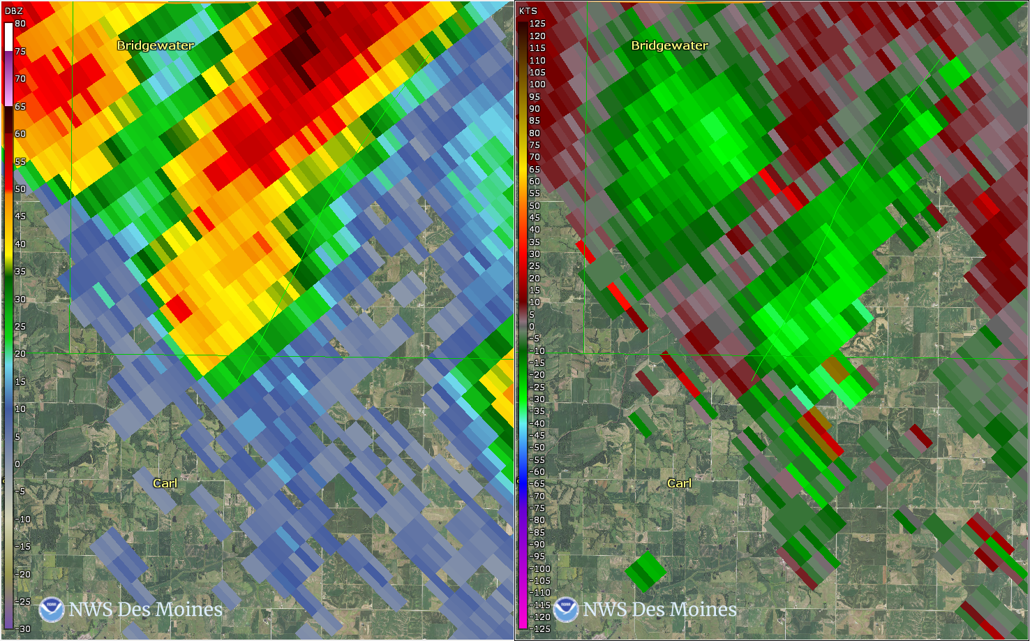
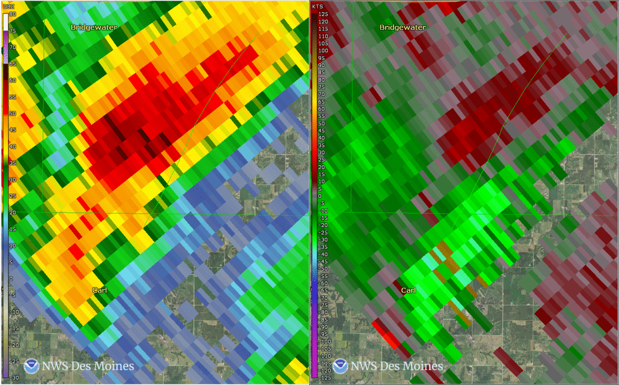
Tornado #1 - South of Fontanelle
|
||||||||||||||||
|
||||||||||||||||
|
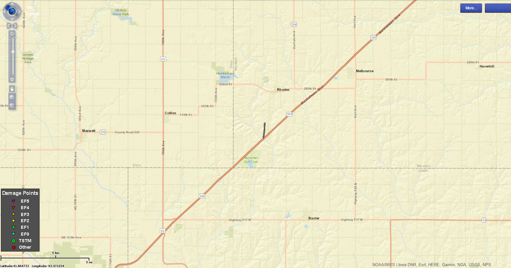
Tornado #2 - South of Rhodes
|
||||||||||||||||
|
||||||||||||||||
|
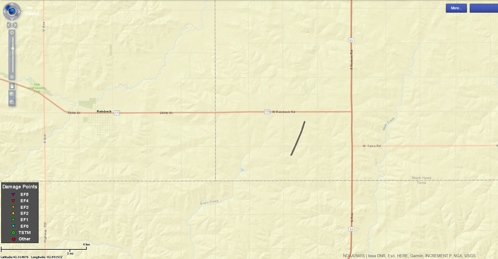
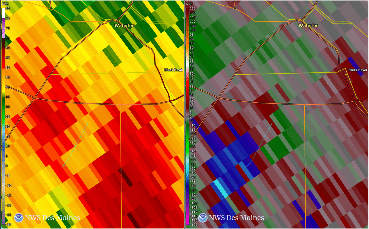
Tornado #3 - South of Hudson
|
||||||||||||||||
|
||||||||||||||||
|
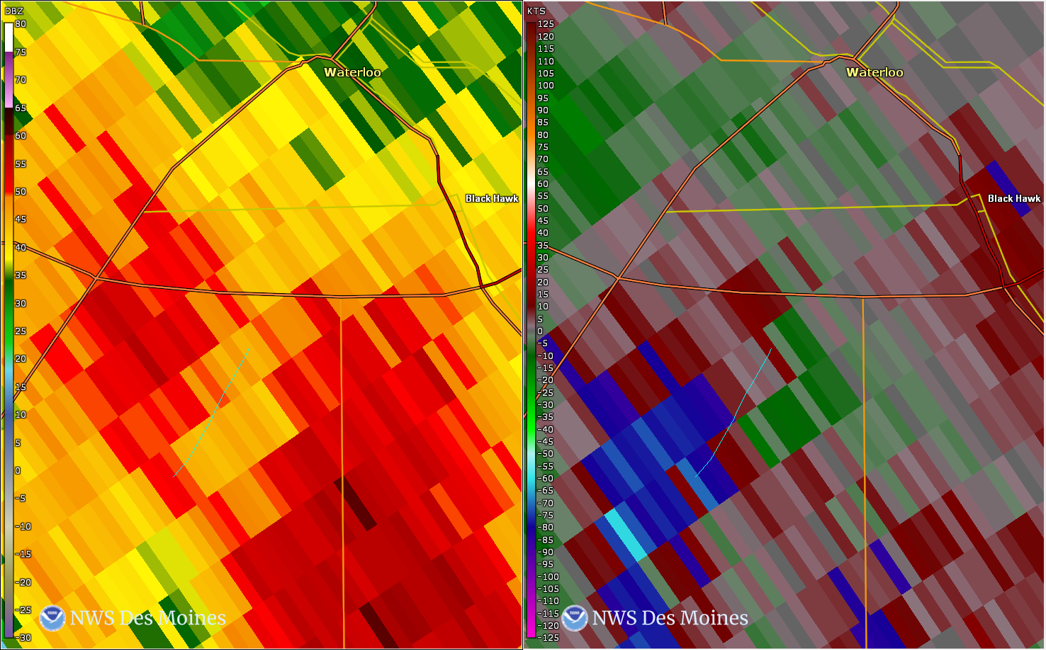
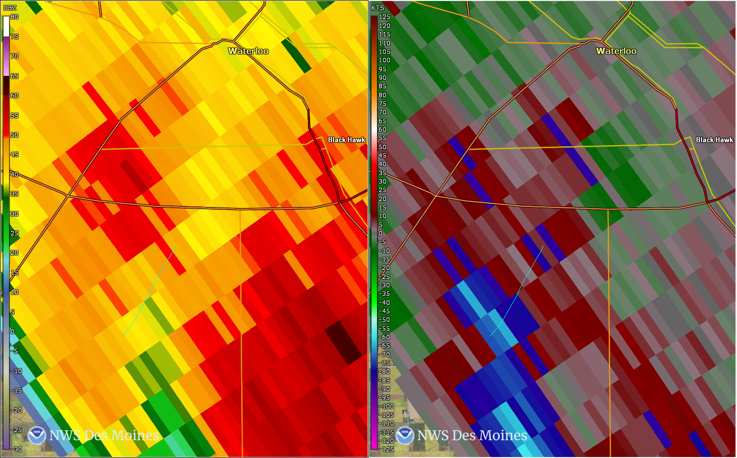
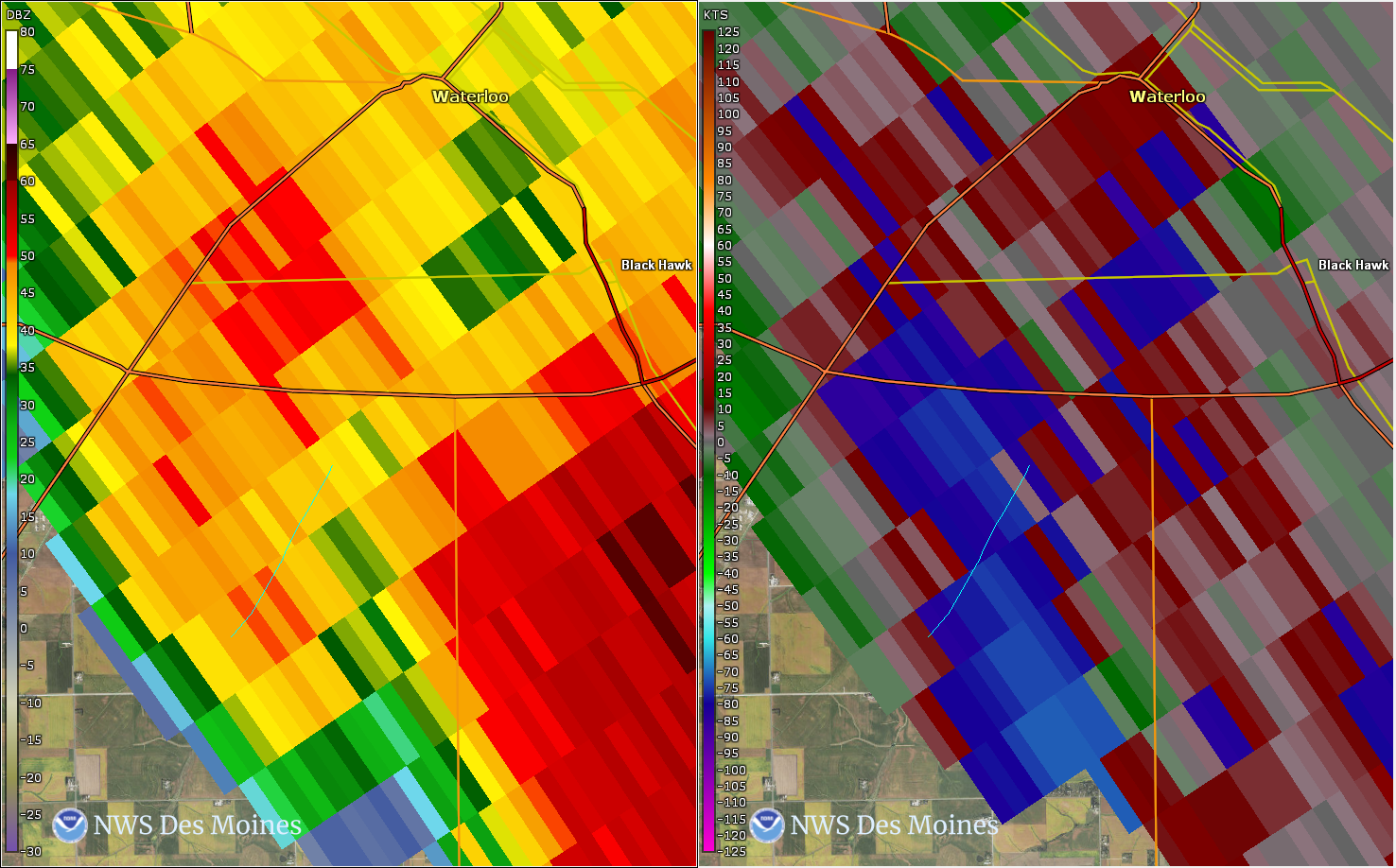
Tornado - South of Waterloo
|
||||||||||||||||
|
||||||||||||||||
The Enhanced Fujita (EF) Scale classifies tornadoes into the following categories:
| EF0 Weak 65-85 mph |
EF1 Moderate 86-110 mph |
EF2 Significant 111-135 mph |
EF3 Severe 136-165 mph |
EF4 Extreme 166-200 mph |
EF5 Catastrophic 200+ mph |
 |
|||||
Photos & Video
A few photos from the event, including some damage pictures.
 |
 |
.jpg) |
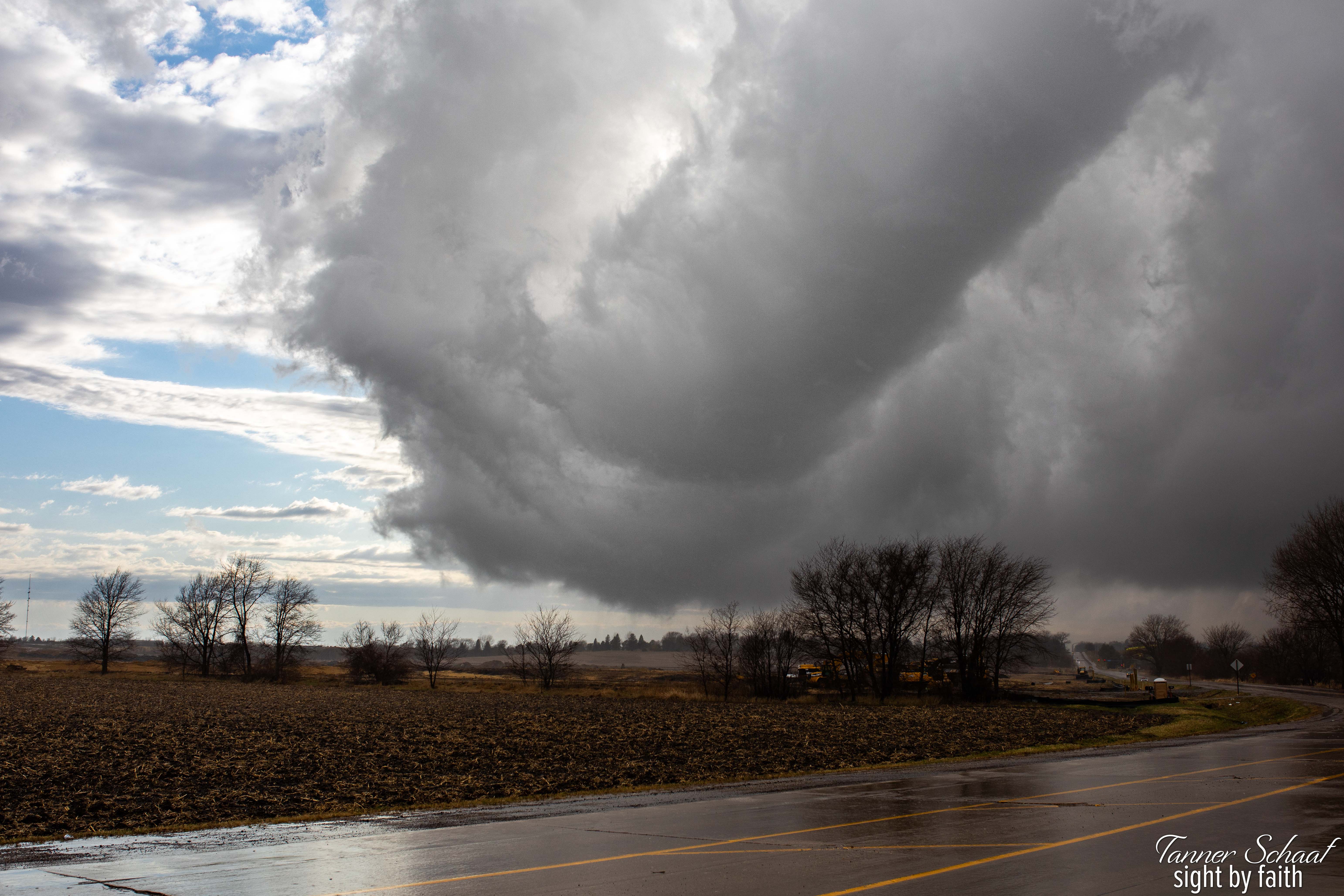 |
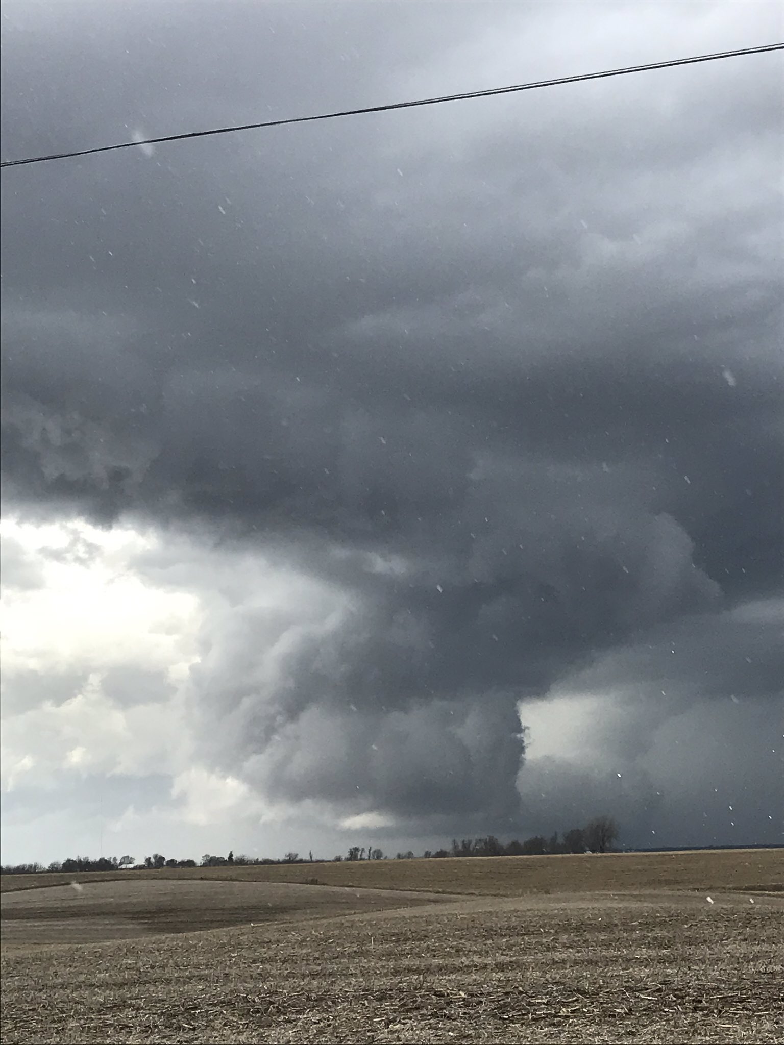
| Very low hanging wall cloud near Prairie City, Iowa. Photo courtesy of Jason Blommers. | Damage to a barn south of Waterloo, Iowa. Photo courtesy of Ty Bellfy via KWWL. | 2x4 ejected into the side of a house just south of Fontanelle, Iowa. Photo courtesy of Bob Kempf. | Southwest of Waterloo, Iowa. Photo courtesy of Tanner Schaaf. |
Storm Reports
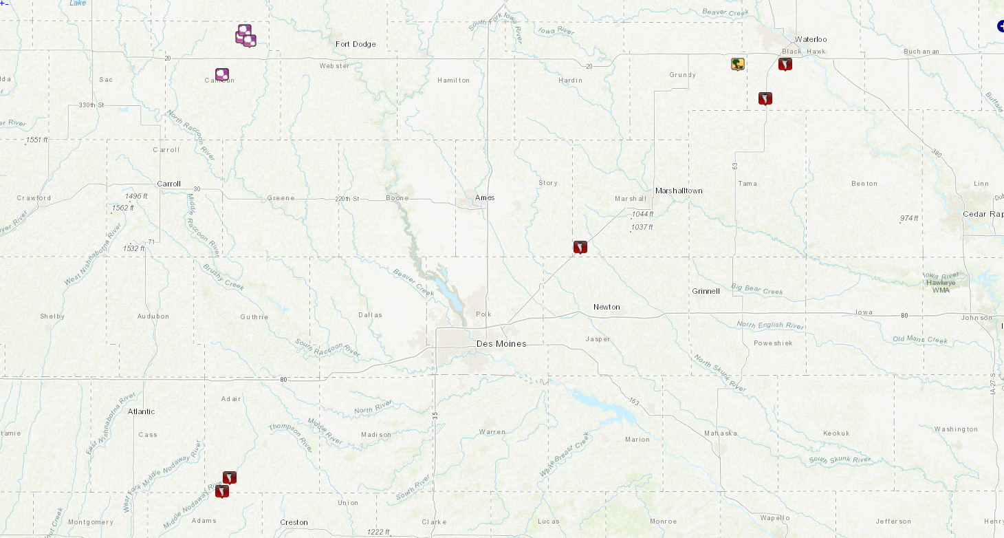
Click on the map or this link to the right for list of storm reports: https://nwschat.weather.gov/lsr/#DMX/202003281910/202003282250/0100
Environment
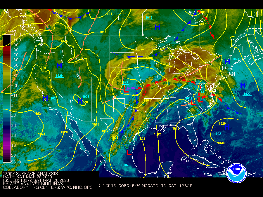
An area of low pressure transitioned across the Central Plains and through the Corn Belt dragging a sharp cold front behind it. Out ahead of the surface low, a warm front surged northward through the day and made it about as far north as Highway 30 to even portions of Highway 20 by the late afternoon hours. Fast moving storms produced 6 tornadoes across the state.
 |
 |
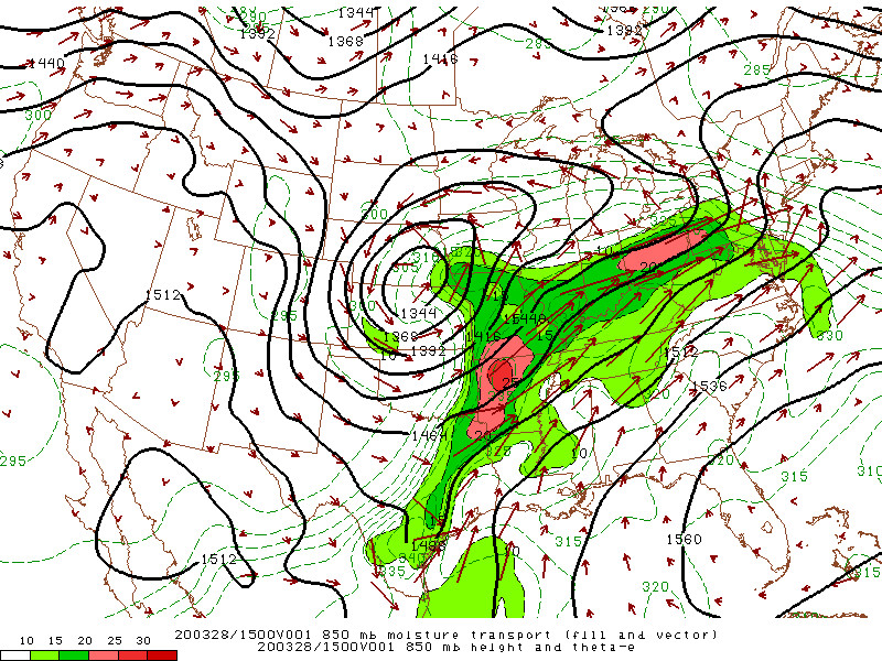 |
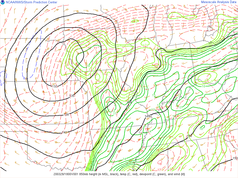
| Surface analysis throughout the day March 28, 2020. this shows the strong low pressure system and associated warm front and cold front that tracked across the state. | 850 mb loop of the event shows the strong low pressure system tracking northeast over northwest portions of Iowa. | As the low pressure moved across the region, it pulled significant amounts of moisture north into the state which is a key ingredient for tornadic development. |
Near-storm environment summary.
 |
 |
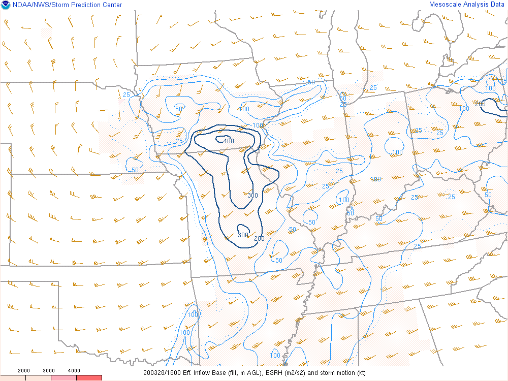 |
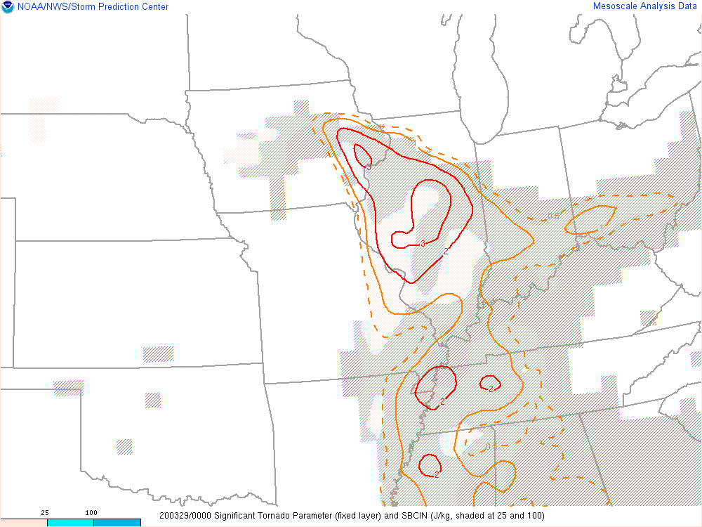
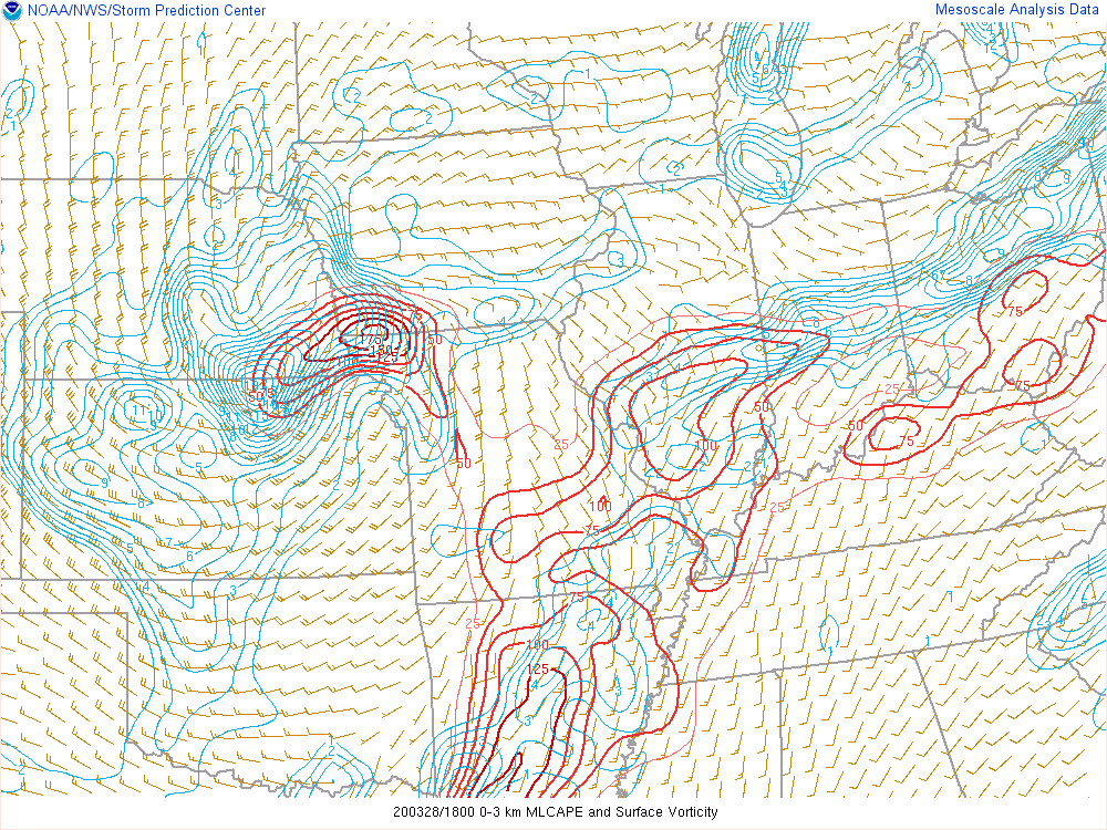
| Significant Tornado Parameter as the storms rolled northeast across Iowa. Most significant tornadoes (EF-2 or greater) have been associated with a STP values greater than 1. As you can see, 3-4 values of STP were found over Iowa. Find more info here on this parameter. | 0-3 KM CAPE values tend to support tornado formation when co-located with significant vertical velocity near the ground. Via SPC | Effective Storm Relative Helicity (m2s2). For official definition, click here. |
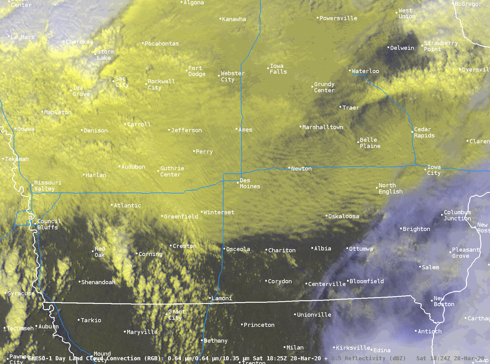
GOES-East 1-minute Satellite data and NWS SPC Outlook and Watch.
 |
.png) |
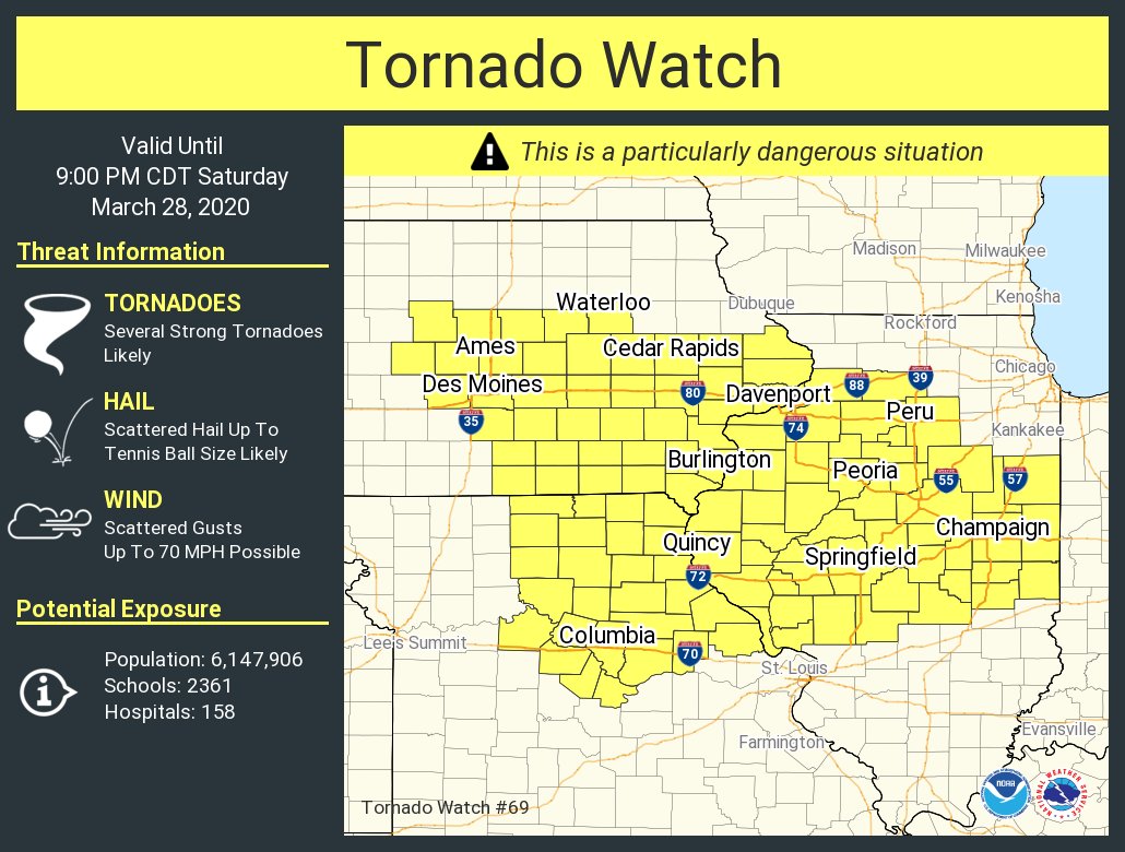 |
| Storms initiating over southwest Iowa. | Storm Prediction Center's Day 1 Outlook Updated at 11:30 AM, March 28, 2020. | PDS Tornado Watch issued at 2:45 PM CDT on Saturday, March 28, 2020. |
 |
Media use of NWS Web News Stories is encouraged! Please acknowledge the NWS as the source of any news information accessed from this site. |
|


 Follow us on YouTube