Overview
A series of disturbances traveling along a slow-moving frontal boundary to the west of Southeast Michigan brought repeated rounds of rainfall to the region over a 48 hour period. As the main low pressure system moved northeastward from the Central Plains to the Upper Peninsula of Michigan on Tuesday, February 20, a record high axis of moisture advected across Southeast Michigan. Record warmth accompanying the moisture axis caused the snow pack to melt as repeated rounds of rain brought two to three inches of rain from Monday, February 19 through Wednesday, February 21.
Flooding
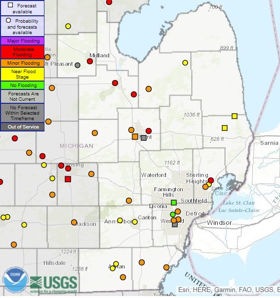
As a result of the heavy rainfall and added runoff from snow melt, widespread stream and river flooding occurred across Southeast Michigan. Many gauges reported minor to moderate flooding starting Tuesday, February 20 and continuing for days afterward.
Hydrographs
 |
 |
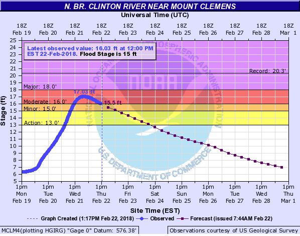 |
| Numerous gauges recorded minor to moderate flooding across Southeast Michigan. | River hyrdrograph for the Tittabawassee River (graph showing both present river readings and forecasted readings). Graph from 1:18pm on February 22nd. | River hyrdrograph for the North Branch Clinton River (graph showing both present river readings and forecasted readings). Graph from 1:17pm on February 22nd. |
Radar
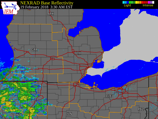
Radar Reflectivity and Precipitation Estimates from Monday, February 19 through Wednesday, February 21
 |
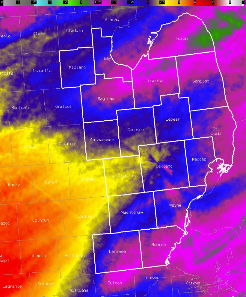 |
| Radar reflectivity from 3:30 AM on Monday, February 19 through 5 PM on Wednesday, February 21 | MRMS 72 hour radar estimated precipitation ending at 7 AM on Wednesday, February 21 |
Rain Reports
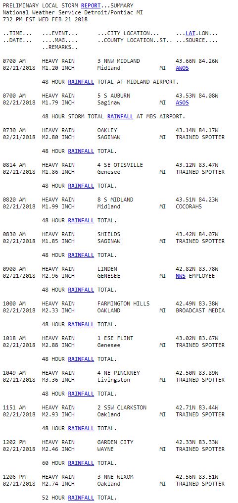
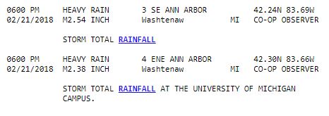
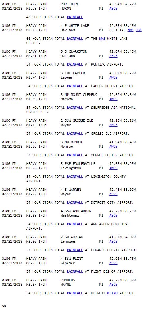
 |
Media use of NWS Web News Stories is encouraged! Please acknowledge the NWS as the source of any news information accessed from this site. |
|


 Follow us on YouTube