Overview
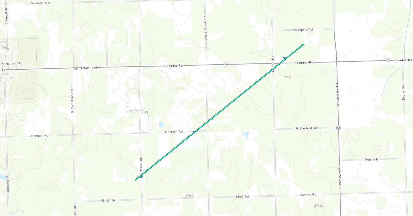
At 8:10 PM A confirmed EF-0 tornado touched down 2.6 miles southeast of Kingston. The tornado was on the ground for seven minutes, and lifted back up at 8:17 PM, 4.2 miles east of Kingston. Sporadic minor tree and crop damage and the removal of roofing material from an outbuilding were observed during a storm survey. Tornado damage was consistent with winds of approximately 75 MPH.
Prior to touch down, southern Michigan sat under a warm and humid air mass that provided precipitation across most of the area during the morning hours. Additional destabilization took place during the late afternoon and early evening that allowed a new round of scattered storms to develop along and north of I-69. Enough instability and shear was present during the early evening to produce weak rotation aloft. Atmospheric dynamics came together over Tuscola County, where better rotation was seen on radar, coinciding with reports of funnel clouds. Dynamics became ripe near Kingston, where a storm spotter observed the touch down of a tornado.
Tornadoes:
|
Tornado - Kingston
Track Map

|
||||||||||||||||
The Enhanced Fujita (EF) Scale classifies tornadoes into the following categories:
| EF0 Weak 65-85 mph |
EF1 Moderate 86-110 mph |
EF2 Significant 111-135 mph |
EF3 Severe 136-165 mph |
EF4 Extreme 166-200 mph |
EF5 Catastrophic 200+ mph |
 |
|||||
Public Information Statement
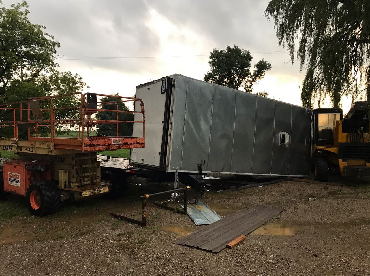
Public Information Statement
National Weather Service Detroit/Pontiac MI
225 PM EDT Fri Aug 18 2017

...NWS DAMAGE SURVEY FOR 08/18/17 TORNADO EVENT...
...Weak Tornado Confirmed Across Far Southeast Tuscola County...

.OVERVIEW...
A weak tornado spun up from a heavy rainshower, as there was no
lightning detected due to the low top of the storm.

.Kingston Tornado...

Rating:                 EF-0
Estimated peak wind:    75 mph
Path length /Statute/:  3 miles
Path width /Maximum/:   100 yards
Fatalities:             0
Injuries:               0

Start date:             August 17 2017
Start time:             810 PM EDT
Start location:         2.6 Miles SE Kingston/ Koylton / Michigan
Start Lat/Lon:          43.391 /-83.146

End date:               August 17 2017
End time:               817 PM EDT
End location:           4.2 Miles E Kingston/ Kingston / Michigan
End_lat/lon:            43.4175 /-83.097

SURVEY SUMMARY: Sporadic minor tree and crop damage along a path
from Clothier Road between Denhoff and Brief Roads to Northeast of the
intersection of Marton Road (Tuscola/Sanilac county line) and Sanilac
Road (M46). Greatest observed damage was the removal of roofing material
from an outbuilding near the corner of Marton and Sanilac Roads, which is
consistent with winds of approximately 75 MPH (EF0). Additional minor tree
damage was observed along the damage path.

EF Scale: The Enhanced Fujita Scale Classifies
Tornadoes into the following categories.

EF0...Weak......65 to 85 mph
EF1...Weak......86 to 110 mph
EF2...Strong....111 to 135 mph
EF3...Strong....136 to 165 mph
EF4...Violent...166 To 200 mph
EF5...Violent...>200 mph

NOTE:
The information in this statement is PRELIMINARY and subject to
change pending final review of the event and publication in
NWS Storm Data.
Photos & Video:
Header
.JPG) |
 |
 |
 |
|
Clothier and Brief Rd Photo Credit: Ryan Harriott |
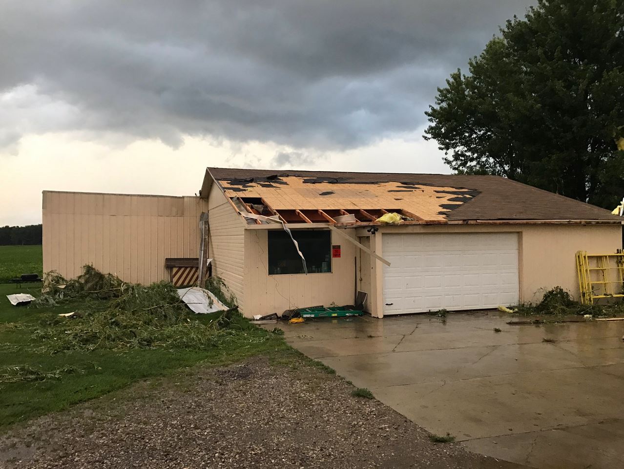
Tornado Wind Damage - Marton & Sanilac Rd Photo Credit: Ryan Harriott |
Tornado Wind Damage - Marton & Sanilac Rd Photo Credit: Ryan Harriott |
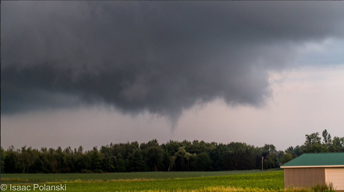
Funnel Located Near Decker Photo Credit: Isaac Polanski |
Radar:
Header
.gif) |
| Radar loop courtesy of Iowa Environmental Mesonet (IEM) |
Storm Reports
PRELIMINARY LOCAL STORM REPORT...SUMMARY
NATIONAL WEATHER SERVICE DETROIT/PONTIAC MI
1013 PM EDT THU AUG 17 2017

..TIME...   ...EVENT...      ...CITY LOCATION...     ...LAT.LON...
..DATE...   ....MAG....      ..COUNTY LOCATION..ST.. ...SOURCE....
            ..REMARKS..

0709 PM     FUNNEL CLOUD     1 S MILLINGTON          43.27N 83.53W
08/17/2017                   TUSCOLA            MI   PUBLIC

            A COUPLE OF REPORTS OF A FUNNEL CLOUD SENT VIA SOCIAL
            MEDIA

0711 PM     FUNNEL CLOUD     3 E MILLINGTON          43.28N 83.47W
08/17/2017                   TUSCOLA            MI   TRAINED SPOTTER

            REPORT OF A FUNNEL CLOUD 3 MILES EAST OF MILLINGTON.

0809 PM     TORNADO          4 E KINGSTON            43.41N 83.11W
08/17/2017                   TUSCOLA            MI   BROADCAST MEDIA

            REPORT OF TORNADO TOUCHDOWN VIA SOCIAL MEDIA -- VIDEO.
            EXACT TIMING AND LOCATION UNCONFIRMED AT THIS TIME.

0813 PM     TORNADO          4 E KINGSTON            43.41N 83.11W
08/17/2017                   TUSCOLA            MI   FIRE DEPT/RESCUE

            REPORT OF POSSIBLE TORNADO TOUCHDOWN. NUMEROUS TREES
            DOWN, A TRAILER IS FLIPPED OVER, AND METAL/SHINGLES TORN
            FROM ROOF.

0816 PM     TORNADO          5 E KINGSTON            43.42N 83.09W
08/17/2017                   SANILAC            MI   911 CALL CENTER

            REPORT OF MULTIPLE TREES KNOCKED DOWN.
 |
Media use of NWS Web News Stories is encouraged! Please acknowledge the NWS as the source of any news information accessed from this site. |
|


 Follow us on YouTube