Overview
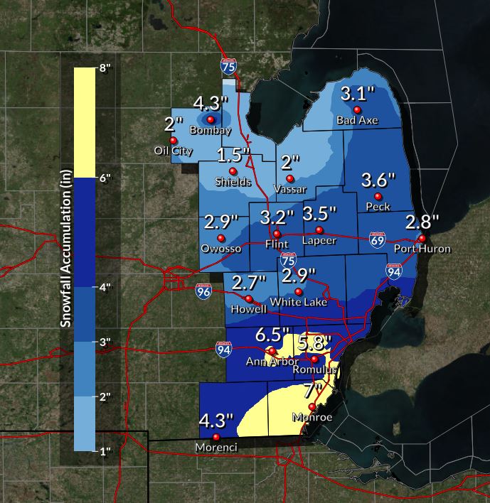
A strong low pressure system pushed eastward across the Ohio River Valley bringing snow to numerous states, including southern Michigan. This long duration snow started across Southeast Michigan around midnight on Friday night and lasted through most of the day on Saturday. There were a few heavier bands of snow that set up during the day, allowing for some higher snowfall totals in certain locations. Overall, this advisory snow brought anywhere from 1 to 7 inches of snow, with higher amounts across Washtenaw, Wayne, Lenawee, and Monroe Counties over an 18 to 19 hour period.Snowfall Totals
This is a preliminary snowfall map and will be updated as new reports come in on Sunday morning.
 |
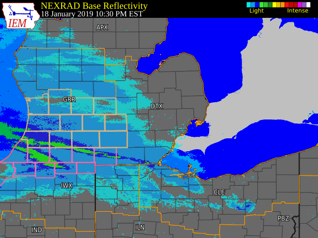
Radar
 |
|
Radar loop from late Friday night through the early evening on Saturday (Loop courtesy of Iowa Environmental Mesonet) |
Storm Reports
Storm reports will be updated as new reports come in on Sunday morning.


 |
Media use of NWS Web News Stories is encouraged! Please acknowledge the NWS as the source of any news information accessed from this site. |
|


 Follow us on YouTube