| Overview | Radar | Storm Reports |
Additional Resources |
May 6, 2012 Severe Weather Event in Bureau and Putnam Counties
The early afternoon of May 6, 2012 proved to be an active one across the National Weather Service (NWS) Quad Cities’ far eastern county warning area (CWA). Around 12:30 pm, storms started developing just east of the Mississippi and intensified as they moved east into Bureau and Putnam counties. The first severe thunderstorm warning was issued at 1:37 pm for Bureau County. These storms continued to develop not only Bureau and Putnam counties, but also affected Henry County. Golf ball sized hail, 70 mph winds, and a funnel cloud were reported with these storms.
The storms continued to strengthen as they marched off to the east towards the Illinois and Indiana border. A tornado, later rated as an EF-1 on the Enhanced Fajita scale (EF-scale), touched down near the town of Watseka in east central Illinois.
Radar Image Loop from May 6, 2012
|
|
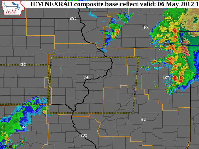
| Radar loop showing severe storms that moved through the area on May 6, 2012. The large dotted red boxes indicate tornado watches and the large yellow boxes are severe thunderstorm watches. Smaller solid red boxes signify tornado warnings and solid yellow boxes are severe thunderstorm warnings. Radar loop courtesy of Iowa Environmental Mesonet. |
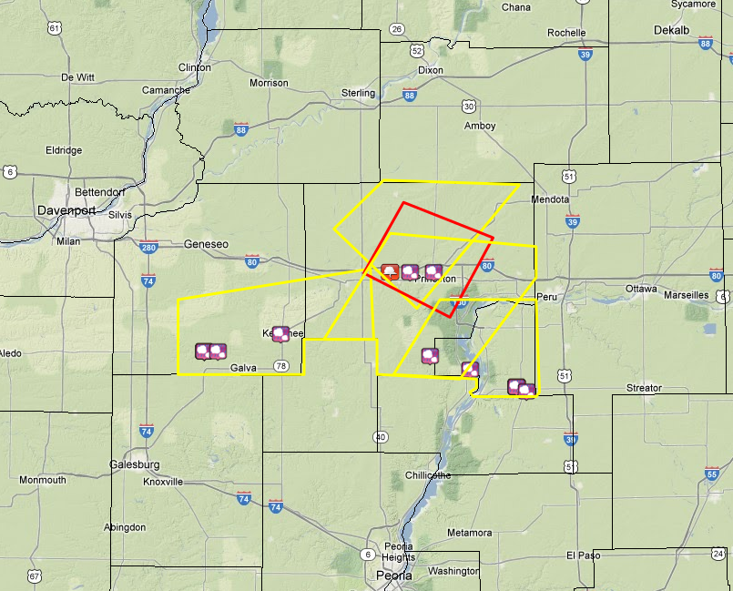 |
| Local storm reports from May 6, along with tornado (red boxes) and severe thunderstorm (yellow boxes). Reports courtesy of Iowa Environmental Mesonet. |
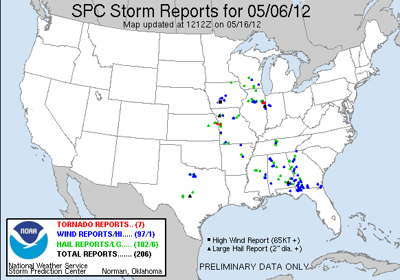 |
| Storm Prediction Center (SPC) national storm reports from May 6. |
Additional Resources on the
May 6, 2012 Severe Weather Event
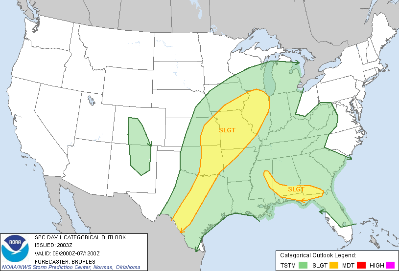 |
| Storm Prediction Center day 1 outlook for May 6, 2012. More information about the outlook can be found here or by clicking on the picture. |
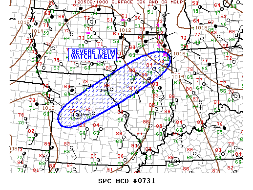 |
| Storm Prediction Center mesoscale discussion for May 6, 2012. More information about the mesoscale discussion can be found here or by clicking on the picture. |
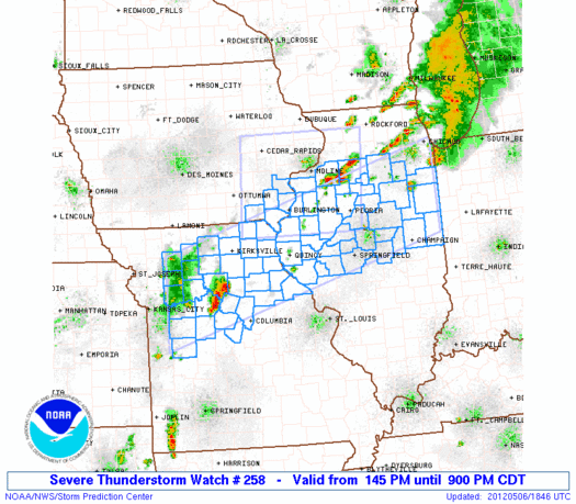 |
| Tornado watch #258 issued on May 6, 2012. More information about the tornado watch can be found here or by clicking on the picture. |


 Follow us on YouTube