A supercell thunderstorm moving along a warm front enhanced by an outflow boundary from an overnight mesoscale convective system (MCS) produced a violent tornado from northeast Missouri into west central Illinois. The supercell initially produced a funnel cloud over Fort Madison, Iowa then moved into west-central Illinois and produced the F4 tornado.
The weather map on the morning of May 13, 1995, showed low pressure in eastern Kansas with a warm front extending through central Missouri. During the afternoon, low pressure moved northeast to near Fort Madison, Iowa with the warm front extending east toward Macomb, Illinois. The supercell thunderstorm that eventually spawned this violent tornado developed over Clark County, Missouri at around 3 pm. The storm produced a funnel cloud over Fort Madison, Iowa then continued to track east along the north side of the warm front, before spawning the tornado just after crossing the Mississippi River into west central Illinois.
The tornado started as an F0 when it initially touched down south of Niota, IL then caused F3 damage by the time it reached Dallas City, IL. Eyewitnesses saw three separate funnels at one point. The Dallas City school received major damage and one older house was blown off its foundation. Several mobile homes were destroyed and a car was rolled six feet up a hill. The tornado proceded to the east northeast and continued to strengthen.
About one mile northwest of Disco, IL the tornado caused F4 damage. At this time the tornado was on the county line between Hancock and Henderson Counties in Illinois and struck the Maxine Clover farm site. The Clover brick home was nearly totally destroyed with only a few parts of walls still standing. The tornado appeared to be about one-half mile wide. It continued to the northeast where it struck the Dick Edmunds farm site. The Edmunds seventeen year old brick home was destroyed along with most of the other farm buildings. Sixty animals had to be destroyed.
As the tornado crossed highway 94 just south of Terre Haute, IL, it only produced F0 to F1 damage, but still appeared to be about one-half mile wide by the scoured dirt path it ground into the area farm fields. At this time the tornado was approaching the small community of Raritan, IL. The Wendell Shaner farm site, located one and one-half miles southwest of Raritan, was hit at this time. Mr. Shaner was thrown about 70 yards out of his home into a field east of the house. He received broken rips and other internal injuries. The Shaner farm site was totally destroyed. Where the home had been located there was nothing left but the basement stuffed full of debris. Hundreds of dead hogs were scattered along and up a hill to the northeast of the home site.
The tornado then clipped the southeast corner of Raritan where damage was occurred along and south of Main Street. The Carl Huss home was totally destroyed while he was in the basement. Mr. Huss received a large bruise on his back when cement blocks were pulled in from the west side of the basement as the home was shredded off its foundation. The 137-year-old farmstead of John and Bev Livermore was also hit at about this time. Mr. Livermore was in the basement with his two grand-children when the tornado struck. The home heating fuel tank, located in the basement, was sucked up and thrown 50 yards away from the house. Mr. Livermore literally had to lay on his grandson to keep him from being pulled out of the basement. The home was totally destroyed. The Richard Likes home, also on the east side of Raritan, was totally blown off the foundation and pushed 50 yards into the field to the east. The Likes were not home at the time. This is also about the time the tornado appeared to reach its maximum width of 0.6 miles.
 |
| Tornado northeast of Raritan, IL near Roseville, IL (photo courtesy of NWS) |
One to two miles northeast of Rariton, the large tornado either weakened or dissipated. F0 to F1 damage and debris continued across Warren County from either the weakened tornado or subsequent tornados. The tornado finally exited Warren county about six miles southwest of Abingdon, IL. This large tornado produced no fatalities and only one injury was of a serious nature.
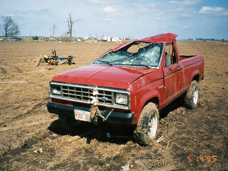
Damage in Raritan was estimated at 2 million dollars. Twenty five homes were destroyed, 48 homes were damaged and 10 farmsteads received heavy damage. Seventy five other homes received damage of a lesser nature. Hundreds of farm buildings in the area were damaged or destroyed, and hundreds of head of livestock were killed by the tornado or later had to be destroyed due to injury. One to two miles northeast of Raritan the large and violent tornado weakened. The storm survey showed F0 to F1 damage continuing across Warren County before ending roughly 6 miles southwest of Abingdon, Illinois in Knox County.
 |
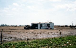
| Raritan, IL tornado damage from May 13, 1995 (photo courtesy of NWS) |
 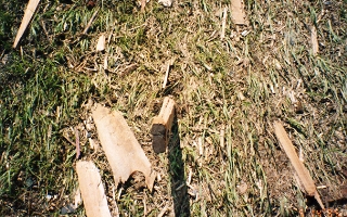 |
| Tornado damage in Raritan, IL (photo courtesy of NWS) |
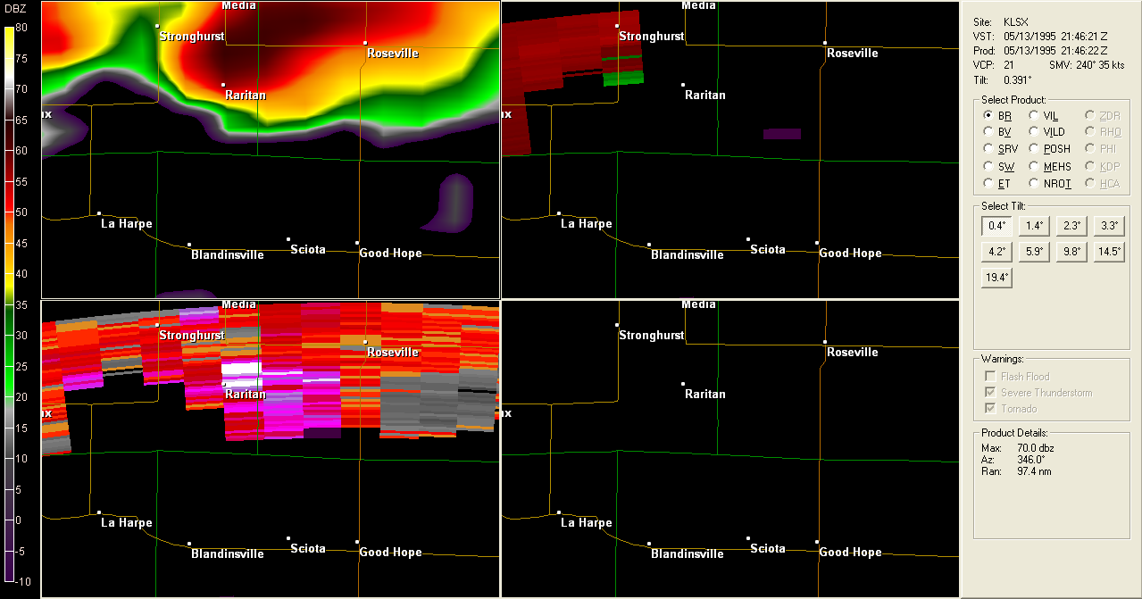 |
| Radar images from NWS St. Louis at 4:48pm (CST) (photo courtesy of NWS) |
The radar data is from NWS St. Louis since the NWS Quad Cities radar was not yet archiving data. Note how VCP 21 provides incomplete volumetric data and only at 6 minute intervals. The 0.5° beam elevation at this storm was ~14,500 ft, so the details of what was ongoing in the lower part of the storm are not available. However, the SW data even at this level seems to track well with the timing and location of the tornado.


 Follow us on YouTube