The Mississippi River will continue to rise through the next 1 to 2 weeks as runoff from snowmelt upstream in combination with rainfall runoff moves through the river system. Confidence has increased that much of the river will see minor to moderate flooding. The river is expected to crest in the Dubuque area early next week, and continue down river.
Flood Category definitions:
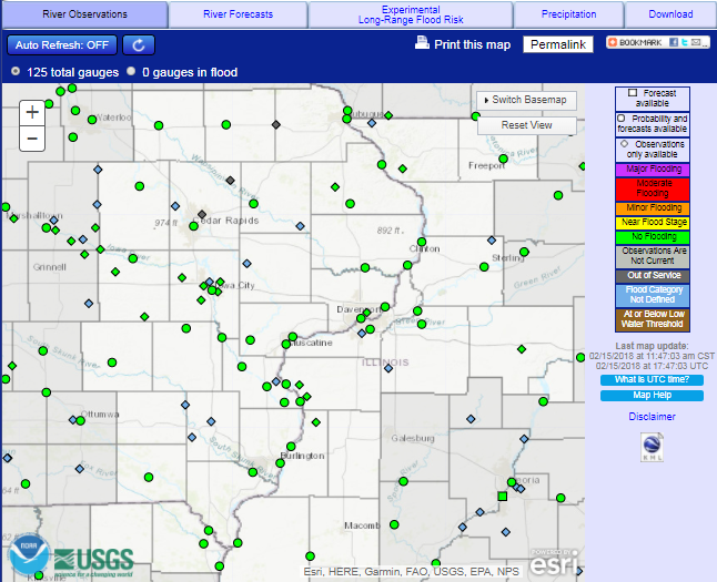
Current and Forecast River Conditions - Advanced Hydrologic Prediction Service (AHPS)
 |
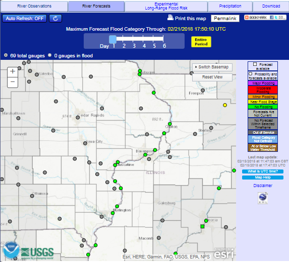 |
| Observed Conditions | Forecast Conditions |
Mississippi River Forecast Page
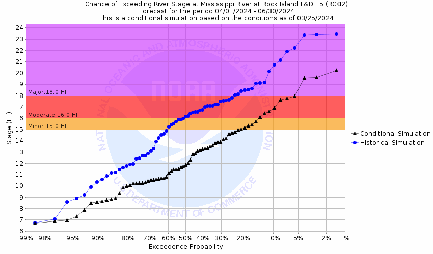
Probabalistic Hydrologic Outlook
Use the links below to find the Graphical Probabilities for the river reaching particular levels.
|
Graphical Hydrologic Outlooks Images below are examples which link to the Mississippi River at Rock Island Lock & Dam 15. Find all other Mississippi River locations in the Quad Cities Hydrologic Service Area in the drop down menu below. |
||
|
|
|
|
 |
 |
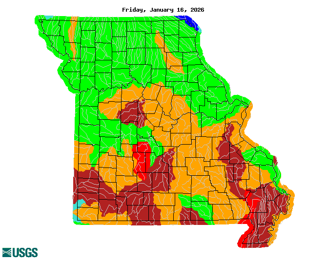 |
| Iowa | Illinois | Missouri |
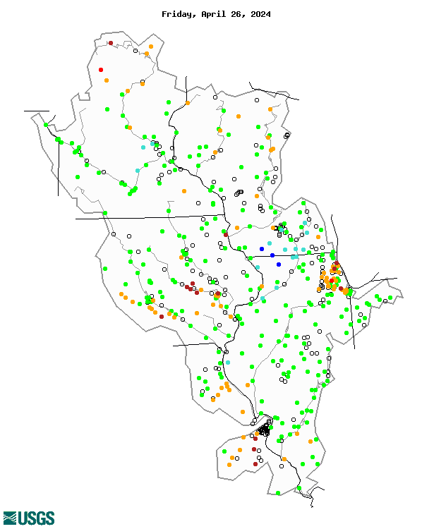
| Images courtesy of the USGS |
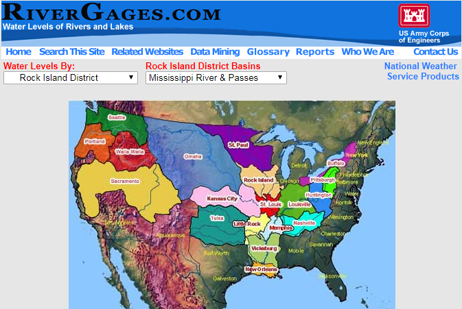 |
| RiverGages.com (USACE Gage Information) |
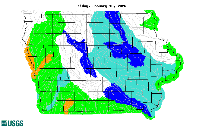
Snow Liquid Water Content and Depth
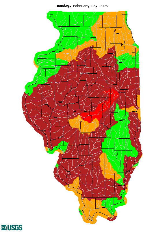
Why is the Mississippi River going up? Look at the differences in the snowpack in the upper parts of the Mississippi River basin between April 17th and today.
Snow Water Equivalent and Snow Depth on 4/17/18 |
||
Current Snow Water Equivalent and Snow Depth |
||
| Images courtesy of the National Operational Hydrologic Remote Sensing Center (NOHRSC) |
Precipitation and Temperature Outlooks
The following are weather outlooks for 8-14 day time period and for May, June, and July.
| 8 to 14 day Temperature Outlook | 8 to 14 day Precipitation Outlook |
 |
 |
|
Three Month Temperature Outlook |
Three Month Precipitation Outlook |
 |
 |
River and streamflow information:
Flood safety and flood insurance information:
Precipitation, temperature, and soil moisture information:
Questions or Comments
If you have questions or comments please contact:
Jessica Brooks
Service Hydrologist
National Weather Service
9040 Harrison St
Davenport, IA 52806
563-386-3976 ext 493
Email: jessica.brooks@noaa.gov


 Follow us on YouTube