Overview
| A strong storm system moving toward the Great Lakes produced unsettled weather over much of the the Mississippi River Valley on Wednesday, Dec. 23. Across eastern Iowa, western Illinois and northeast Missouri, temperatures warming into the mid 50s and lower 60s were about 20 degrees above normal. At Moline, IL, a high of 60 degrees toppled the previous record of 59 degrees set in 1982. Elsewhere, high temperatures ranging from 64 degrees at Mount Pleasant to 50 degrees at Independence set the stage for severe weather. Tornadoes were reported near Good Hope and Taylor Ridge, while thunderstorms, torrential rain, strong winds, and small hail were reported from northeast Missouri to northwest Illinois. Preliminary rainfall amounts were generally less than an inch, with 0.69 inches at Davenport, 0.65 inches at Burlington, 0.41 inches at Cedar Rapids, 0.34 inches at Dubuque, and 0.80 inches near Freeport. | 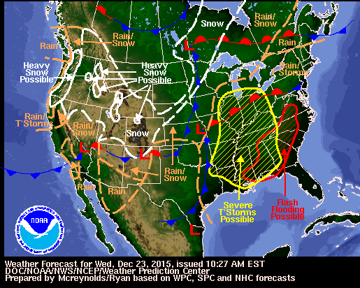 |
Tornadoes:
|
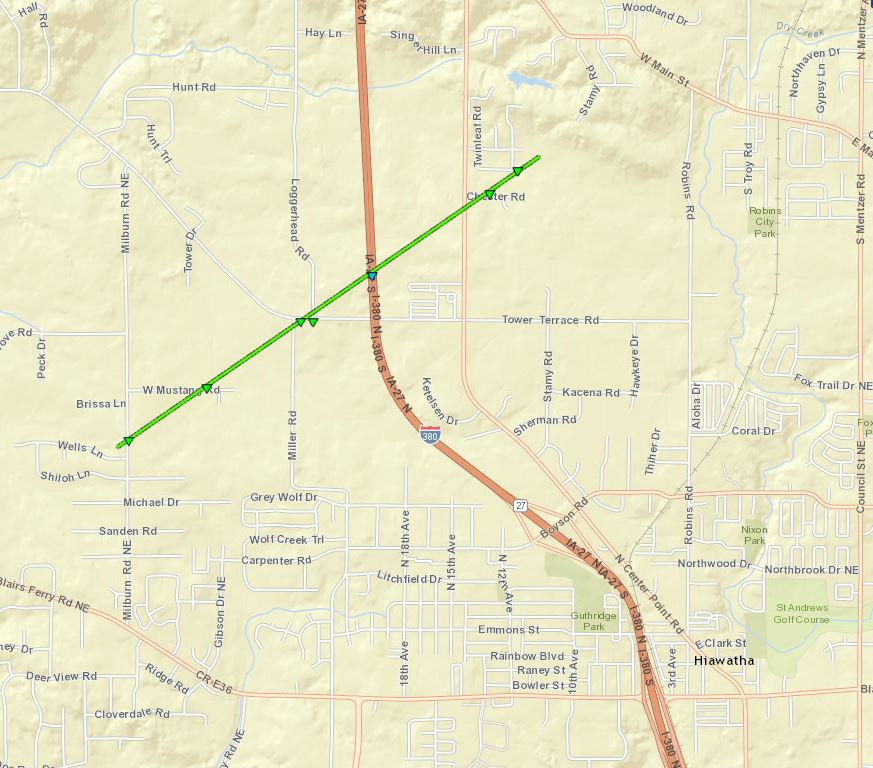
Tornado #1 - 2 SW Sciota, IL to 4.5 S Roseville, IL
Track Map 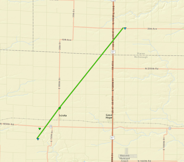 
Click Map for Larger Image |
||||||||||||||||
|
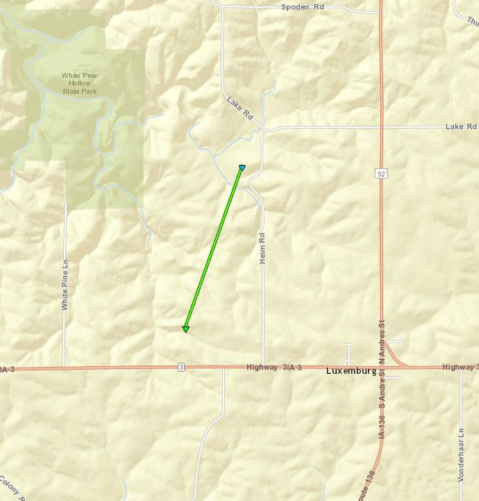
Tornado #2 - Reynolds/Taylor Ridge, IL
Track Map 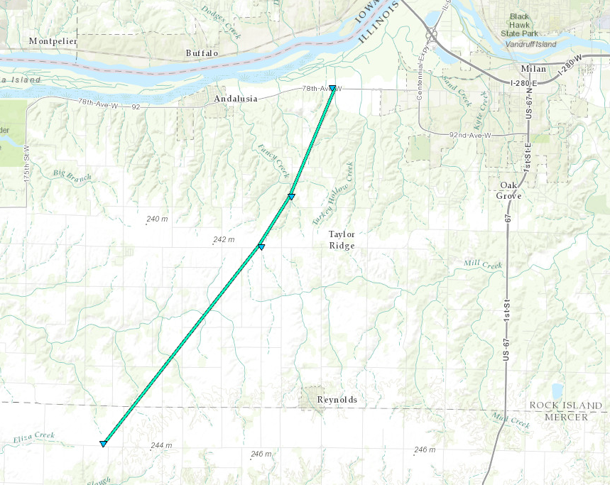
Click Map for Larger Image |
||||||||||||||||
|
|||||||||||||||||||||||||||||||||||
The Enhanced Fujita (EF) Scale classifies tornadoes into the following categories:
| EF0 Weak 65-85 mph |
EF1 Moderate 86-110 mph |
EF2 Significant 111-135 mph |
EF3 Severe 136-165 mph |
EF4 Extreme 166-200 mph |
EF5 Catastrophic 200+ mph |
 |
|||||
New Records
| RECORD HIGH TEMPERATURE SET AT MOLINE IL DEC 23 |
A record high temperature of 60 degrees was set at Moline, IL December 23, 2015. This breaks the old record of 59 set in 1982. |
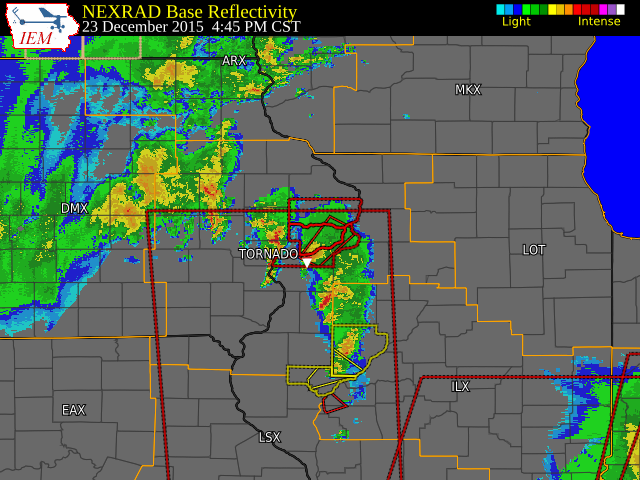
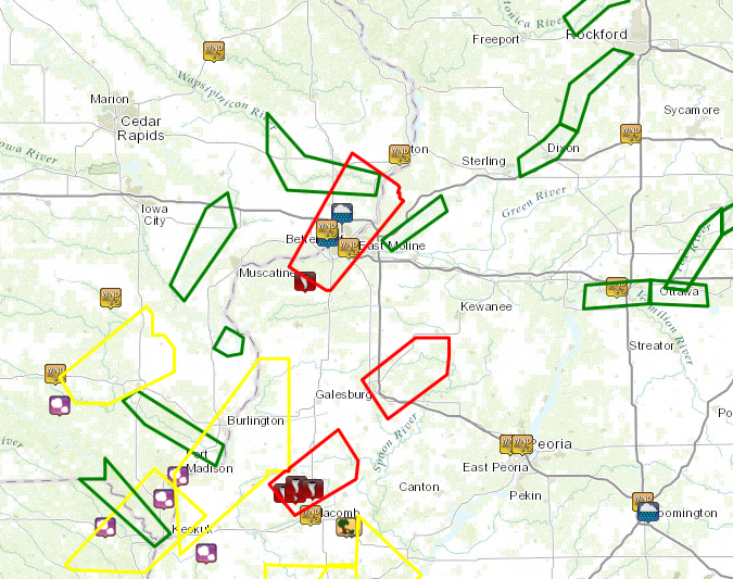
Radar:
| Click on image to enlarge and loop. |
 |
Additional Information
The Forecast
 |
 |
 |
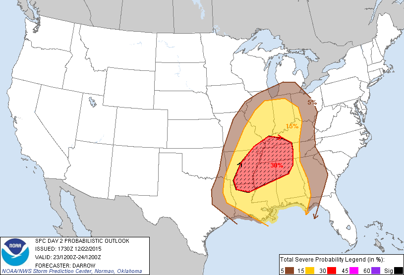 |
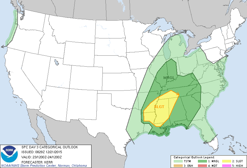
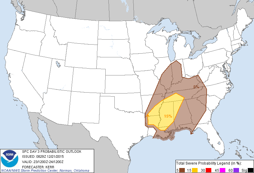
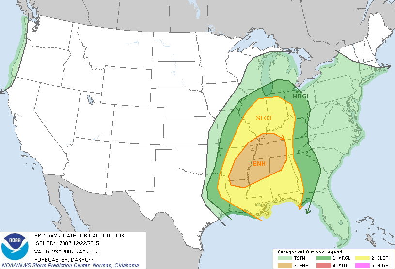
| SPC Day 3 Categorical Outlook | SPC Day 3 Probabilistic Outlook | SPC Day 2 Categorical Outlook | SPC Day 2 Probabilistic Outlook |
 |
 |
 |
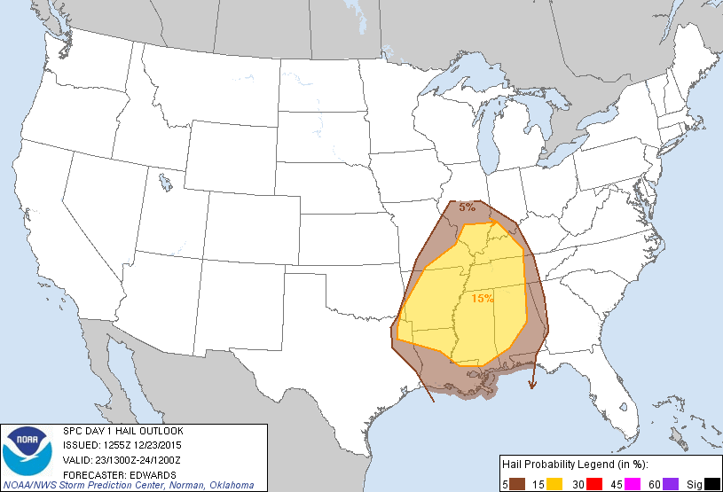 |
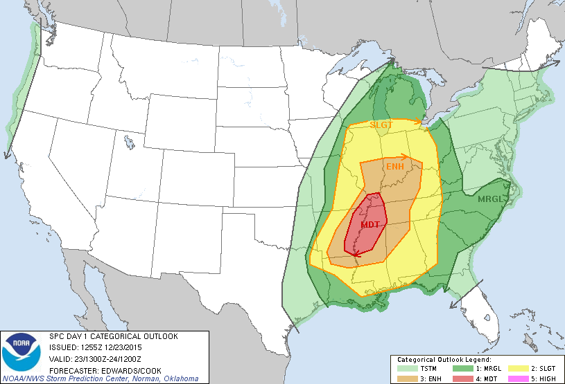
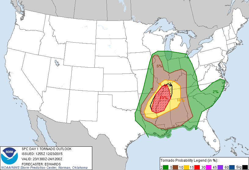
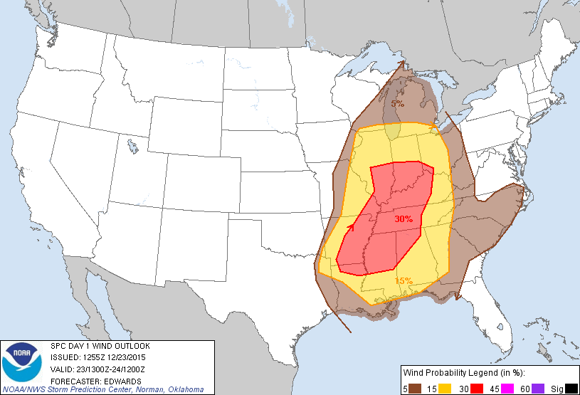
| SPC Day 1 Categorical Outlook | SPC Day 1 Tornado Outlook | SPC Day 1 Hail Outlook | SPC Day 1 Wind Outlook |
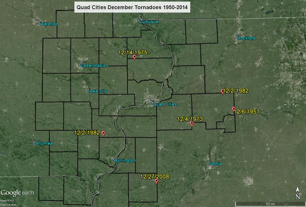
December Tornadoes - Quad Cities - 1950-2014
 |
Media use of NWS Web News Stories is encouraged! Please acknowledge the NWS as the source of any news information accessed from this site. |
|


 Follow us on YouTube