Overview
|
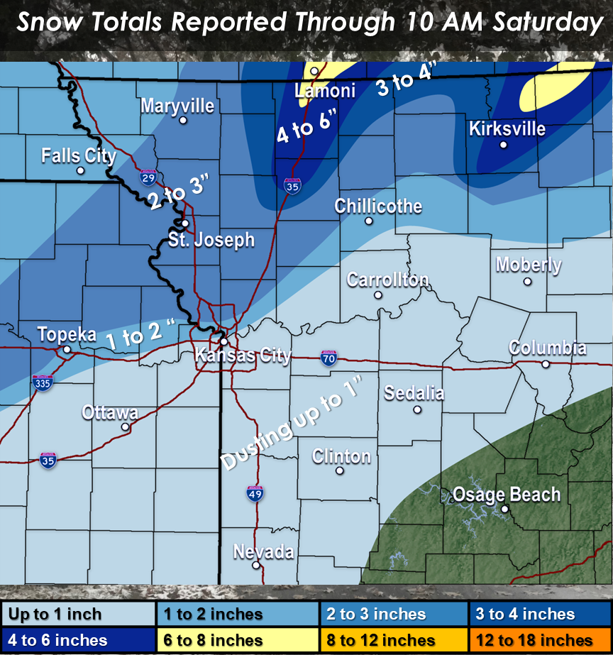
Precipitation began to develop across portions of northwestern Missouri through 1 to 2 PM, Friday. Initial precipitation began as snow, as temperatures across northwestern Missouri remained below freezing. Across western Missouri and eastern Kansas, temperatures warmed well into the upper 30s near 40, through the the afternoon. With surface moisture increasing through midday, fog persisted, increasing in density across portions of the area in the early afternoon. Through the late afternoon and evening, drizzle and light rain began to spread across portions of the region. Through 7 PM, a moderate band of rain began to settle across portions of eastern Kansas and western Missouri. Surface temperatures began to decrease through 10 PM, with a transition to rain and snow mix as temperatures began to approach 32 degrees. By 11 PM, precipitation across the KC Metro had transitioned to all snow. At the same time, the ongoing snow across northwestern Missouri continued to taper off. By the end of the event, a decent band of 1 to 3 inches of snow spanned from northeastern Kansas through northern Missouri, with brief banding of snow resulting in pockets of 4 to 5 inches and some isolated reports of 6 inches across far northern Missouri. |
 Snow across northern Missouri fell through the afternoon and evening hours of the 18th, while snow across eastern Kansas into western Missouri into north central Missouri occurred in the late evening and overnight hours. Snow had nearly tapered off between 4 and 5 AM. |
 |
 |
 |
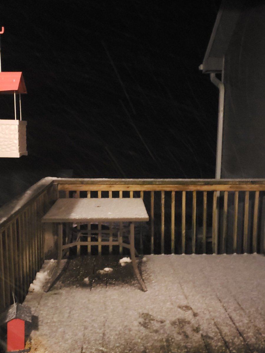
| NWS Meteorologist north of Platte City had a light accumulation by 7:30 PM, Friday. Ended up with 2 inches by 9:30 PM. |
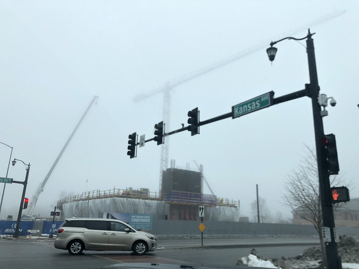
Foggy and damp was the story most of the day, here's a look from Overland Park Friday afternoon. Photo: Twitter - @big_pittman |
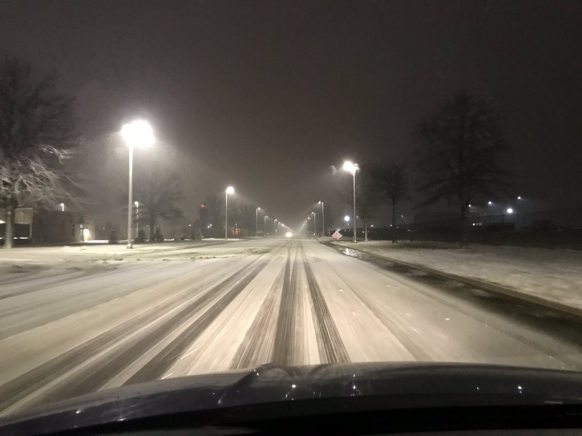
As snow rates increased and temperatures dropped quickly, snow began to accumulate on area roads across the KC metro Friday Night. Photo: Road to KCI via Twitter: @mrtigergator |
 |
Media use of NWS Web News Stories is encouraged! Please acknowledge the NWS as the source of any news information accessed from this site. |
|


 Weather Story
 Weather Map
 Local Radar
 Follow us on YouTube