
Strong to severe thunderstorms capable of damaging wind gusts, large hail, and perhaps a couple tornadoes, are likely Thursday from parts of the lower Ohio Valley into the southern Plains. An Enhanced Risk (Level 3 of 5) outlook has been issued. Further north, a warm front will bring areas of rain showers to portions of the Great Lakes and Northeast U.S. Read More >
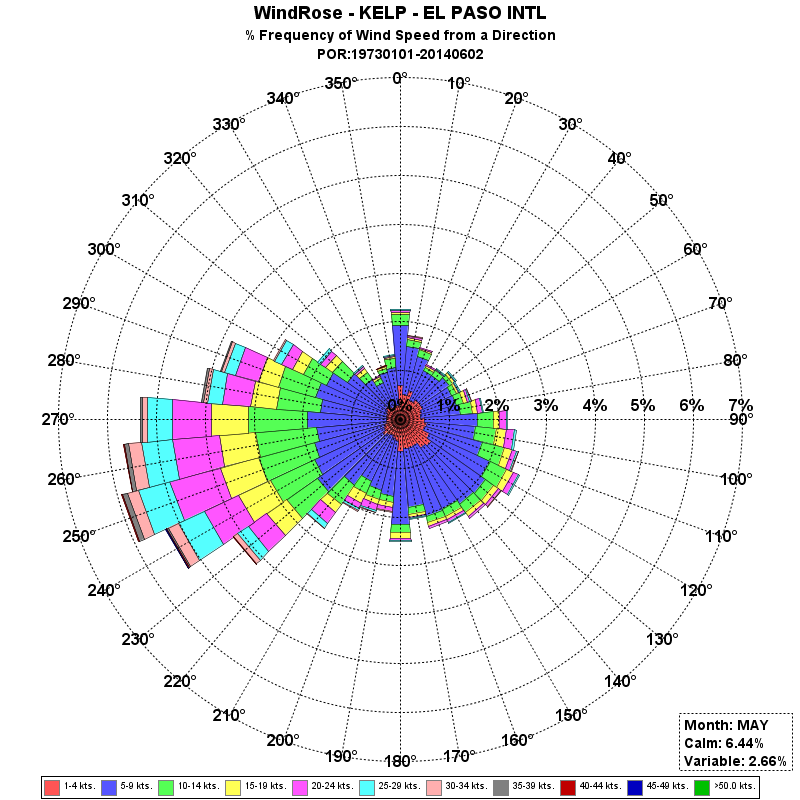
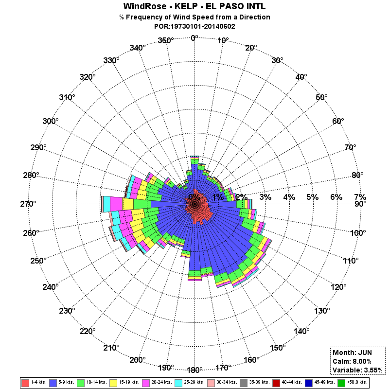
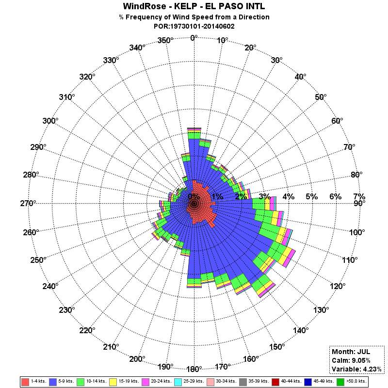
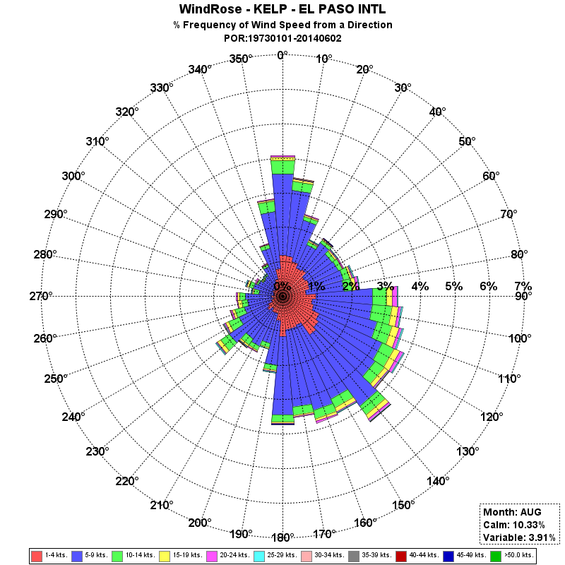
| El Paso Wind Rose Data |
 |
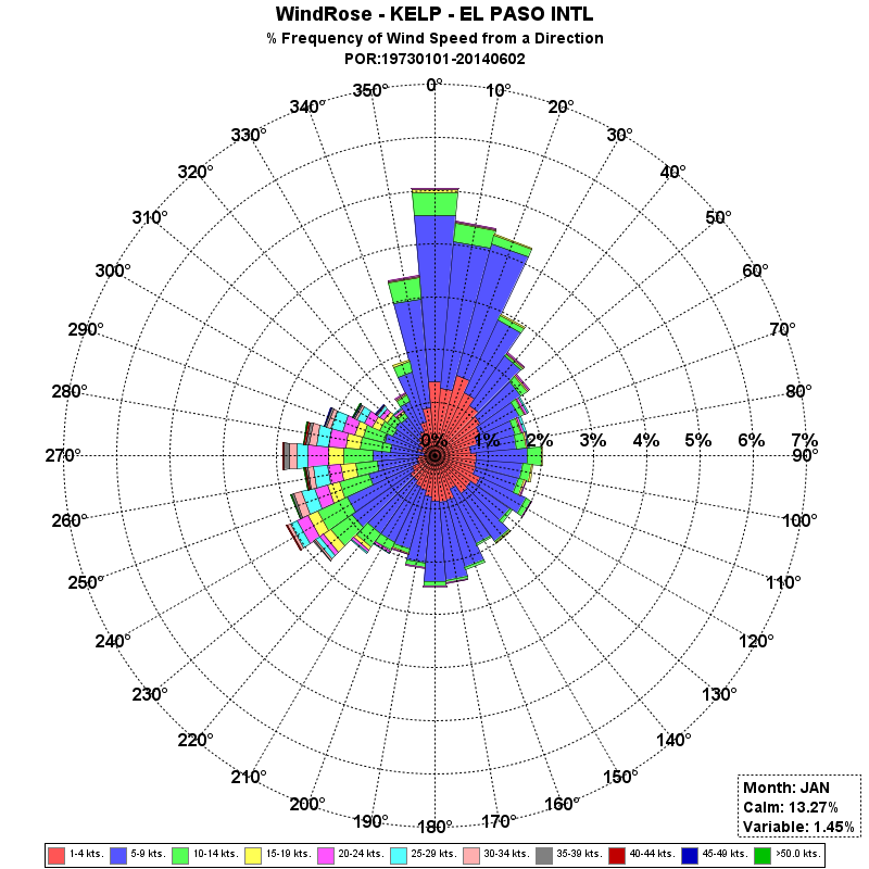
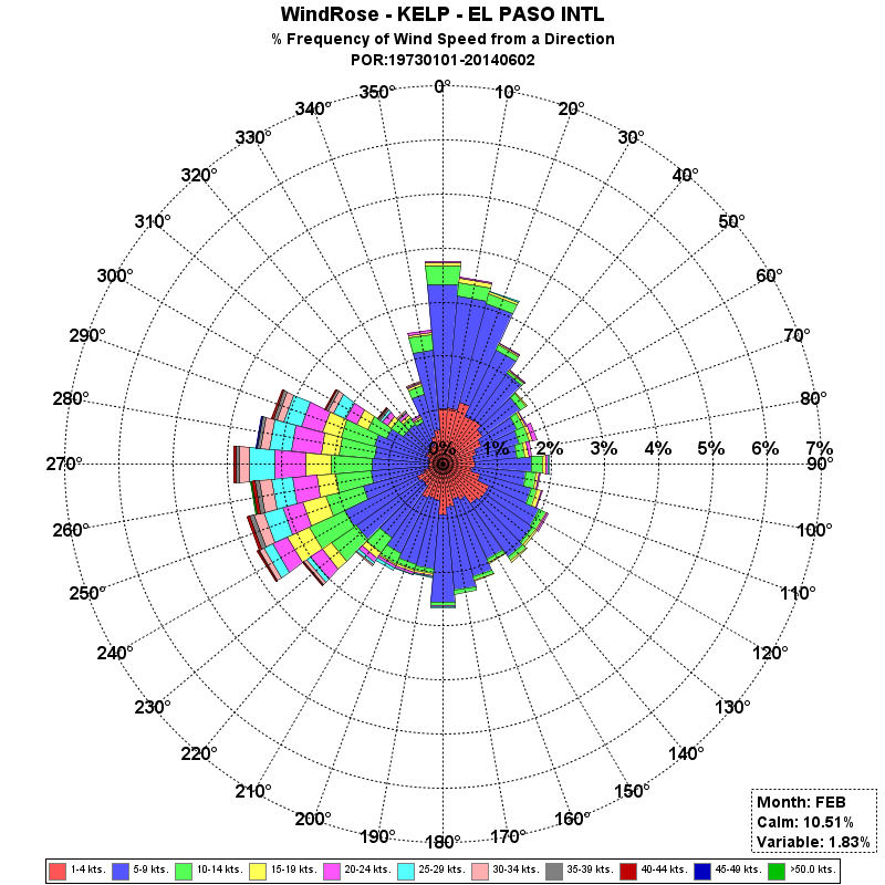
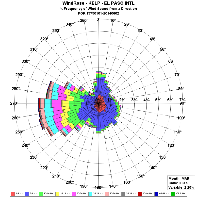
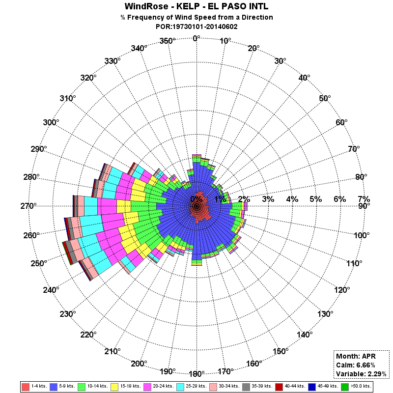
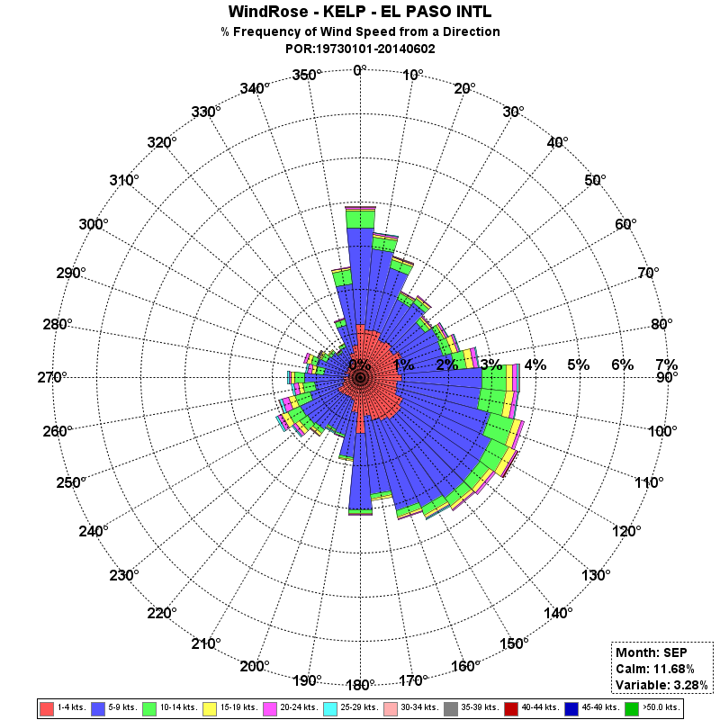
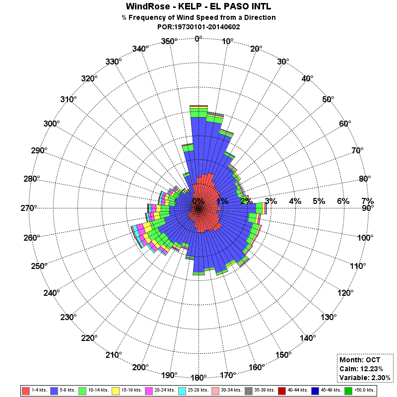
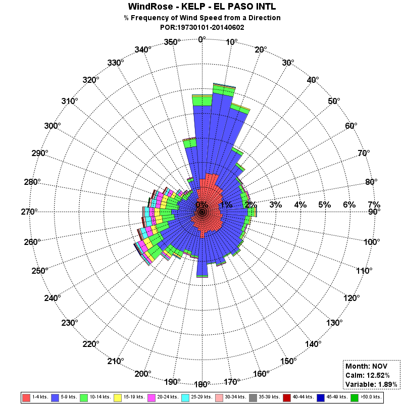
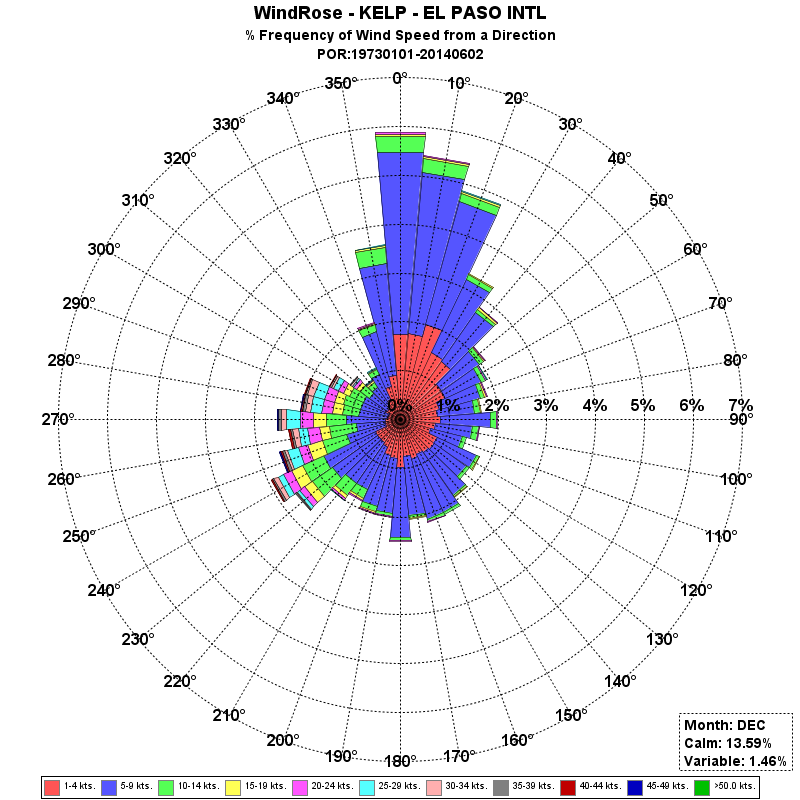
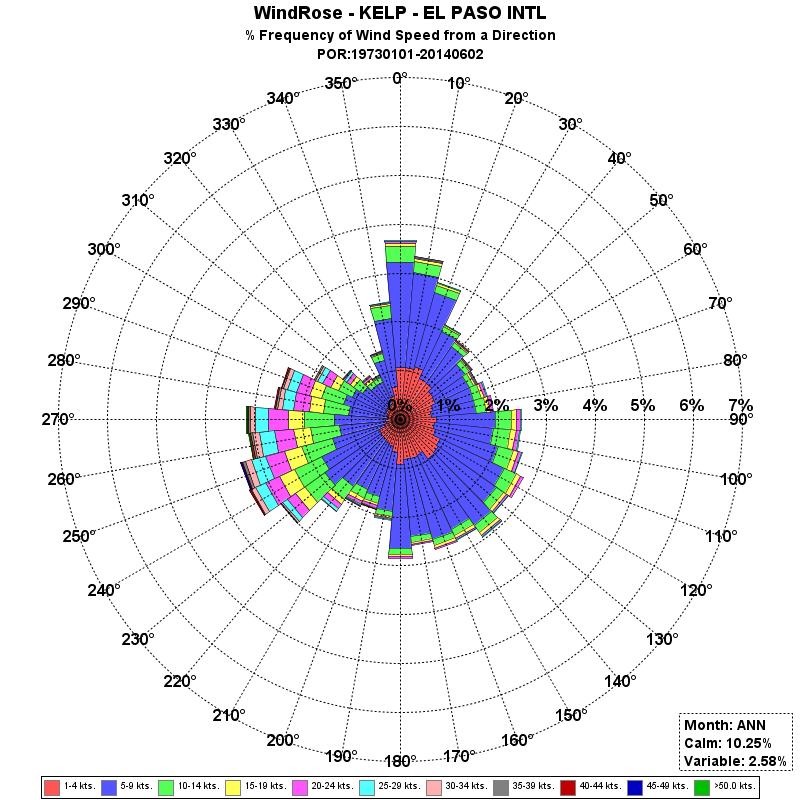
Wind roses can be used to graphically depict the predominant transport direction of an area's winds. Air quality is often correlated with the dominant transport direction of the wind. Wind roses provide the best information regarding the percentage of time the direction(s) and speed(s) associated with a certain air quality can be expected over a long period of time. The following data was collected 01-01-1973 - 06-02-2014 at the El Paso International Airport. |
 |
 |
 |
 |
 |
 |
 |
 |
 |
 |
 |
 |
 |


 Follow us on YouTube