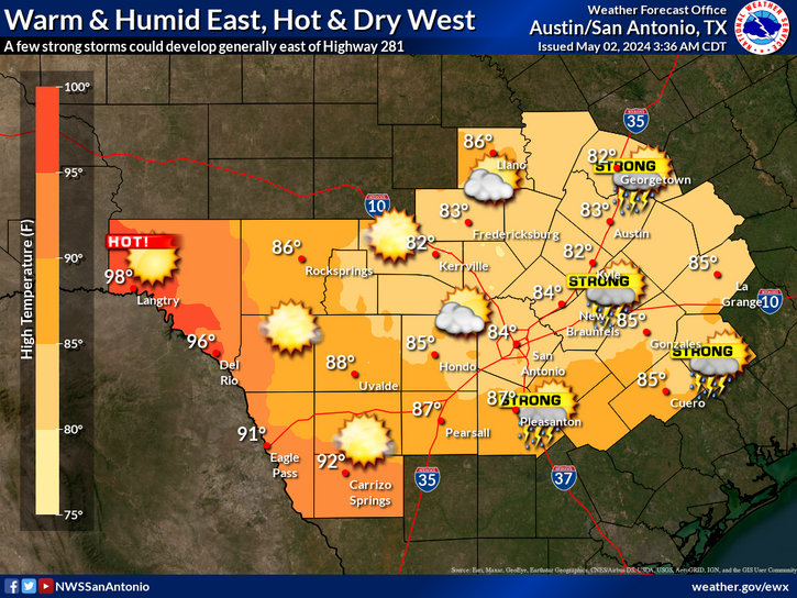
Isolated to widely scattered thunderstorms are possible from this evening through about midnight. Any of these storms could become strong to severe with large to very large hail as the main threat. Best chances will be across the Hill Country and Southern Edwards Plateau.
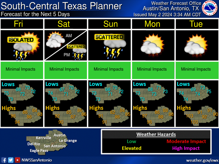
Additional isolated to scattered storms are possible Friday afternoon across northern and western areas. Chances for showers and storms will then increase Saturday and Saturday night with a cold front. Much cooler conditions are forecast behind the cold front on Sunday before we begin to warm back up early next week.


 Austin/San Antonio Radar
 Weather Map
 Satellite Imagery
 Del Rio Radar
 Digital Forecast Map
 Tropical Outlook
 Drought Status
 Air Quality
 Fire Weather Forecasts
 Observed Rainfall
 Observed Temperatures
 Daily Climate Graphs
 Follow us on YouTube