February 12, 2019 EF-0 Tornadoes:
Four short-lived EF-0 tornadoes occurred within a line of strong to severe thunderstorms that affected portions of north and central Georgia on Tuesday, February 12, 2019. These tornadoes produced primarily minor damage along their short paths. Additional straight-line wind damage also occurred elsewhere as these thunderstorms swept across the area. Both Columbus and Macon recorded strong wind gusts as the storms quickly passed, with a 56 mph gust recorded at the Columbus airport and a 55 mph wind gust at the Macon airport.
1) Fayette County
2) Clayton County
3) Henry County
4) Macon County
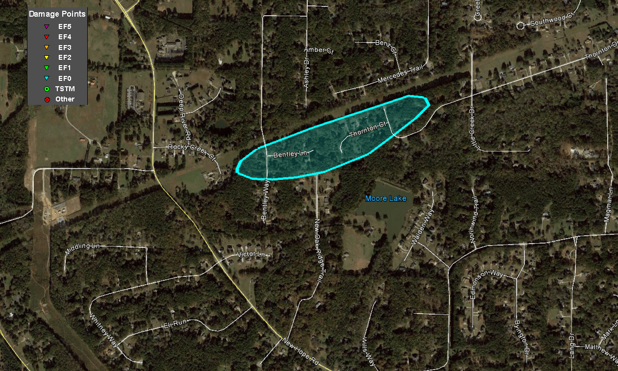
1) Fayette County Tornado:
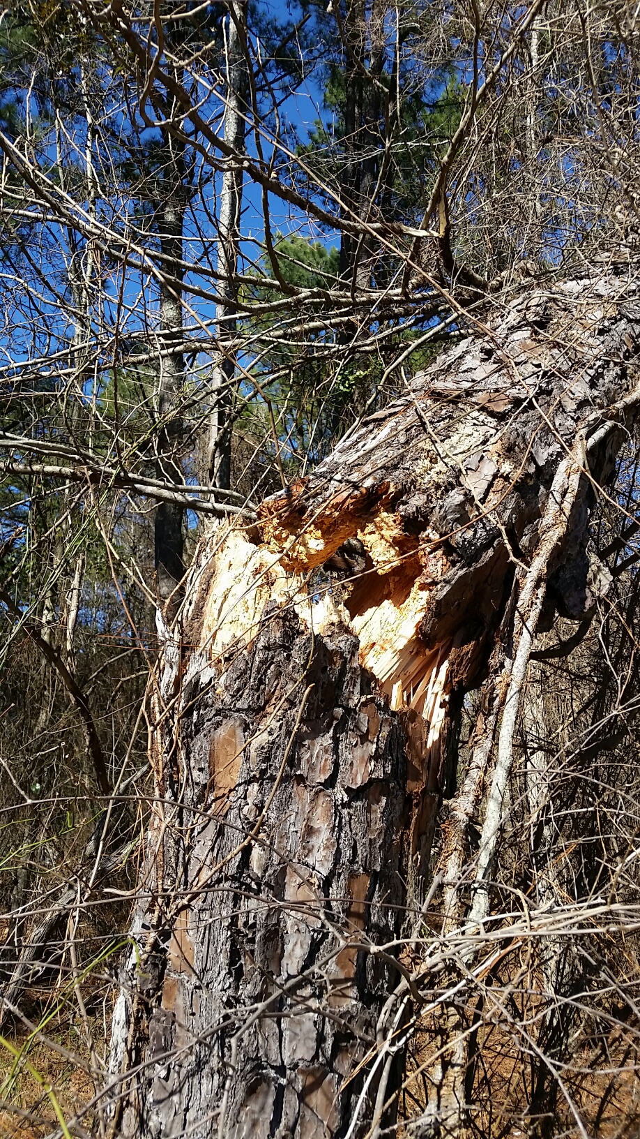
A weak quasi-linear convective system (QLCS) tornado touched down briefly several miles north of Fayetteville in northern Fayette County around 1:20 PM on the afternoon of Tuesday, February 12. Several trees were snapped or uprooted in a concetrated area between Bentley Way and Thornton Drive/Thornton Court as well as on New Oak Ridge Trail. A brief, shallow Tornado Debris Signature (TDS) showed up along this path from Peachtree City (FFC) radar, which helped support the weak EF-0 tornado diagnosis. Sporadic reports of "one or two trees" down on either side of this area were likely due to strong thunderstorm winds associated with the line.
 |
| Damage Path - Fayette County |
|
| County |
Rating |
# of Injuries |
KML |
| Fayette |
EF-0 |
0 |
 |
|
| Rating: |
EF-0 |
| Peak Wind: |
65-70 MPH |
| Path Length: |
0.6 miles |
| Path Width: |
150 yards |
| Fatalities: |
0 |
| Injuries: |
0 |
| Start Date: |
February 12, 2019 |
| Start Time: |
1:29 PM EST |
| Start Lat/Lon: |
33.50297 / -84.47912 |
| End Date: |
February 12, 2019 |
| End Time: |
1:30 PM EST |
| End Lat/Lon: |
33.50576 / -84.47008 |
|
|
|
|
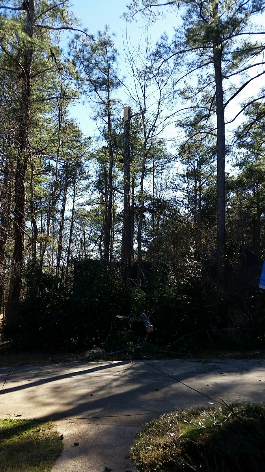 |
| This tree was snapped on New Oak Ridge Trail |
This tree was snapped by the tornado. |
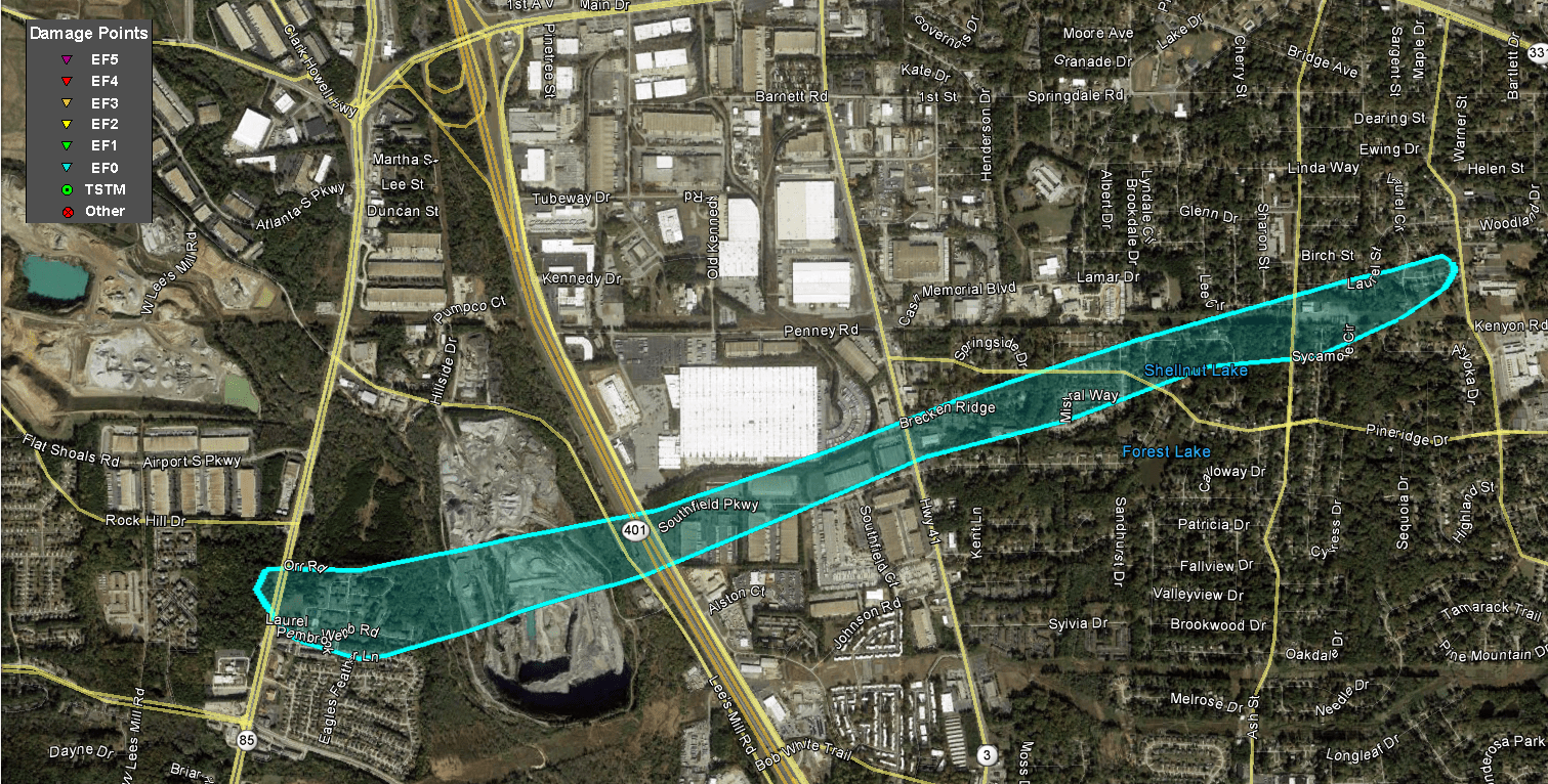
2) Clayton County Tornado:
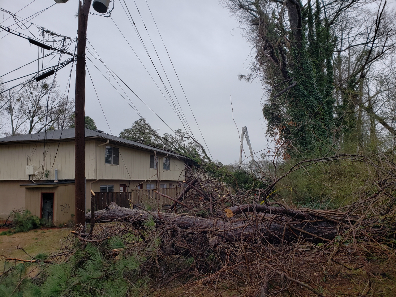
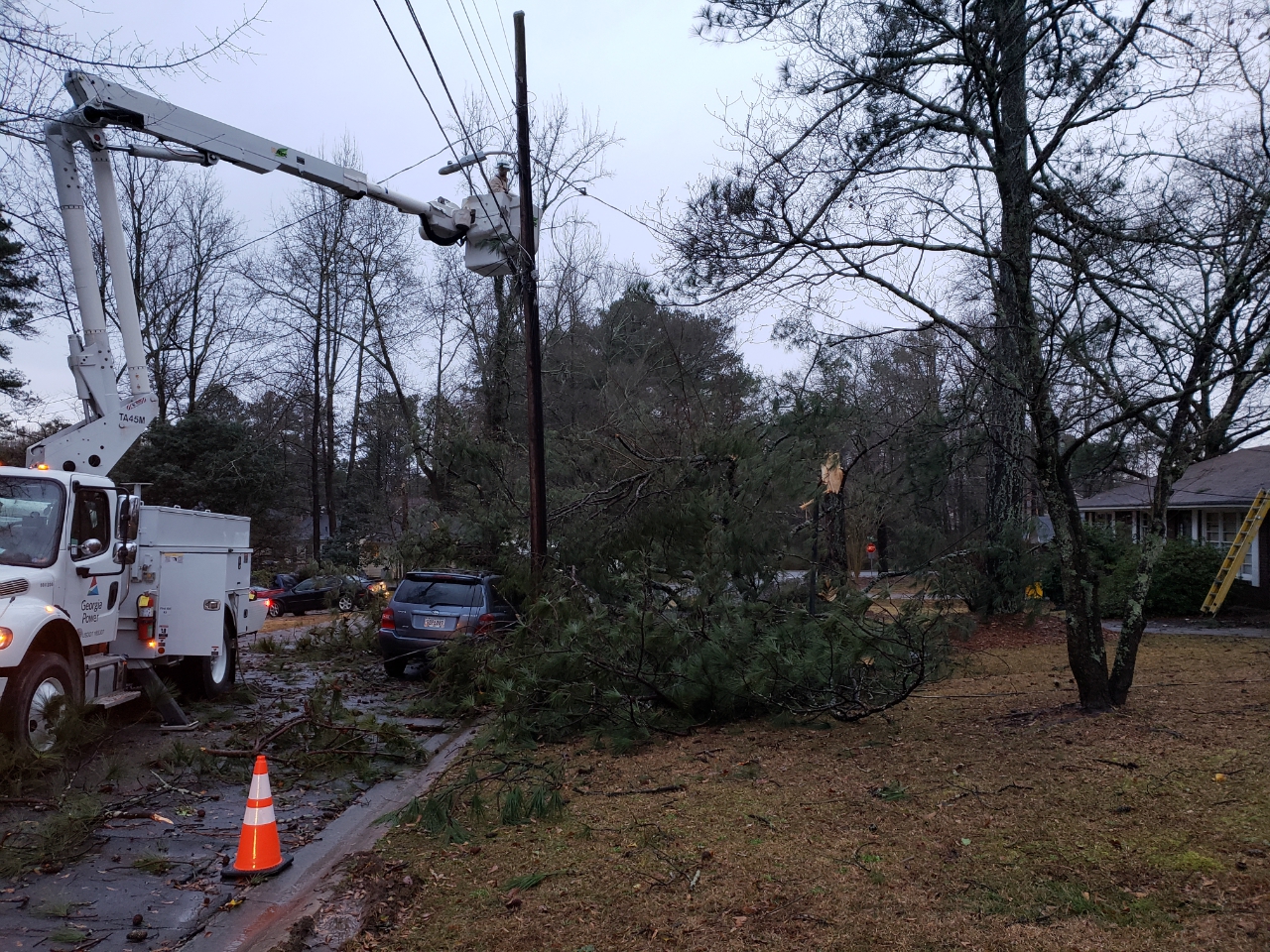
A classic quasi-linear convective system (QLCS) tornado occurred in northern Clayton County early on the afternoon of February 12, 2019., with damage first notable near an apartment complex off of GA Highway 85 between Forest Park and Riverdale. Several trees were snapped on either side of the highway. The tornado ripped a few shingles off the roofs of the apartment and uprooted several additional trees as it moved east-northeast. Additional trees were snapped or uprooted off of Pine Ridge Drive between Virginia Circle and Ash Street. The last bit of damage occurred off of School Lane where several large tree limbs fell onto a house. There was no additional damage noted immediately downstream from this location, but as the line of storms continued eastward, some minor damage was seen in the Ellenwood area east of I-675. This damage was not determined to be associated with the tornado.
 |
| Damage Path - Clayton County |
|
| County |
Rating |
# of Injuries |
KML |
| Clayton |
EF-0 |
0 |
|
|
| Rating: |
EF-0 |
| Peak Wind: |
75 MPH |
| Path Length: |
3.0 miles |
| Path Width: |
100 yards |
| Fatalities: |
0 |
| Injuries: |
0 |
| Start Date: |
February 12, 2019 |
| Start Time: |
1:33 PM EST |
| Start Lat/Lon: |
33.597751 / -84.363415 |
| End Date: |
February 12, 2019 |
| End Time: |
1:39 PM EST |
| End Lat/Lon: |
33.609243 / -84.357071 |
|
|
|
|
 |
| Several trees were downed onto power lines and on a building at the Laurel Park Apartments. |
These trees were snapped onto power lines on Virginia Circle. |
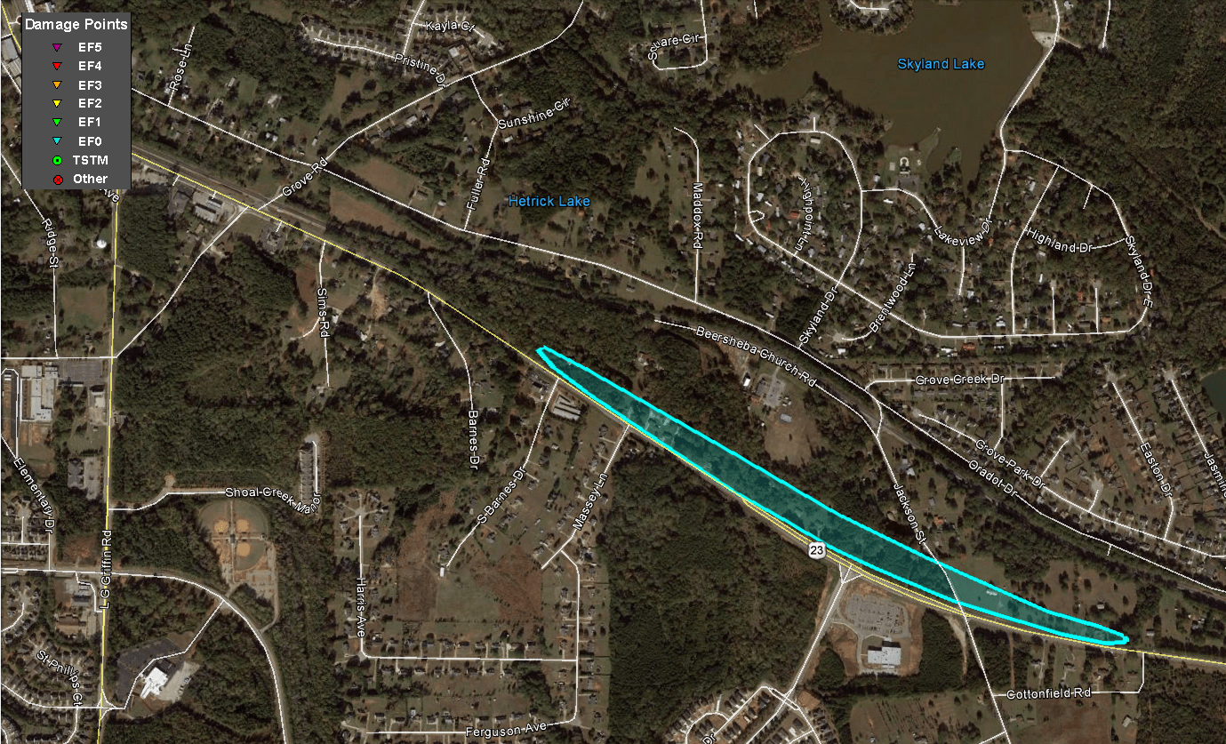
3) Henry County Tornado:
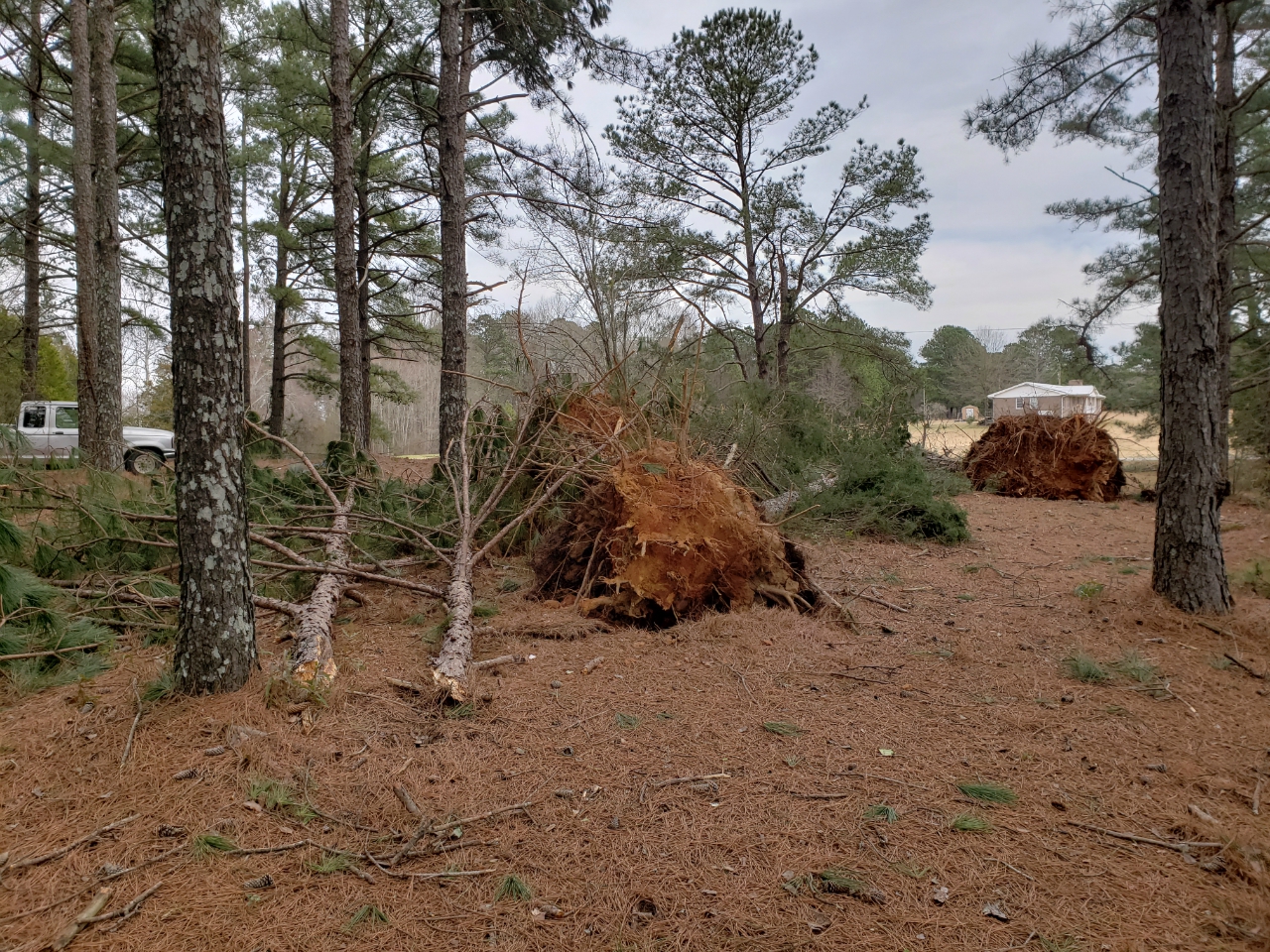
A very brief QLCS tornado touched down just southeast of Locust Grove in southern Henry County. The tornado snapped and uprooted several trees along the north side of Highway 42 between Barnes Drive and Davis Road. Just before the tornado lifted, the front and side porches of a residence were lifted up and collapsed. No other damage was seen to the house. Based on this damage as well as the tree damage, maximum winds likely reached around 75 mph which supports the EF-0 rating.
 |
| Damage Path - Henry County |
|
| County |
Rating |
# of Injuries |
KML |
| Henry |
EF-0 |
0 |
|
|
| Rating: |
EF-0 |
| Peak Wind: |
75 MPH |
| Path Length: |
0.9 miles |
| Path Width: |
100 yards |
| Fatalities: |
0 |
| Injuries: |
0 |
| Start Date: |
February 12, 2019 |
| Start Time: |
2:12 PM EST |
| Start Lat/Lon: |
33.33928 / -84.09713 |
| End Date: |
February 12, 2019 |
| End Time: |
2:14 PM EST |
| End Lat/Lon: |
33.33337 / -84.08335 |
|
|
|
|
 |
| A number of trees were uprooted along the tornado's brief track. |
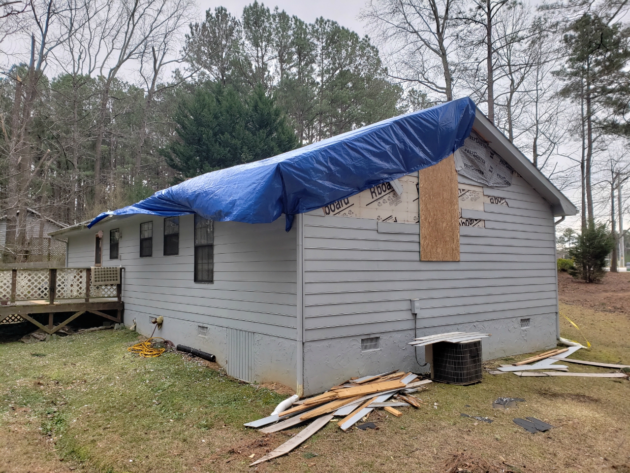
This home received siding and roof damage. |
4) Macon County Tornado:
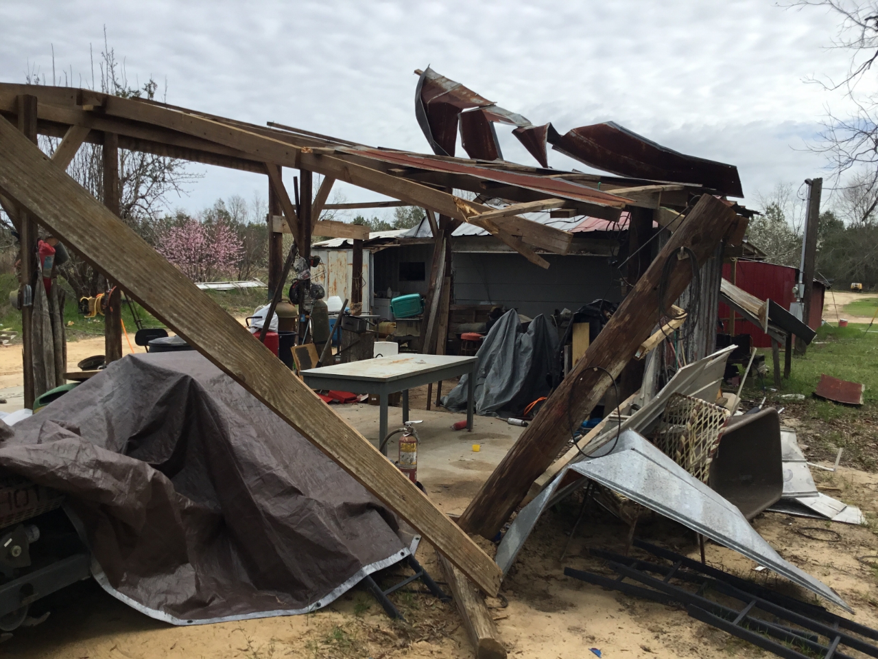
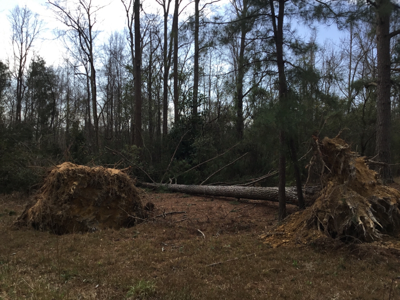
A short-lived QLCS tornado touched down near the city of Ideal in western Macon County. The tornado snapped and uprooted at least 10 to 20 trees along Brook Road. A small shed sustained roof and wall damage before the tornado picked up the shed and threw it nearly 200 yards away. The tornado snapped another large tree before lifting near Tom Watson Avenue and Brooks Road. Based on this damage, maximum winds likely reached around 75 mph which supports the EF-0 rating.
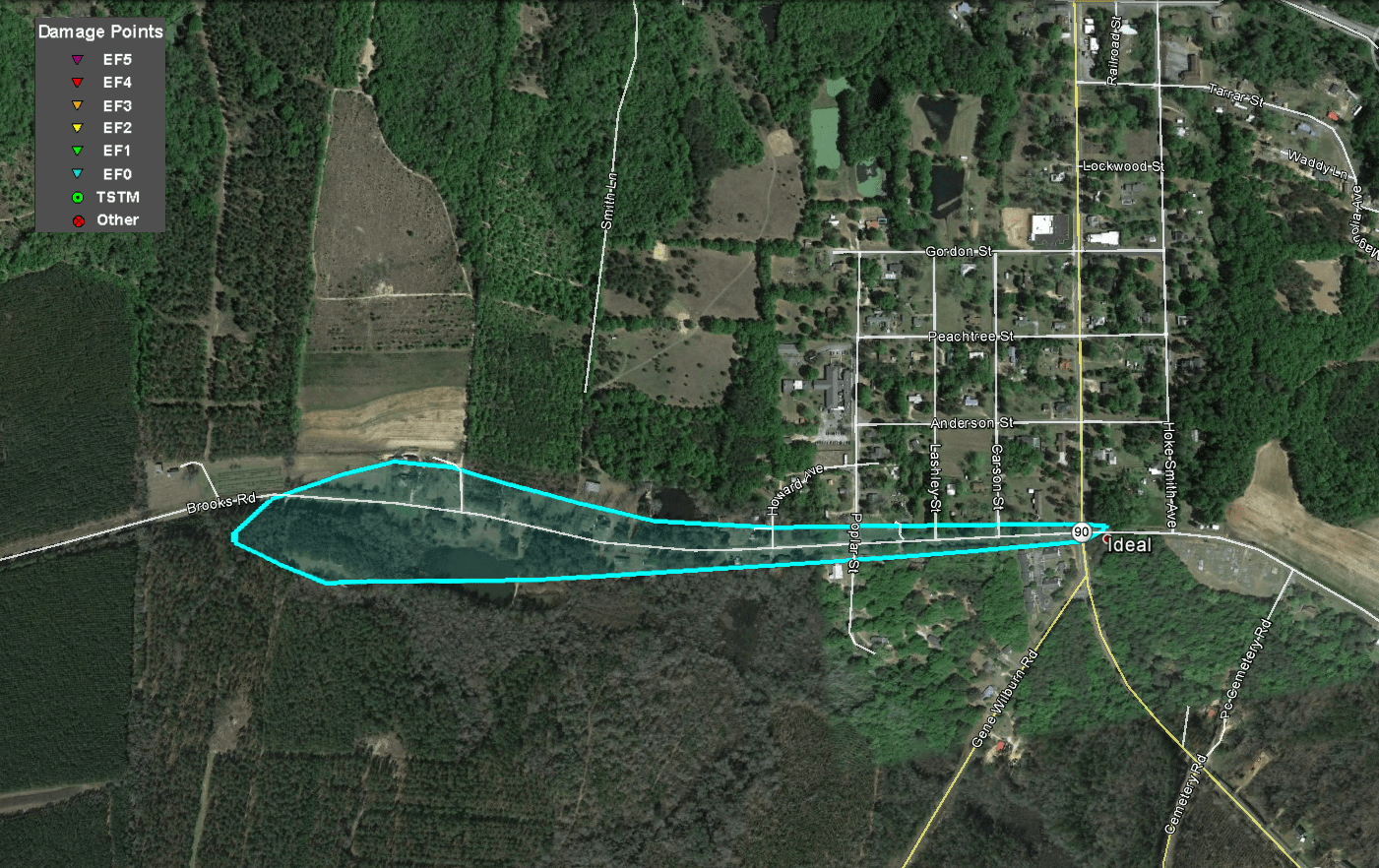 |
| Damage Path - Macon County |
|
| County |
Rating |
# of Injuries |
KML |
| Macon |
EF-0 |
0 |
|
|
| Rating: |
EF-0 |
| Peak Wind: |
75 MPH |
| Path Length: |
0.8 miles |
| Path Width: |
200 yards |
| Fatalities: |
0 |
| Injuries: |
0 |
| Start Date: |
February 12, 2019 |
| Start Time: |
2:29 PM EST |
| Start Lat/Lon: |
32.36962 / -84.20180 |
| End Date: |
February 12, 2019 |
| End Time: |
2:31 PM EST |
| End Lat/Lon: |
32.36969 / -84.18800 |
|
|
|
|
 |
| A small shed sustained roof and wall damage. |
A couple of trees uprooted by the tornado. |


 Follow us on YouTube