What Upcoming El Niño Means for North and Central Georgia
Forecast projections have consistently pegged this summer with a likely transition to an El Niño phase across the Pacific Ocean – so what does this mean for us here in North and Central Georgia? With it being over 4 years since the last El Niño occurred, many may not be familiar with its typical influences on the area. By definition, El Niño marks abnormally warm sea surface temperatures across the eastern and central portions of the tropical Pacific, which triggers an atmospheric response. Click the graphic below for more information:
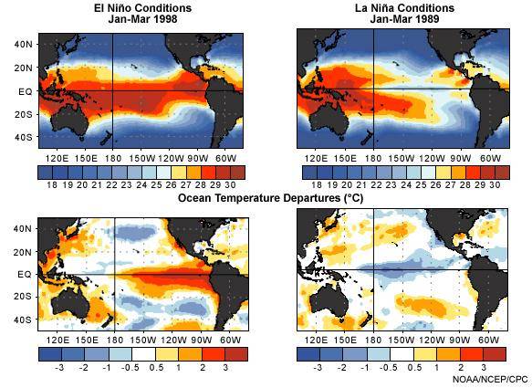
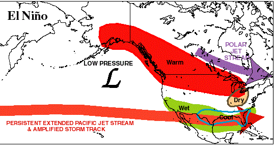
Essentially, the increased heat energy of the ocean results in a shift of the nearby weather circulations. This shift can in turn alter the jet stream pattern that affects storm tracks across the U.S. How will this affect the weather here in Georgia? Such shifts in the jet stream pattern during El Niño events typically result in above normal precipitation and below normal temperatures for portions of the state. These impacts are usually more pronounced during the winter season rather than during the summer. A winter that is wetter and cooler than normal would not exactly be the best news given this past chilly and saturated season.
Winter is not the only season usually impacted by an El Niño – hurricane season is too. Records support that the Atlantic Tropical season is typically less active during El Niño events. Since the 1960s there have been 14 El Niño events, of which only 3 of these seasons had average or above average tropical cyclone activity. An average season (June 1 to November 30) would have 12 named storms, 6 hurricanes, and 3 major hurricanes. Despite the typical below normal seasons, Georgia has felt some effect from either a tropical storm or depression 50% of the time, and we all know that it only takes one land-falling storm to make a significant impact during a season! It has been nearly a decade since a hurricane has tracked across the state, but we cannot let our guard down!
Severe weather is trickier to relate to El Niño since no single event can be directly attributed to such climate variability. However, there are some interesting numbers when comparing previous spring seasons since 1996. The number of statewide tornadoes during El Niño springs (March, April and May) averages to be approximately 9, below the overall average of 13, based on the official Storm Data record. The El Niño event tornado totals are also lower than during Neutral phases (~12) and about half that of La Niña phases (~16), although these statistics could change if investigating pre-1996 records.
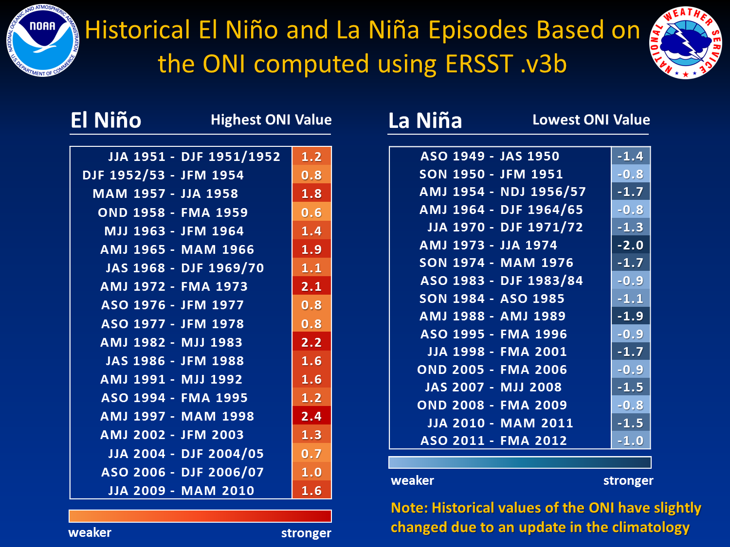
The forecast transition to an El Niño comes by no surprise, since we’ve been in a Neutral phase for the past two years, and records indicate that since 1950 every Neutral period of at least 12 months has transitioned to an El Niño. These events usually last a year to year and a half. Below is a graphic depicting the historical El Niño and La Niña events marked by the Oceanic Niño Index (ONI) where greater than 0.5 is El Niño and less than -0.5 is La Niña (Neutrals are between these values). Click on the graphic to see a complete listing in more detail:
Data prepared by the Atlanta Forecast Office.


 Follow us on YouTube