Impact Based Warnings
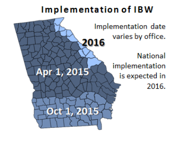
Starting April 1, 2015
Impact Based Warnings (IBW) are an experimental product that started in 2012 in NWS Central Region and in 2015, 67 of the 122 Weather Forecast Offices will participate in the experiment. IBWs are designed to improve communication of the most critical information through the use of specific statements, easy to find hazard and impact information and the use of summary tags at the bottom of warnings. As a result, partners and users will notice minor changes to Tornado and Severe Thunderstorm Warnings, and to Severe Weather Statements.
Although implementation date will vary by office, NWS Atlanta/Peachtree City, will transition to Impact Based Warnings on April 1, 2015.
Changes to Warning Text
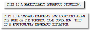
Specific Statements
Specific phrases will be used in Tornado Warnings for both the considerable and catastrophic tags.
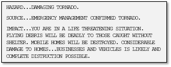
Hazard and Impact Information
Each Tornado and Severe Thunderstorm Warning will contain individual lines that clearly state hazard and impact information.
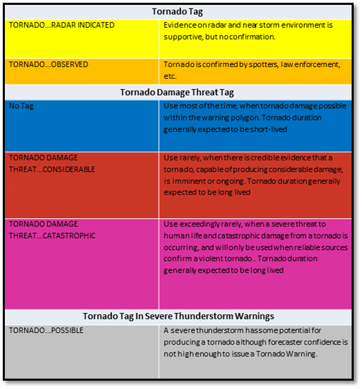
Tags
Tags will appear at the bottom of Tornado and Severe Thunderstorm Warnings, and in the Severe Weather Statements that update the warnings.
In a Severe Thunderstorm Warning, tags will be used to define:
In a Tornado Warning, two types of tags can be used:
Additional Resources


 Follow us on YouTube