May 26, 2015 Meriwether County EF-1 Tornado and Wind Damage in Harris County
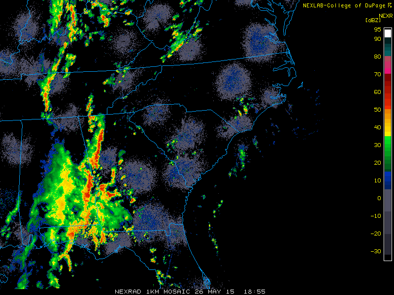
A remnant large scale boundary from storms that caused significant damage and flooding in Texas and Oklahoma on May 25 moved east into Georgia during the afternoon hours of May 26. The boundary combined with strong surface heating and modest winds off of the surface helped to produce a line of strong to severe thunderstorms during the afternoon and evening hours.
The National Weather Service in Peachtree City...in conjunction with Harris and Meriwether County Emergency Management...conducted ground surveys of storm damage from severe thunderstorms that occurred late Tuesday may 26. Pockets of more significant damage were seen in portions of Harris and Meriwether Counties. Damage was a result of both thunderstorm winds and a tornado in two separate areas. details of the storm damage are below.
During this event, 10 Severe Thunderstorm Warnings were issued for portions of North and Central GA beginning at 2:37 PM through 6:30 PM EDT.
Meriwether County:
A tornado briefly touched down within a cluster of severe thunderstorms just west of Warm Springs along HWY 194 in Southern Meriwether County. Much of the damage was to trees...either snapped or uprooted as the tornado moved northeast before lifting just northwest of the town of Woodbury. The worst of the damage occurred between Roosevelt Highway and Juke Line Road where numerous trees were snapped/twisted or uprooted. This is where the determination of EF-1 rating happened with maximum winds of 90 Mph. Due to the remoteness of this area and limited road access... it was difficult to survey spots between Roosevelt Highway and Temple Dukes Road...but additional damage /trees down/ likely occurred.
|
 |
| Map of the EF1 tornado track which started west of Warm Springs, GA and ended west of Woodbury, GA |
 |
 |
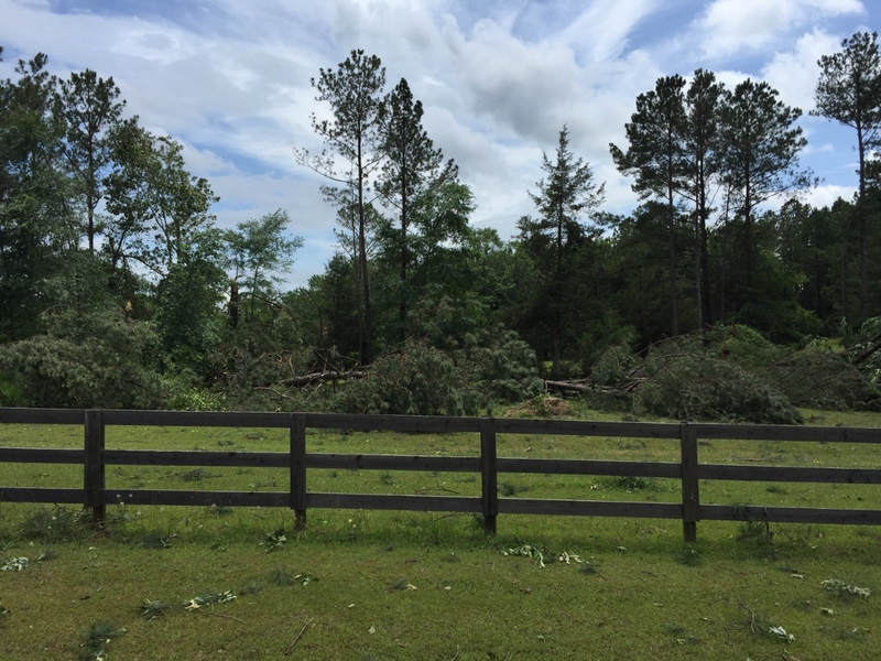
| Numerous Trees snapped west of Warm Springs near Juke Line Road | Numerous Trees snapped west of Warm Springs along GA Hwy 194 |
 |
 |
| Numerous trees were downed near the community of Raleigh along Temple Dukes Road | Trees down west of Woodbury along GA 109 |
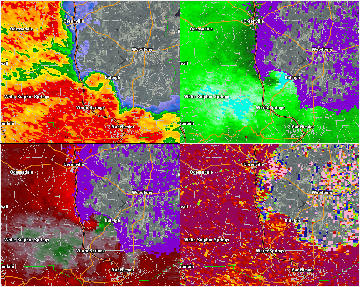 |
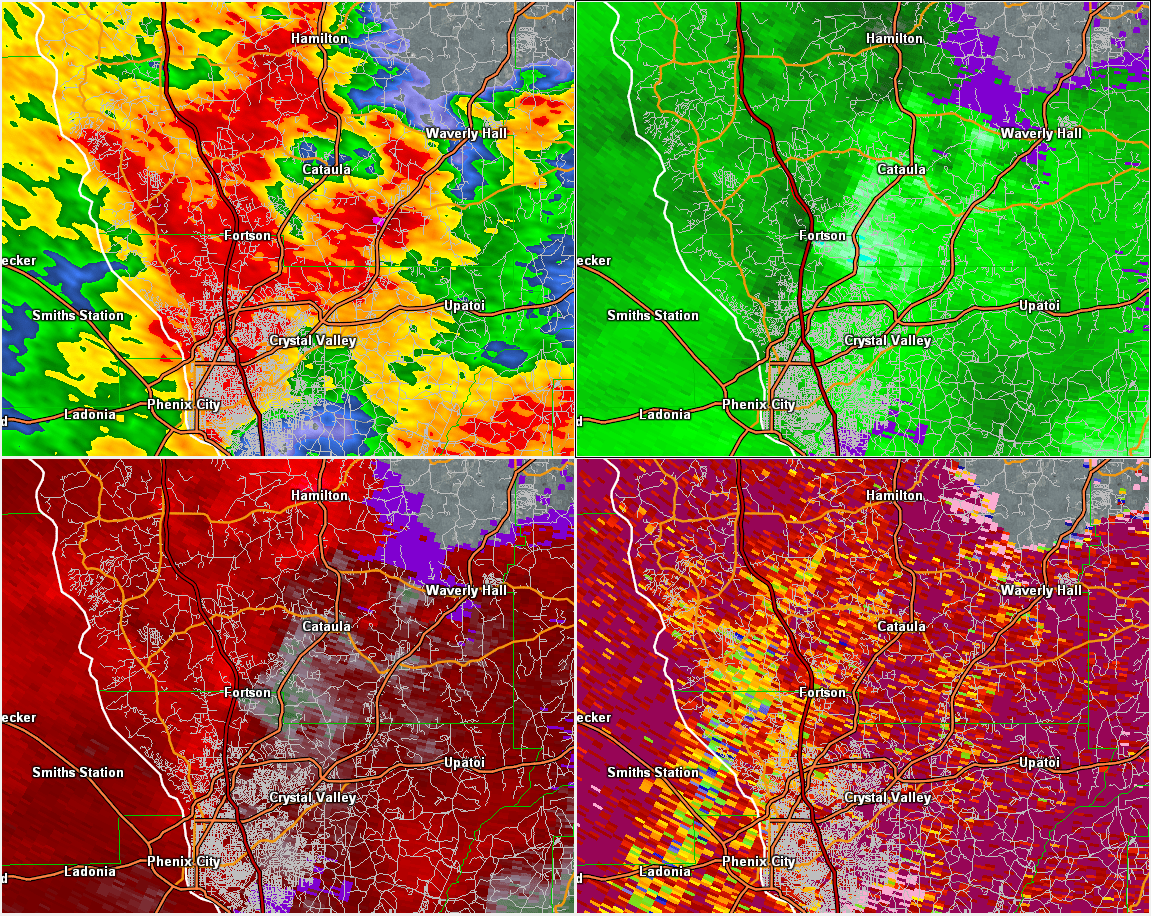
| 4 Panel radar image of the storm just after touching down near Warm Springs. Not any evidence of a TDS signature from the bottom right panel, but there was a weak rotation noted briefly in the radar. Top Left-Reflectivity, Top Right - Base Velocity, Bottom Left - Storm Relative Velocity, Bottom Right - Correlation Coefficient. |
Harris County:
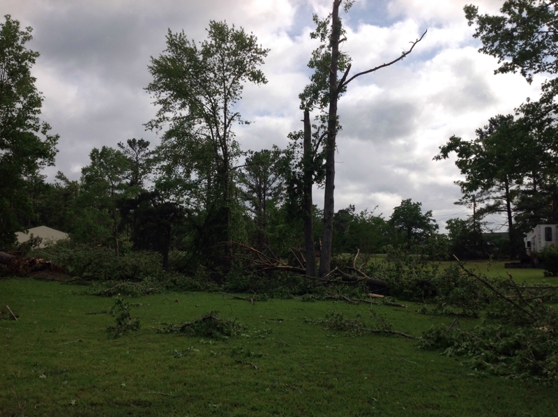
Starting Southwest of Almond road in Muscogee county...a burst of thunderstorm winds resulted in several medium-sized pine trees snapped or uprooted. The pocket of damaging winds accelerated northeast...Snapping and uprooting additional medium to large trees in a concentrated area between Shenandoah Drive and Jones Road. Some structural damage was seen in this area -- a large camper was flipped on its side and a portion of a plywood/sheet-metal roof was torn off. All the debris/damage was blown down in mainly one direction - the primary direction of the storms which was southwest to northeast. Additional trees were Blown down along the grey smoke loop...Just west of hwy 27...southwest of the town of Cataula.
|
||||||||||||||||||||||||
|
 |
| Map of the core of the wind damage in Muscogee and Harris counties. More sporadic wind damage occurred northeast toward Cataula as well as southwest of the path shown across I-185 mostly confined to tree damage. |
 |
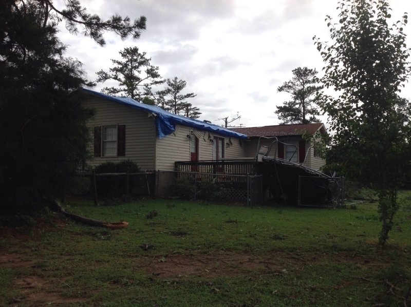 |
| Camper overturned near the intersection of Shenandoah Drive and Jones Road | Home with roof damage and tree damage nearby along Jones Road |
 |
 |
| Tree Damage in southern Harris County | Tree worker helping to clear trees next to a house on Jones Road |
 |
| 4 Panel radar image of merging storms just as the damage was occurring in northern Muscogee county. It is likely that a downburst occurred in that region as a cell from the southeast merged with the line of storms moving in from the west. Top Left-Reflectivity, Top Right - Base Velocity, Bottom Left - Storm Relative Velocity, Bottom Right - Correlation Coefficient. |


 Follow us on YouTube