by Jim Noel, Barry Gooden, Gary Beeley and Terry Murphy
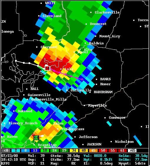
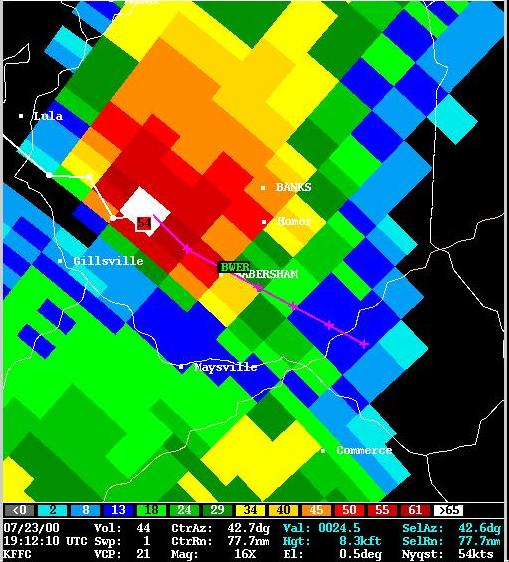
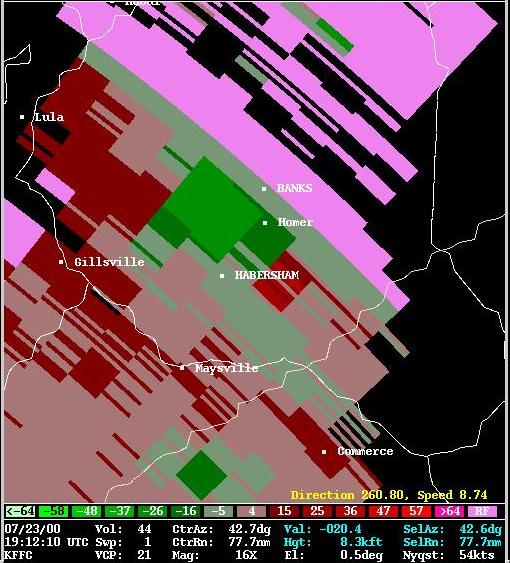
On Sunday, July 23, 2000 a severe thunderstorm moved across Dawson, Hall, and Banks counties. There was considerable wind damage across all three counties along with some large hail. There were also reports of tornadoes. A Storm Survey Team from the National Weather Service Forecast Office in Peachtree City visited the area and reviewed all available data the next day. The following are its findings:
Storm formed 6 miles southwest of Jasper in Pickens County between 1230 pm and 1 pm EDT
Brief F0 / F1 tornado touchdown near Murrayville between 200 pm and 210 pm EDT. Path was 50 to 100 yards wide.
Reports of highs winds, trees down and golf ball size hail across northern Hall County 200 pm to 250 pm EDT.
Second brief F0 / F1 tornado touchdown 3 miles south of Lula around 250 pm. Around half a dozen homes damaged. Path was 50 to 100 yards wide.
Damage Summary...
Finally, brief tornado touchdown about 5 miles west to southwest of Homer near Welborn Road around 310 pm EDT. Minor damage to one home. Path was up to 100 yards wide and lasted for about 1 to 2 miles.
At least one to two dozen homes damaged...mostly from falling trees.
Hundreds of trees snapped or uprooted. Several were very large hardwood trees.
Damage to power lines and telephone lines.
Apparently no deaths and only one unconfirmed injury in Banks County.
 for damage photos


 Follow us on YouTube