Thunderstorms Bring Hail and Wind Damage to a Wide Area of Georgia
May 2, 2003
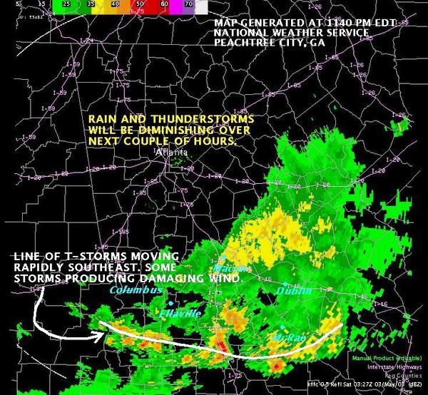
On Friday May 2, 2003 what began as a couple of lone afternoon thunderstorms in the northwest corner of Georgia, evolved into a solid line of dangerous storms across the state's midsection by around midnight. The storms in the north formed up into a broken string of storms that gradually evolved into two lines of storms. Then these two lines eventually merged into one. Storms moved south as this evolution took place.
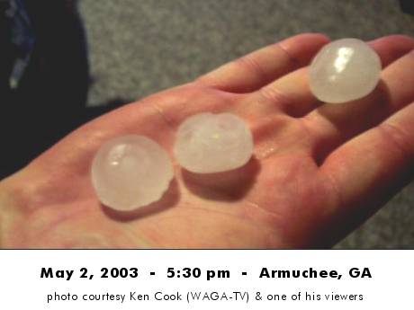
The air over the state was unstable, due to afternoon heating. Conditions were favorable for storms to produce large hail - and that is what they began doing during the 4 o'clock hour. At times the storms also produced downbursts, which resulted in localized wind damage. One of the strongest storms dropped hail the size of baseballs near Trion in Chattooga County. By day's end there would be many reports of hail the size of nickels and pennys or larger.
After sunset conditions became favorable for the thunderstorms to produce more wind damage and somewhat less hail. Indeed, This is what was observed.
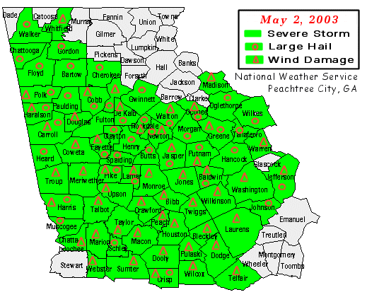
To see how much of the state was affected, see map below.
Nearly the entire state was treated to nature's light show.
The National Weather Service Forecast Office in Peachtree City issued 116 warnings during this event. 72 counties in our service area reported damage. Several counties were hit more than once.
| How did this RV get into this position? |
RV was backed against tree
when strong winds uprooted it |
an "uplifting" experience |
![[ How did this RV get into this position? ]](/images/ffc//events/stm050203/dmg50203asm.jpg) |
![[ RV was backed against tree when strong winds uprooted it ]](/images/ffc//events/stm050203/dmg50203bsm.jpg) |
![[ an 'uplifting' experience ]](/images/ffc/dmg50203csm.jpg) |
Photos courtesy Tim Ketterson, Sr. WA4TIW and StormHunter.net .
|


![[ How did this RV get into this position? ]](/images/ffc//events/stm050203/dmg50203a.jpg)
![[ RV was backed against tree when strong winds uprooted it ]](/images/ffc//events/stm050203/dmg50203b.jpg)
![[ an 'uplifting' experience ]](/images/ffc//events/stm050203/dmg50203c.jpg)
 Follow us on YouTube