As a follow-up to last nights severe weather event (June 3 - 4, 2000) in portions of southeast South Dakota...the National Weather Service conducted a damage survey in Clay and Union counties. The survey was mainly centered around the communities of Vermillion and Burbank in southern Clay county.
Besides tree damage in Vermillion...a picnic shelter was also destroyed in Prentice Park due to falling limbs from surrounding trees (Figures 1 & 2). All of the damage that was witnessed correlated well with the reports of strong straight-line winds that were received by the National Weather Service last night. Along with the strong winds...a few funnel clouds were also spotted but did not touch down and were not responsible for any of the damage. This finding was based upon not only the damage survey but also on eyewitness accounts from local law enforcement and the public.
Based upon the damage survey...the damage resulted from 70 to 75 mph wind gusts during the first severe thunderstorm approximately around 8:05 PM. However...a second severe storm moved through the area around 2:00 AM that added insult to injury with a second round of 60 to 65 mph wind gusts. This caused even more tree damage (Figures 3, 4, & 5) in Vermillion and other areas of southern Clay...southern Union...and northern Dixon counties.
Todd Heitkamp
Warning Coordination Meteorologist
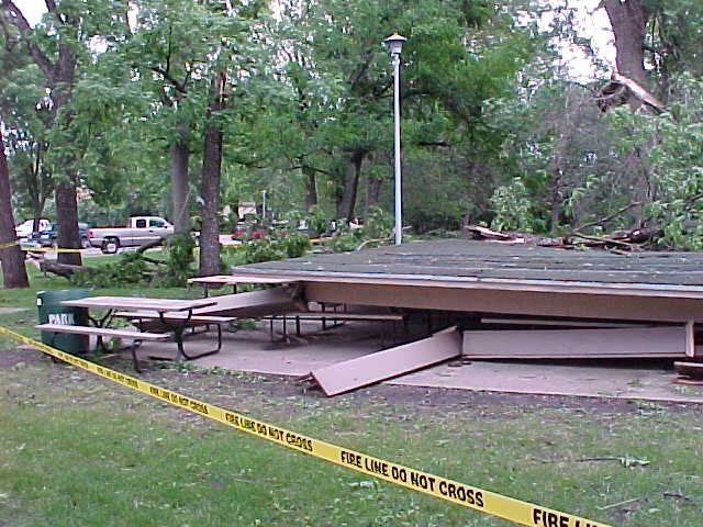 |
Figure 1. Picnic shelter in Prentice Park. Note the legs of the shelter pointing to the south (to the right in picture) indicating winds hit the roof from the northwest forcing the roof to collapse to the south on top of the legs. Also note the direction the tree limbs are laying on the ground. This further indicates strong winds from the same direction. |
| Figure 2. The south end of the picnic shelter showing the same things as in Figure 1. | 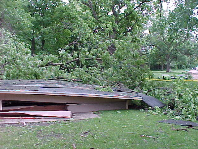 |
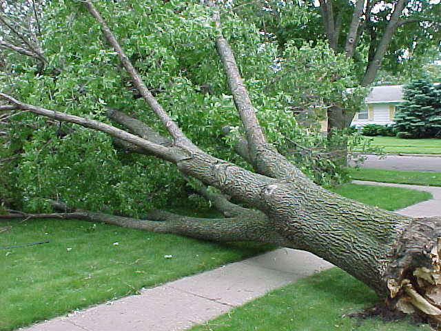 |
Figure 3. Large tree down. Cosmetically the tree looks healthy. But upon closer look (Figures 4 and 5), one notices something different. |
| Figure 4. Closer view of the inside of the tree. Note dark brown area in center of tree indicating that the tree was old and rotten making the tree susceptible to strong winds. | 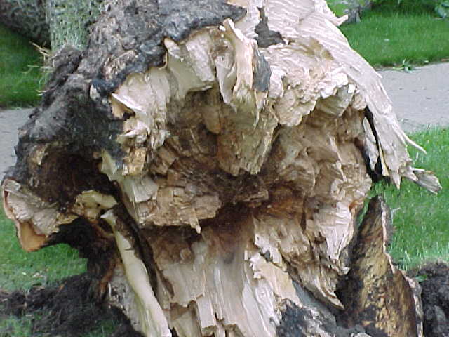 |
| Figure 5. Closer view of the tree root system. Again note the brown color and also note the shallow root system. This tree was first weakened by the evening storm and then downed by the early morning storm even though the second storm produced less severe winds. | 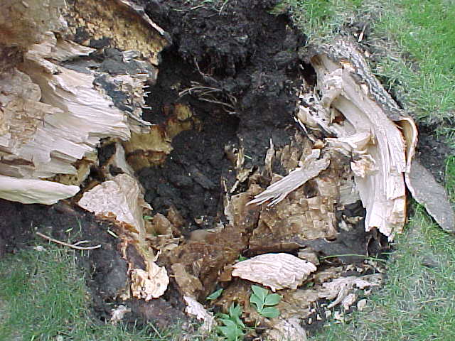 |


 Weather Story
 Weather Map
 Local Radar
 Follow us on YouTube