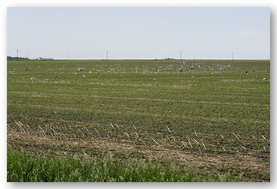
Twelve tornadoes were confirmed by the National Weather Service in Sioux Falls as a result of severe thunderstorms which moved across northwest Iowa and southwest Minnesota on the evening of June 11, 2008. A description of the damage as well as maps and pictures of some damage are below.
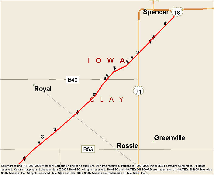
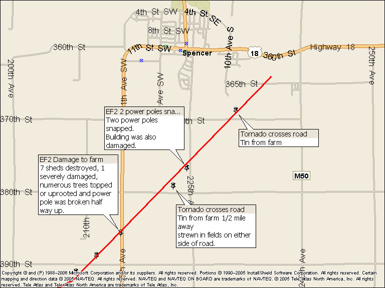
A long track, EF2 tornado, initially touched down 4 miles south of Royal, Iowa at approximately 6:40 pm CDT. This tornado remained on the ground for approximately 20 minutes, finally dissipating 1 mile east of Spencer - just south of U.S. Highway 18. The tornado path was approximately 13 miles long and crossed Highway 71 approximately 3 miles south of Spencer, Iowa. Based upon damage, the width of the tornado reached up to 100 yards. EF2 winds are estimated to be around 115 mph.
Eight farmsteads were affected by the storm with outbuildings sustaining various amounts of damage including several sheds destroyed by the tornado. In addition, numerous power poles were either broken or leaned over by the tornado as it moved across Clay County. The tornado was rated EF2 based upon damage in 3 different areas. One damaged farmstead was 3 miles south of Royal. Numerous grain bins east of Royal received EF2 damage. Finally another farmstead received EF2 damage along Highway 71 south of Spencer. In the latter case, 7 sheds were destroyed and one was severely damaged in addition to numerous trees being broken at the base. Only the home was spared any damage.
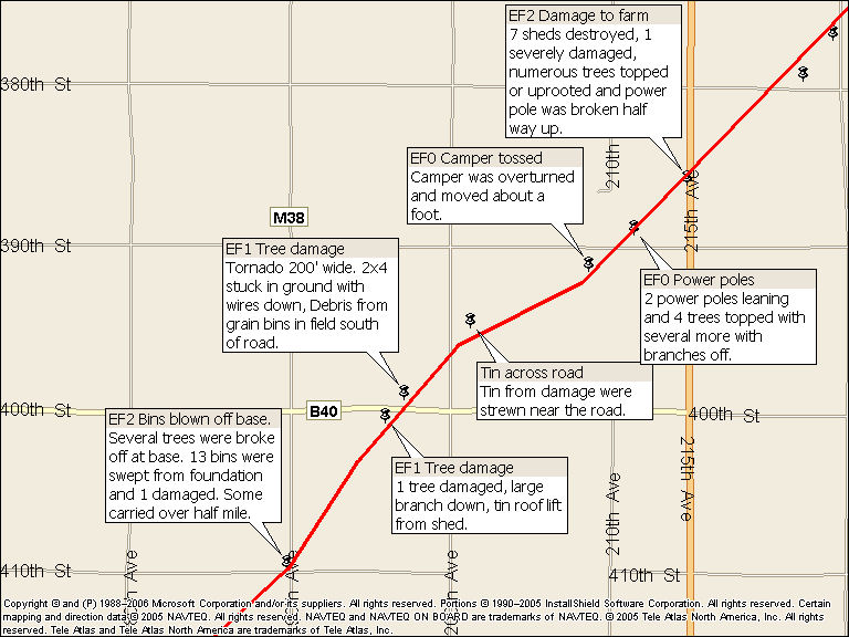
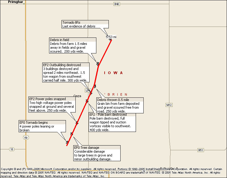
An overview of the damage path for the EF2 tornado in Clay County, Iowa is below.
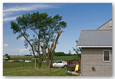
Specific damage near Royal, Iowa
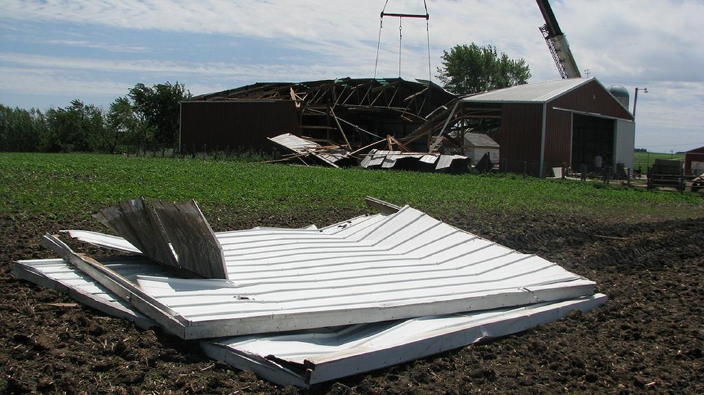
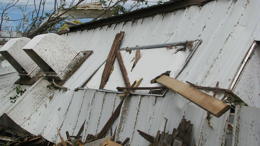
Machine shed significantly damaged from tornado. Tornado moved from right to left in the picture. Bolted door (seen in foreground) failed resulting in roof failure.
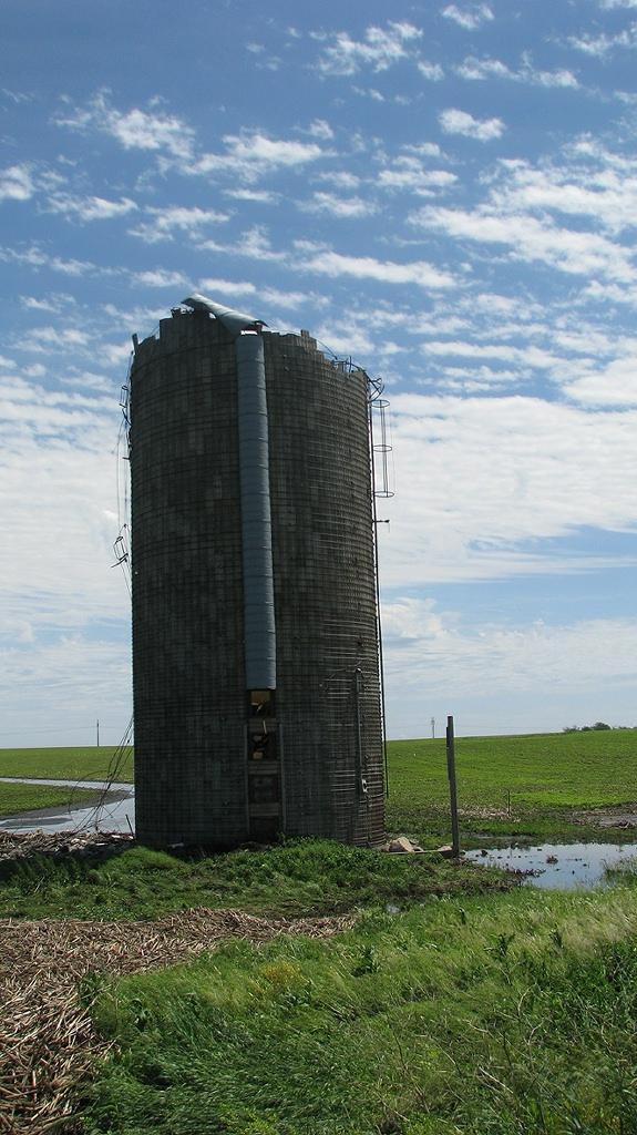
The tornado continued to the northeast removing the top of this silo. The tornado also produced damage to an adjacent farmstead.
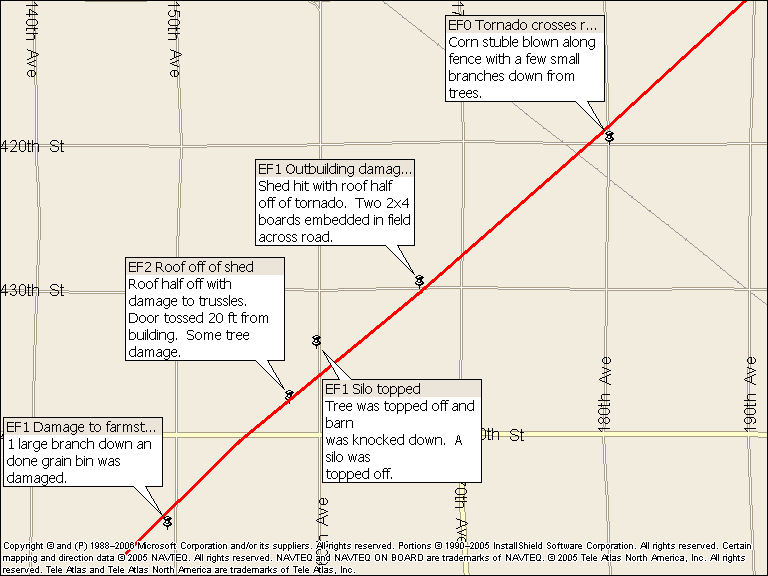
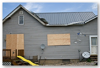
Specific damage information south of Spencer, Iowa.
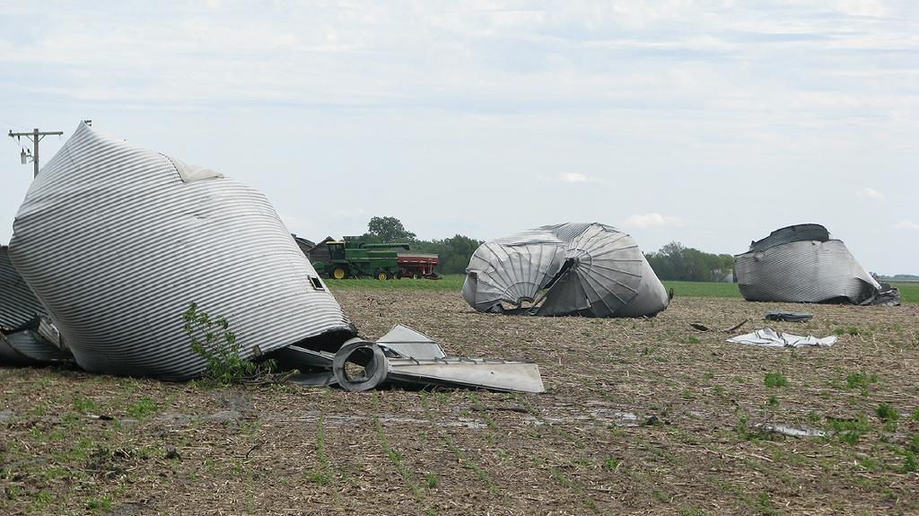
Numerous grain bins were blown downwind. Concrete walls on a pit silo were also broke by tornado.
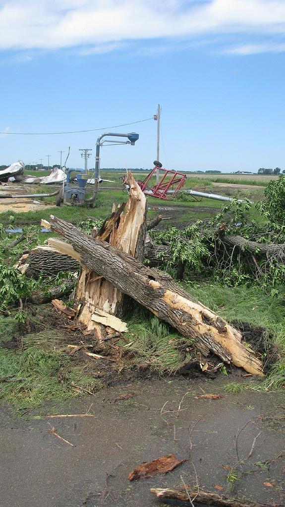
Extensive tree damage occurred to a small shelter belt of cottonwoods adjacent to the grain bins.
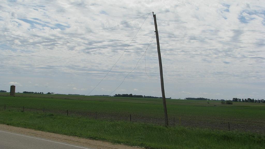
Power lines removed from two sections along B-40. Power poles were shifted in the ground but not broke.

2 x 4 embedded into the ground.
Damage path and information to the south and east of Spencer, Iowa.
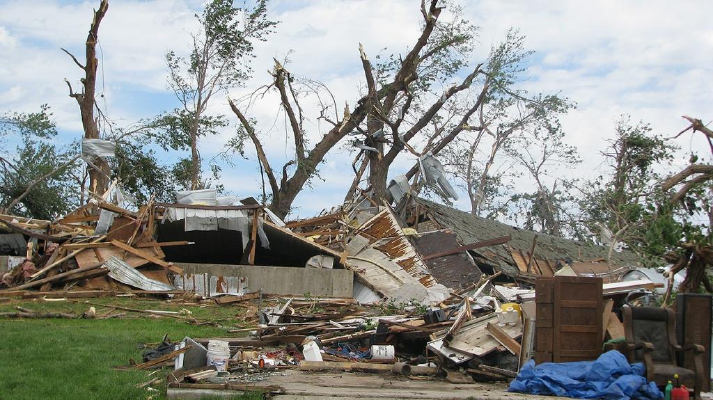
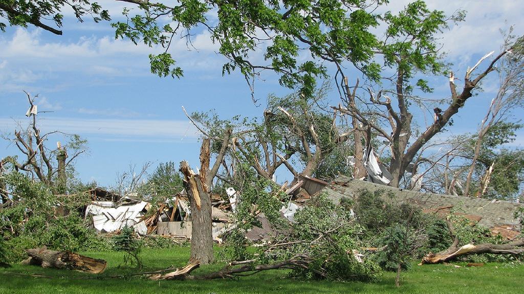
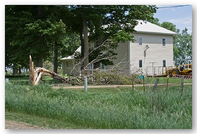
Extensive damage to trees and sheds at a farmstead along highway 71, approximately three miles south of Spencer, IA.
Damage a few miles south of Spencer along Highway 71.
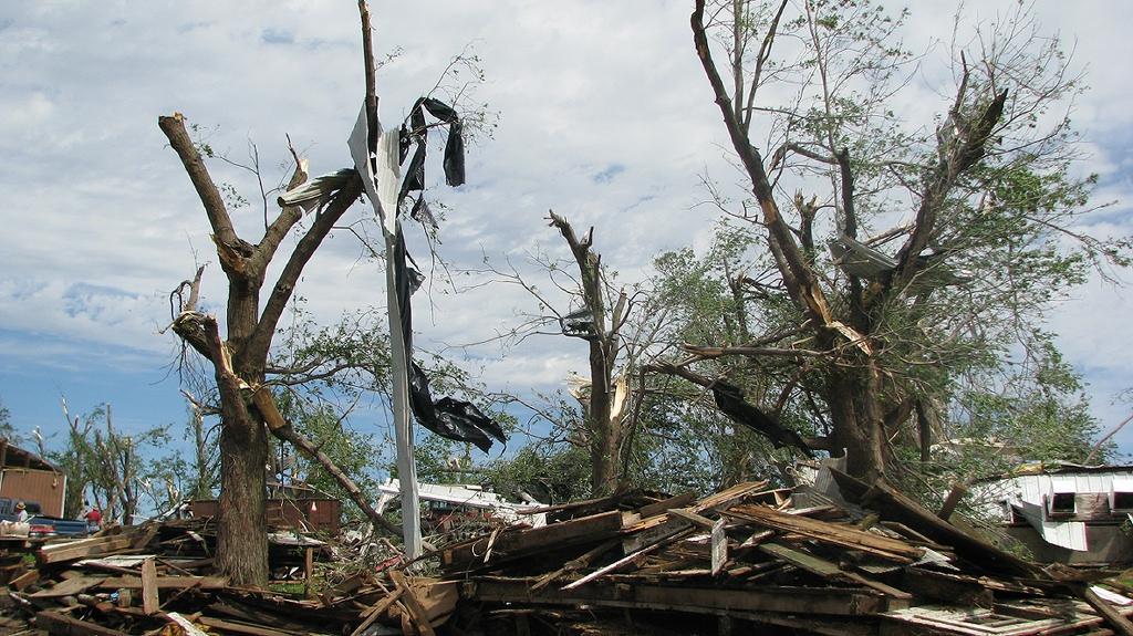
2x4s embedded into a destroyed shed.
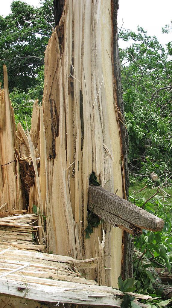
2x4 embedded into a tree trunk.
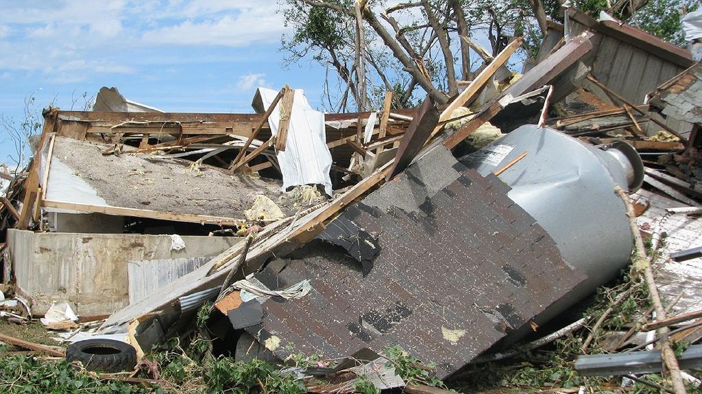
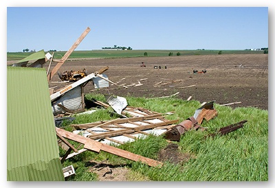
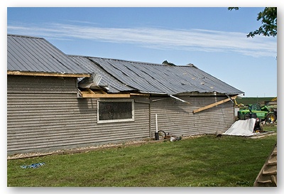
One of several sheds destroyed just south of Spencer.
Shed and tree damage.
A second EF2 tornado touched down approximately 5 miles east of Paullina, Iowa at 6:06 pm CDT. This tornado remained on the ground for 10 minutes, finally dissipating 5.5 miles east-southeast of Primghar, Iowa. The tornado path was 5.5 miles long. Based upon damage the width of the tornado reached up to 300 yards. EF2 winds in this area are estimated to be around 120 mph.
Three farmsteads were affected by the storm, with outbuildings sustaining various amounts of damage including several sheds destroyed by the tornado. In addition, numerous large power poles were either broken or leaned over by the tornado as it moved across southeast O'Brien County. The tornado was rated EF2 based upon damage to 2 farmsteads along county road L54.
An overview of the damage and path for O'Brien County are on the map below.
This tree and home were damaged about half a mile from the initial touchdown of the tornado in O'Brein County in Northwest Iowa.
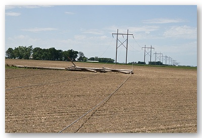
The tornado snapped large power poles off the base.
Heavy equipment was removed from this outbuilding and carried nearly 1/2 of a mile before coming to rest in a farm field.

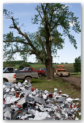
Tin from a nearby outbuilding was shredded into small pieces.
This tree and home were damaged by the tornado south and east of Primghar. Mud and small pieces of debris battered the house as the tornado passed.
Debris carried downwind by the tornado.
In southwest Minnesota, two EF1 tornadoes were surveyed. The first EF1 tornado touched down 5 miles northeast of Wilmont, Minnesota in Nobles County around 5:46 pm. This tornado had a path length of approximately 4 miles and was on the ground for 8 minutes - dissipating around 5:54 pm. This tornado affected two farmsteads, one in Nobles County and a second in Murray County and did damage to outbuildings on both farms. In addition, there was extensive damage to trees within a shelter belt approximately 1 mile southwest of Wirock, Minnesota. Maximum winds were estimated to be around 90 mph with this tornado.
A map of the path and damage northeast of Wilmont, Minnesota are below.
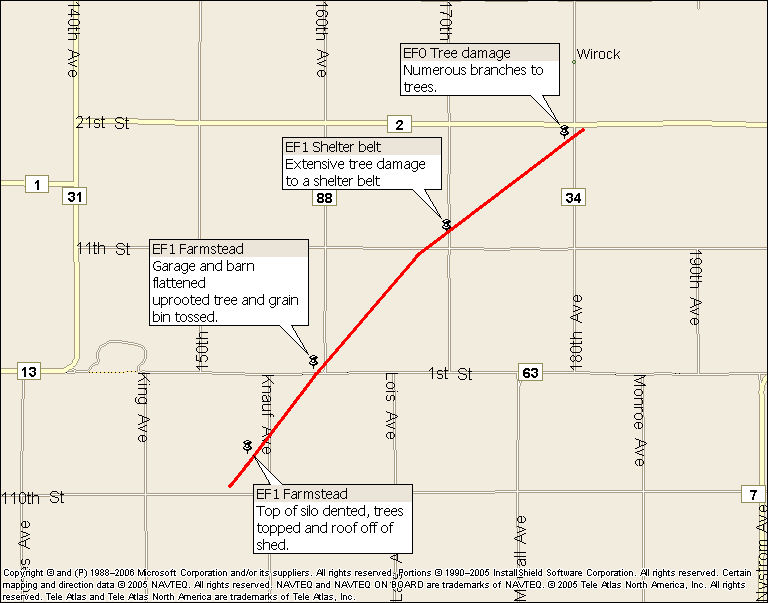
A silo and several sheds were damaged by a tornado near Willow Lake in southern Murray County.
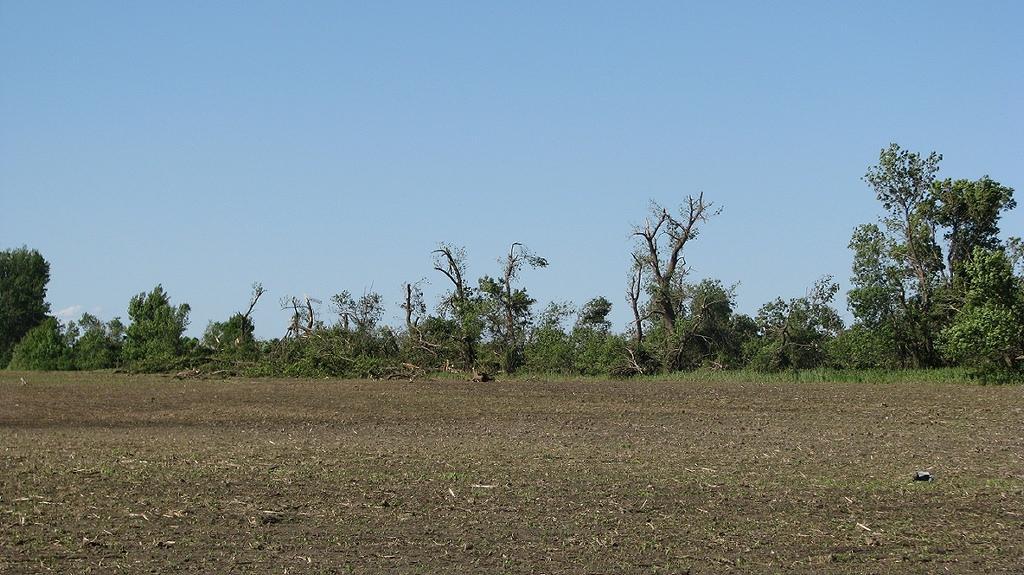
Damage to shelterbelt.
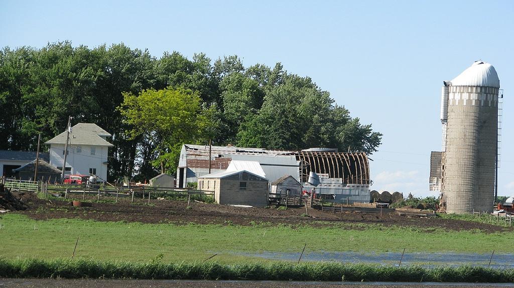
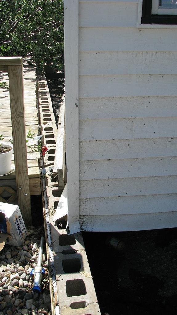
The second EF1 tornado was observed north of Fulda, Minnesota in Murray County, Minnesota at 6:05 pm. This tornado touched down 2 miles north of Fulda, Minnesota and had a path length of approximately 3 miles. The tornado was on the ground for 5 minutes and lifted approximately 4 miles north-northeast of Fulda at 6:10 pm. The tornado did extensive damage to a farmstead 2 miles north of Fulda on Highway 59. A woman was injured when the roof came off her house and a wall collapsed as she took shelter in a closet. In addition, two sheds were destroyed on the property as the roof from the home went through a shed. Another home and two other outbuildings received minor damage on the farmstead. There was also extensive damage to trees. Debris from the farm was carried over a mile.
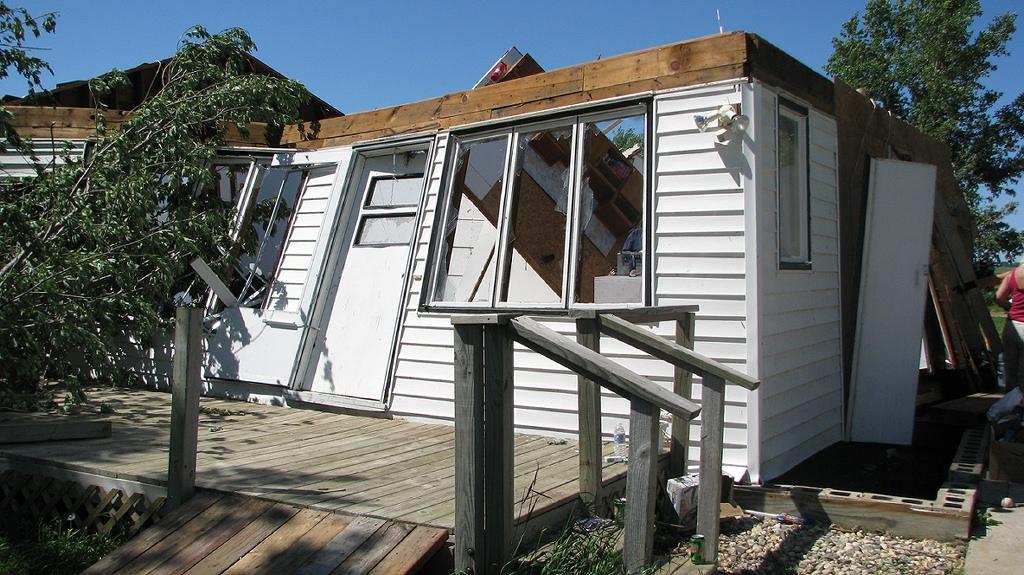
Home significantly damaged by tornado just north of Fulda, Minnesota.
This home was shifted several feet off its foundation, but was only anchored with nails.
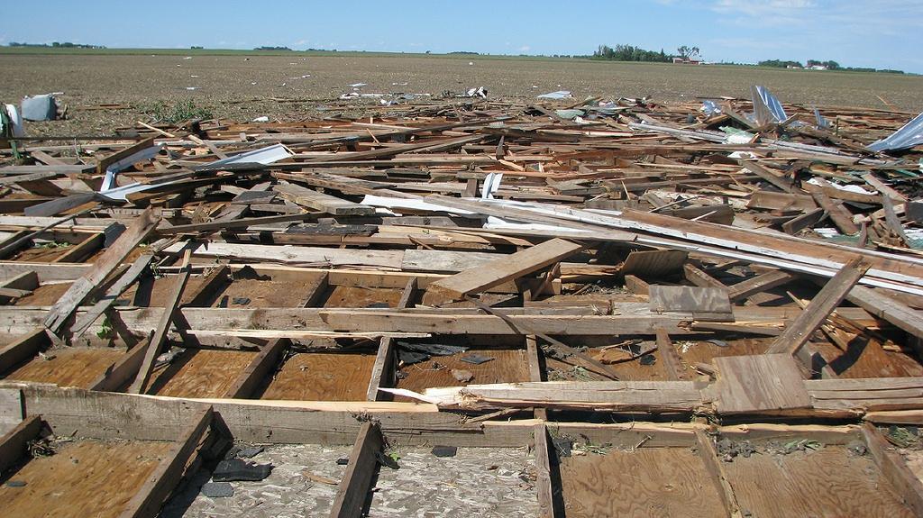
A large portion of a shed was carried 50 to 100 feet into a farm field.
A map of the path and damage near Fulda, Minnesota are below.
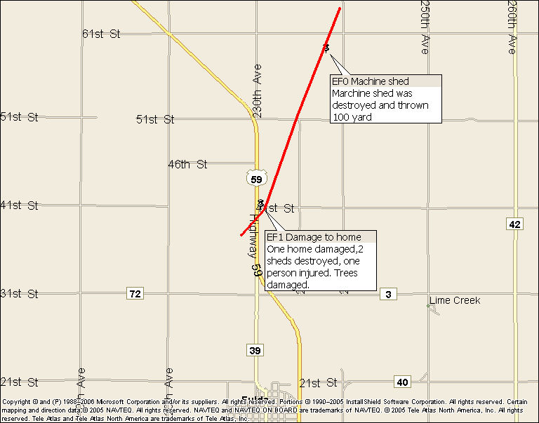
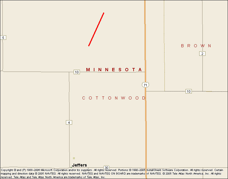
A third tornado, EF0, was also reported in southwest Minnesota. This tornado touched down approximately 6 miles north of Jeffers, Minnesota in Cottonwood County around 6:45 pm. This tornado was on the ground for 2 miles for less than 5 minutes. This tornado did minor property damage as well as knocking branches off of several trees.
A map of the path and damage near Jeffers, Minnesota are below.
Seven other tornadoes were confirmed by the National Weather Service in Sioux Falls on June 11.
0.5 mile south of George, Iowa - EF0
3 miles northwest of Ashton, Iowa - EF0
5 miles west of Pierson, Iowa - EF0
1 mile east of Paullina, Iowa - EF0
4 miles southwest of Sutherland - EF1 - damage to outbuilding
2 miles north of Dickens, Iowa - EF0
2 miles north of Webb, Iowa - EF0
ENHANCED FUJITA SCALE
EF0...65 TO 85 MPH
EF1...86 TO 110 MPH
EF2...111 TO 135 MPH
EF3...136 TO 165 MPH
EF4...166 TO 200 MPH
EF5...201+ MPH


 Weather Story
 Weather Map
 Local Radar
 Follow us on YouTube