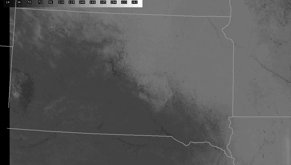
With the recent warming trend across the area, especially along and west of the Missouri River, a large difference in snow cover has developed across the Plains. While much of western South Dakota and Nebraska have little or no snow cover, several inches of snow blanket the ground over much of eastern South Dakota as well as Minnesota and Iowa. The visible satellite picture from 2 pm CST, Tuesday, January 20, shown below, illustrates this difference. The darker areas on the satellite picture show where there is little or no snow cover. This includes Rapid City, Philip, and Lake Andes. Meanwhile, the white areas is where snow still covers the ground including Sioux Falls, Brookings, Watertown, Aberdeen and Mobridge. Pierre, Chamberlain and Yankton are at the western edge of the snow cover.
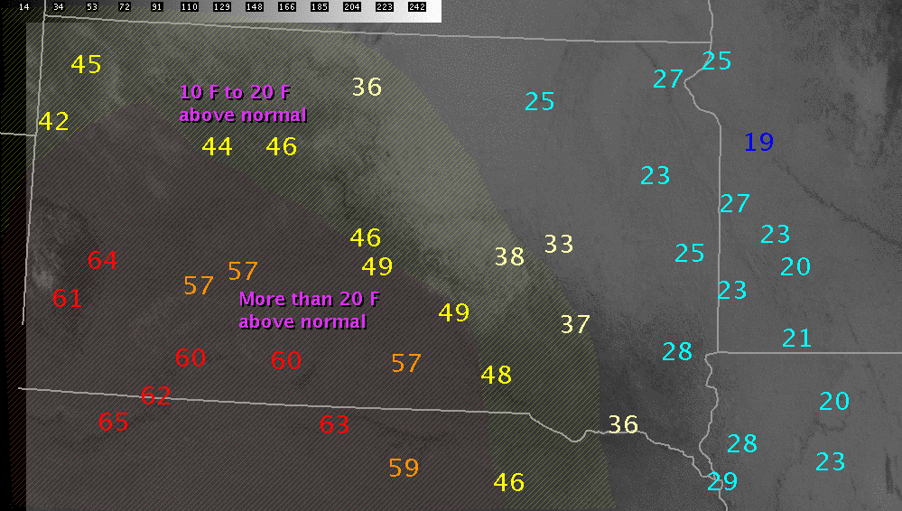
The image below displays the high temperatures from Tuesday, January 20 on top of the satellite picture. Shaded are areas where the temperatures was 10 degrees (white) and 20 degrees (red) above normal. In southwest South Dakota and western Nebraska, high temperatures were in the 50s and 60s. However, over the deeper snow cover of eastern South Dakota, Minnesota and Iowa, the high temperature was only in the 20s. For western South Dakota, this placed high temperatures from 10 to 30 degrees above normal. Over far eastern South Dakota into Minnesota and Iowa, highs were approximately 5 degrees above normal.
In addition to the snow cover, which reflected much of the sunlight back into space and slowed the warming, very warm air aloft was able to reach the surface across western South Dakota. This is because westerly flow off the higher terrain in Wyoming sinks to the surface as it moves to lower elevations. As air sinks it will warm and the result is temperatures well above seasonal normals. The fact that winds were out of the northwest at 20 to 40 mph this afternoon helped bring this warm air to the surface more efficiently.


 Weather Story
 Weather Map
 Local Radar
 Follow us on YouTube