
Highlights of the 2024 Total Solar Eclipse as it crossed North and Central Texas on Monday April 8th. Read More >
What happened?
On the afternoon and evening of April 11th, 2016, an intense supercell thunderstorm traversed North Texas roughly from Wichita Falls to Tyler. This storm will be remembered for the massive hail it produced, especially in the city of Wylie where 80% of homes were affected and over $300 million in damage occurred. Fortunately, only a few minor injuries were reported.
This review primarily explores the portion of the event located within the NWS Fort Worth forecast area, although the thunderstorm developed and dissipated outside of this geographic area. Explore the links below for an in-depth review of this event.
Storm Reports
There were more than 50 severe hail and wind reports associated with this thunderstorm, many of which are plotted below. The storm's east-southeast path can be seen as it tracked roughly from Bowie to Canton.

Environmental Setup
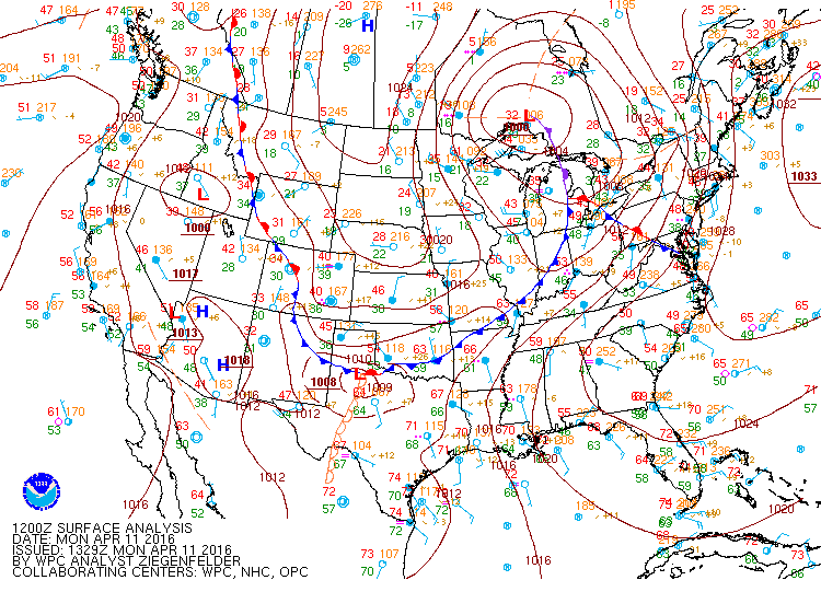
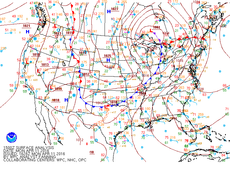
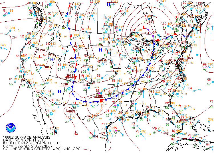
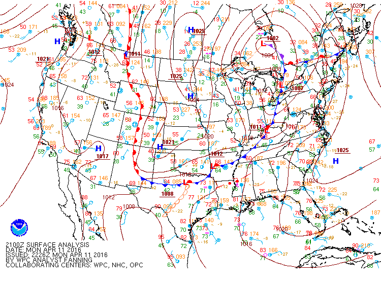
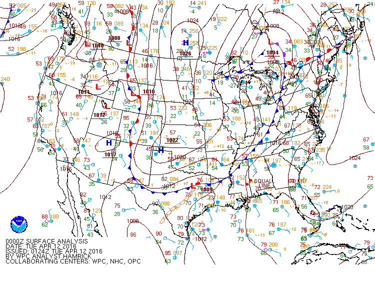
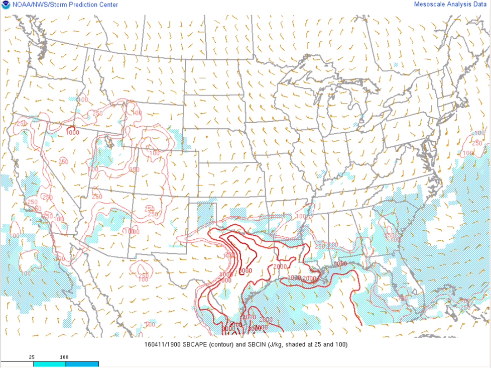
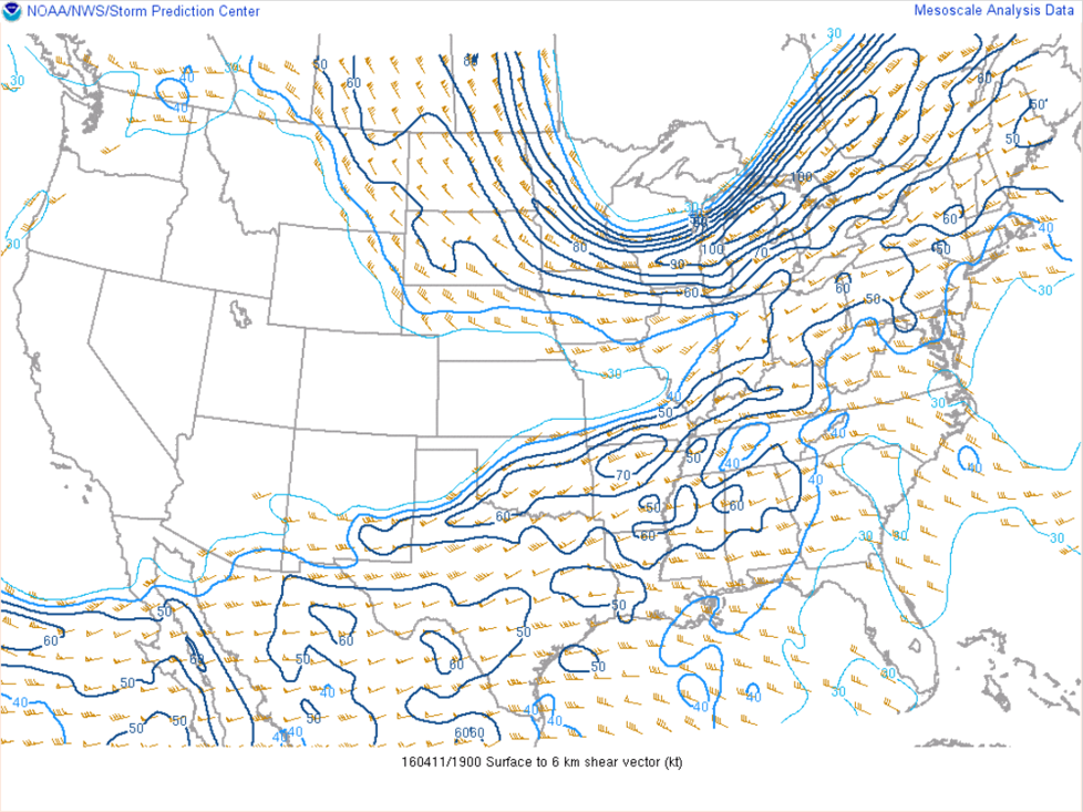
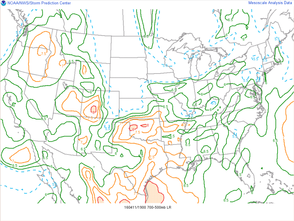
An environment favorable for supercell thunderstorms was in place on the afternoon of April 11th. Ample instability was available along and south of a cold front and east of a dryline. In addition, strong wind shear allowed storms to develop rotating updrafts, hence the supercellular nature of the isolated storms that formed.
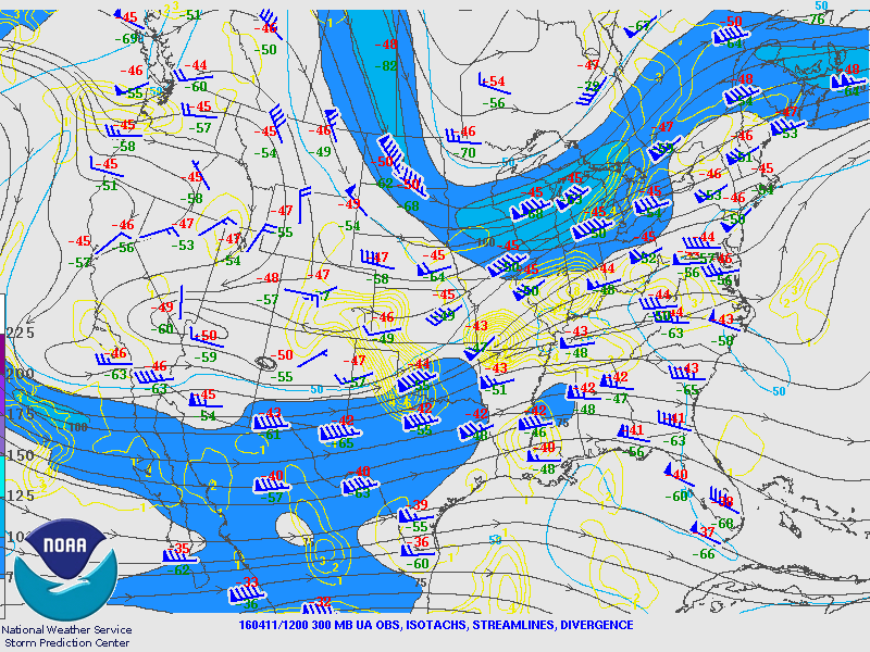
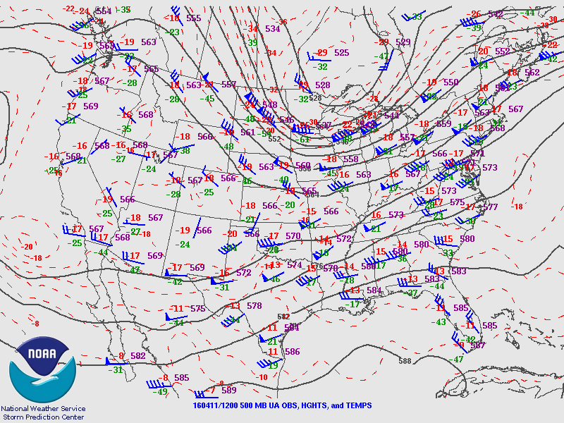
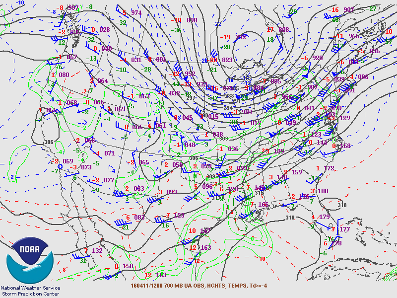
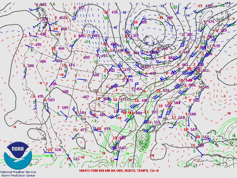
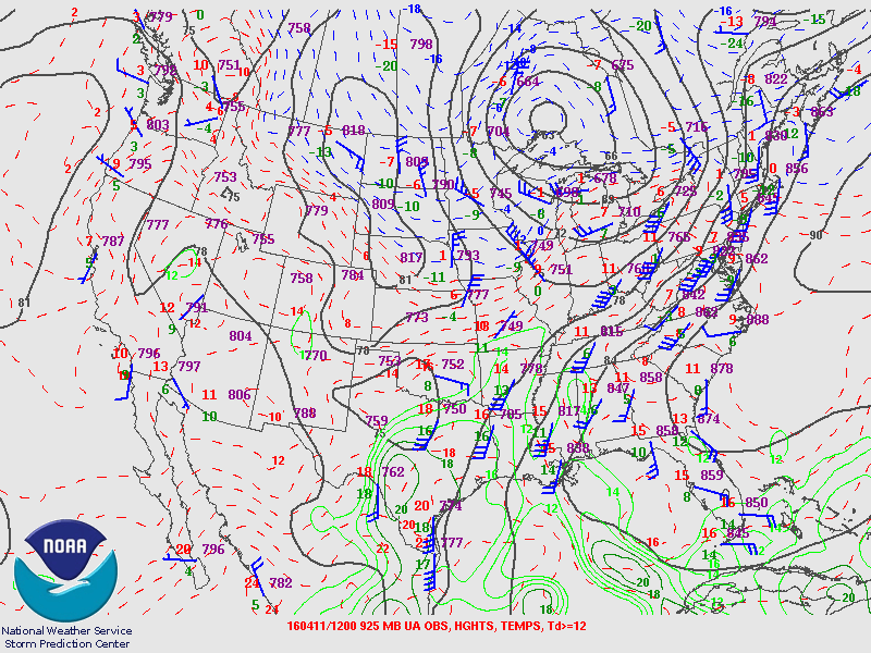
Upper-air analyses, WPC surface analyses, and select SPC Mesoanalysis graphics are below. Click to enlarge image.
|
300mb 12z |
500mb 12z |
700mb 12z |
850mb 12z |
925mb 12z |
|
Sfc 12z |
Sfc 15z |
Sfc 18z |
Sfc 21z |
Sfc 00z |
|
Sfc CAPE 19z |
Wind Shear 19z |
Lapse Rates 19z |
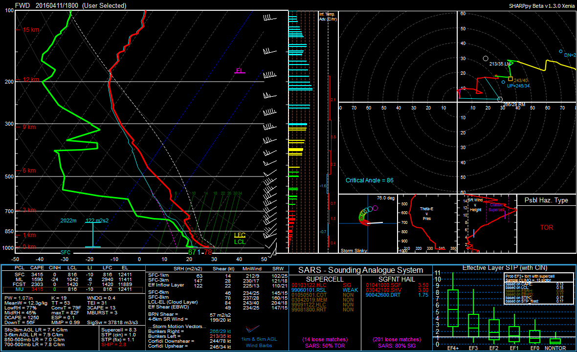
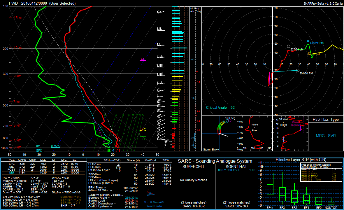
Weather Balloon Data
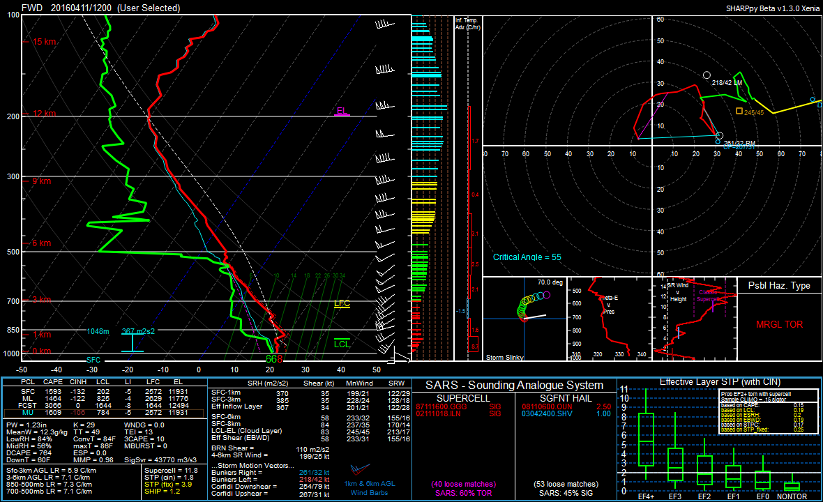
A special weather balloon launch was conducted at 18 UTC which revealed very large amounts of instability (over 3000 J/KG of CAPE) and strong deep-layer wind shear (over 45 kts). In addition, very steep mid-level lapse rates (7-8º C/km) and a wet bulb zero height around 8000 ft suggested that very large hail would be possible.
Fort Worth soundings from 12, 18, and 00 UTC are below. Plotted with SHARPpy toolkit, click to enlarge image.
|
12 UTC |
18 UTC |
00 UTC |
×
×
×
Radar Analysis
This supercell maintained an incredibly impressive radar presentation throughout its life cycle with classic supercell attributes including a hook echo and weak echo region (and bounded weak echo region at times). A series of images from the KFWS radar depicting these features and a discussion of their importance are below. All images created using GR2Analyst.
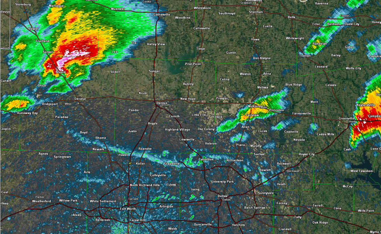
Base reflectivity loop
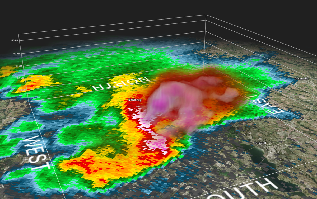
As the storm entered the Sunset, TX area, it displayed classic supercell attributes at low levels. In the middle and upper levels of the storm, the reflectivtiy core was positioned over the clear air region in the low levels. This overhang of very high reflectivities aloft was indicative of a very strong updraft supporting hail up to baseball size.

Vertical reflectivity loop (0.5°, 1.8°, 4.0°) at 2113 UTC
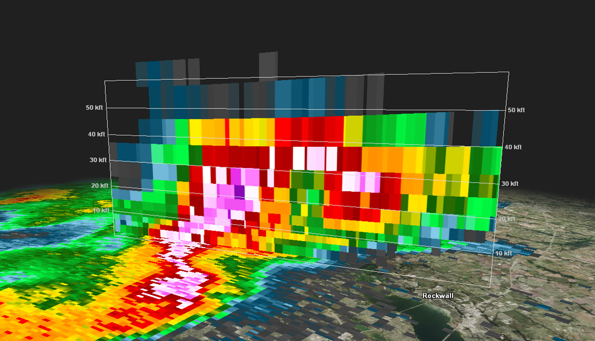
As the supercell moved into Collin County, it reached its maximum intensity. 60dbz echoes were observed to nearly 40,000 ft. A bounded weak echo region was positioned directly over the city of Wylie where the updraft of the supercell likely maintained vertical speeds exceeding 100 mph. This bounded weak echo region was observed as high as the 5.1 degree elevation scan from the FWS radar which is approximately 30,000 ft above ground level in this location.

Vertical reflectivity loop (0.5° to 8.0°) at 2300 UTC
|
Reflectivity cross section as storm was located over Wylie. Area of weaker reflectivity beneath the higher reflectivities aloft indicative of a very strong updraft. |
Reflectivity 3-dimensional volume depicts a massive hail core suspended above the supercell's updraft as storm was located near Wylie. |
Why didn't this storm produce a tornado?
You may have noticed the southward-moving "fine lines" on the radar loop above. These lines marked the leading edges of a shallow cold front and an outflow boundary which rushed out ahead of the storm. This shallow cooler and drier air undercut the storm's inflow of warm, moist air which means this supercell was "elevated" above this shallow cooler air for most of its life span. In order for a tornado to form, the storm would have needed to be ahead of this cold front with warm and moist air between the storm's base and the ground. Once the supercell was undercut by the cold front, the potential for a tornado to occur was virtually eliminated.
The drastic change in the environment brought by the cold front could be seen by analyzing the METAR observation at the Denton, TX ASOS site (KDTO) which is depicted in the images below. As the cold front moved through, the temperature (red) and dewpoint (green) dropped significantly and the surface winds turned to the north; this destroyed the low-level instability necessary for the development of a tornado. Similar revelations of these environmental changes can be gleaned from the FWD 00 UTC weather balloon release (displayed above) as the cold front had moved through the balloon release location by this time.
|
~20 UTC |
~21 UTC |
~22 UTC |
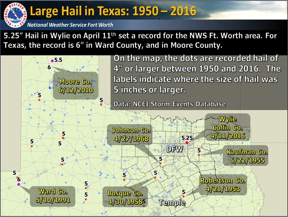
Hail Records
This hail storm set a record for the largest hail stone in the NWS Fort Worth forecast area of 5.25 inches. However, this does not break the record for the largest hail stone in the entire state of Texas. Moore County and Ward County, both in western TX, have each had hail stones measuring 6 inches. Some of the largest Texas hail stones since 1950 are plotted on the map below.
×
×
×
×
×
×
×
×
×
×
×
×
×


 Follow us on YouTube