December 29th, 2006 North Texas Tornado Outbreak Radar Images
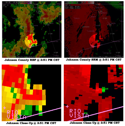
These images show the KFWS reflectivity and storm relative mean
radial velocity data from southern Johnson County at 351 PM CST
on 12/29/06. The supercell thunderstorm that produced the tornado
is centered northeast of Rio Vista. A well defined hook is evident
in the reflectivity image on the east side of the supercell storm.
The storm relative velocity image shows an intense gate-to-gate
circulation feature (red next to green) within the reflectivity hook.
The storm was moving north at around 40 mph and was responsible for
a long-track tornado across western Hill County into central and
eastern Johnson County.
Damage along parts of the path of this long-track tornado justified an F-2 rating, with maximum estimated winds of around 135 mph.
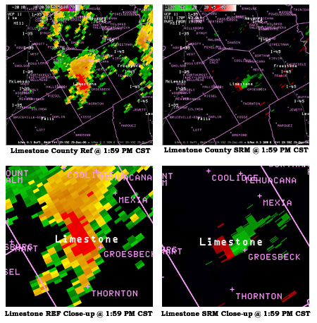
These images show the KFWS reflectivity and storm relative mean radial velocity data from central Limestone County at 159 PM CST on 12/29/06. The supercell thunderstorm that produced the tornado is centered west of Groesbeck.
The storm relative velocity image shows a well-defined circulation couplet (red next to green) just west of the town of Groesbeck in central Limestone County.
The storm was moving north at over 40 mph and was responsible for
producing F-2 tornado damage in a swath across Limestone County.
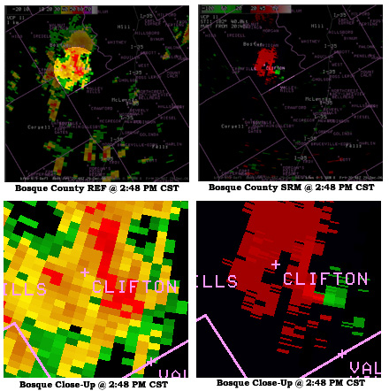
These images show the radar reflectivity and storm relative mean
radial velocity data from Bosque County at 248 PM cST on 12/29/06.
The radar images are from the KFWS (Fort Worth - Spinks) WSR-88D
radar. The supercell thunderstorm that produced the tornado is
shown just east of Clifton at this time. The storm relative velocity
image shows a well-defined circulation couplet (red next to green)
southeast of Clifton in southern Bosque County.
When the Doppler radar shows strong outbound velocities (red colors)
very close to high inbound velocities (green) in the low levels of
the storm, that is evidence of strong low level rotation which could
be associated with a tornado on the ground.
The storm was moving north at 40 mph and was responsible for F-2
tornado damage east of Clifton.


 Follow us on YouTube