
Marginally severe thunderstorms capable of strong wind gusts and hail will be possible Saturday across much of central Texas, and during the afternoon across parts of the Southeast U.S. Heavy rain from thunderstorms may bring isolated flash and urban flooding, along with new and renewed rises on rivers and streams throughout East Texas and the lower Mississippi Valley. Read More >
| Jack County Tornado Climatology Page 1880-Present |
| Click here to return to the North & Central TX Tornado Climatology mainpage |
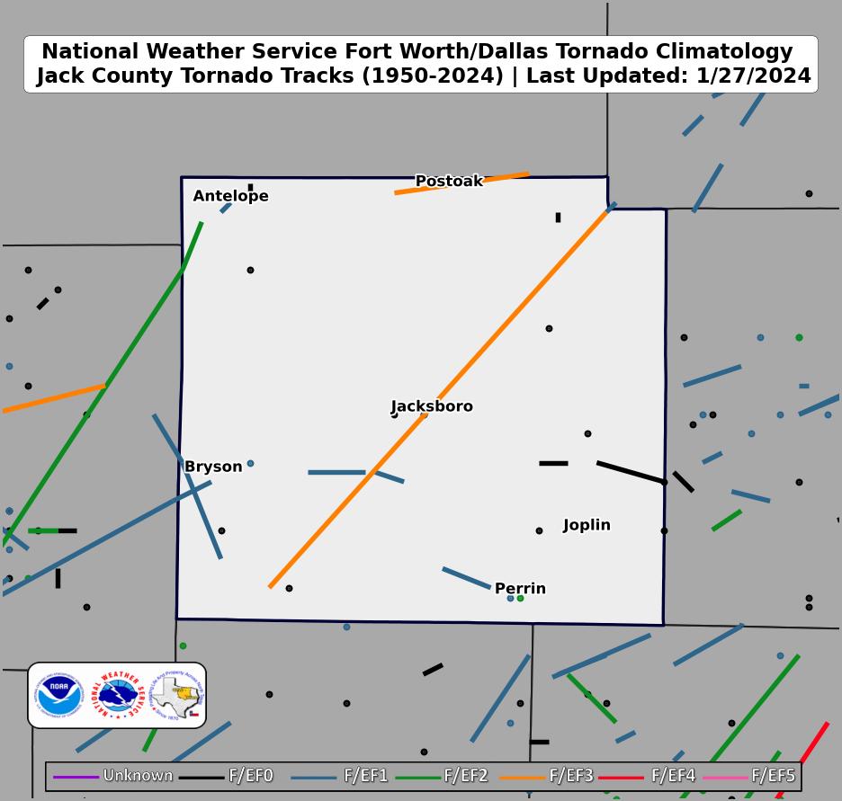 |
| Click map for larger image |
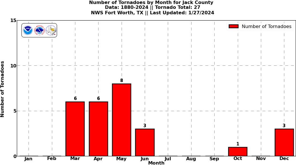
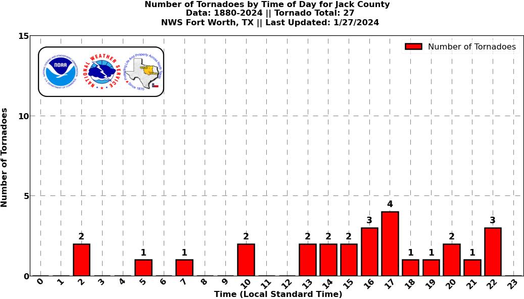
Jack County Graphical Tornado Data |
Tornadoes in Jack Co. by Year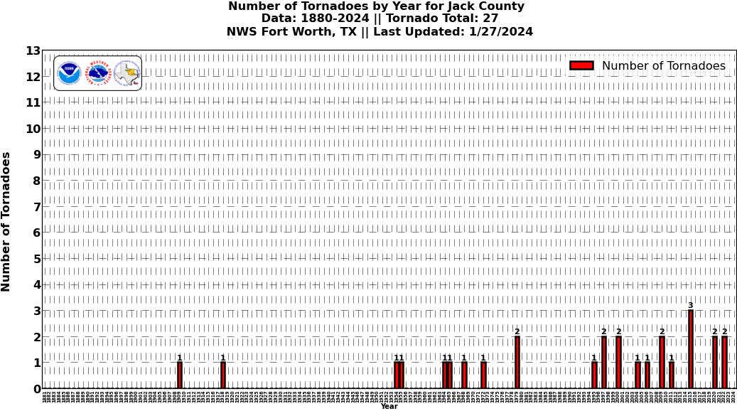 Click image for larger figure |
Tornadoes in Jack Co.
|
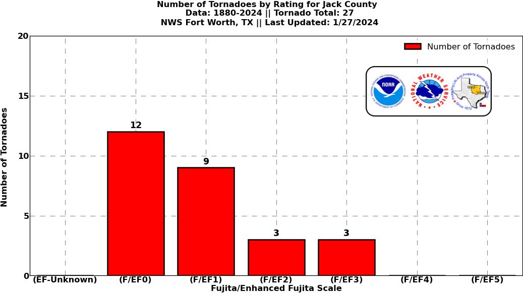
Tornadoes in Jack Co.
|
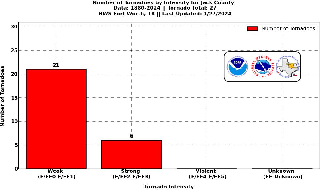
Tornadoes in Jack Co.
|
Tornadoes in Jack Co.
|


 Follow us on YouTube