|
Event Summary:
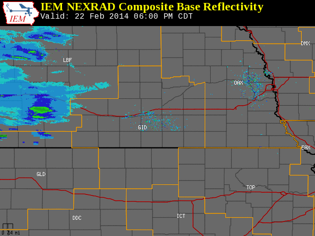
Starting during the evening hours of Saturday, Feb. 22, 2014, and lasting into the morning of Sunday the 23rd, southern portions of the local area received a narrow band of heavy snow generally ranging from 6-9". Unlike many snow events where accumulations are more "uniform" across a larger area, this was truly a case of "all or nothing" as places within the main band received significant accumulations, while places only a few miles north or south of the main band received little to nothing. Generally speaking, this primary snow band within the local coverage area was only 10-15 miles wide, with the heart of it extending along an axis from northern Furnas County through Harlan County, and then east-southeast across northern Phillips and Smith counties in Kansas. Fortunately, winds were not very strong during this event, keeping blowing and drifting to a minimum.
This type of intense, narrow banding is not all that uncommon, and occurs as a result of higher-than-normal atmoshperic instability aligned underneath a strong upper level jet streak. As evidence that most places outside of this heavy snow band received little to nothing, locations such as Hastings and Beloit only reported a non-measurable trace. This event was a prime example of how challenging winter weather forecasting can be at times, as forecast models often do not start "pinpointing" small-scale features such as intense, narrow snow bands until only a few hours before they form.
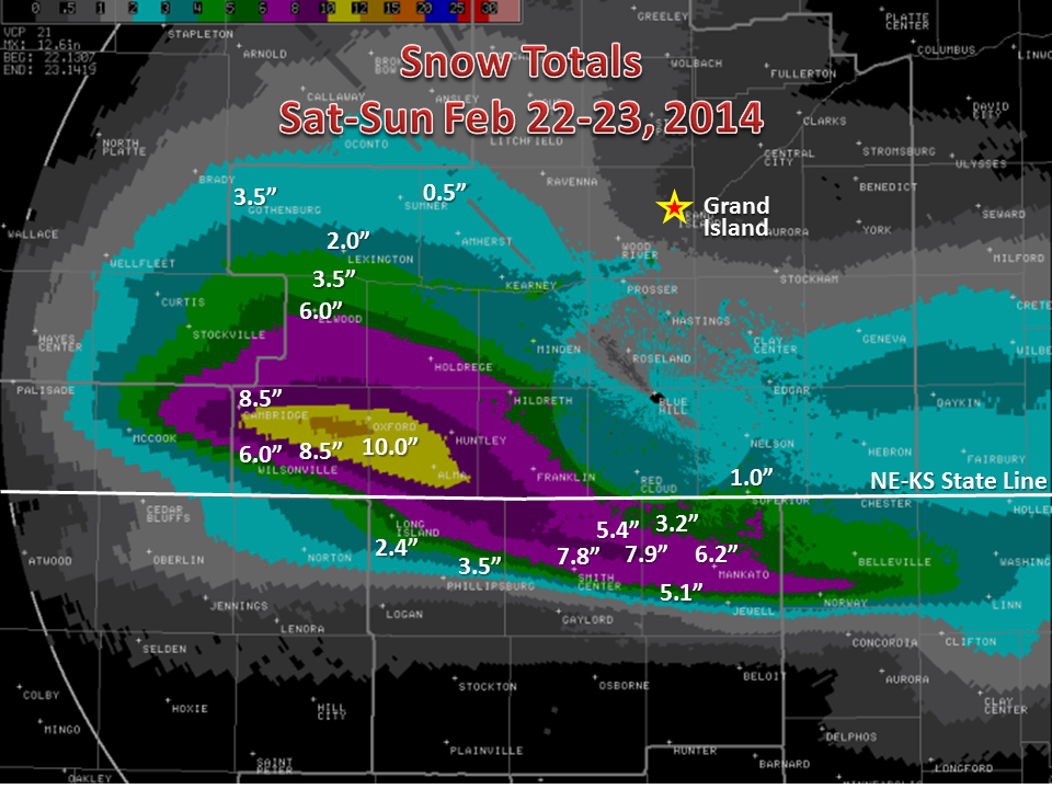
Below is a list of a few official snow totals from NWS Cooperative Observers (please note that a few unofficial reports suggested higher totals, including an estimated 10" at Stamford in Harlan County):
| Location |
Snowfall |
| Lebanon, KS |
8.9" |
| Cambridge |
8.5" |
| Smith Center, KS |
8.0" |
| Edison |
8.0" |
| Mankato, KS |
6.5" |
| 8 S Elwood |
6.0" |
| Wilsonville |
6.0" |
| Ionia, KS |
5.1" |
| Burr Oak, KS |
3.8" |
Here are a few snow totals overlaid on a radar estimation of snowfall across the area:
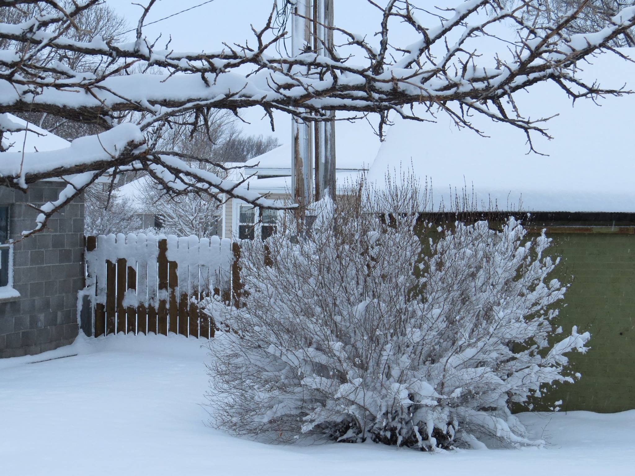
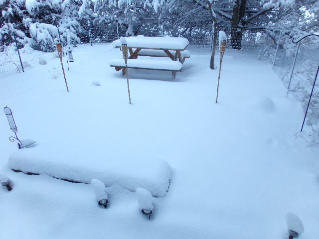
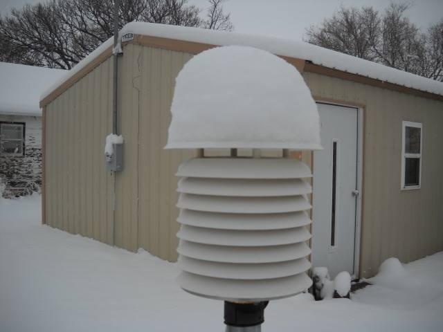
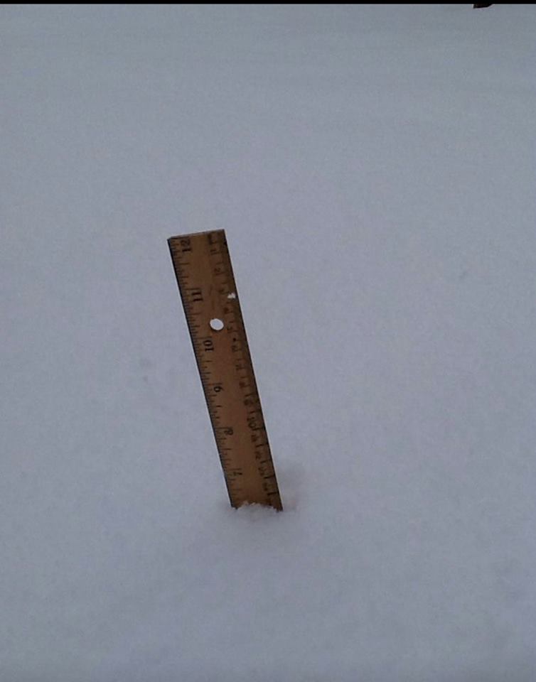
Here are a few photos from the area hardest hit by the heaviest snow:
 |
 |
Cambridge, NE.
Photo courtesy of Jeff Wulf. |
Near Hendley, NE.
Photo courtesy of
Darla McGahan. |
 |
 |
Smith Center, KS.
Photo courtesy of
Bob Levin. |
Mankato, KS. Photo courtesy of Nadine Smith.
|
|


 Follow us on YouTube