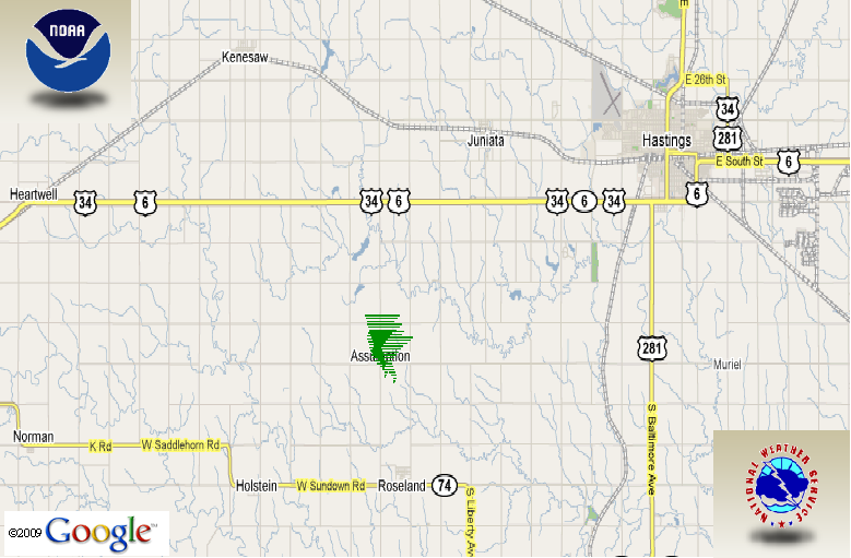
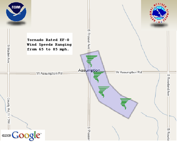
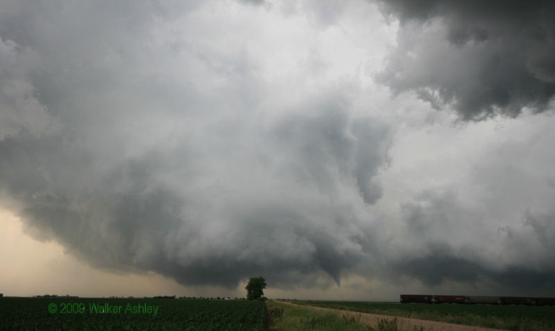
Personnel from the Hastings, Nebraska National Weather Service Office conducted a storm damage survey for a supercell thunderstorm that occurred during the evening on June 15, 2009. It was determined that an EF-0 (Enhanced Fujita Scale) tornado touched down in central Adams County, approximately three miles north of Roseland, Nebraska near the village of Assumption. An EF-0 means that the strongest winds were between 65 and 85 miles per hour.
The approximate time of the tornado was at 8:18 pm CDT. The tornado was on the ground for about five minutes and traveled a half mile. The maximum damage width was 250 yards. Damage was confined to a couple of overturned center pivots along with some crop damage. There was also damage noted at one farmstead on the southeast edge of Assumption. Some minor tree damage, a broken window on a house, and minor damage to a couple of outbuildings occurred at that location.
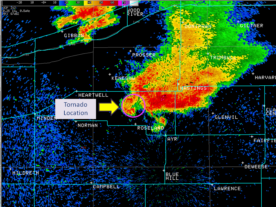
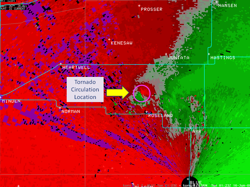
The graphics below show the location and track of the tornado. (Click on images to enlarge.)
Radar observations depict the tornado actually moved very little during its lifespan, and primarily spun near Assumption. A couple of radar images of the tornado location are posted below.
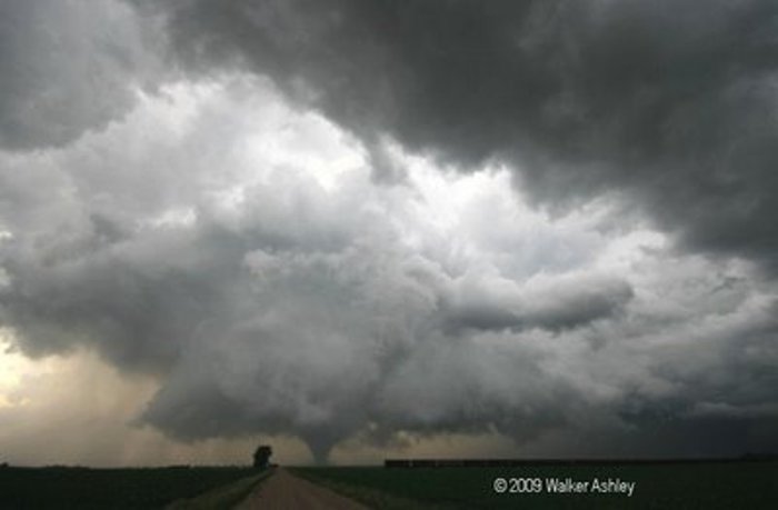
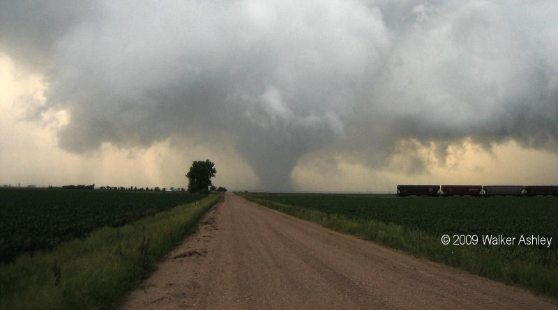
These photos are courtesy of Walker Ashley:
 |
 |
|
Click on the images to enlarge |
|
|
 |
 |
|
| Image of precipitation at 8:23 PM (approximate tornado location is in the circle) | Image of storm relative velocity at 8:23 PM (tornadic circulation of the winds noted where the RED and GREEN are next to each other in the circle) | ||
Another brief tornado was also reported by a storm chaser 3 miles south of Shelton at 8:37 PM. This tornado lasted about one minute. No damage was reported.


 Follow us on YouTube