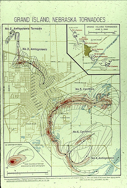
The Grand Island Tornadoes
It may still seem like yesterday to some folks, but Monday, June 3, 2019 marked the 39th Anniversary of one of the most devastating and unique tornado events to ever strike south central Nebraska. This event, consisting of 7 tornadoes that touched down that evening in, or near, Grand Island was arguably an unparalleled event in meteorological history. It is likely that never before, or since, have this many slow-moving, damaging and deadly tornadoes affected such a small, but populated geographic area for such a long time-span of 2 hours and 45 minutes...
A Look Back at June 3rd, 1980
The following narrative is a summary of the Grand Island, Nebraska, tornadoes of June 3, 1980. All but two pictures included in this account were provided by Dr. Roger Wakimoto of the University of California, Los Angeles. Dr. Wakimoto's photos and graphics are from 1980, and were used as the basis for assessing tornado paths, intensity, and research of this unique event.
 |
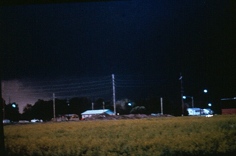 |
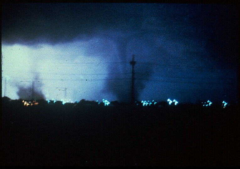
| Tornadoes #2 (Left) and #3 (Right) looking north from North Johnson Drive, or roughly Webb and Faidley. Photo by Rod Gartner about 9:00 p.m. | Exact location and time unknown. |
On June 3, 1980, a massive supercell thunderstorm complex developed just north of Grand Island, Nebraska, during the early evening. This complex moved slowly south-southeast through the city at around 8 mph. This outbreak provided the basis for a book and television movie, as well as tornado and engineering research. Over a period of less than 3 hours, this storm complex produced 7 tornadoes in and around Grand Island. There was one tornado of F4 intensity and 3 others that were rated F3.
Five people were killed, about 200 injured, 475 living units and 49 businesses were destroyed, with a total damage of nearly 300 million dollars. Also of note, three of the tornadoes rotated anti-cyclonically, or clockwise, a rare occasion in the northern hemisphere, where over 99 percent of tornadoes rotate cyclonically, or counter-clockwise.
 |
 |
 |
||
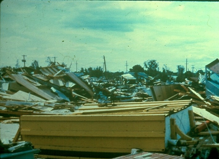
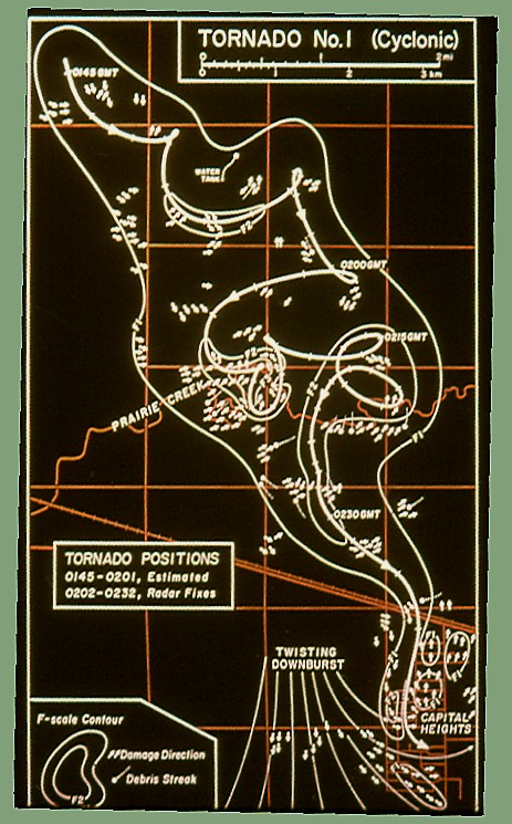
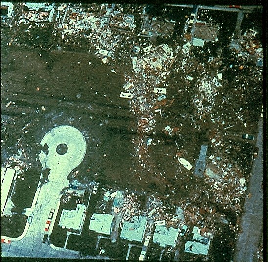
| Original graphic of the 7 tornadoes on June 3rd. The insert in the upper right corner depicts the 7th tornado in western Hamilton County. | Photo of the intense damage done in Grand Island. | Graphic showing the very complex path and wind patterns of tornado #1, which began northwest of town before heading into the Capital Heights area. |
|
 |
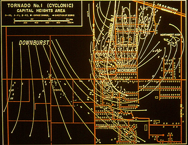 |
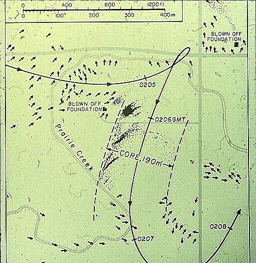
| Close-up graphic of a section of the path of tornado #1. Note the abrupt change in the direction of movement. | The final stages of tornado #1 (solid line). This tornado passed just west of Northwest High School. |
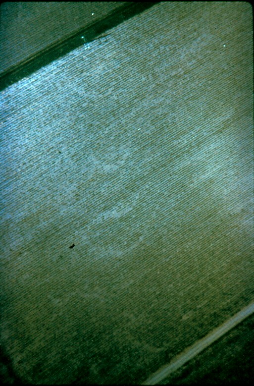
At approximately 8:45 p.m., the 1st of 7 deadly tornadoes set down 11 miles northwest of Grand Island, 3 miles north of Prairie Creek. The 700-yard wide F3 tornado tracked south for 7 miles, ending 4 miles northwest of downtown Grand Island. While the straight line path was 7 miles, the twisting and erratic movement covered over twice that distance, 14.5 miles, while spending 49 minutes on the ground. Along this path, a woman was killed while trying to drive to a relative's house, 25 people were injured, and farm homes were torn apart.
 |
 |
 |
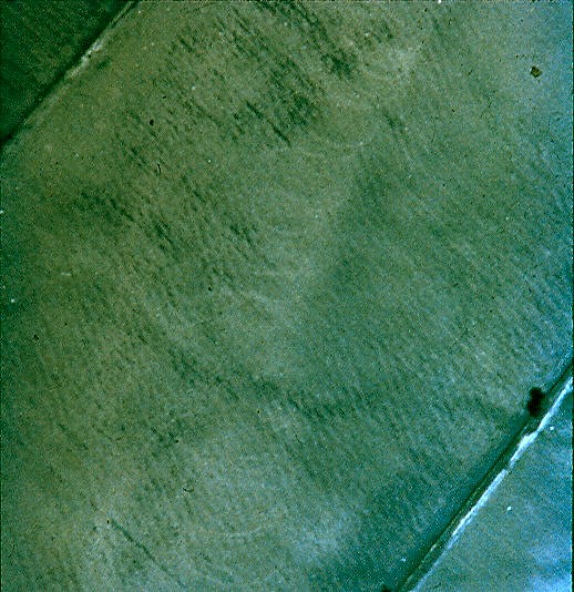
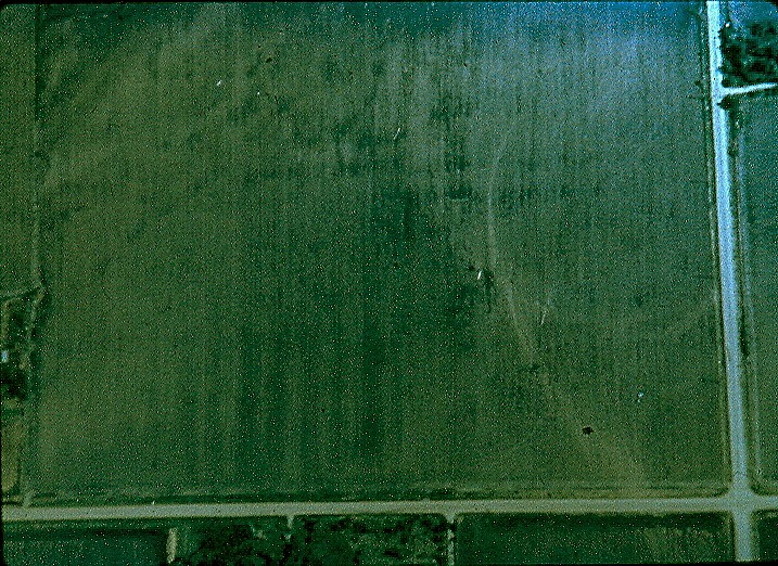
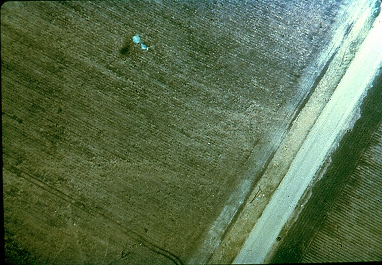
| Aerial photo of tornado path through a field. "Swirl" pattern of the tornado circulation is clearly visible. | Aerial photo of tornado path. Note the "swirl" pattern or scour marks. | Damage to a house strewn along the tornado path. The Prairie Creek runs along the left side of the picture. |
 |
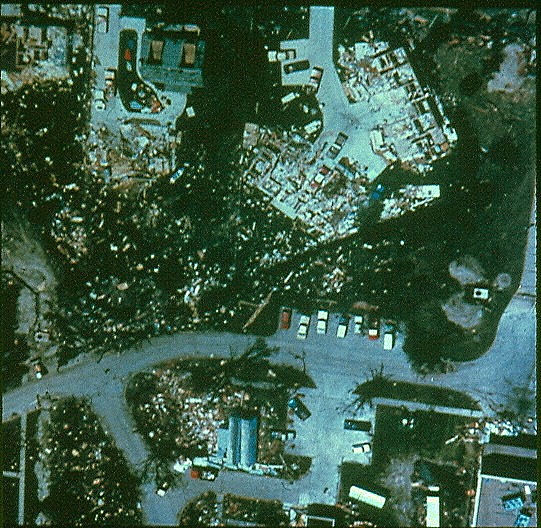 |
| Extensive damage in northwest Grand Island. | Another view of damage in northwest Grand Island. |
At 9:00 p.m., a 2nd short-lived tornado set down north of Highway 2 near the intersection of Webb and Airport Road, just east of the first tornado. This short-lived anti-cyclonic tornado, the first of three that evening, moved northeast lifting back into the clouds at around 9:12 p.m.
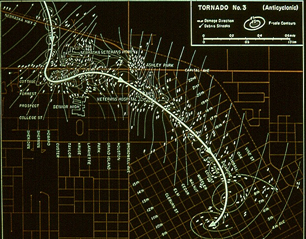
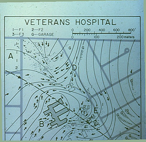
The 3rd tornado of the evening, the second anti-cyclonically rotating tornado, touched down at 9:05 p.m. between Webb Road and Highway 281, just north of Airport Road. This 500-yard wide F3 tornado briefly tracked north, then reversed course to the south, then southeast across northern Grand Island, leaving a 3.5 mile long path of destruction. Most of the damage done by this tornado was rated F0, with some F3 damage in the vicinity of the VA Hospital along Capitol Avenue. While there were no fatalities, 40 people were injured by this tornado before it lifted over the center of town around 9:30 p.m.
 |
 |
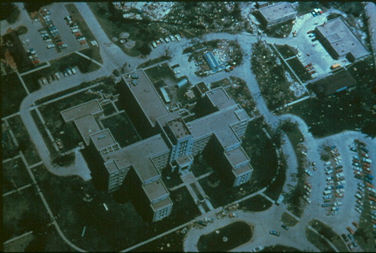 |
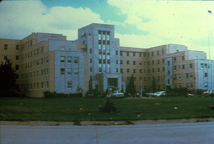
| Graphic depicting the path of tornado #3 through northeast Grand Island. At one point, this tornado was rated a F3. | Front view of broken windows of the VA Hospital. | Overhead view of the VA Hospital. Note the extensive damage just east of the building (top of the screen). |
 |
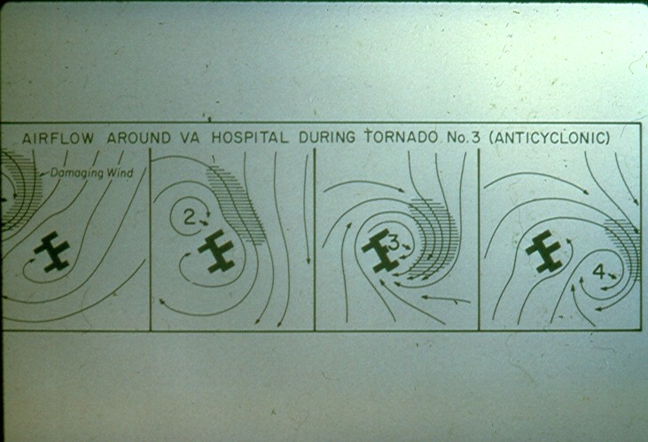 |
| Graphic showing path of tornado #3 (dotted line) by the VA Hospital. The wind direction is depicted by the streamlines. | Graphic depicting the core of strongest winds wrapping around the tornado, affecting the area just east of the VA Hospital the hardest. |
The 4th tornado, the third anti-cyclonic tornado of the evening, set down at 9:46 p.m. near Highway 34 and Shady Bend Road. This tornado tracked southwest to just northeast of the intersection of Stuhr and Shimmer Roads, then turned north on the west side of Stuhr Road before lifting near Highway 34 at 9:50 p.m.
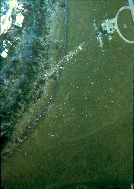
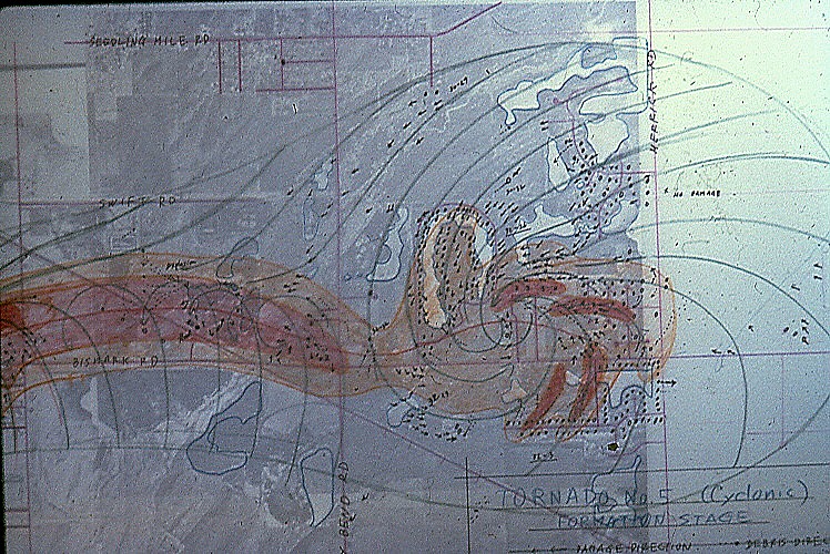
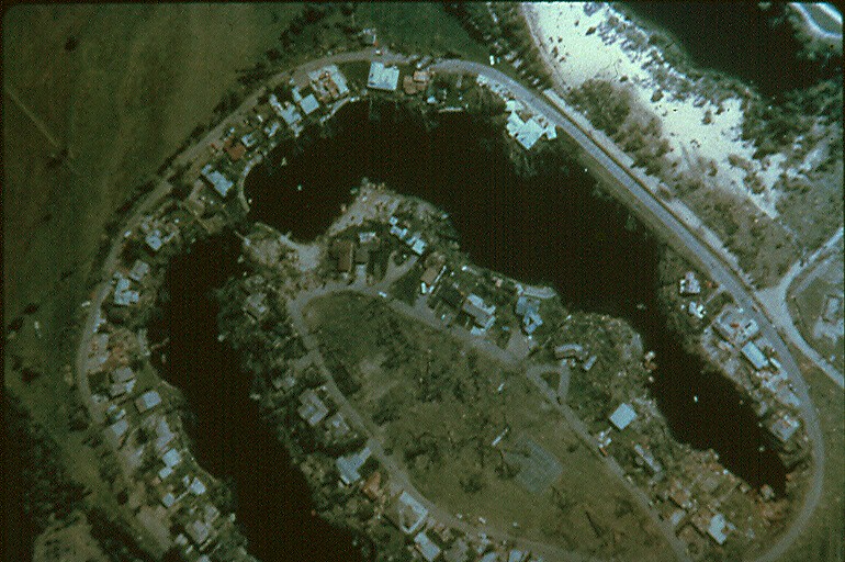
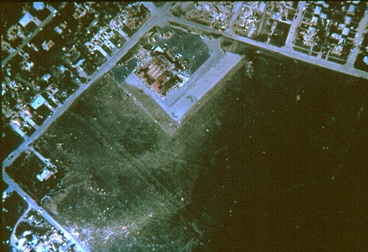
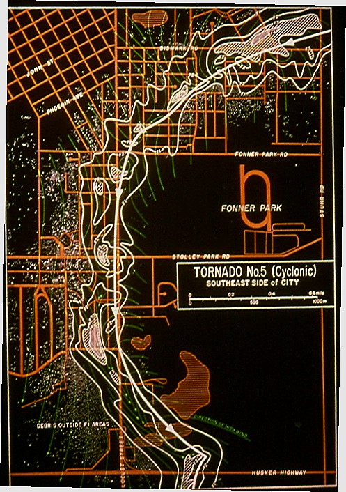
At 10:16 p.m., the 5th, and deadliest and most powerful tornado of the evening, touched down on the east side of Grand Island, in the Eagles Lake and Crystal Lake areas. This 1000-yard wide F4 tornado swept west, just north of Bismark Road, crossed Shady Bend and Stuhr Roads, before turning southwest across Bismark Road north of the Fonner Park area. The tornado continued to move southwest through residential areas until it reached the South Locust Street business district at Locust and Fonner Park Road. From this point, the tornado moved due south along South Locust until it turned southeast a few blocks north of the intersection of South Locust and Highway 34. The tornado then crossed Highway 34 and tracked another half of a mile southeast before ending at 10:28 p.m. During the few minutes the tornado tracked along Locust Street, the damage was most devastating, and homes and businesses were "obliterated". The 6-mile long tornado track took 12 minutes to cover, and resulted in 4 fatalities, one each in a trailer home, a frame home, a lounge, and under a collapsed awning near a motel. In addition, 110 others were injured along the storm's violent track.
 |
 |
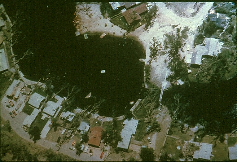 |
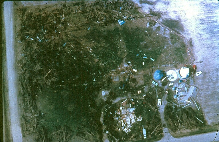
| Hand analyzed map of the early stages of tornado #5 near the Merrick County line east of Grand Island. This tornado moved west and just north of Bismark Road. | Aerial view from the damage from tornado #5. | Damage just east of Grand Island with tornado #5. Note the huge trees which fell into the lake. |
 |
 |
| Aerial photo of the bowling alley (Meves Bowl) on East Bismark Road. | Graphic depicting the path of tornado #5, the "South Locust Tornado". This tornado was rated a F4. |
The 6th tornado, rated F2, spun up at 10:25 p.m. east of Shady Bend Road just north of Highway 34. This tornado moved southwest to near Stuhr Road south of Highway 34, then turned southeast, traveling south of Shimmer Road to about 1 mile southwest of the Hall and Hamilton County bridge. This 600 yard wide tornado tracked 6 miles over rural areas, injuring another 18 people before ending at 10:35 pm.
 |
 |
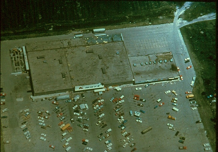 |
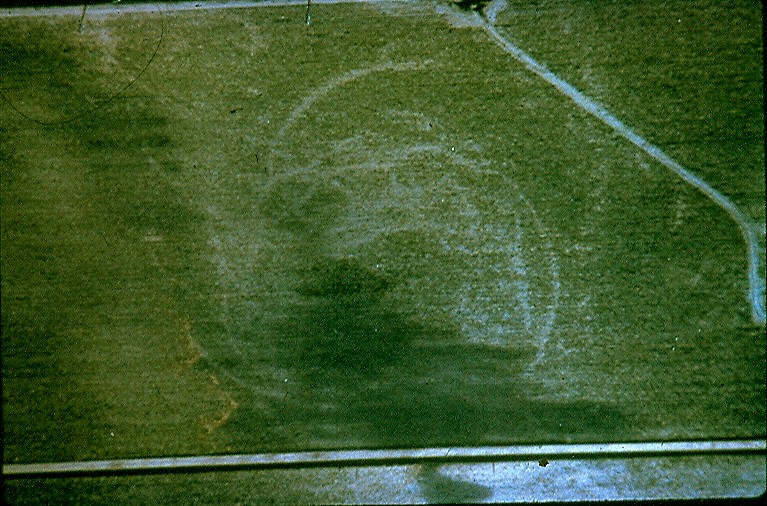
| Aerial view of scour marks from one of the tornadoes just southeast of Grand Island. | Farmstead destroyed. Note the incredible tree and structure damage. | KMart (now Skagway) on South Locust was spared major damage and served as a command post for post-storm operations. |
 |
 |
| Damage in rural areas southeast of town. | More scour marks from one of the tornadoes southeast of Grand Island. |
As the thunderstorm complex moved south toward Interstate 80 during the late evening, it made a left turn to the east, usually indicating the end of severe weather. Not so in this case. About the time the storm turned in direction, the 7th and last tornado touched down at 10:45 p.m., southeast of the Hall-Hamilton County bridge. This tornado swept east and northeast over open farmland for 13.4 miles, before ending at 11:30 p.m.
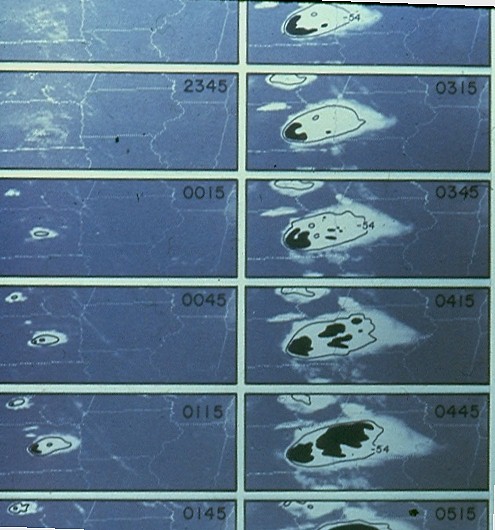
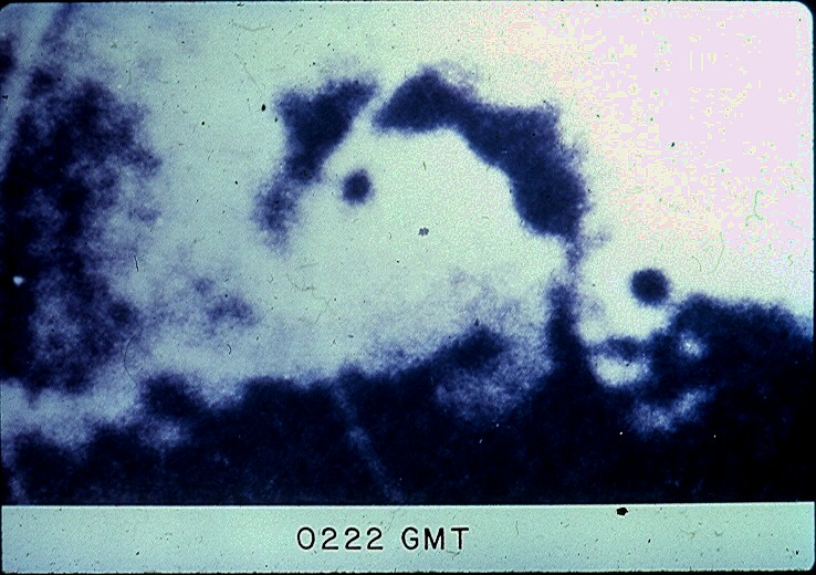
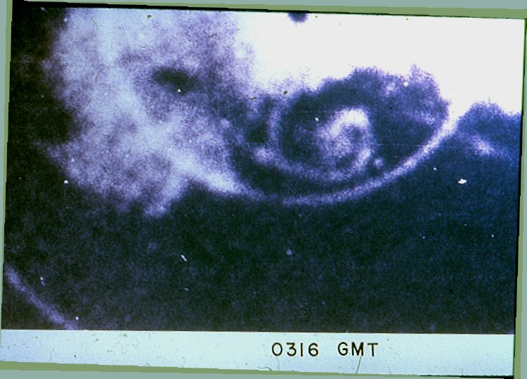
Meteorologists and technicians at the Grand Island National Weather Service (NWS) Office, located at the airport, monitored radar, satellite, and surface weather conditions and issued warnings throughout the event. The Tornado Warnings turned into Severe Thunderstorm and Flash Flood Warnings overnight as the huge supercell complex moved east. For their outstanding service during the storm, the entire staff of the Grand Island NWS was awarded a Department of Commerce Unit Citation. The pictures below depict some radar, satellite, and surface wind information from June 3, 1980, as seen by the staff of the NWS office at the airport.
 |
 |
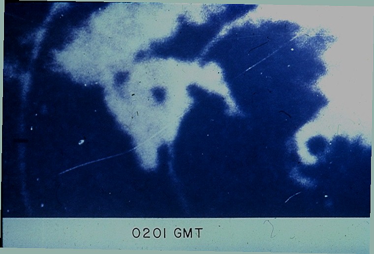 |
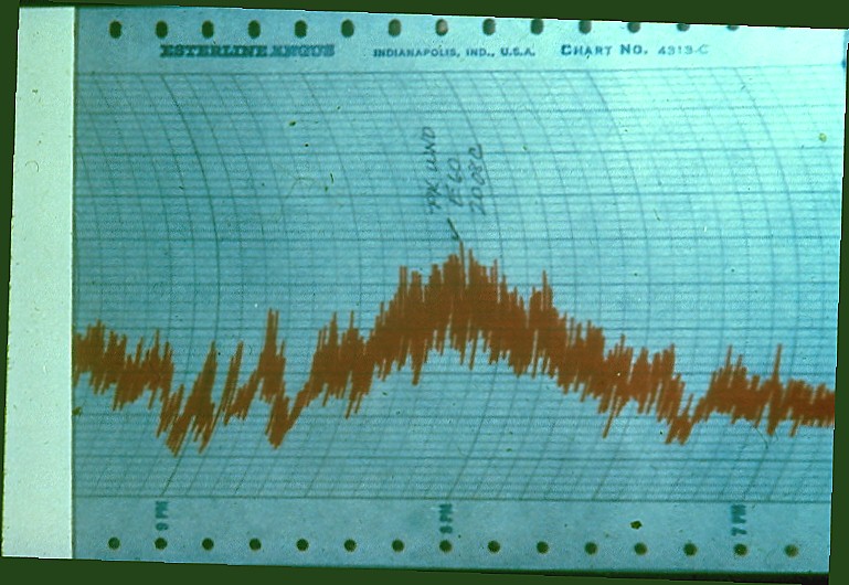
| Picture of the wind recording printout from the NWS office in Grand Island. A peak gust of 60 mph was reported from the east. | Series of satellite images from the storm. The storm developing around 6:15 p.m. and eventually had cloud top temperatures of 60oC below zero. | Radar view of tornado #1 at 9:01 p.m. The tornado center is the large hole (dot) on the left side. The radar site is the larger dot on the right side. |
 |
 |
| Tornado #1 continues west (left) of the radar. Tornado #3 is just southwest of the radar (clockwise finger-like depiction). Time is 9:22 p.m. | Radar view of the formative stages of tornado #5 at 10:16 p.m. The "curly-Q" or "wrapped" image south of the radar is the tornado. |
Now 39 years later, the memories of June 3, 1980, live on in the minds and memories of so many who survived the event, and the families and friends of the five people who perished. For many, it will simply be known forever as the real Night of the Twisters.


 Follow us on YouTube